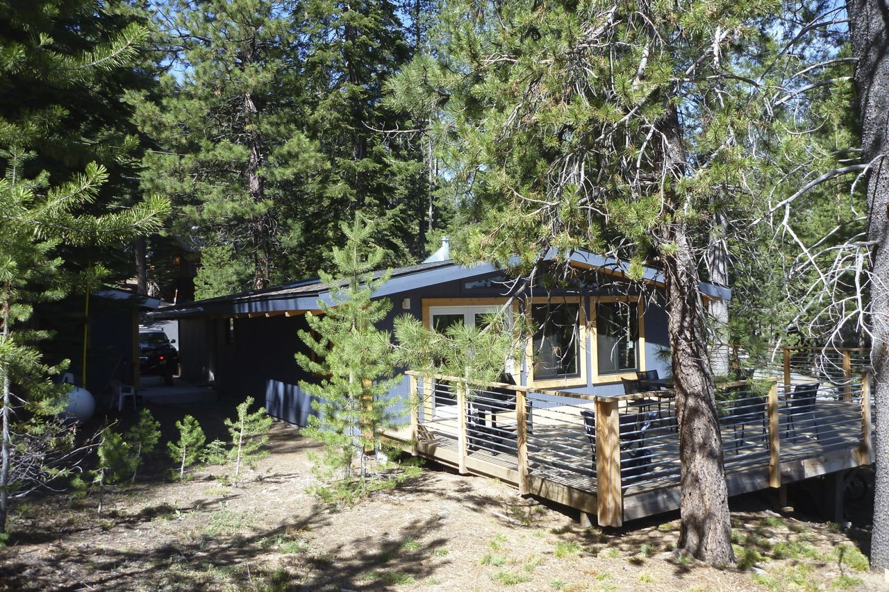
After a week of good living in a mate’s cabin out of Truckee it was time to get going again.
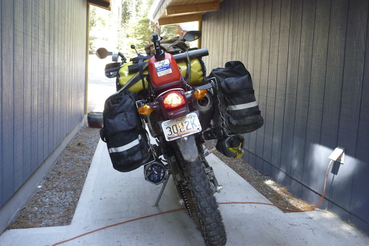
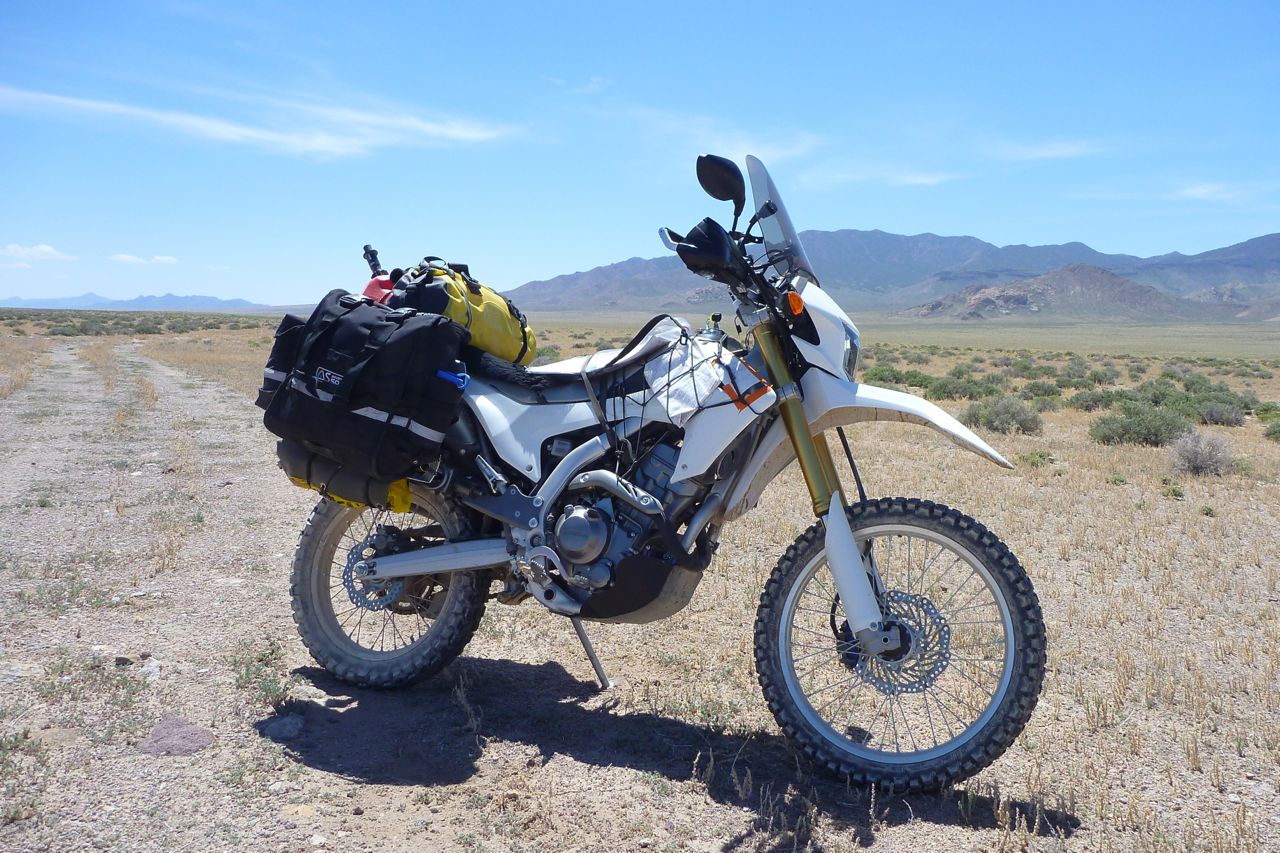
The CRF is poised on the launchpad, showcasing v2.1 of the packing system with double undertubes and a fuel can instead of that tedious fuel bag. On the CRF I have to fill up 2-3 times a day. The good thing is it makes the seat more tolerable.
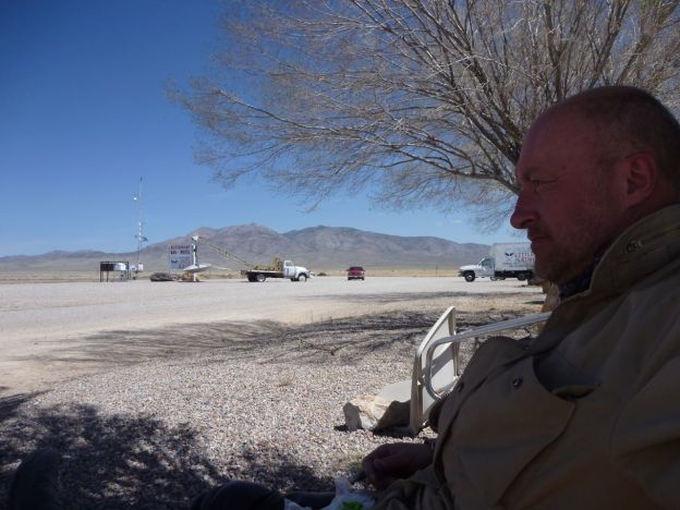
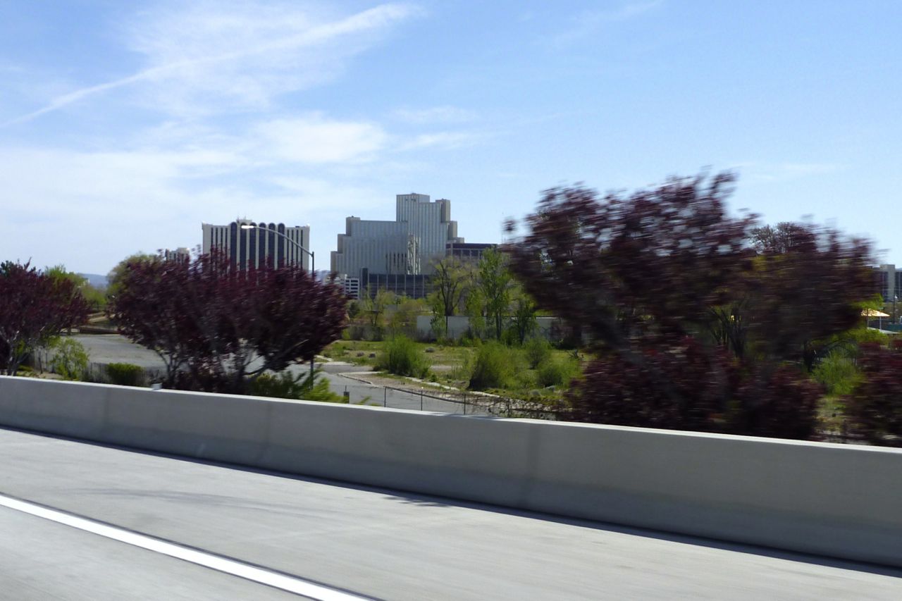
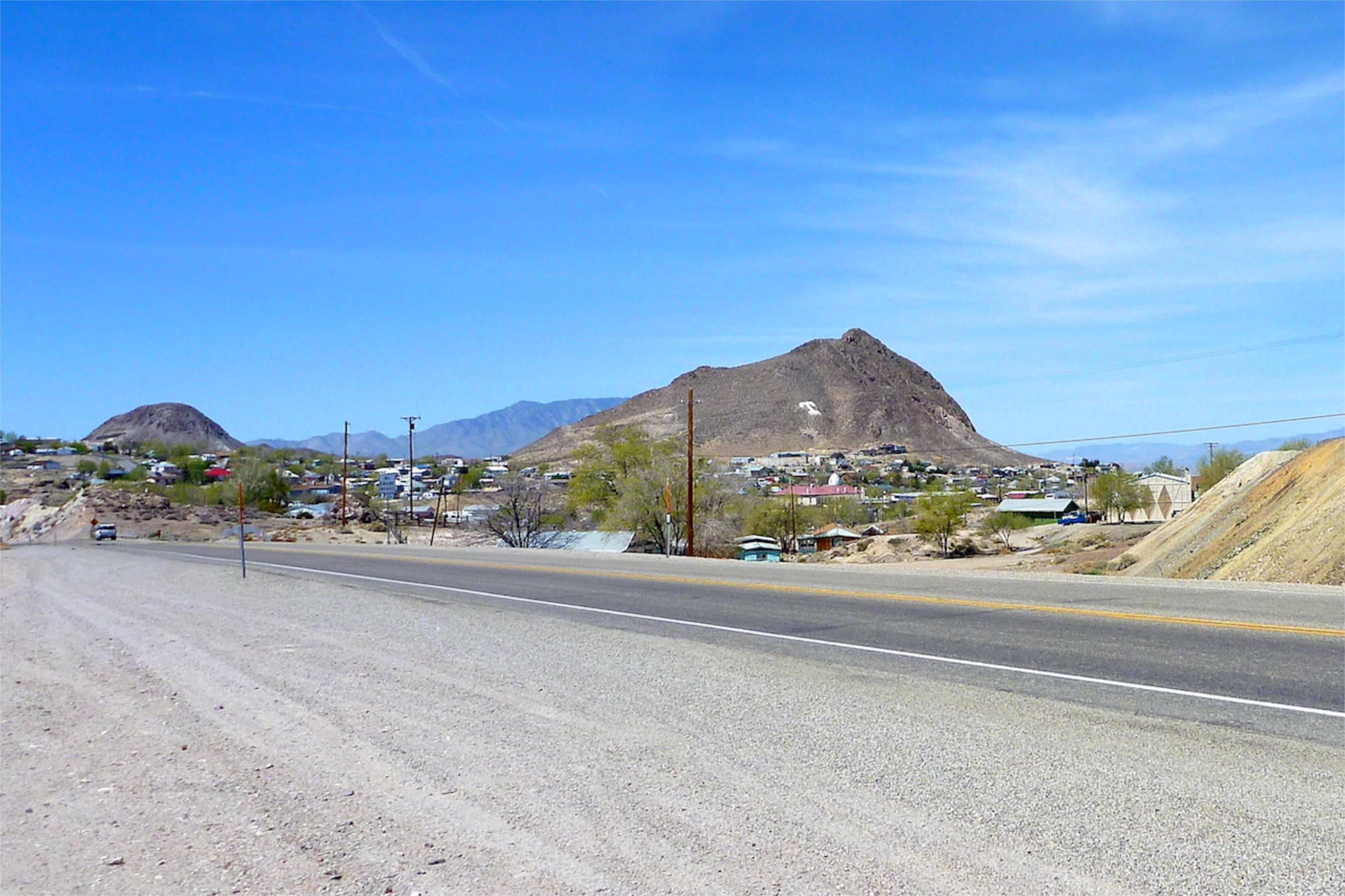
Out past Reno which I rode through last week on a day ride to Virginia City, a mining boom town that, architecturally at least, seems to have missed out on the 20th century (other touristic aspects have kept up). It’s a fun, bendy ride up to V City, btw.
The trouble with Reno is I ended up with “I shot a man in Reno…” in my head for the next couple of days, but there are worse songs to be stuck on. Well I know I had it coming, I know I cain’t be free But this song keeps a playin’ And that’s what tor-chures me…
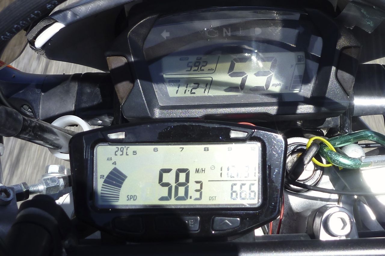
Look at the error on the Honda – shocking – and the odo is even worse, some 12% under. All verified with GPS, TT Vapor and freeway mile markers and SMSs from the Pentagon.
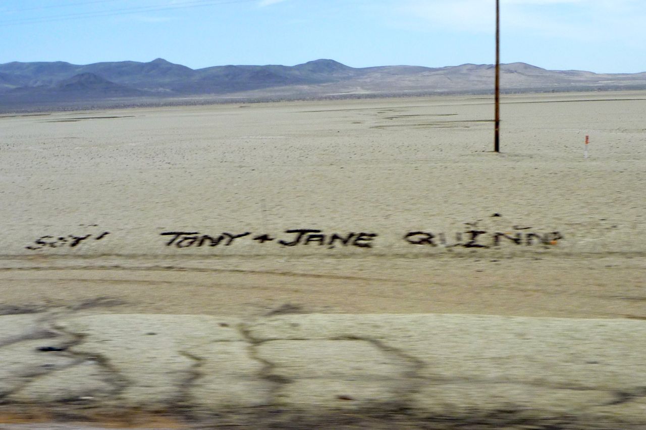
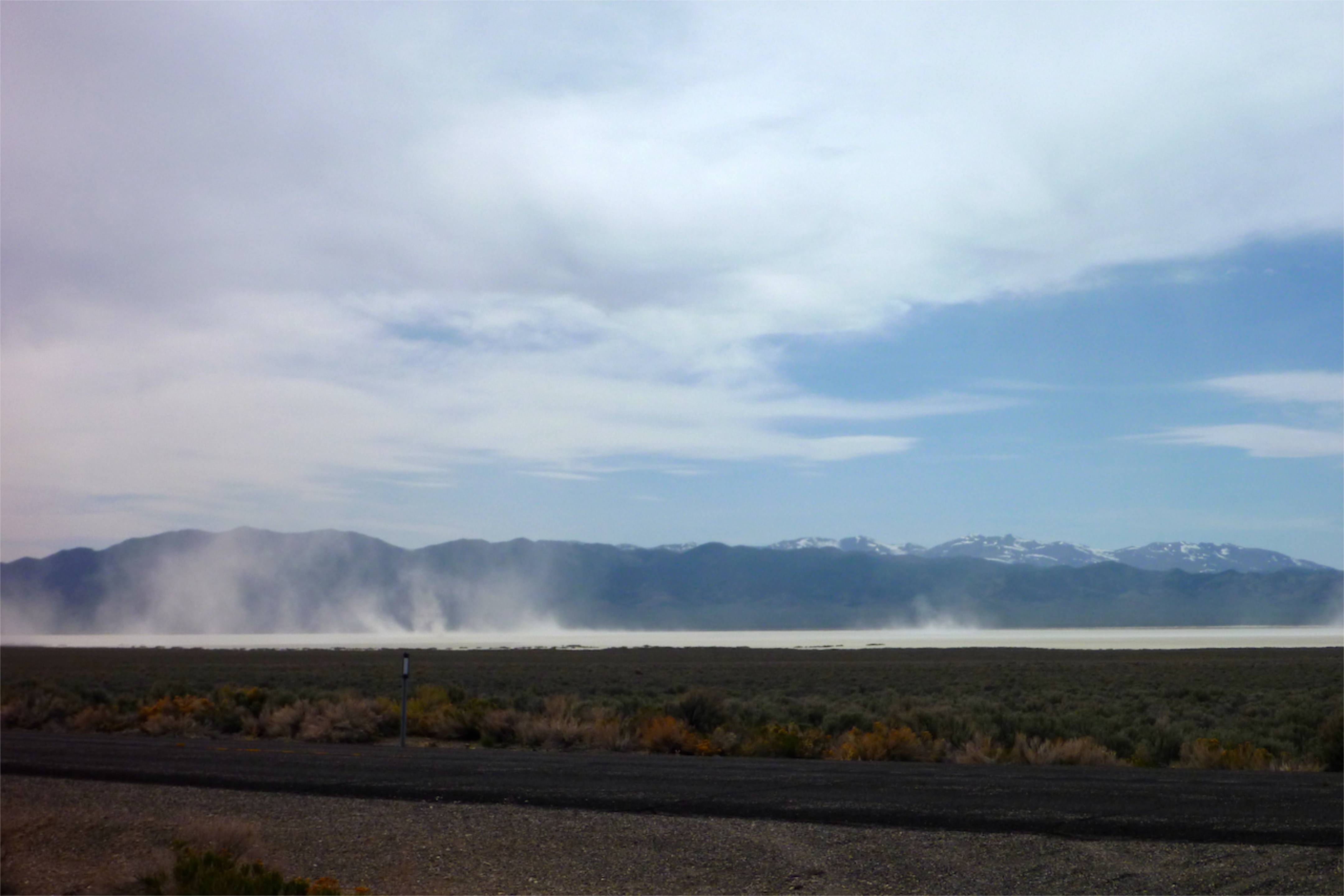
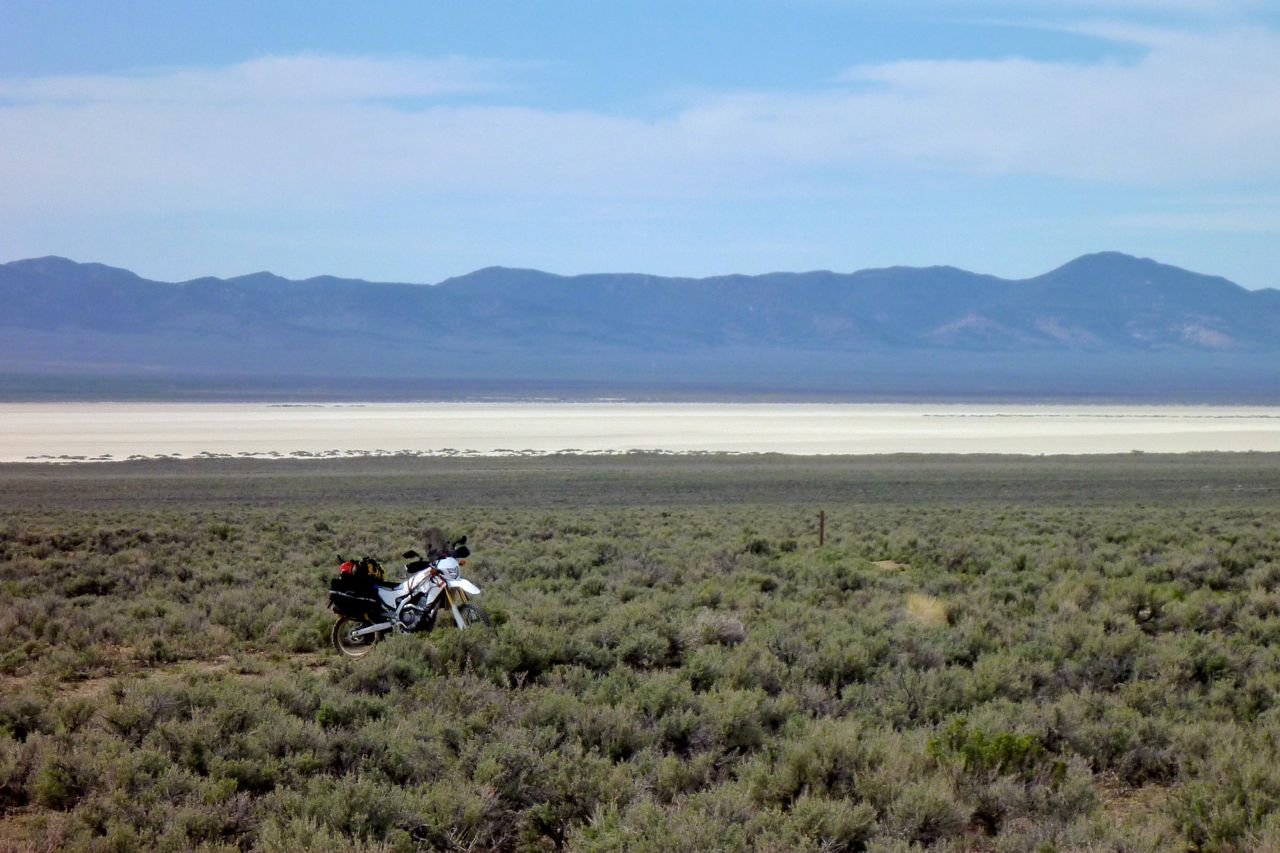
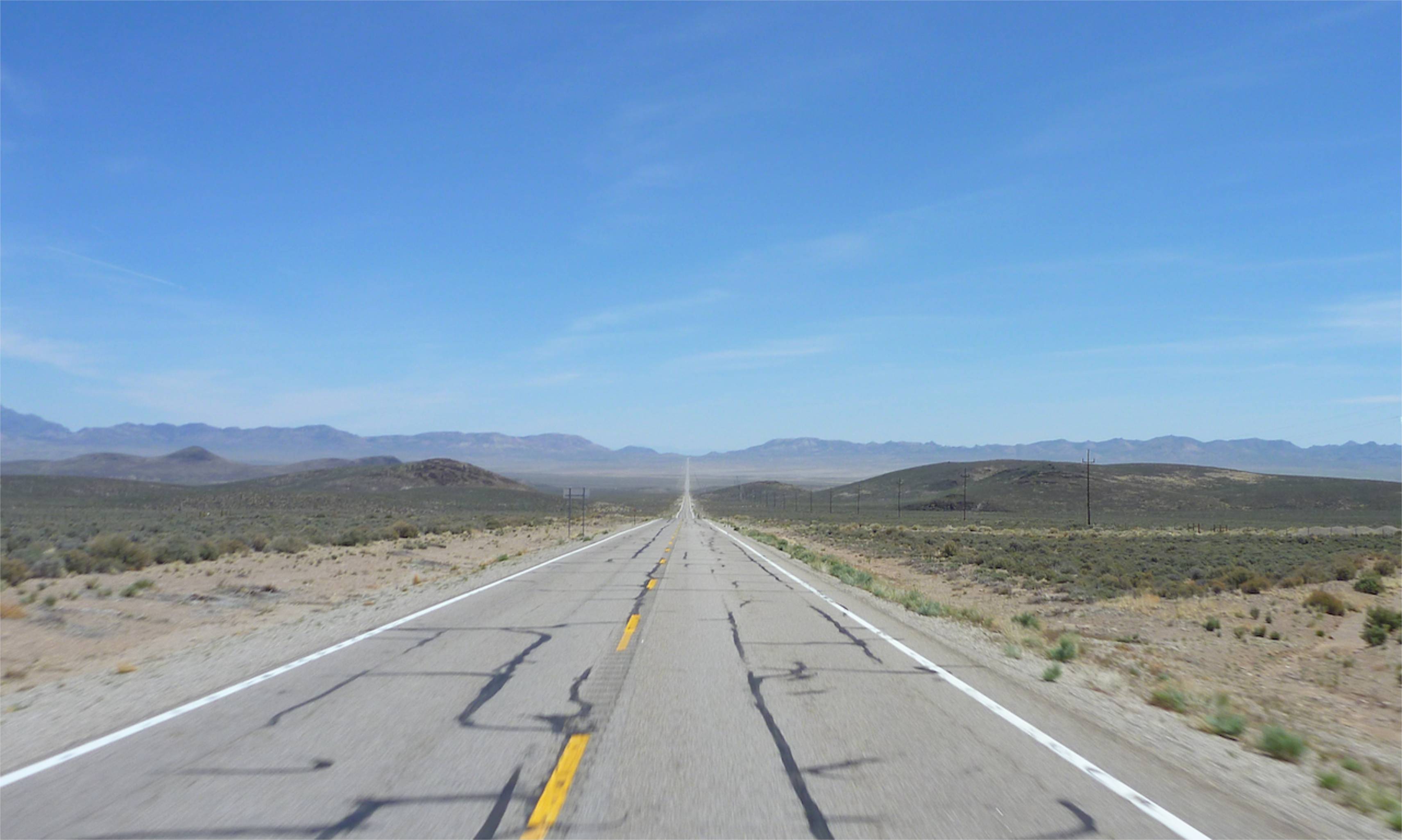
I turn off 80 to 50 – much less traffic. After Fallon range follows basin, follows range. Some basins have a salt pan and all along this one people had left messages in black stones.
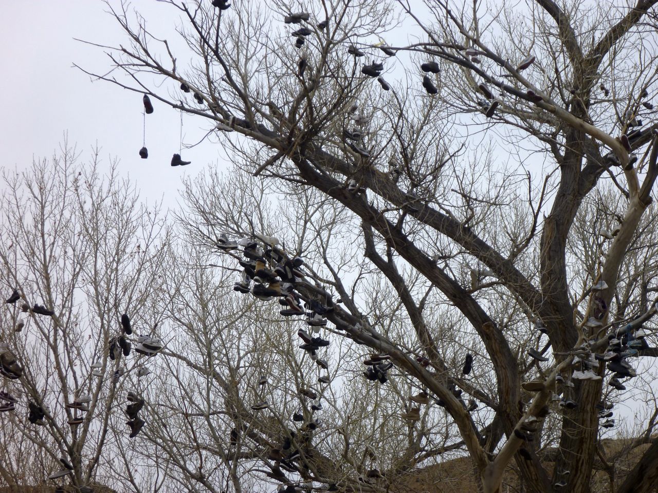
Soon I pass the Nevada Shoe Tree. Got some smelly old trainers? Chuck ’em up here.
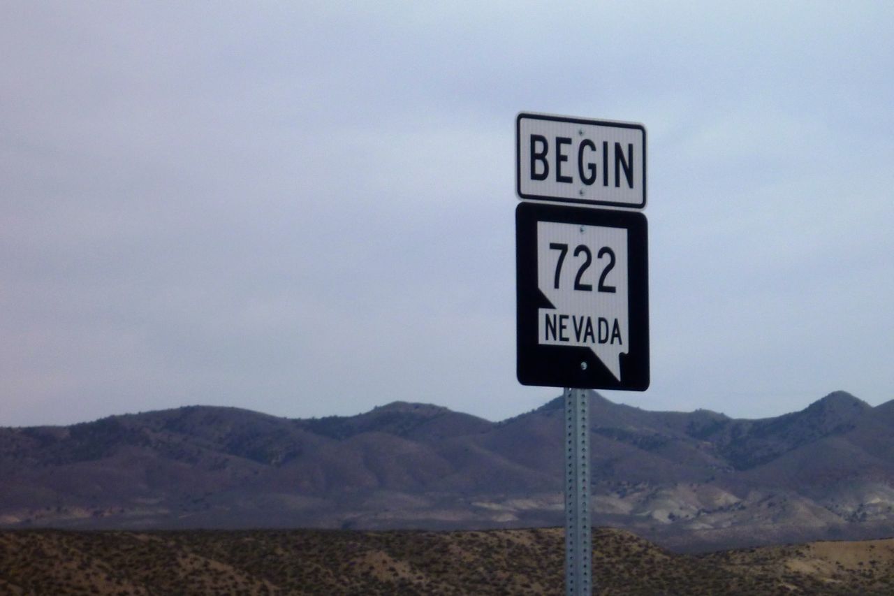
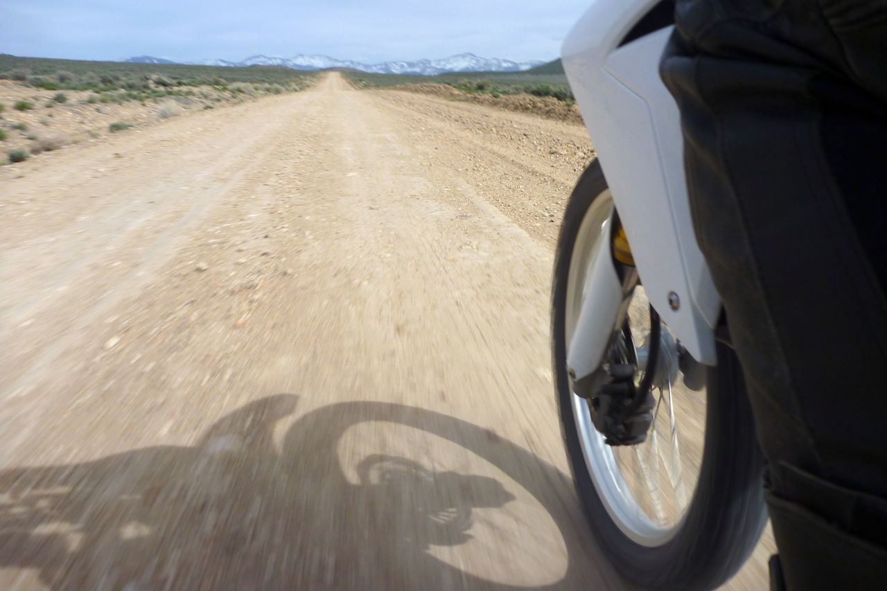
I then turn off 50 onto ‘Old 50’ or 722.
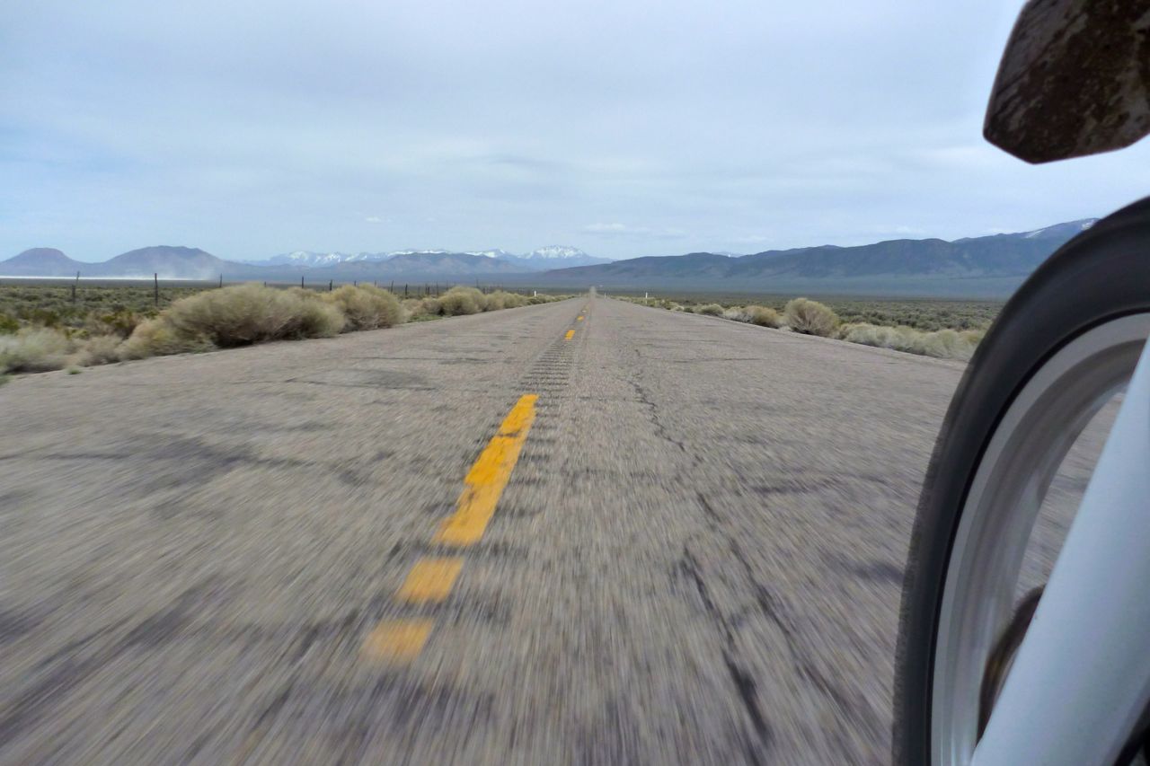
Looks like pictures of Route 66 but traffic is close to zero so I can go as slow as I like. With a hot backwind 55 feels good.
Over there the heat is stirring up dust devils on the pan. The Vapor says ambient is low 30s C – what’s that, getting on for 90?
I’m eyeing up a track over the range to the next valley. This one looks a bit thin but I give it a go. Within a mile it peters out. I have committed the cardinal navigational error of pre-emption. I tell you what though, that sage sure smells nice once your panniers brush past it.
The Nevada flag – or it ought to be. Blue blue-grey over Salt over Sage.
This is the right track heading east to the next valley. I hope to cross that range at the back, but despite me sweating like a kipper it looks a bit snowy up there and on the far side it’s only tarmac. My new ankle-level shooting technique. What else can you shoot when alone? When this is all done I’m going to produce a photo moto book: Southwest Ankle USA.
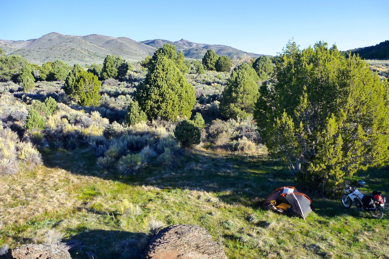
On the far side I take the dirt road south, passing a few ranches, like where The Virginian used to work. Benchmark maps are a great nav resource when combined with a Nuvi, but I could be on the limit with fuel although it’s getting much more economical. I poured in a gallon can after 80 miles and the tank was full. Here I am updating my fuel log. I was going to camp here but…
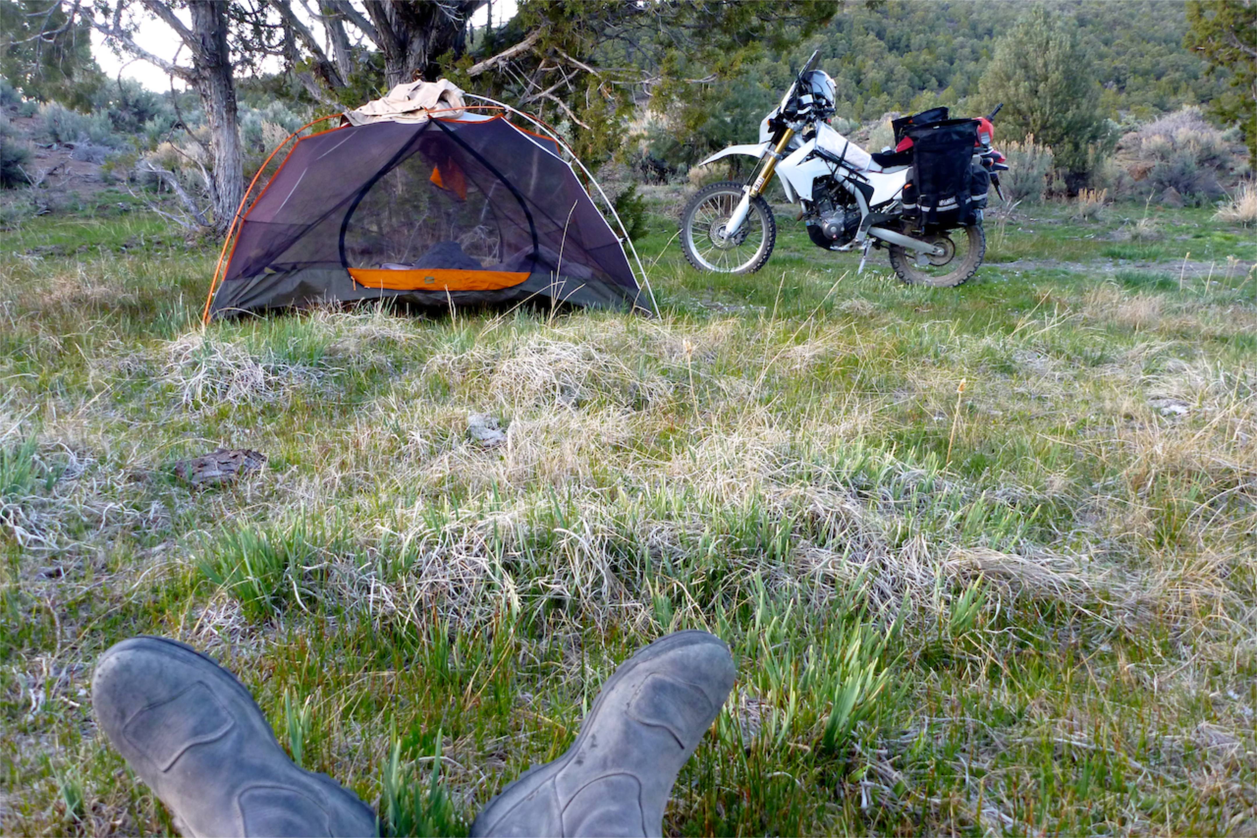
… I went for a wander and found a much nicer and more protected spot 5 mins away. It was still 7500′ – a week or two ago and only 100 miles from here I turned away from camping at that height, but I guess Spring has finally sprung.
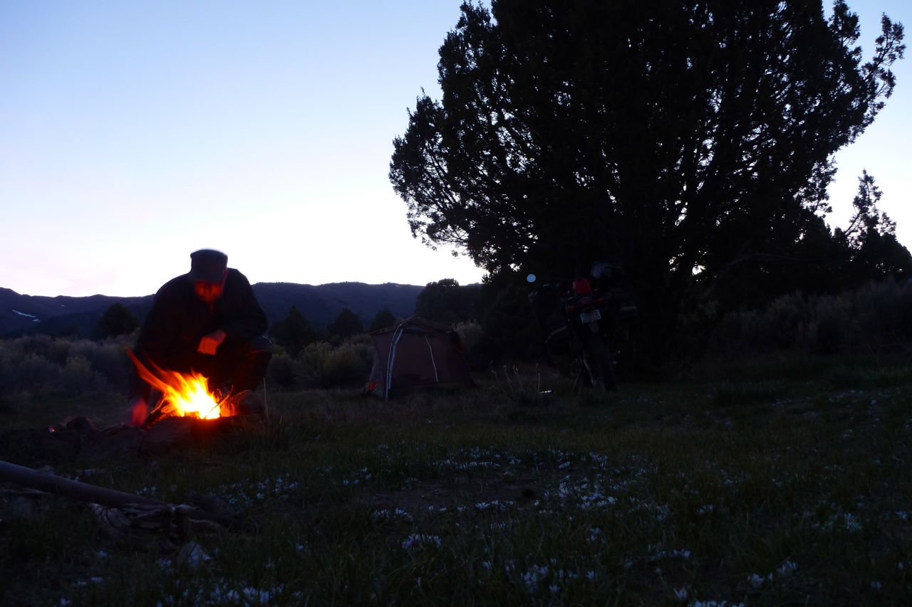
I make a fire, ignoring the beer bottles in there. After about half an hour one explodes like a shotgun cartridge. Luckily I wasn’t staring wistfully into the flames at the time. What sort of rank idiot wastes a full bottle of beer? There was another one in there – pretty cooked by now. There was also a packet of sausages lying around – I threw them in too and they exploded, splattering me in smoked hickory sausage fat. Better than broken glass I suppose. I hope I didn’t wreck someone’s upcoming picnic stash…
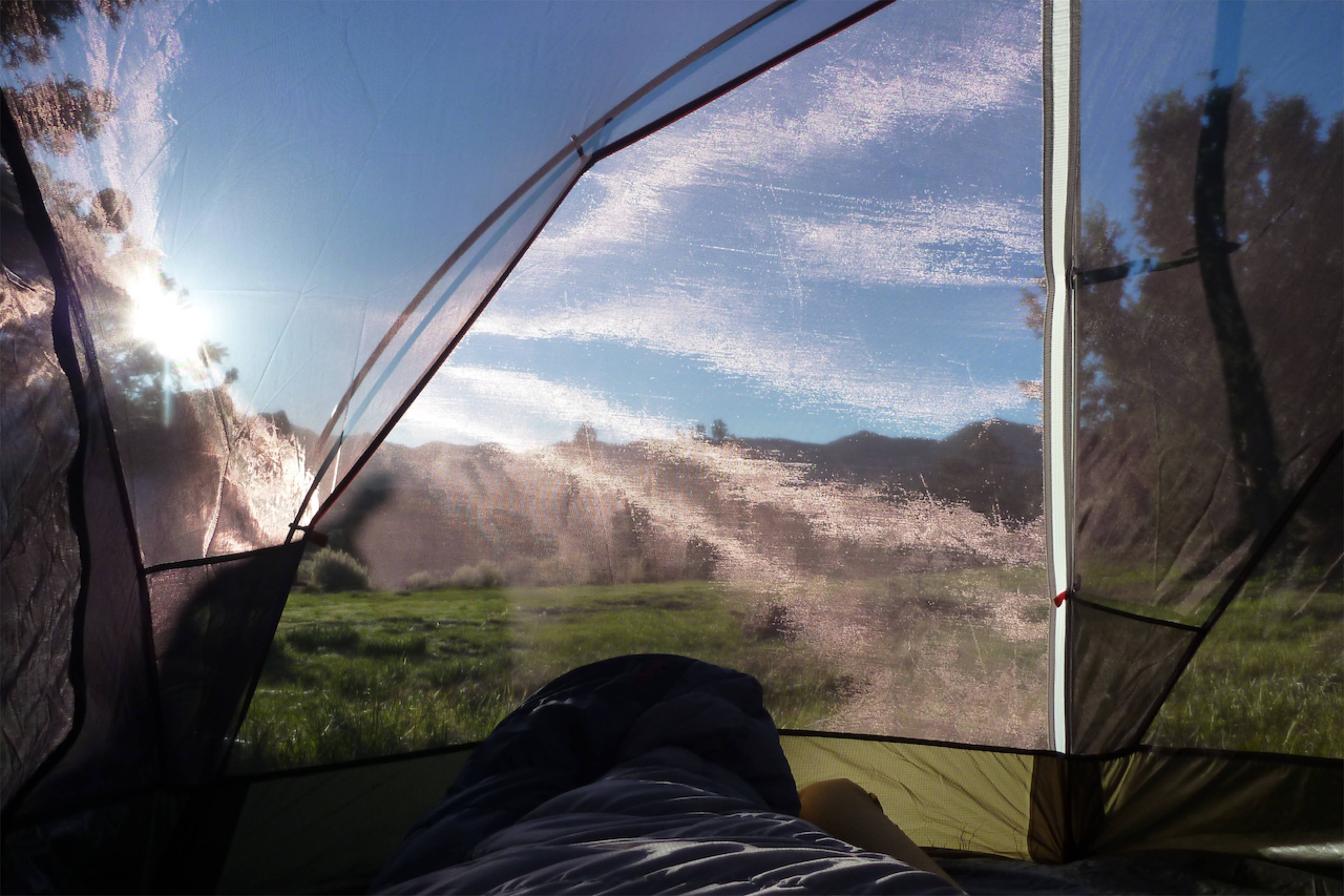
I thought I brought my fly sheet only (more space) but I had my inner (less bugs). As long as it’s not raining it’s a more agreeable way to wake up.
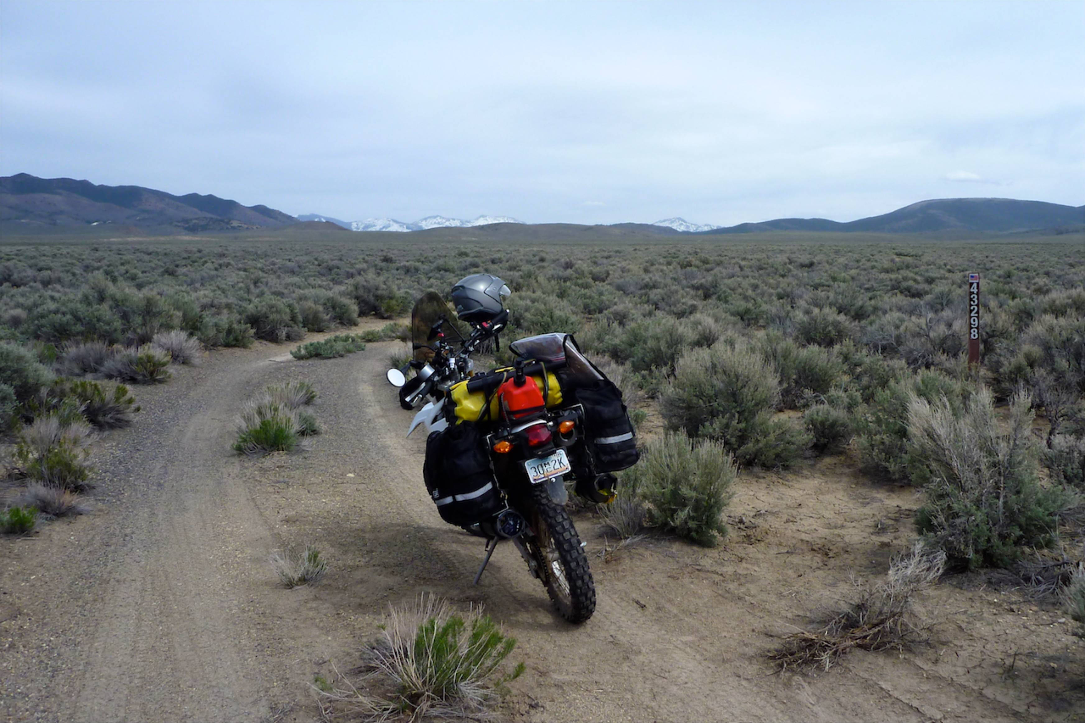
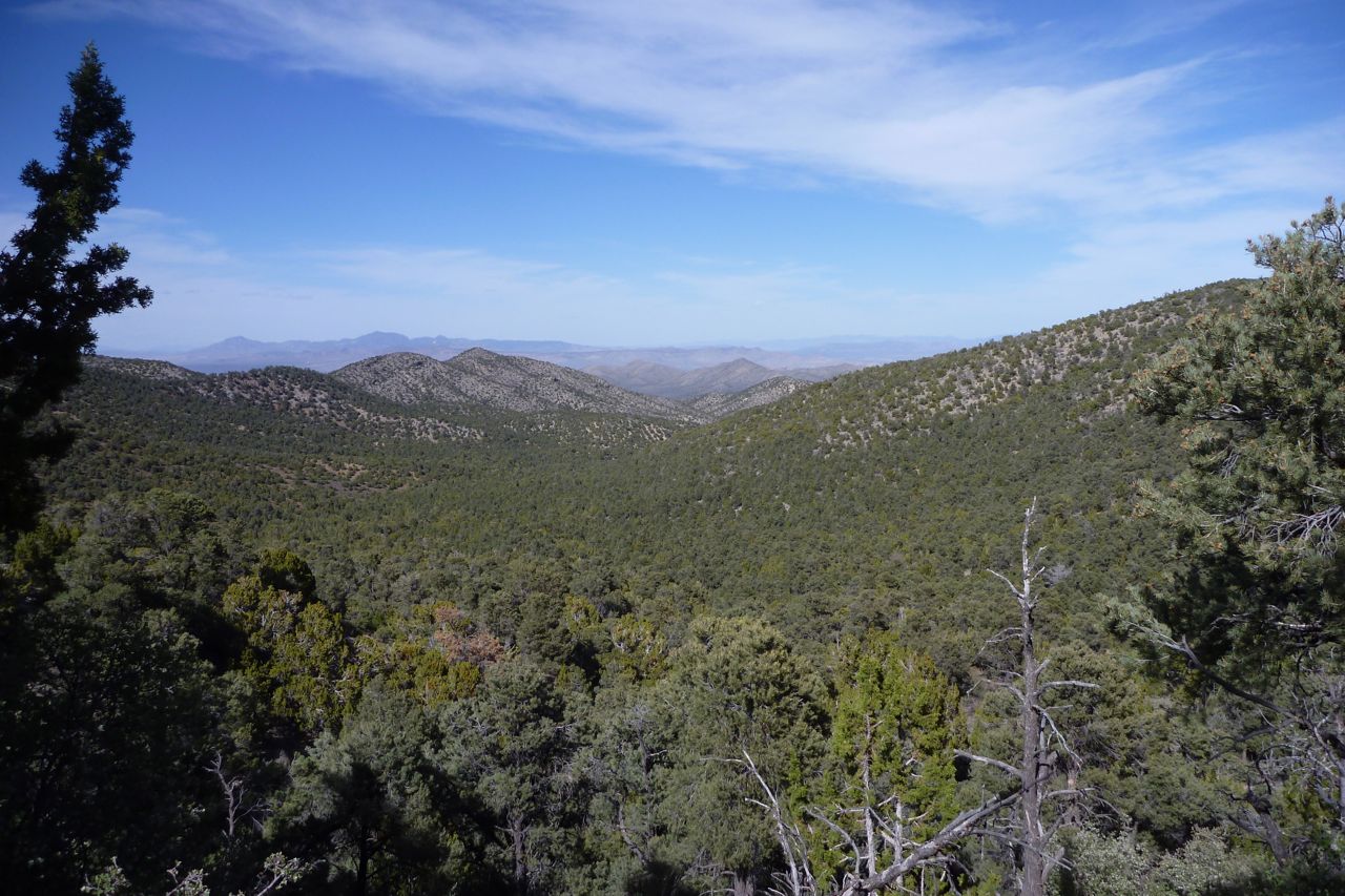
Besides flat ground, all you need is grass and a few trees to make an ambient camping spot (no, really!). Trouble is in Nevada you have to climb to over 7000 feet to find both. Below that is sagebush and dirt. Not nice Saharan sand, just dirt.
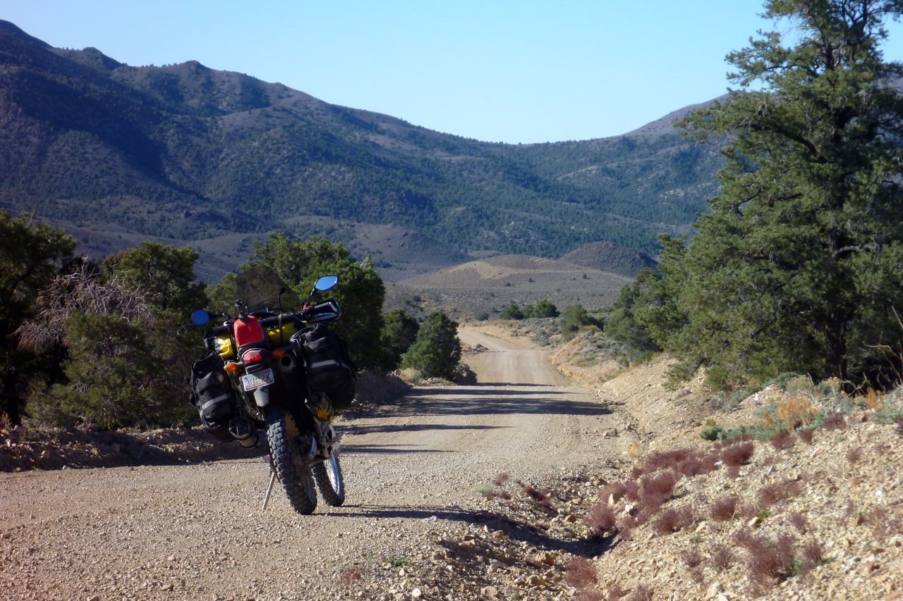
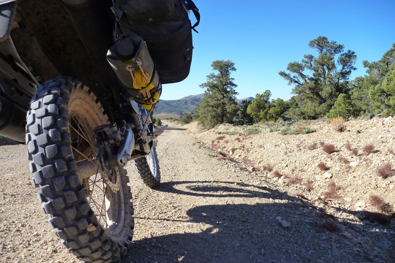
I ride on south on this GS12-able track. A lovely clear day after yesterday’s muggy overcast. The good thing with camping is you’re on the road early.
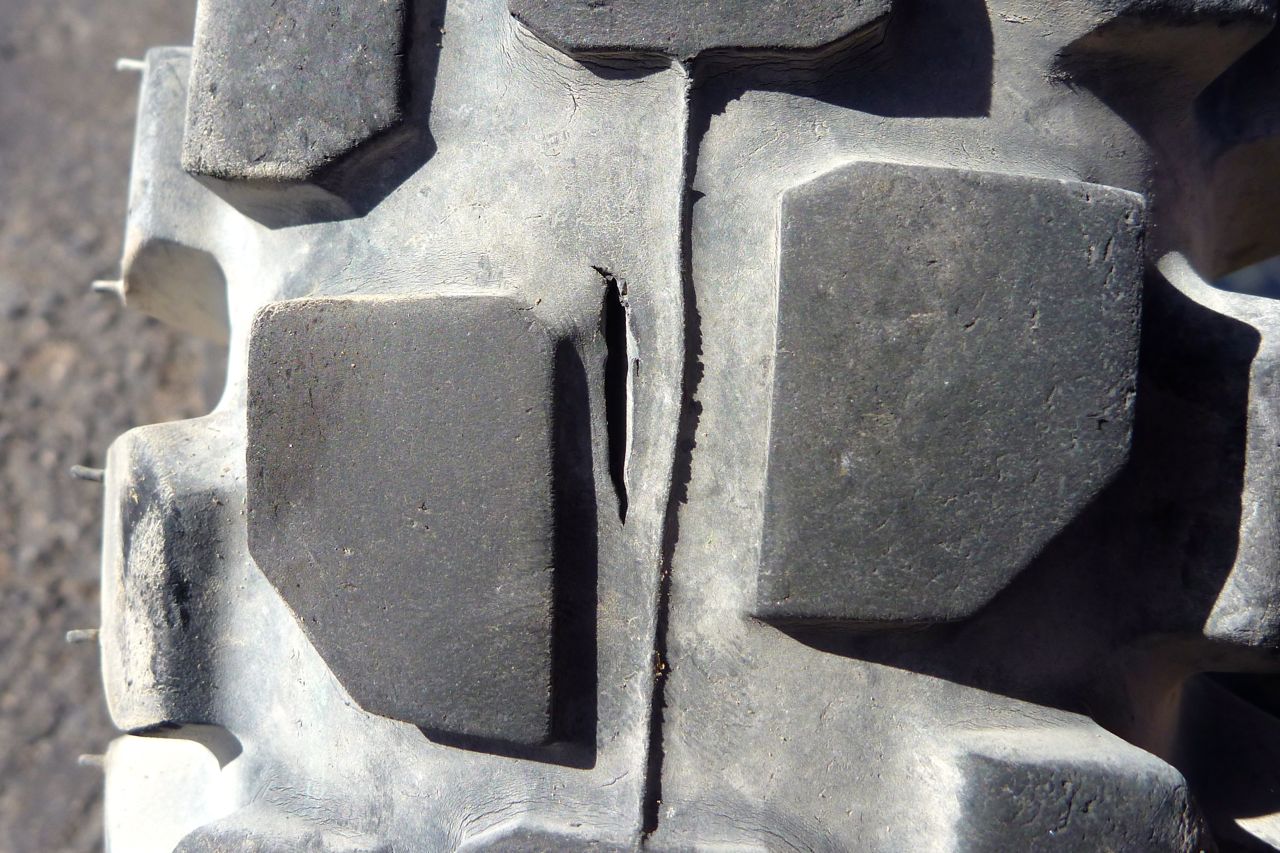
I notice my back tyre is wearing very fast. 2500 miles from new and it’s got 5-6mm left. I better do something about that quick.
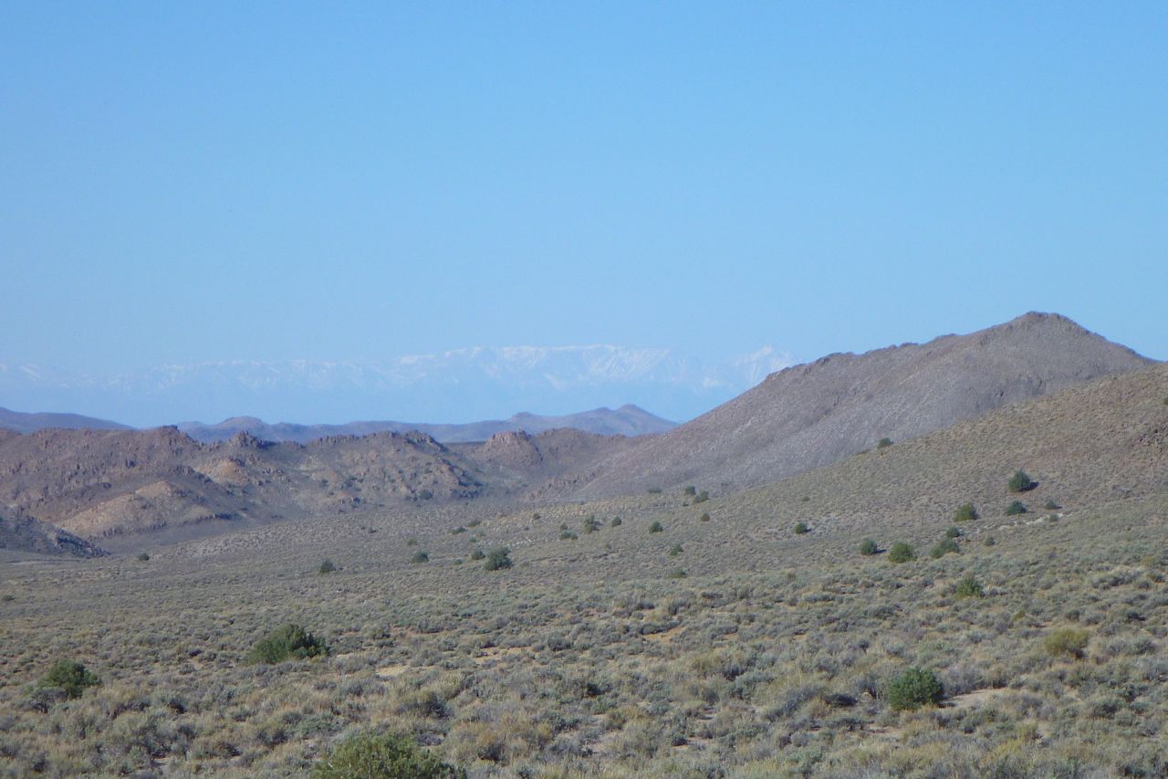
Far in the distance the snowy Sierra Nevada on the other side of Death Valley where I was a couple of weeks back.
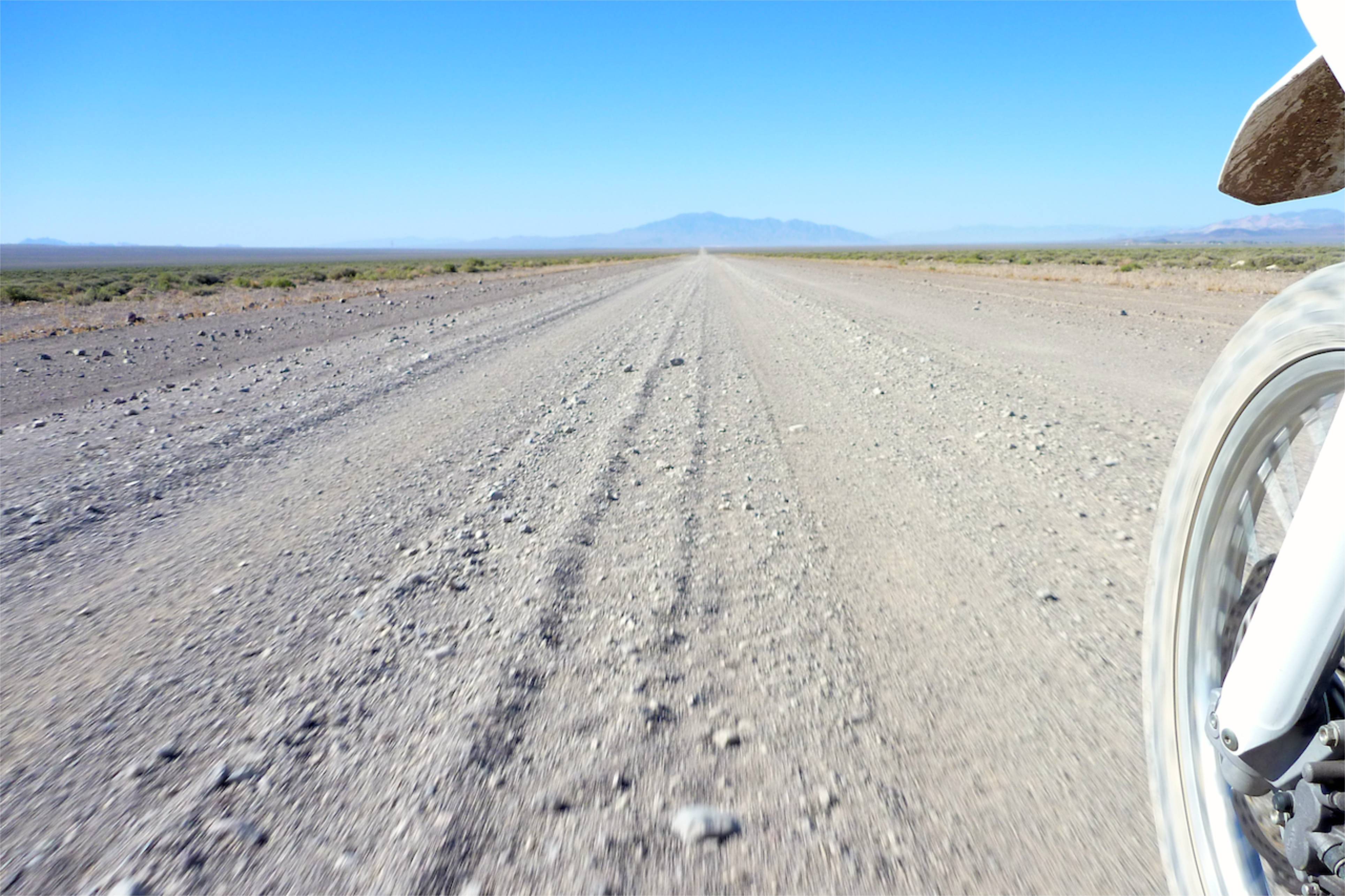
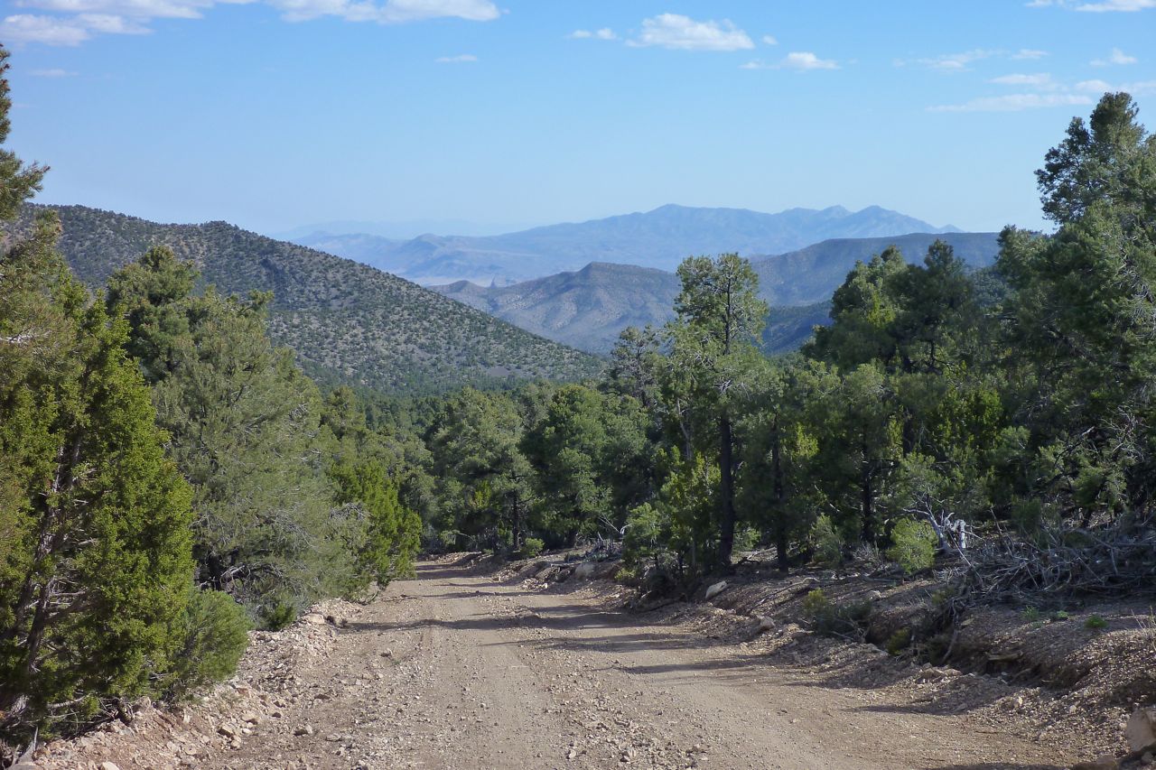
I emerge from the mountains and follow a network of gravel tracks south to Tonopah where I hope they have wifi with the fuel.
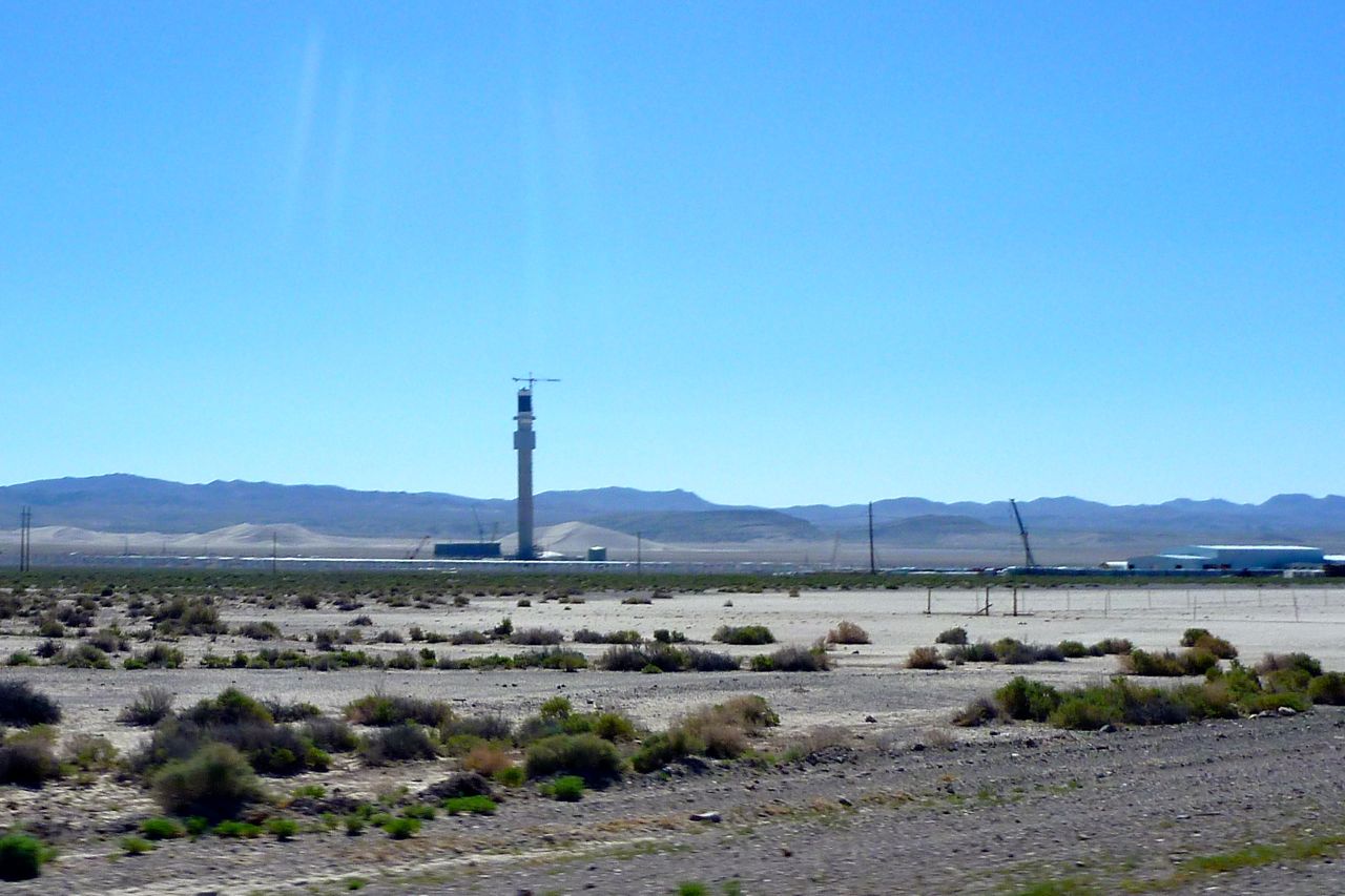
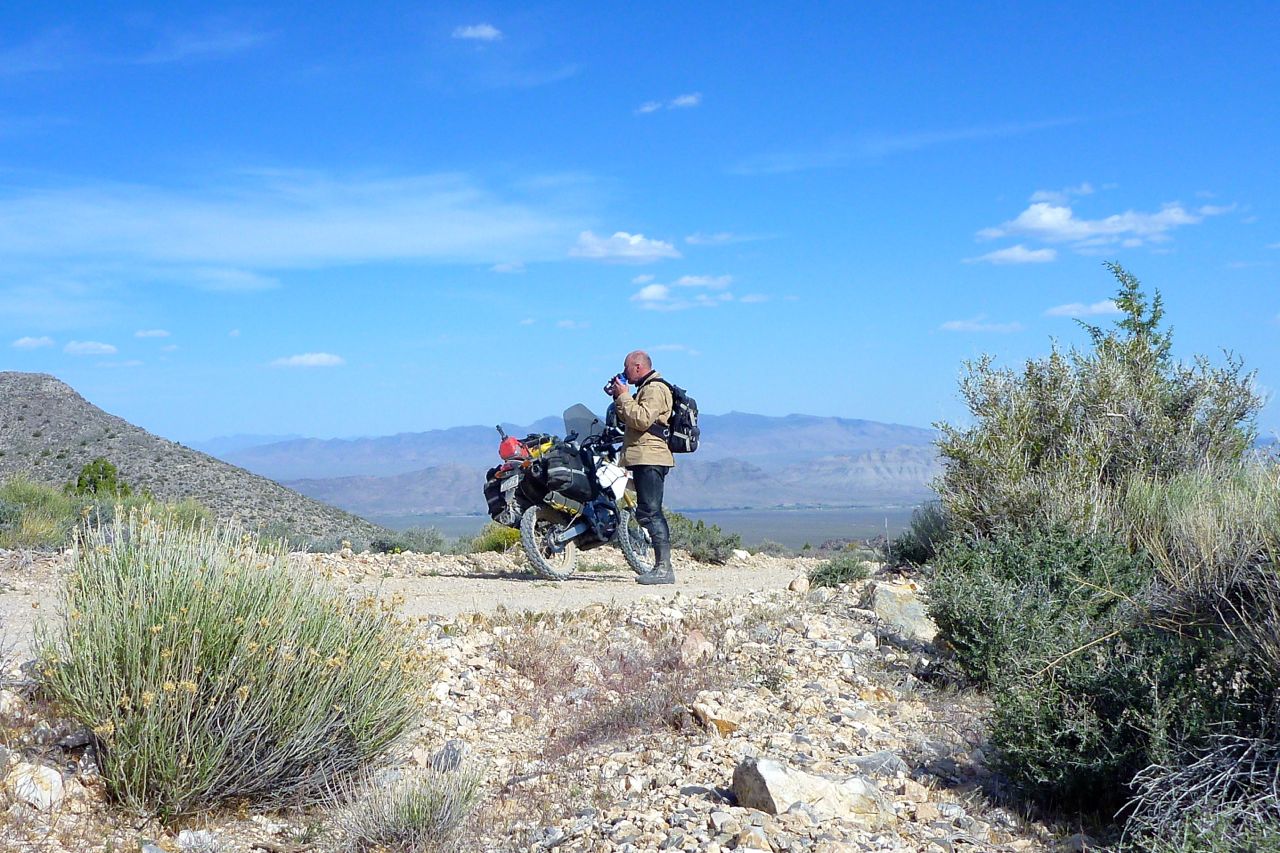
I pass this strange tower. I am just north of ‘Area 51’ – anything could be possible. Turns out it’s one of those parabolic solar generators. An array of mirrors on the ground focus on the tower top like magnifying glasses and generate intense heat and I presume steam. The Southwest should be covered with these, IMO. You barely even see a solar panel out here…
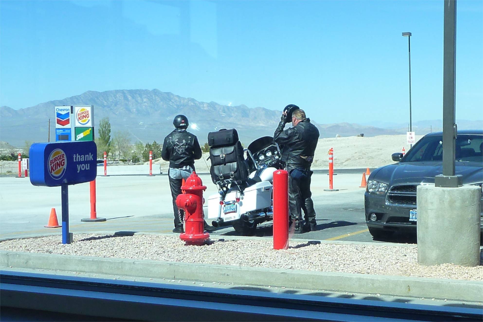
Most of the bikes otr are Harleys. This one’s rear luggage arrangement caught my eye. It looks way out back there, like a luggage vending machine, but on a full dress Hog it probably doesn’t affect the handling noticeably – and anyway is something to lean on. Outside of a Freddie Mercury video I’ve never seen assless chaps before either.
Tonopah turned out to be an old mining town – rather more characterful than Fallon. It reminded me of Tennant Creek in northern Australia. But no wifi at the servo so I jog on.
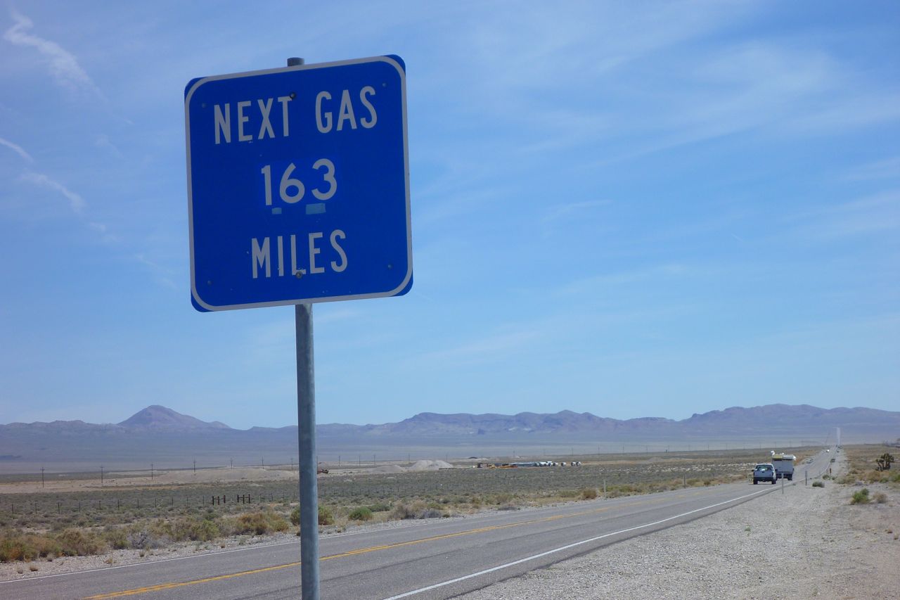
Really? Oh dear – let me recalculate. Well I can theoretically get that out of the 2 gallon tank now and have a can on the back so I should make it.
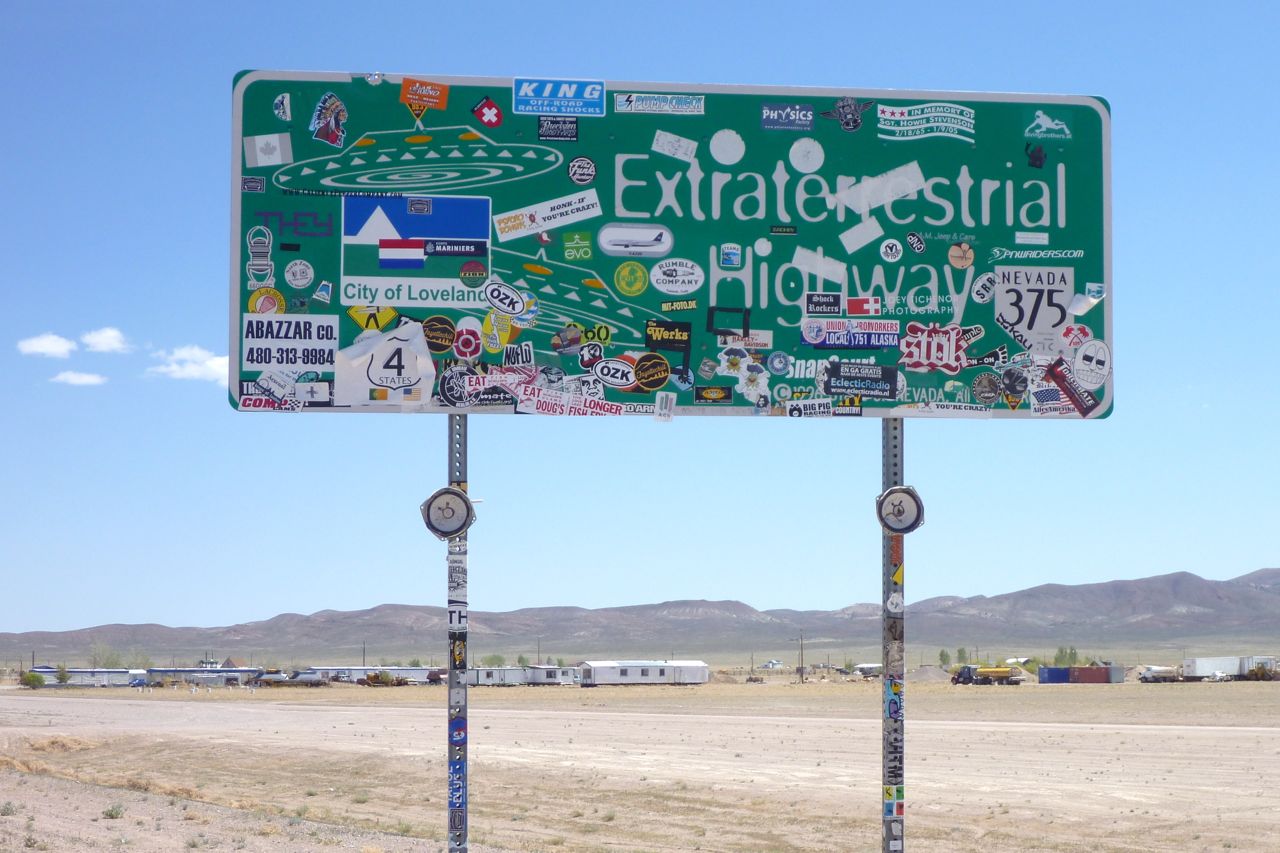
This is the ‘ET Highway’ to Rachel, north of Nellis AFB and it is hot enough to melt a flying saucer.
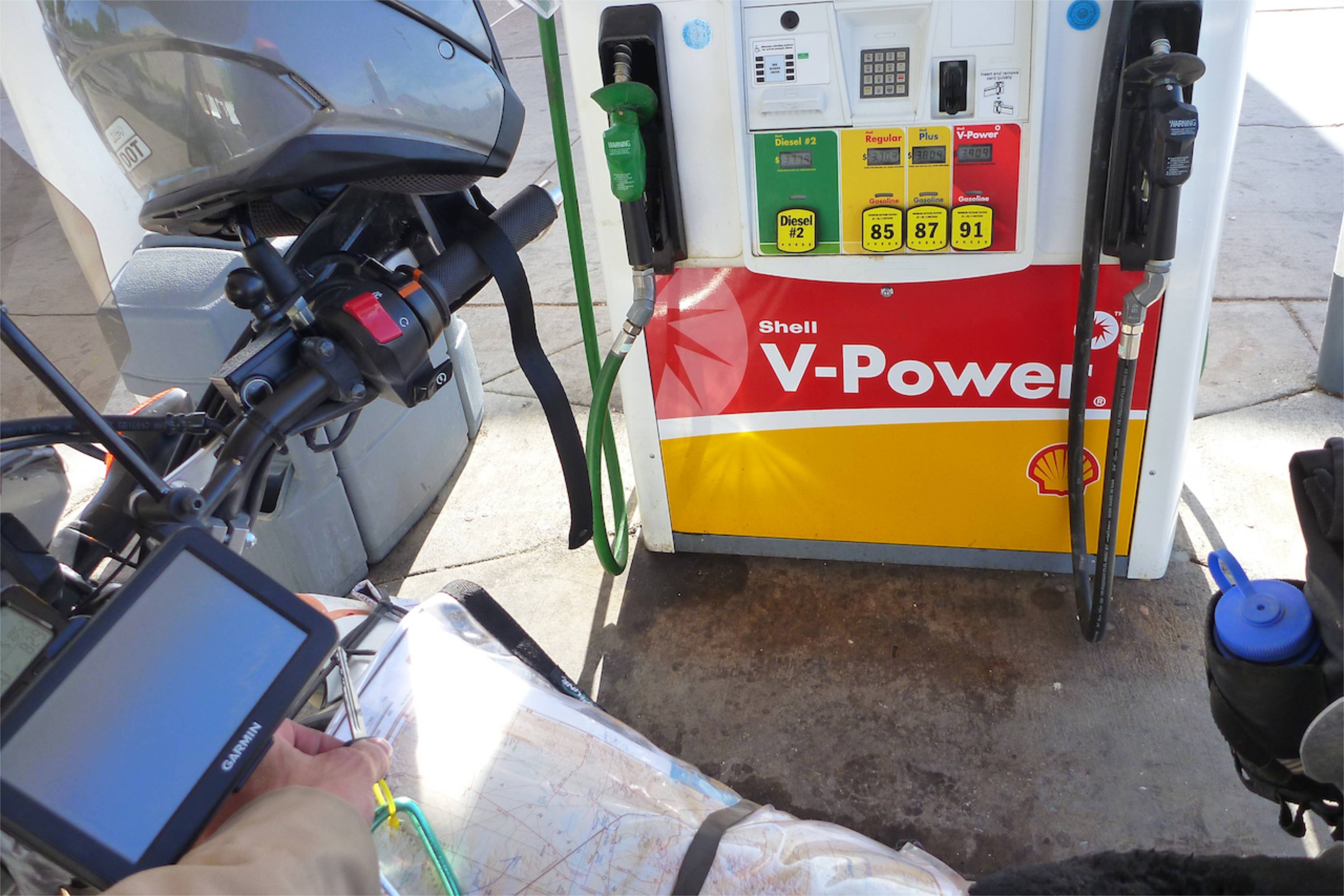
I pull over at 83 miles and can’t even get 1.1 US gallons in there. Hot backwinds are helping me get nearly 100 miles to the Queen’s gallon. If it’s over 30C at 5000+ feet in April, what is August like?
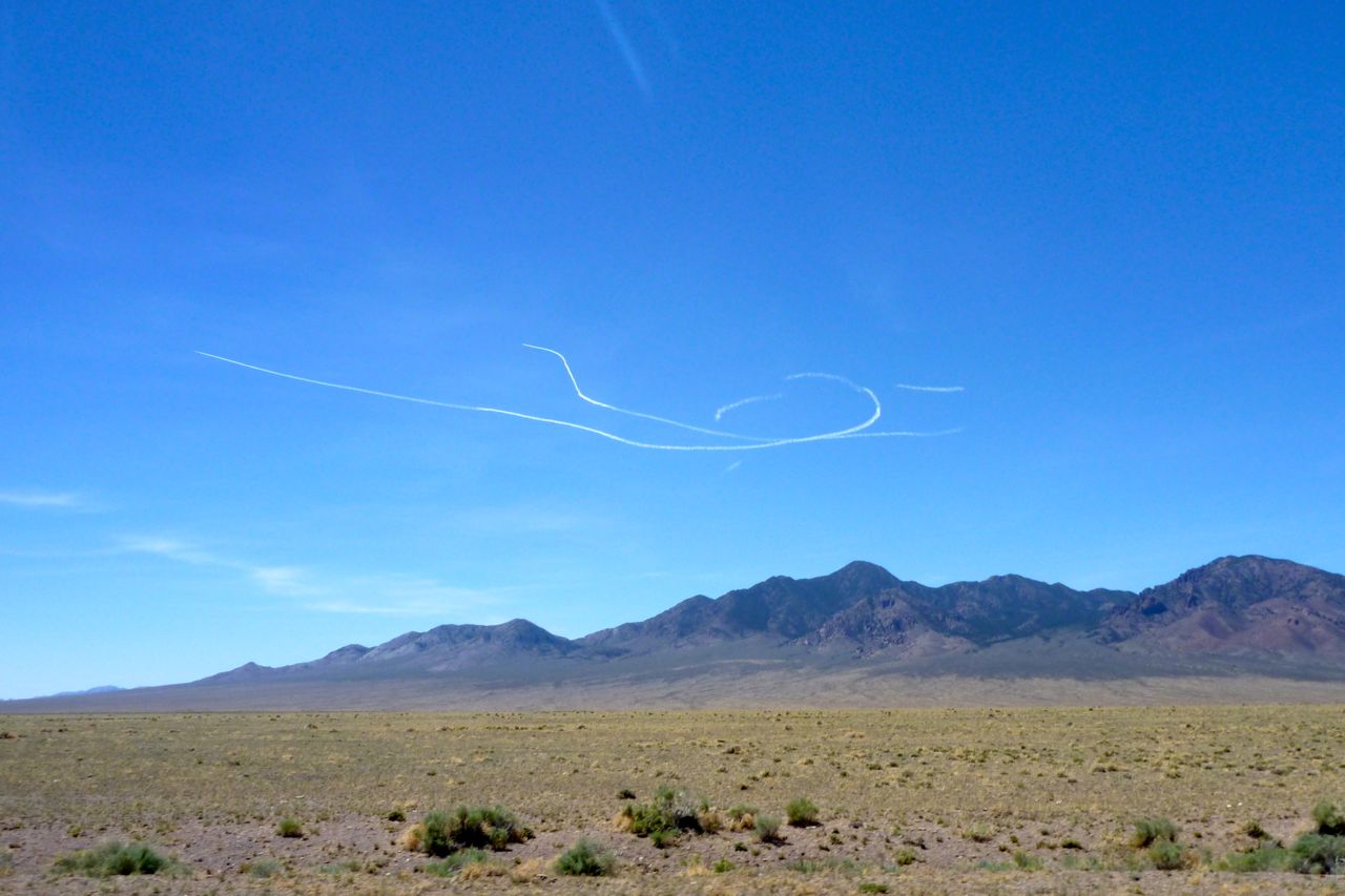
As I pass Nellis I wondered whether I’d see any sign of the sinister activities that make the place famous amongst the tin foil hatters. Those vapour trails are not a Boeing 787 being put through its paces, that’s for sure. Two jets fly off into the ionosphere at high speed.
This must be Rachel, NV. Again, reminds me of the Wycliffe Well roadhouse south of Tennant Creek, NT. Same silly UFO theme to lure the weary and bored off the highway.
I find some welcome shade to eat and drink. I’m heading over those ranges in the background on a 60-mile dirt road. Let’s hope it’s cooler up there.
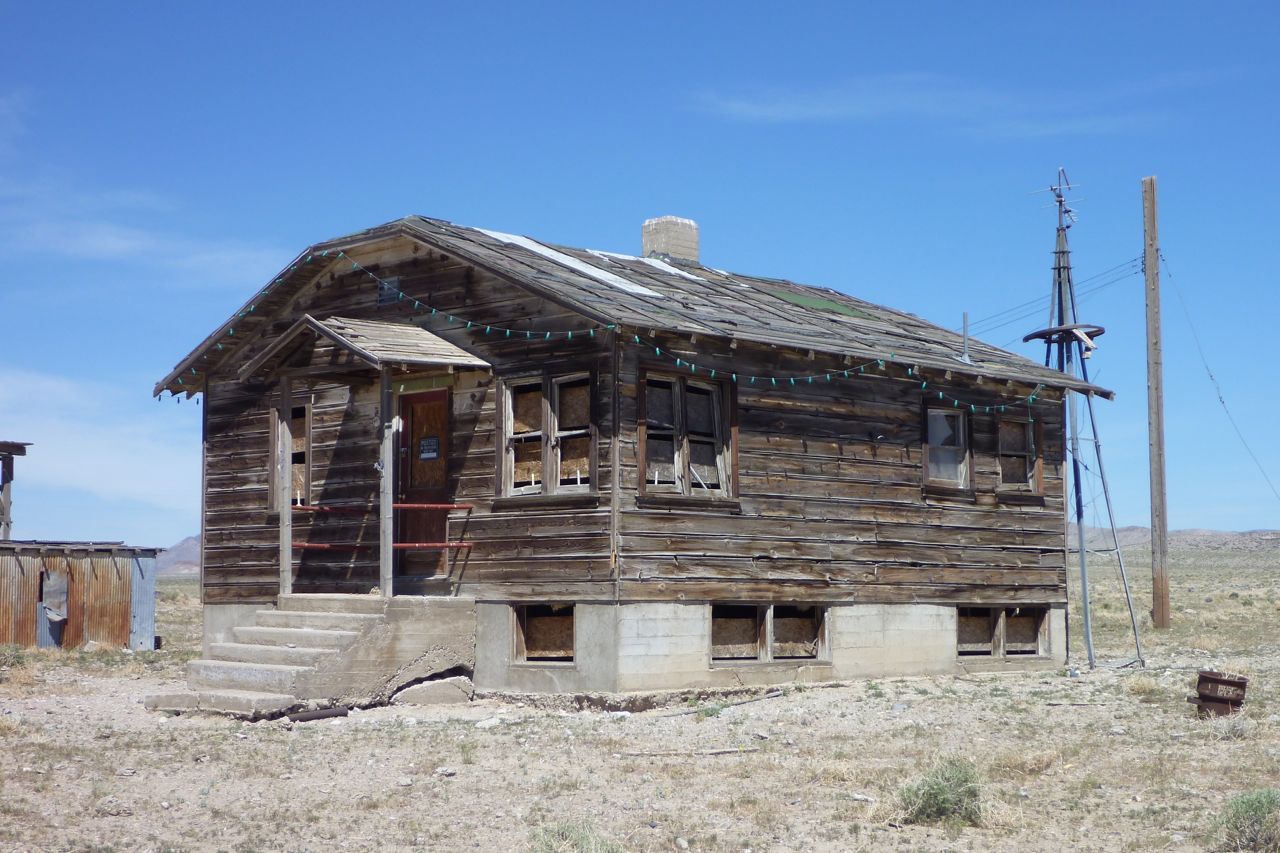
It’s an old ranch house (though in fact these dilapidated old cabins are all over the west). I notice they call the bigger ones ‘stations’ out here too.
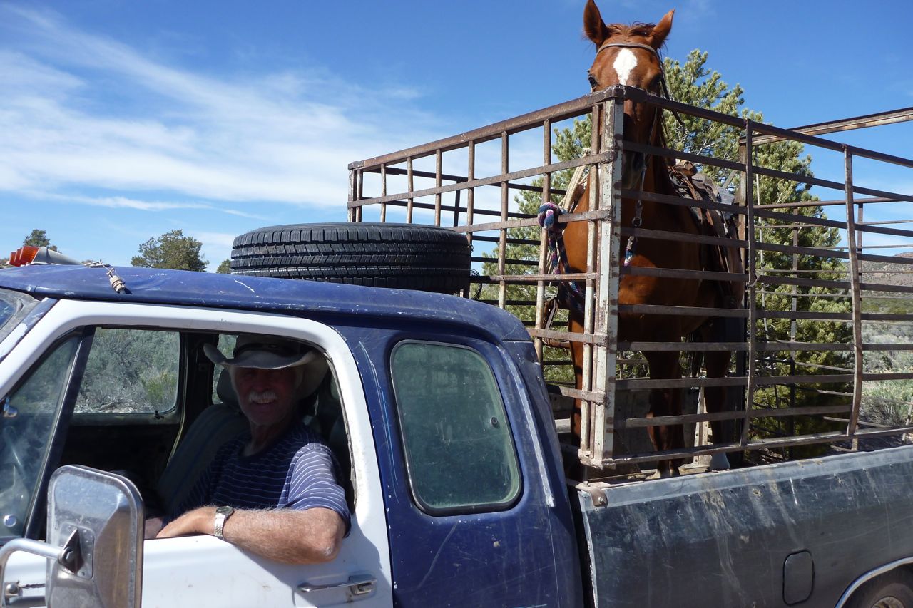
I meet a man taking his horse for a drive. Yes the road goes over the pass and down the other side, he reassures me. Are those ass-filled chaps you’re wearing there, son?
Did I say it was hot? It’s a tad gnarly too, and the Honda struggles with its wide road gearing on the dirt. Some climbs I’m in first and have a few front end moments. I ride watching the temp read-out and when it gets to 100°C I turn it into the wind for a bit. I may put in some thicker 10-40 oil in Moab. Nice views up top, but.
Down the other side I coast to cool the motor. I tell you I would have been in a right old muddle up here without the Nuvi, even though it cuts out a lot from the vibration. My Nuvi only shows dirt roads when you ‘Go To’ but was still $70 well spent. Tracks in all directions, you see. You still need the Benchmark for planning though.
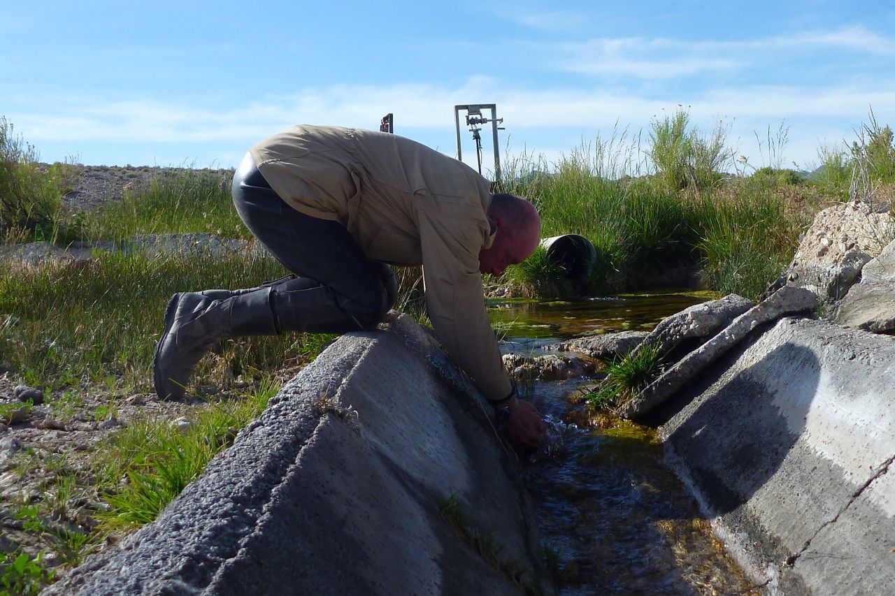
Out of the hills and I need a drink right now. My head is nearly as red as the fuel can.
Coming down to the highway I see either a blue wall of some kind of lake. It’s Lake Nesbitt! I ride right through the gate for a mini wash. That’s better; time now to look for a motel. I am shagged out.
Down in Ash Springs its 82 mpg at the servo. (98 UK) Amazing but then that’s why one compromises on a 250. Though on the dirt it’s no compromise at all. The man recommends the Alamo Motel down the road: great spot and a friendly guy. Later I wander off to the gas station for a treat and find a huge supermarket/hardware/cafe/auto store/green grocer/bakery behind the counter. In a little two-motel town? I suppose like a loan, they consolidated all their stores into one manageable item, bigger than my local Safeways.
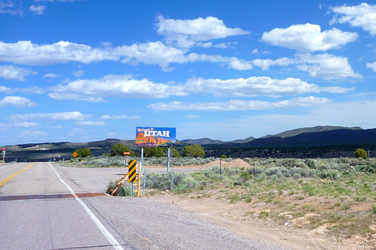
Today I had a great ride planned over to Utah, crossing the border on a 80-mile dirt road. But as I check on the state of the back tyre I’m not too surprised to see a nasty 2cm gash in the middle of the tread probably picked up on that ride out of Rachel. I’ve already ordered a new tyre to arrive in Moab c/o a helpful advrider, but looks like I better stick to the highways across Utah or I’ll end up like Everett Ruess. Luckily south Utah is not the worst place to be stuck on a road. I marked the gash to see if it grows, as they can do. If it grows too fast I make have to think of something else before Moab.
Nevada border – report ends
I hear that train a comin’ It’s rolling round the… SHUT TF UP!!!
Nice ride, I used to live out there but always stayed on the freeway. Nice to see some of the wild areas. Also if your chaps are not assless, then they are simply leather pants:)
Great blog! I saw your post about this excerpt on the #motochat hash tag today, and I’ve read all of your entries now. I spent ten years in Nevada and explored many of those areas. I’m now up in NW Oregon for work… much greener, less dusty, and more to explore! If you find yourself up this way, ping me, I’ll show you around. @RobGADV


Nice ride, I used to live out there but always stayed on the freeway. Nice to see some of the wild areas. Also if your chaps are not assless, then they are simply leather pants:)
LikeLike
Fantastic, Chris.
LikeLike
Great blog! I saw your post about this excerpt on the #motochat hash tag today, and I’ve read all of your entries now. I spent ten years in Nevada and explored many of those areas. I’m now up in NW Oregon for work… much greener, less dusty, and more to explore! If you find yourself up this way, ping me, I’ll show you around. @RobGADV
LikeLike