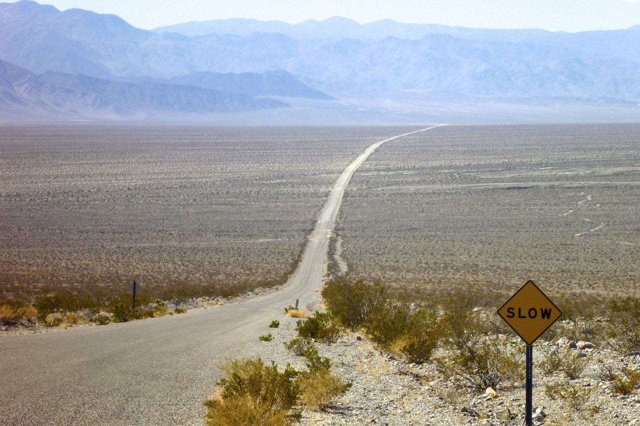
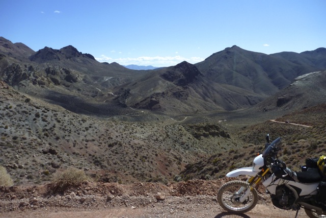
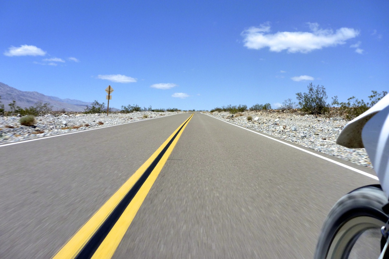
You can tell from the picture on the left that today was going to be a good day. An empty road reaching across the high desert to a vanishing point in a distant mountain range. Winding my way through Titus Canyon to the other side of the hills, the land dropped to below sea level – Death Valley, where I’d turn north over more dirt roads and ranges to Big Pine in California’s Owens Valley.
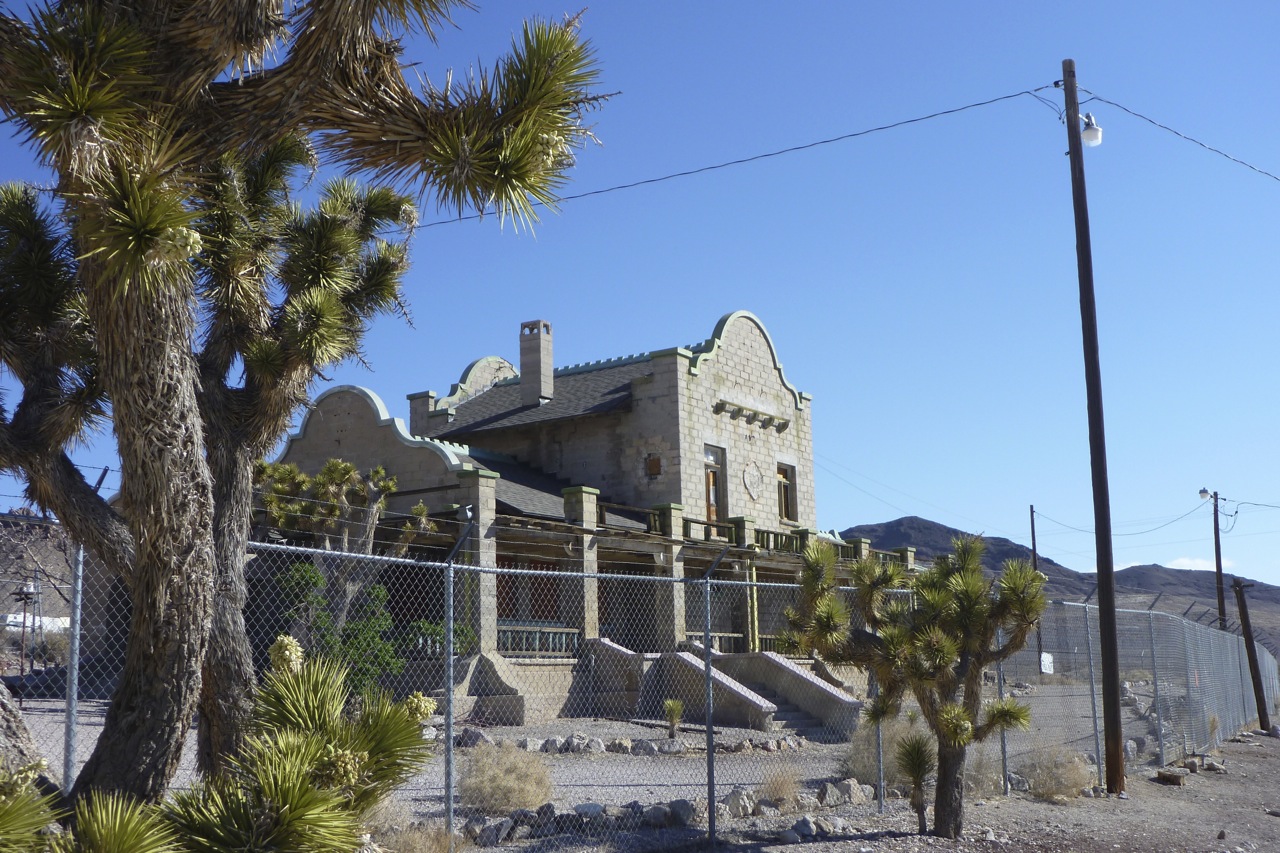
Before that and still in Nevada, I popped in to Rhyolite ghost town which in the early 20th century managed to go through its birth–boom–bust cycle in just six years. Disappointingly, the crumbling gold rush ruins were all fenced off, making it less of a ghost town and more of a hazardous site.
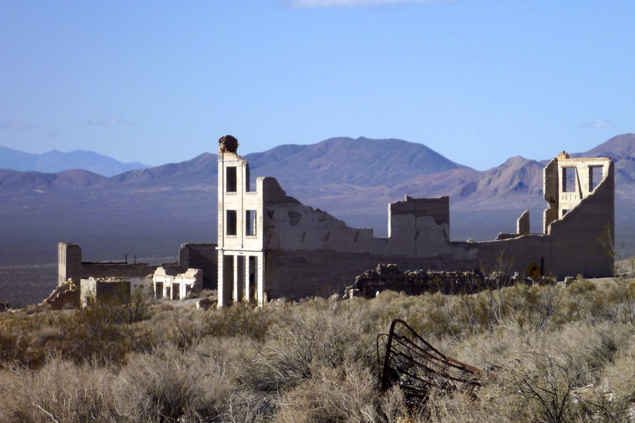
There was a ruined school (left) and a nice-looking hotel amid some Joshua trees (top right) with a curvy, Spanish colonial-era facade. It would have been more fun to stay in than last night’s Motel 6, but clearly Rhyolite has had its day.
Titus Canyon to Death Valley
Just down the road was the turn-off for Titus Canyon which Al had recommended as a great way to slip into Death Valley. SUVs followed me in and initially the stony, corrugated track was not in harmony with my jacked-up suspension and road-pressure tyres. Some tracks are like that or just required acclimatising to, but soon the trail began to climb into the Grapevine Mountains where the colourful rubble glowed rich with mineral promise.
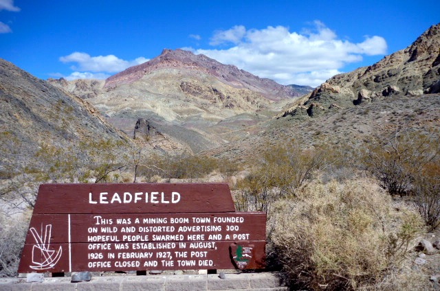
I came across the remains of Leadville, site of another brief episode of mineral mining madness in the 1920s; now just a couple of shacks and a heavily barred shaft penetrating the hillside. As has proved the case in similar places I’ve visited in Western Australia, the easily mined stuff usually gets cleared up before word gets far, and very often the best money was made providing services to the hopeful miners until they stampeded off to the next rumoured strike. In the UK or even Europe there’s no such tradition of mineral booms or ghost towns. A couple of centuries ago your lot was pretty much set from birth which must have made emigrating to the New World colonies in North America and Australia to chase riches all the more tempting.
It was all downhill from here to near sea level. A good chance then to stick it into neutral or turn off altogether and try to save fuel as I wasn’t sure how far I’d get or how much I’d consume getting to the next point, probably Big Pine at least 100 miles away (the satnav couldn’t calculate it on my dirt road route, despite fiddling with the settings and ‘avoidances’).
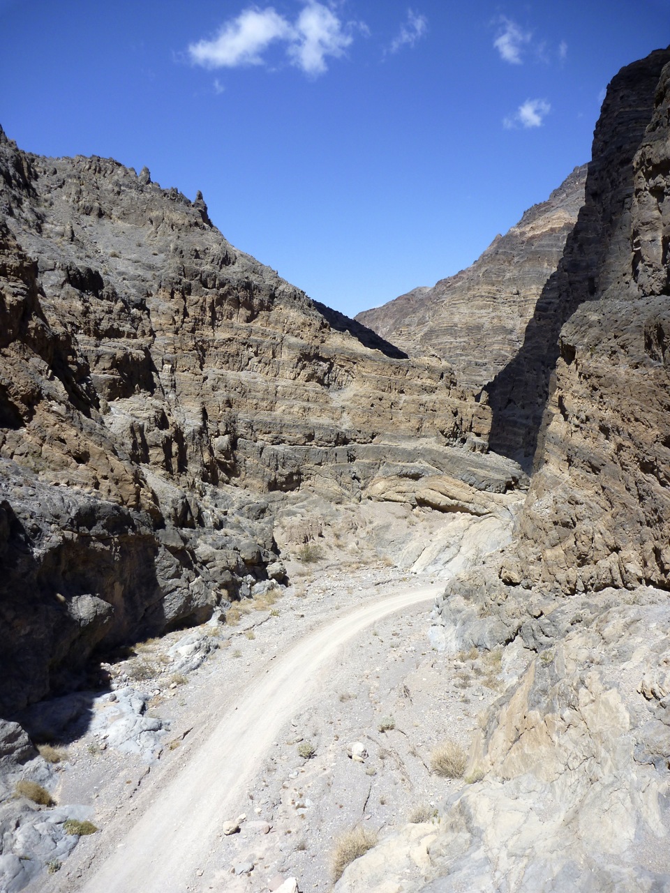
Titus Canyon is designated as one-way running west, as once it gets towards the end it’s bending left to right every 50 yards and narrows to about 20 feet wide – not enough for a pair of your typical local 4WD trucks to pass each other. Coasting down the box canyon bends, I took a strolling couple by surprise as they’d walked up from the mouth of the canyon for a look inside.
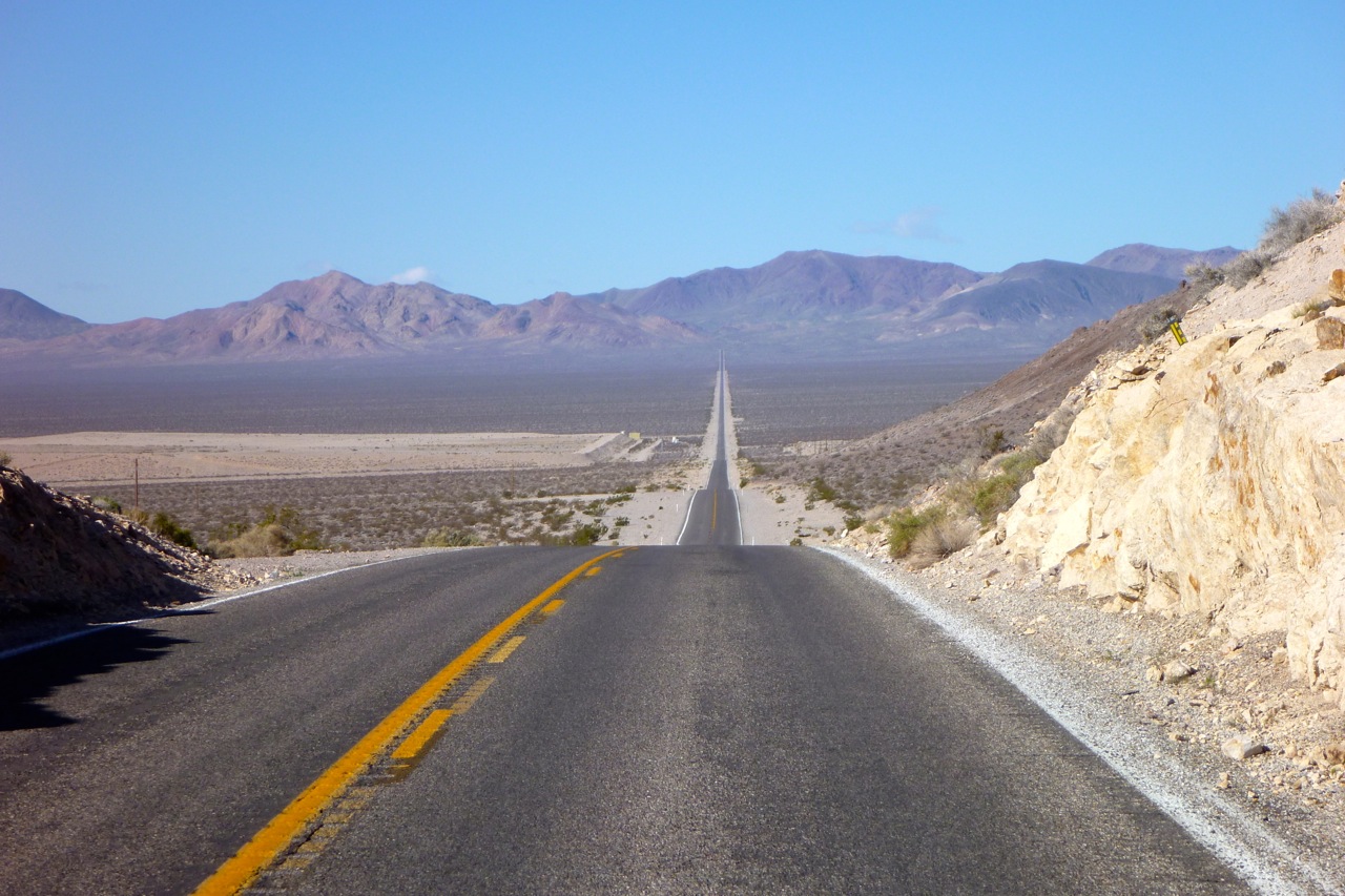
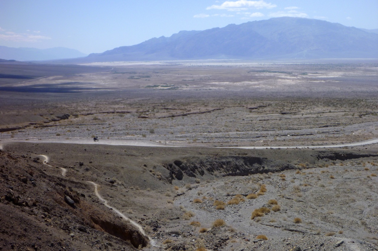
Out at the mouth, Death Valley (map) stretched across the horizon with the Panamint mountains as a backdrop (below). To the south lay Stovepipe Wells (fuel, though I didn’t know that then) and beyond that the salt-caked playa of the Badwater Basin; the lowest point in the US.
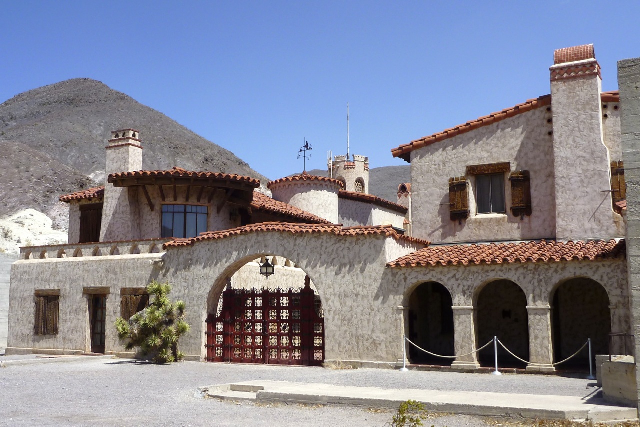
I first came here in the mid-90s and recall camping somewhere up the side of the valley; it was October but at 3am it was still about 30°C or 86. The Valley was a lot cooler today and there was now a smooth paved road running up the middle. Heading north the annoying wind was still in my face but I figured I’d risk a detour to Scotty’s Castle, expecting some naff, faux-medieval folly. In fact it was just the grassy, palm-shaded lunch spot I was looking for. There was a crude, concrete castle possibly housing a power house, but much more interesting was what looked like an Italianate villa built between the wars.
I was still in DVNP and asked the ranger how far Big Pine might be via the northern road. He wasn’t sure but in the end guessed it was less than 100 miles which was probably within my range once I’d used the fuel bag.
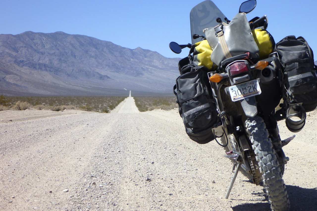
Coasting where I could, I turned off the paved Ubehebe Crater road (wish I’d gone to the crater now) and onto the rough dirt road leading up to Crankshaft Crossing. A sign said Big Pine something like 87 miles so I knew I’d make it. A dirt rider soon came the other way with a wave, and near the Crossing came another guy braving the gravel and washboard on a V-Strom.
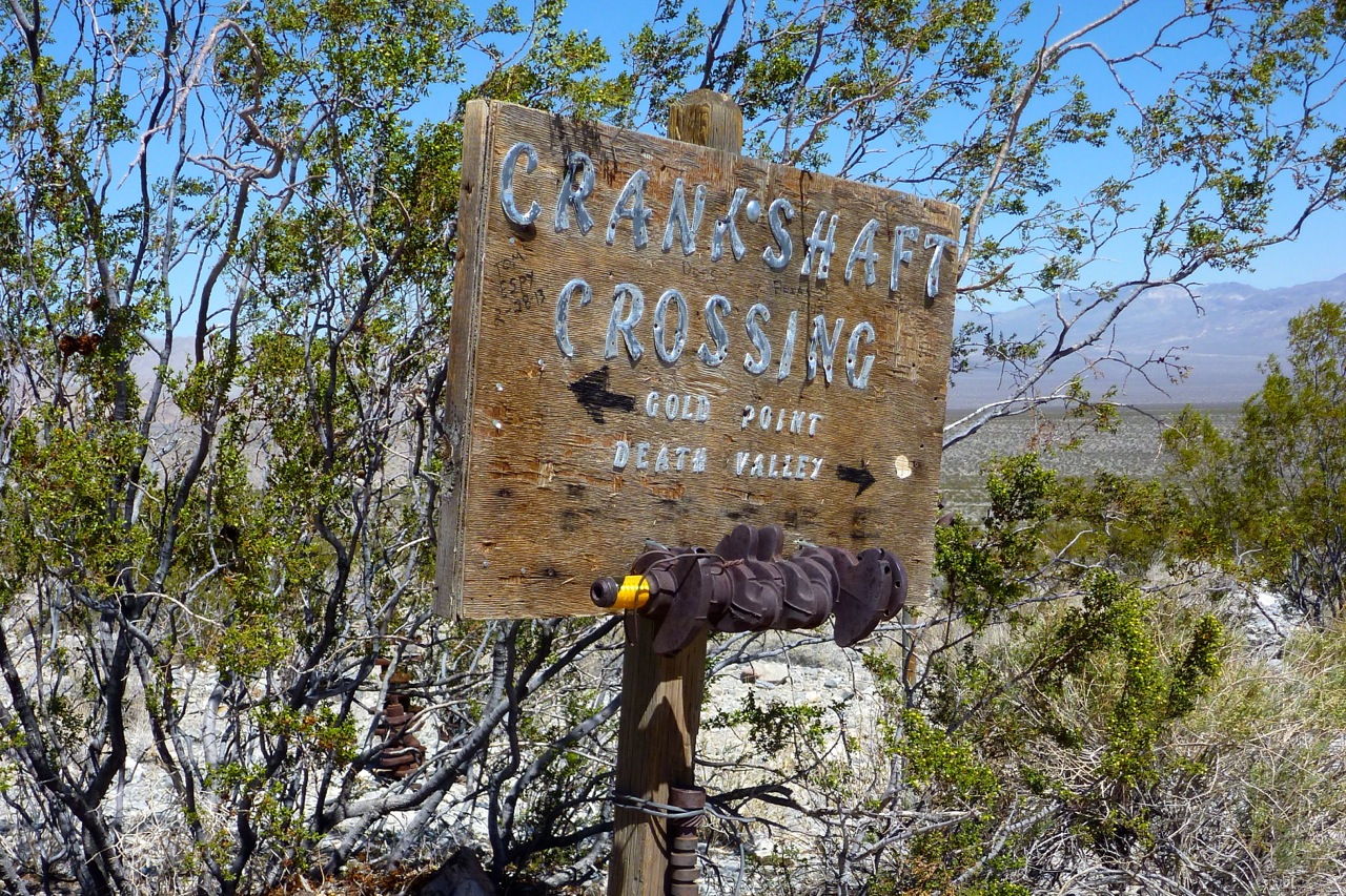
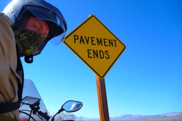
Crankshaft was another place I recalled from 1995. Back then I’d scrawled ‘Yeah!’ under a ‘Pavement Ends’ road sign. The photo had been featured on the back cover of AMH3 a year or two later. Could you believe it, but it came to my attention that those rats at Aerostich went right ahead and made a sticker out of my razor-like roadside wit, an entrepreneurial snatch which helps keep Rider Wearhouse afloat to this very day. I’m not bitter and anyway a lawyer advised me that writing messages on highway road signs was not a valid basis to instigate legal action, unless it was being aimed at me by the sheriff of Inyo County. I’m over it now and for old time’s sake shot against an ungraffitied sign just up the road.
I knew there was a range or two to cross to get to Big Pine but I’d again underestimated how high it could get; my maps only show peaks and less often pass heights. It’s much more than I’m used to climbing in the Sahara or even Morocco. The ill-tuned CRF, gagging on too much gasoline croaked uphill, dropping down to 40mph at 7500 feet (~2300m) which seems to be a bhp watershed for the Honda.
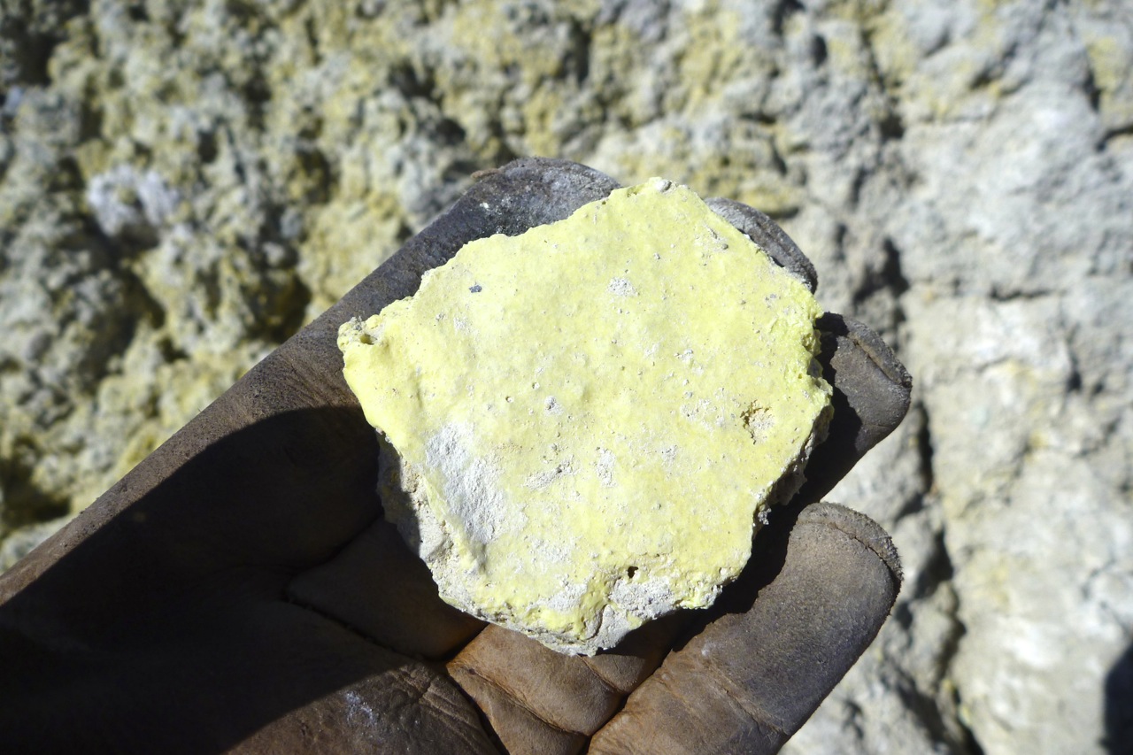
Up ahead the wind blew a flurry if white dust and with it a familiar smell from schoolday chemistry. Rounding a bend revealed an old mine by the road. Rusted machines were subsiding into the fine white powder which I rode across raising another billowing cloud.
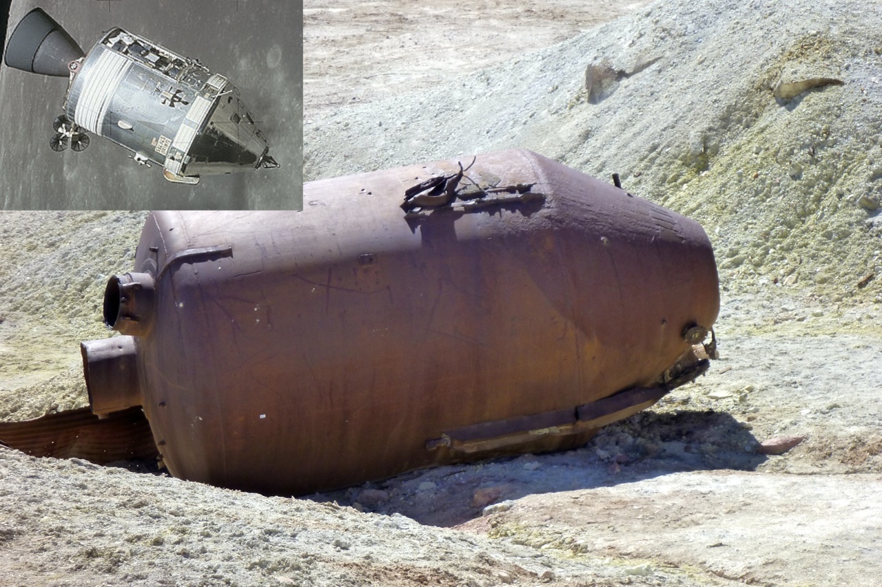
Finding a rock to perch the stand on, pale yellow rocks at my feet explained the smell: sulphur, above left). (Or for those that use them, the map also says ‘Sulfur Mine’). I’d never seen natural sulphur before; if only old gold mines had debris like this! Over there it looked like a prototype of NASA’s Apollo Command Module had fallen intact into the dirt (right).
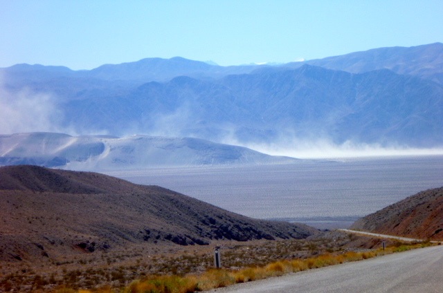
Over the pass I dropped into the Eureka Dunes valley where the wind was whipping up the grains and hurling them south (right). Not a place for a drilled out airbox and anyway, I’ve seen my share of sand dunes. But taking advantage of the lee of a signboard, I tipped the fuel bag into the tank and then set off along that very rare thing – a freshly graded track!
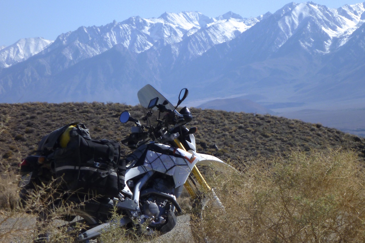
That lead, by and by, over another range which turned to reveal the snowy Sierra Nevada to the west (left) and Big Pine at its feet. Not far away was the 14,505′ (4421m) summit of Mount Whitney, the highest point in the contiguous US and just 80 miles from Badwater Basin. How’s that for a ‘land of contrasts’?
I’m no expert but the people in Big Pine, CA seemed different from Nevada, a bit more prosperous and less out back. Once I worked out how to make the pump work, the news was rather poor: despite all the coasting and gentle dirt roading all I’d managed was 54USmpg (65UK). Clearly coming over the Panamints and Inyo ranges had been an effort for the Honda, but the way I rode I should have managed 65US. Tomorrow I’d have to deploy Plan B.