• KLX250S main page
• Baja Gallery
• KLX – mountain and desert
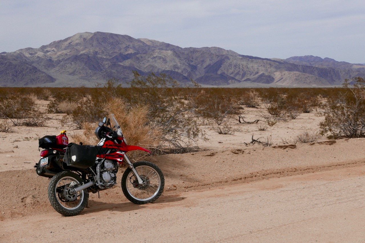
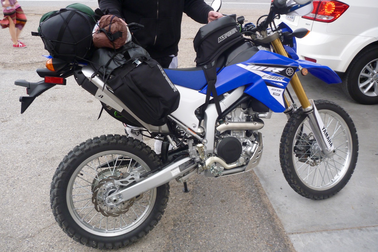
With the KLX set up, I took off for a few days. The plan was to explore the Mohave desert between the Arizona border and the Sierra Nevada. Along with Baja, this has been an unfulfilled biking destination for as long as I’ve been trail biking.
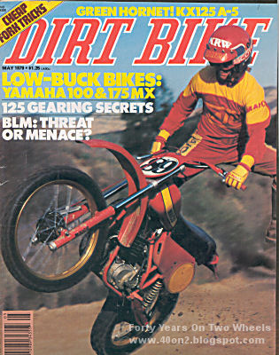
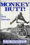
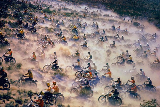
In the late 70s I gobbled up the seminal Dirt Bike magazine from cover to cover – and most of their riding was done out here, east of LA. DB founder and editor Rick Sieman wrote up his ‘Dirt Biking Years’ as Monkey Butt, the memoir of an increasingly bitter individual who saw his opportunities to gun across the Mohave scrublands slowly eroded by the rise of the Joshua Tree-hugging environmentalists. In the good years the iconic, non-competitive Barstow-Las Vegas run (‘B2V’, below) had a start line of some 3000 bikes spread out a mile wide. By the late 80s the B2V got outlawed by the BLM, Rick Sieman did time for protesting/trespassing then emigrated to Baja in disgust. But as the fully legal LAB2V, a form of the event still survives.
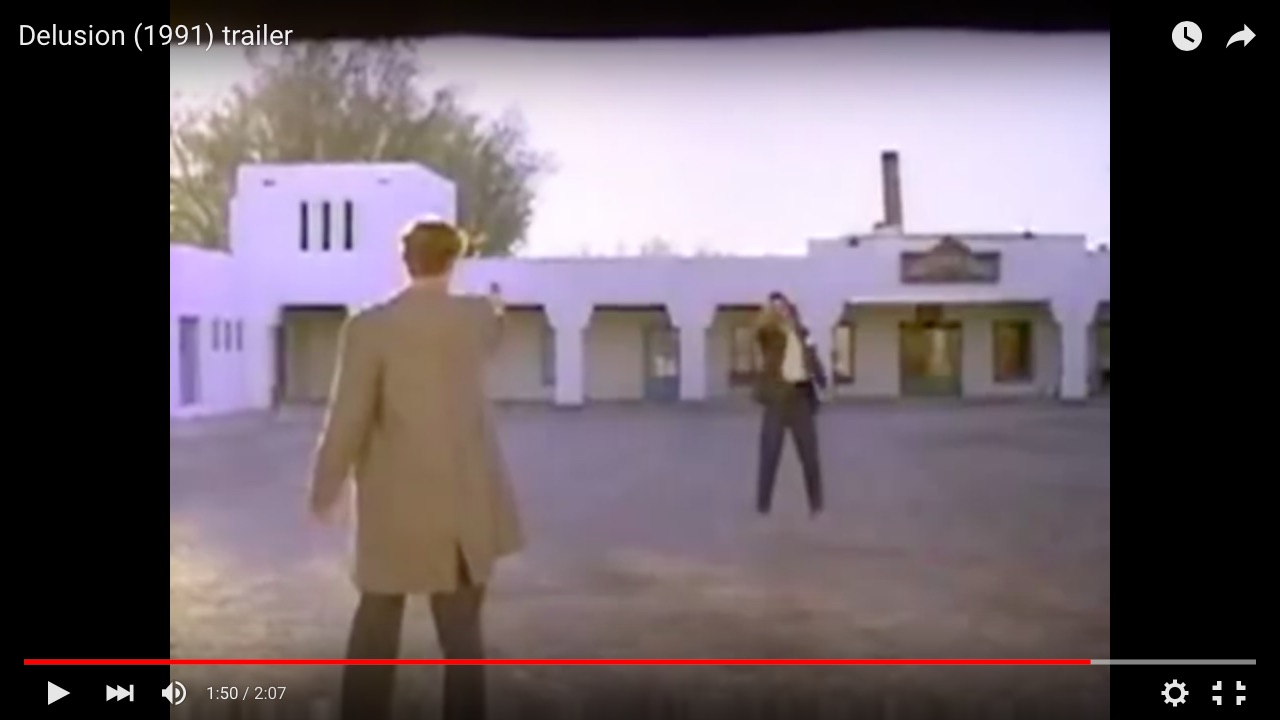
You don’t have to be an old fan of DB to recognise that besides low-flying Maicos, countless movies have also been shot out in the Mohave, a short distance from Hollywood. Time Rider (Back to the Future meets TT500 desert racer) will be known to many riders my age, but be it a zombie western, a road movie, teenage slasher or Mars on the cheap, the arid scrubby, mountain-rimmed playas east of LA have provided the space and landscapes to spin a yarn. In 1991 I well remember watching a B-grade road movie called Delusion with its climactic shoot-out outside a 1930s deco motel at Death Valley Junction (left). Death Valley Junction – what a great name. A few days later I rolled up right outside that very motel (and passed it again on this trip,now reopened). Your road trip becomes your road movie out here.
It may even go back even further than that. Childhood telly like The High Chaparral, Bonanza, Lost in Space, and movies like Planet of the Apes all included locations out here. If you’ve ever watched telly or seen a film, chances are the Mohave backdrops will be in your blood. Painting yourself green and wearing a salad bowl for a hat? Well, that’s just down to personal choice. Hell, we’re in California!
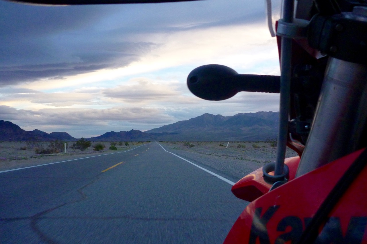
I left Phoenix on a hot afternoon (as the song goes), looking to get a couple of hours in. Destination: west. I-10 was obviously out on a 250, there was more fun to be had on 60 up to Wickenburg, then back southwest via Salome and up 72 to Parker on the Colorado river.
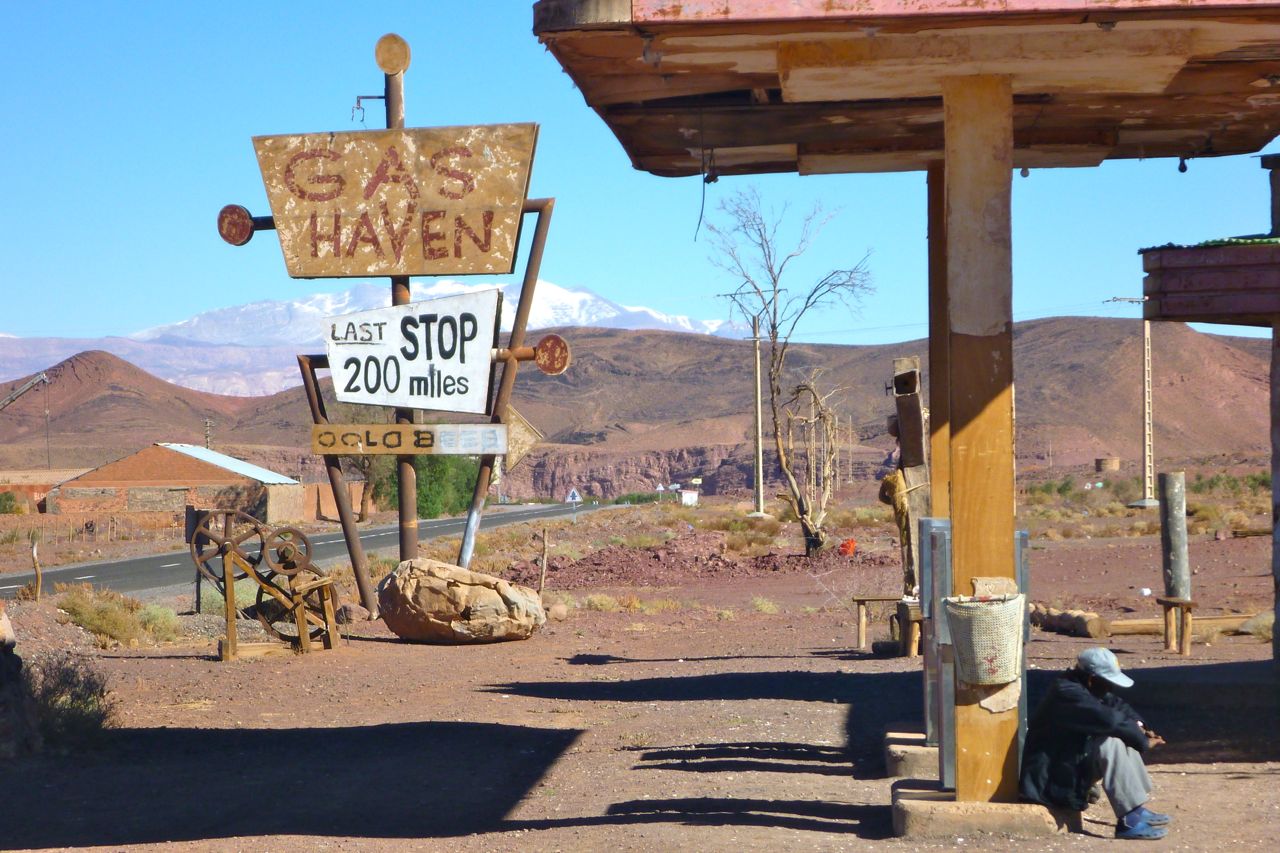
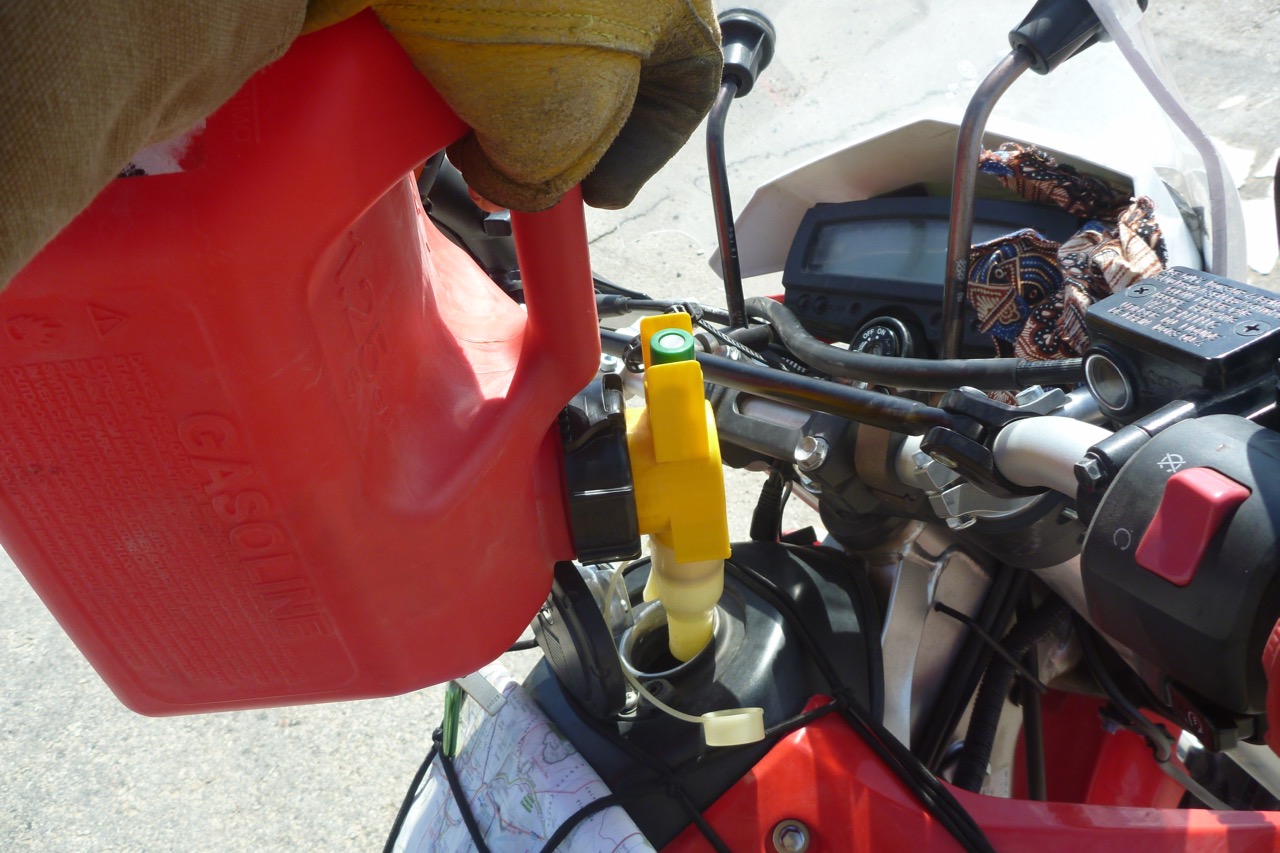
Just like last time on the CRF, my ingrained thrift saw me fill up on 87 fuel – they wouldn’t sell it if it was bad, right? Wrong. My new ride was soon running like an MZ on watered-down kerosene and hit reserve at only 88 miles, somewhere east of Salome. Still, getting off to top up the bike was a relief. I refilled at a ‘Gas Haven’ roadhouse – the one pictured above is an old Hills Have Eyes movie set in Morocco. You’ll find the real thing all over the Mohave and the Southwest.
Rocking up in a small desert town like Parker can be as thrilling as an Iowa farmer marvelling at Piccadilly Circus. The bright neon signs glow against the inky sky, growling V8s and trucks roll through – it’s all Tom Waits needed in his prime.
The downside to all this road trip romance can be underwhelming food if you try to dodge the fattening fast food traps. Or even if you don’t.
Next day I hopped over the turbid Colorado river which will be sucked down to nothing by adjacent conurbations and irrigation in the next 200 miles. Barely a trickle will reach the Gulf of California.
Hereabouts names on the map can add up to nothing more than a scattering of ramshackle, sun-bleached trailer homes or shacks ringed with dead cars, washing machines and other scrap. Is it a town or just a loose collection of dwellings where a outcasts, loners, rogue chemists or desert lovers pitch up to live on their terms?
Over late brekkie at Chiricao Summit on unavoidable I-10, the penny drops and I fill up with full-fat 93-grade gasoline with added maple syrup. Hey presto, the bike is running like it should. Next turn north leads into Joshua Tree NP, a cool sounding place where like the song doesn’t go, I may find what I’m looking for.
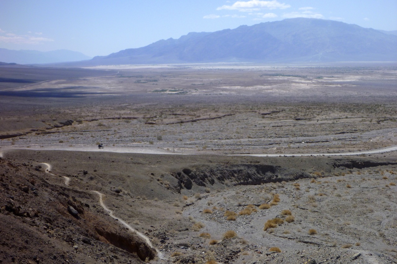
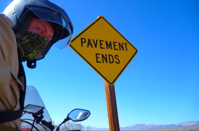
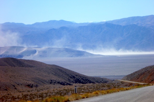
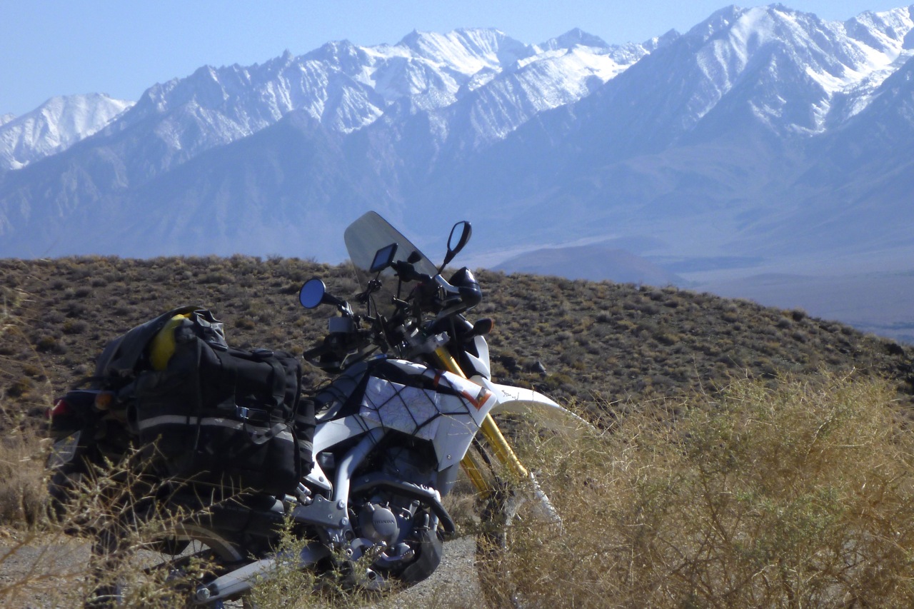
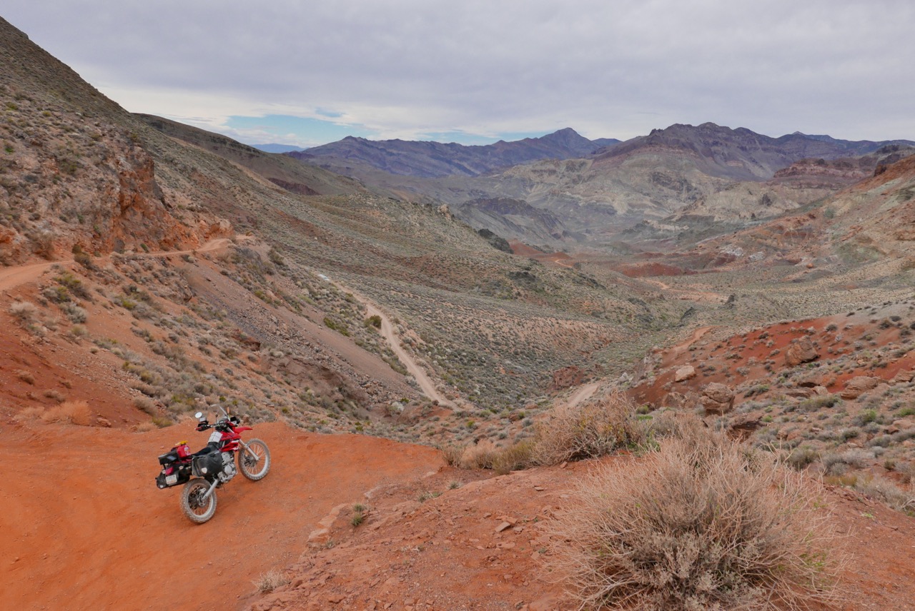
I’d downloaded a free Desert Southwest map for the Garmin Montana but seem to be missing out on juicy dirt roads – or I’m not reading it right (#2 it was). The NP paper map has more legible detail: Old Dale Road spins off the main drag and heads for the hills. ‘Four-wheel drive only’ it says – it’s even listed on DangerousRoads.Org – but after years of wheeling in western Australia I’ve become blasé to all that. Initially it’s a light sandy track and the KLX rattles over the washboard, front end surfing and wandering on its trail tyre. The backlight makes it hard to read the surface so I stop to air down a bit. It doesn’t make much difference but under 30mph the 140-kilo Kawa doesn’t have the momentum to flip out when it gets out of shape.
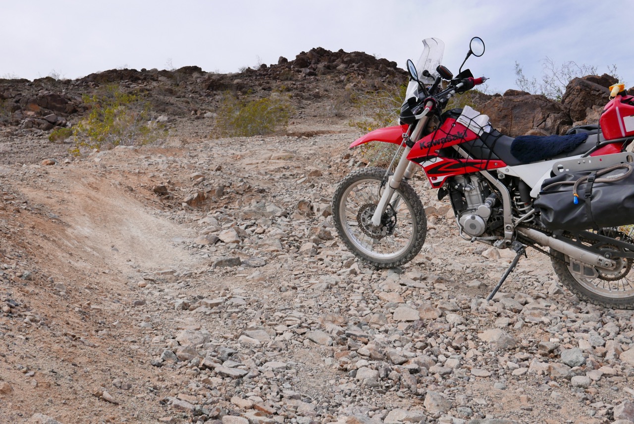
Then the track turned a corner and headed into the mountains and, yes sirree, you’d want a fourbie with clearance and low range up here – or be a GS pilot with steady nerves if on your own. On occasions it gets as gnarly as the gnarliest Moroccan tracks I do, requiring confident launches up or around rock steps and over loose piles of stones.
To my relief the KLX takes it all in its stride with its combination of harmless power, light weight and compliant suspension that all helps control the bike, not require fighting it. What a revelation; that’s what I was looking for.
Up on the heights other numbered but unmapped JT (Jeep Trail?) tracks branch off and my route isn’t always clear. Orientation has to be guessed off the broad-brush NP map with the help the Montana’s compass and a desert rider’s eye for what appears to be the most used trail.
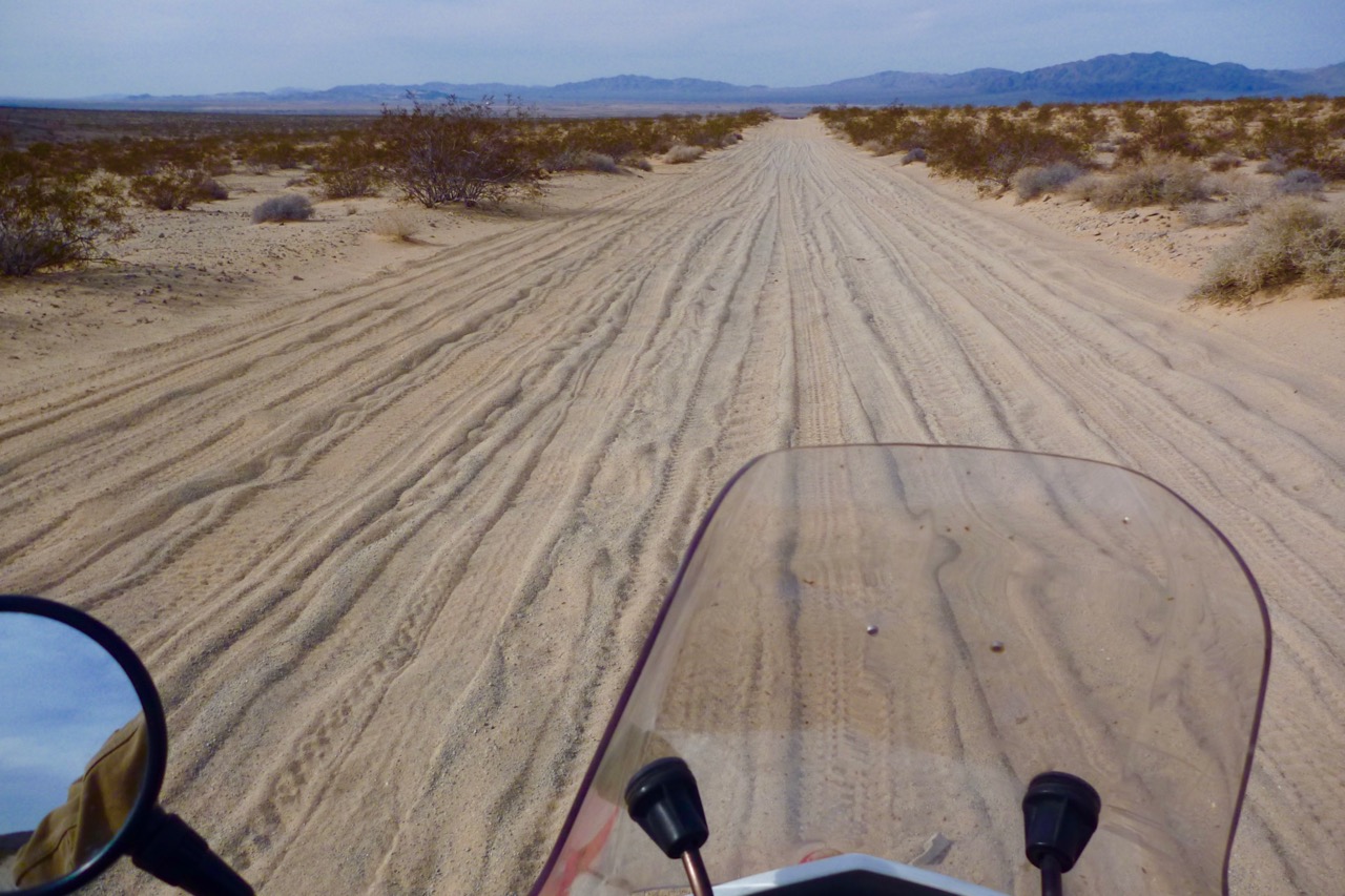

Out of the hills and back on a broad sandy runway, the bike is handling much better now. It occurs to me the energetic workout has reformatted my reflexes in tune with the bike’s bucking and sliding. Well, that plus lower shadows are now across the track, raising the definition.
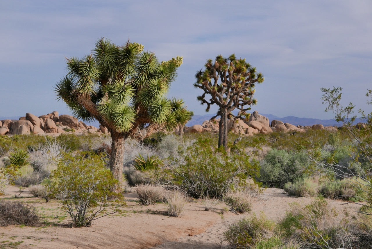
Back on the highway near Twentynine Palms, as the sun begins to drop I air up and scoot back into the north side of the park for the 4000-foot high scenic loop where all the J-Trees actually grow. Below, it could be the ‘Poison Forest’ episode straight out of Lost in Space where the green Siren lures in stranded argonauts.
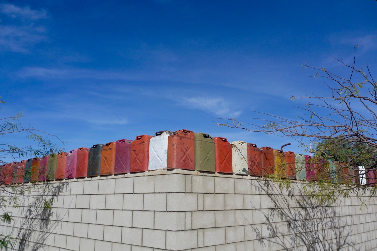
In Joshua Tree town the cheap-motel manager claims she’s ‘full’ but then relents and apologises for mistaking me for ‘a local’. I get this suspicion at other lodgings too – presumably highway-roaming two-wheel reprobates with swastika tattoos on their foreheads take the piss or cause trouble. Opposite the hotel the neighbouring compound had a colourful row of what I call ‘Ameri-Cans‘ capping the wall. Inside I try to watch TV for some added cultural immersion, but it’s a lost cause – you can literally channel hop from one commercial to the next.
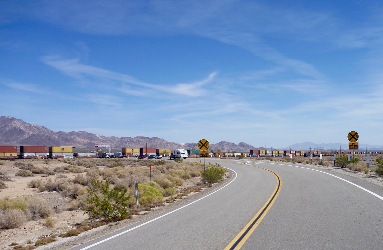
There are roads leading north up to Amboy and Kelso next day. I kind of hope they’ll be wide gravel dirt with shady borders, but will take what I get. Out of 29 Palms it’s actually deserted crumbling blacktop, like parts of old Route 66. There are a lot of east-west railroads round here, all converging on LA I presume. At Amboy, an old rail depot, we stop at a crossing to watch a mile-long BNSF train pulled and pushed by six locos. It’s a cue for another song and a ‘so-that’s-what-it-means’ explanation of its lyrics:
And the Burlington Northern’s pullin’ out of the world
With a head full of bourbon and a dream in the straw
And a Gun Street Girl was the cause of it all
A Gun Street girl was the cause of it all
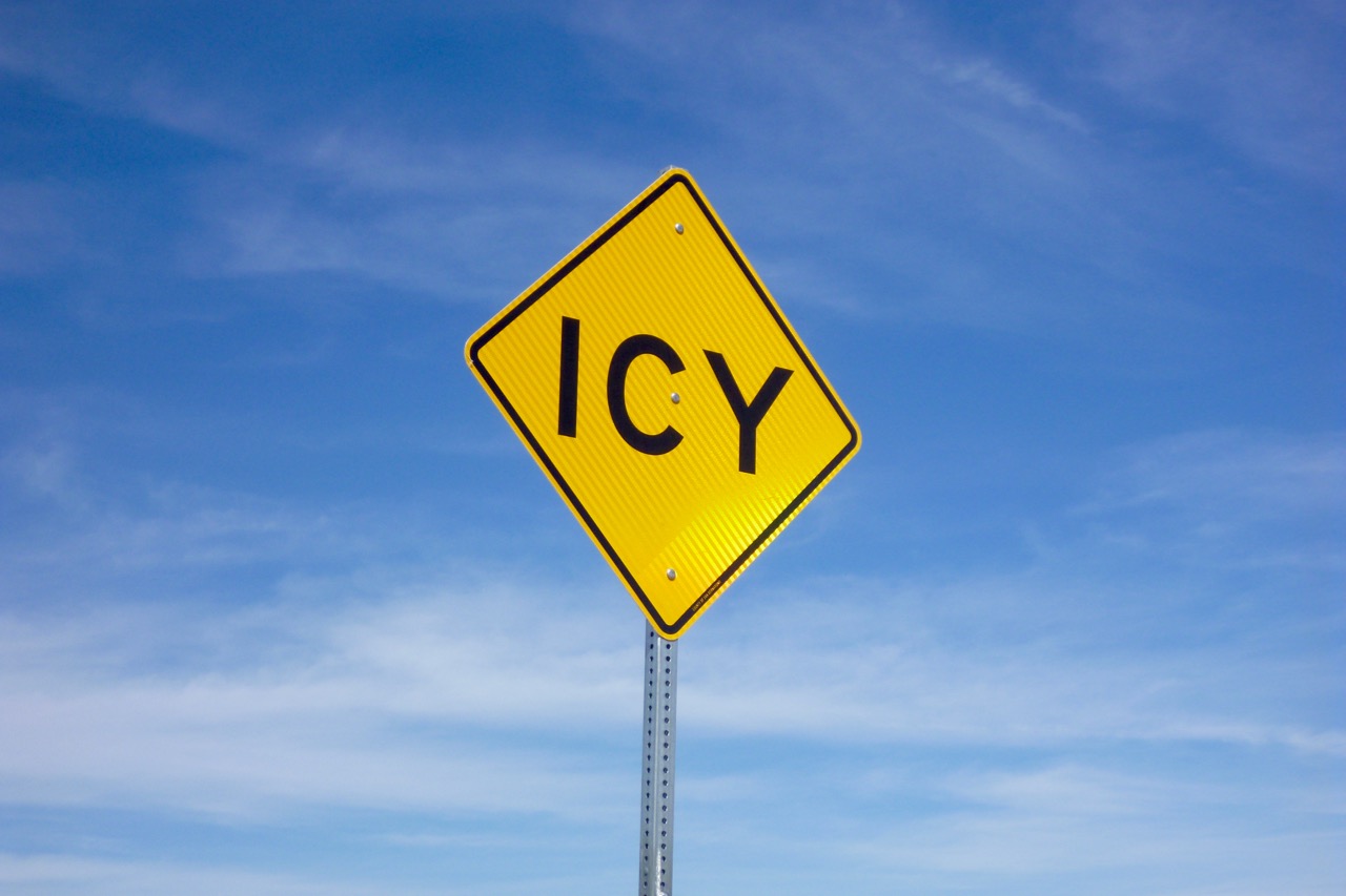
Amboy has an old roadhouse motel near a former Chloride mine – another authentic ‘gas haven’ with five-dollar fuel, no coffee and milling tourists. ‘Icy’ warns a sign on the next turn, but not today. Up top I follow a track to a grassy clearing and eat, read and doze, then head down the north slope with dunes on the horizon.
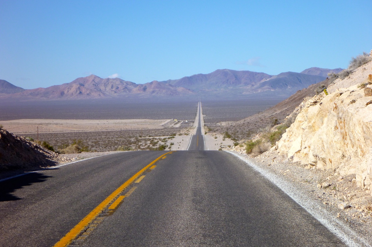
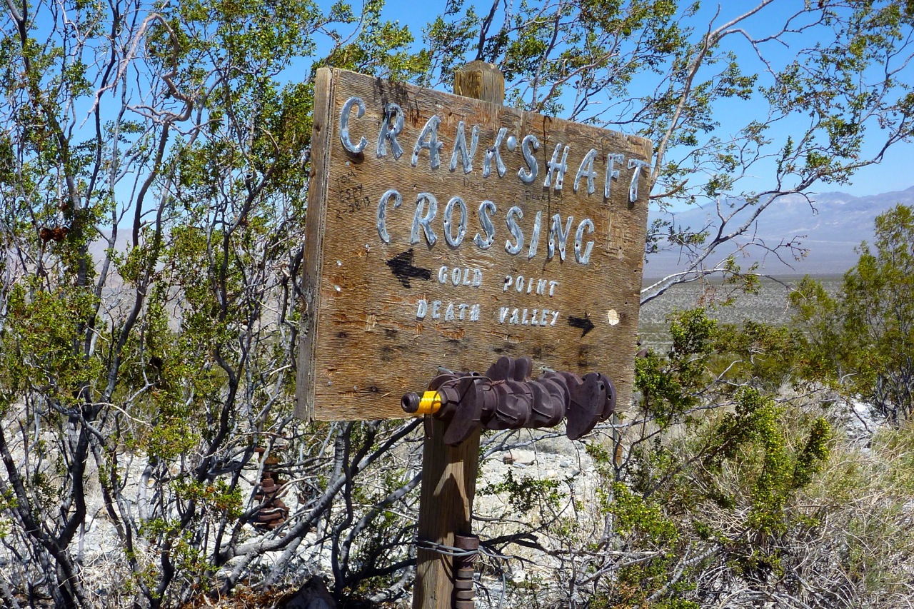
Kelso – another railroad ghost-depot. I’m wanting northeast for some intriguing backroads into Death Valley, but have to choose west for Baker and fuel (‘He was pulling into Baker on a New Year’s Eve – One eye on a pistol and the other on the door). My paper map seems unreliable, my GPS map has no key of course (but if I zoom right in dirt roads are there) and the Garmin World Base Map is – err – basic in outback California.
With a can on the back, to pass the time I decide to run the bike dry: only 125 miles but 88mpg (73US). Not bad I suppose. I snatch a few extra miles by coasting to Baker, enjoying the cycle-speed breeze. I’m not achieving a lot today, but no one’s watching.
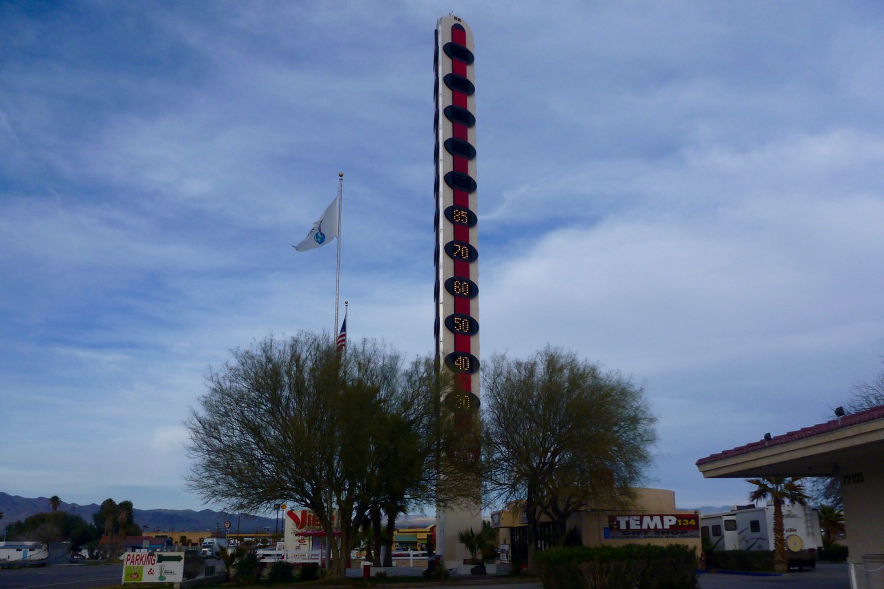
Baker is alongside I-15 and its famous Pole of Temperature (left) is reading 85°F, but by the weekend the weather is set to turn. Storm off the Pacific, wind and rain by Sunday they say.
Baker’s too close to the interstate to invite an early cut, but up the road in Shoshone there’s no room at the village inn. ‘Pahrump is your nearest bet, honey’. Another 30 miles and it’s nighttime in Nevada. Fill up at the servo – it’s all I ever seem to do. ‘Motels? Right at the lights’. Once installed, I whizz back to casino-lined downtown helmet-less for my bi-annual BK. Is Nevada helmet-free? Probably.
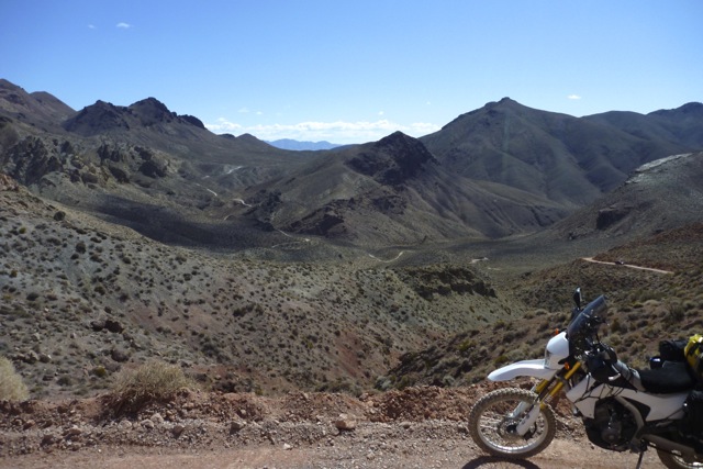
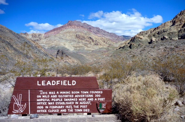
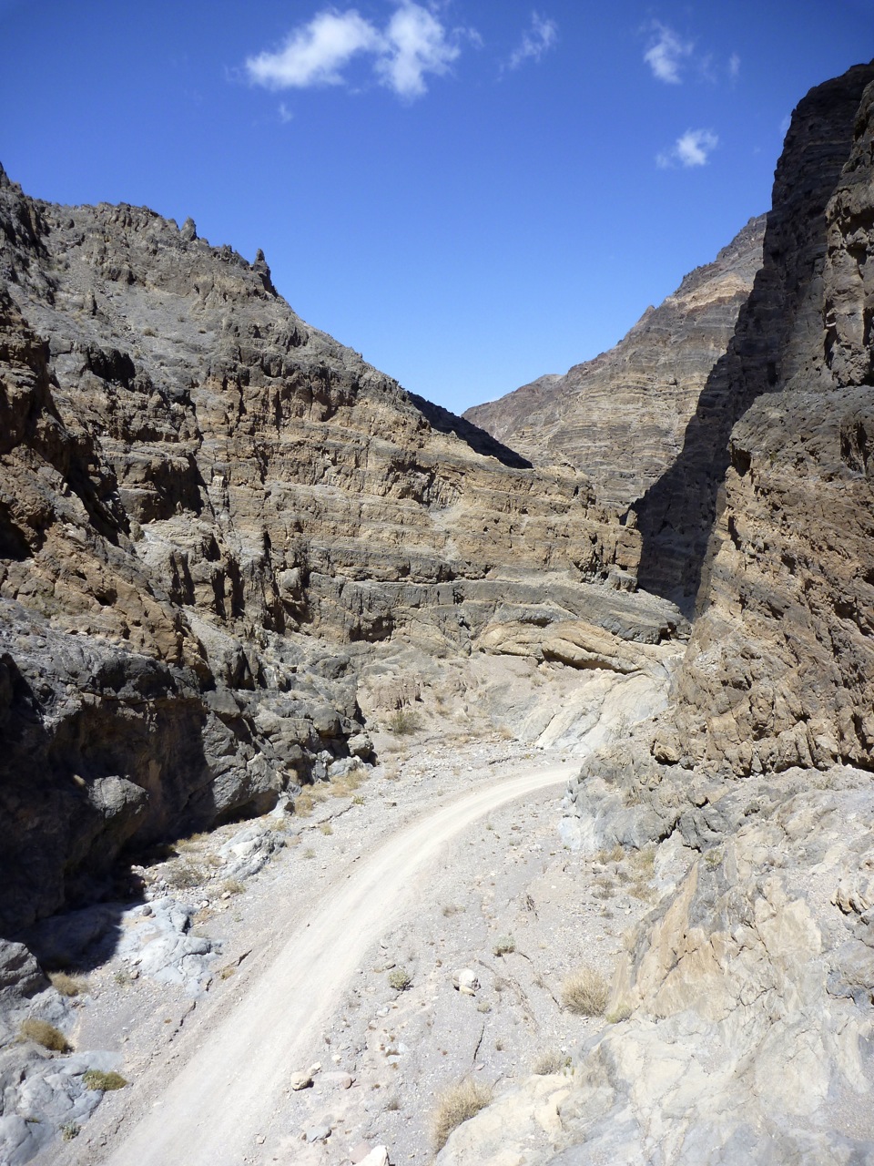
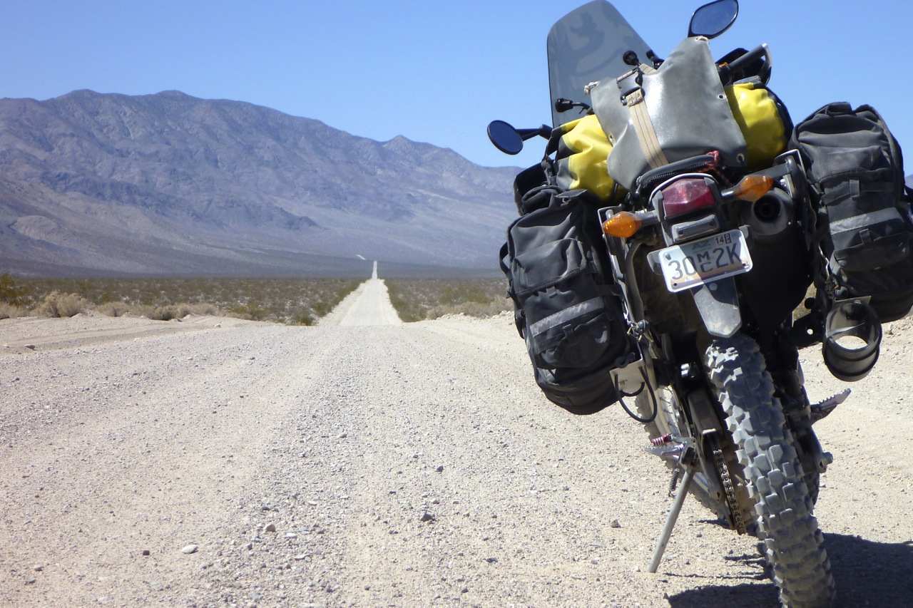
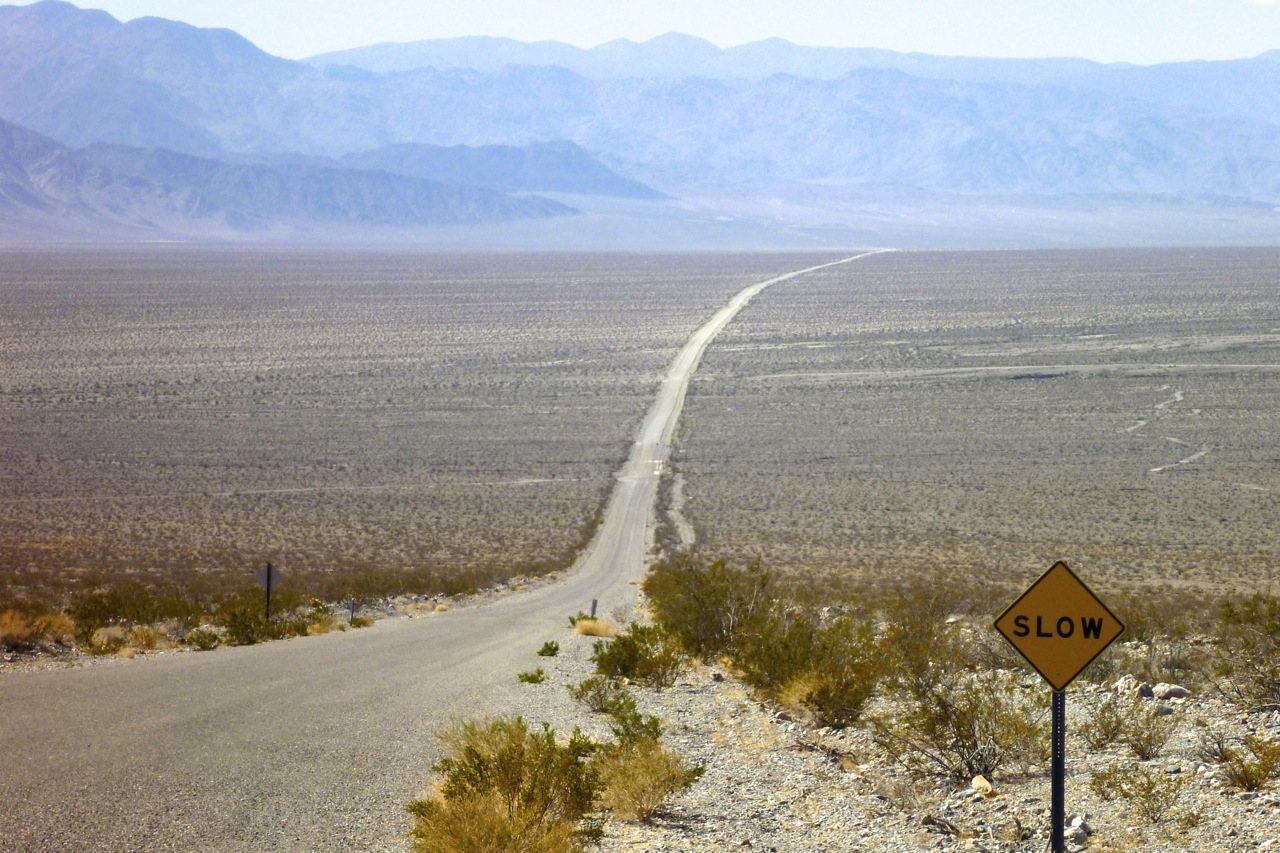
Today I know exactly where I’m going. Up to Beatty for the Titus Canyon track which sneaks into Death Valley from the east. Other all-terrain recreationists are out in force today. I realise later I could’ve cut through Ash Meadows on the way to Beatty for a bit of dirt relief, had I studied the Southwest GPS map more closely last night on Base Camp. But out here there are no bad route finding decisions. Smooth dirt or broken asphalt, spin a bottle; it’s all good.
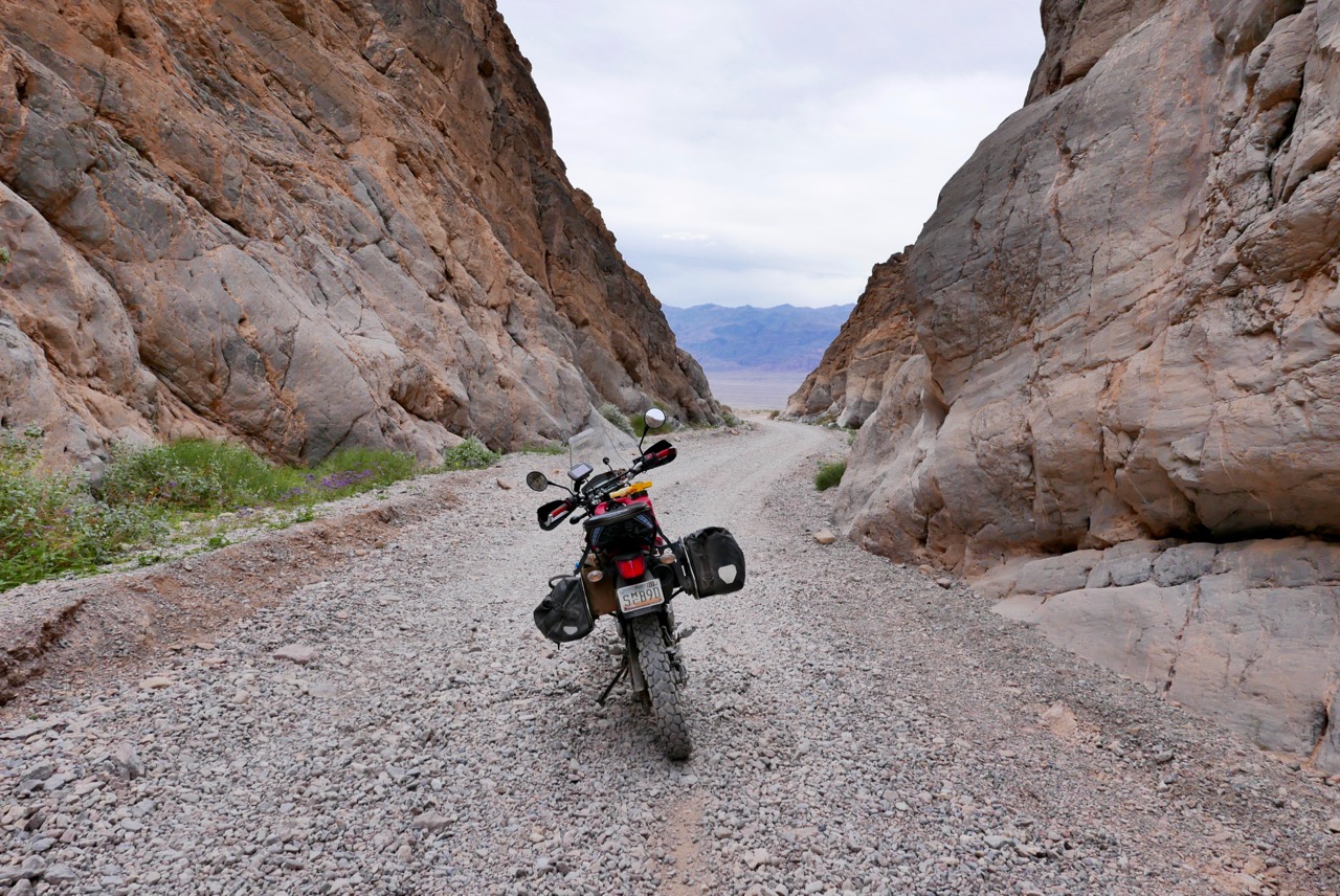
Titus is even better than I recall – a classic one-way route which, after an initial washboard approach, winds up to a high pass from where I’m able to switch off and coast almost right to the canyon mouth, peering across the arid pans of Death Valley. Without the engine distracting you, riding the KLX is like being on an oversized mountain bike, you can focus on the lines and body position while slipping silently past lumbering 4x4s.
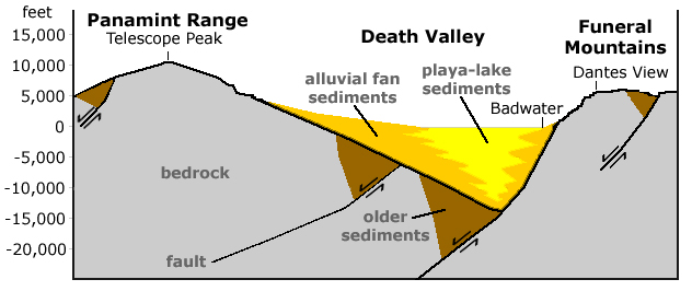
It’s Saturday and even though it’s overcast the word is out: rare wildflowers are blooming following winter rains and the park is packed with petal spotters. I don’t suppose I’m the first person to wonder how this basin can be below sea level so far inland and not eventually fill up with debris from millennia of run-off. The visitor centre puts me straight: tectonics tilt blocks like fallen dominos, the low points happen to be below sea level. Then three tall ranges of Sierra Nevada create a Triple A rain shadow – no moisture reaches DV. Add the glaring radiation bouncing heat up against heat, and what drops may fall won’t even hit the ground so there’s never enough flash flooding and erosion to fill up the valley. Or not for a long time yet.
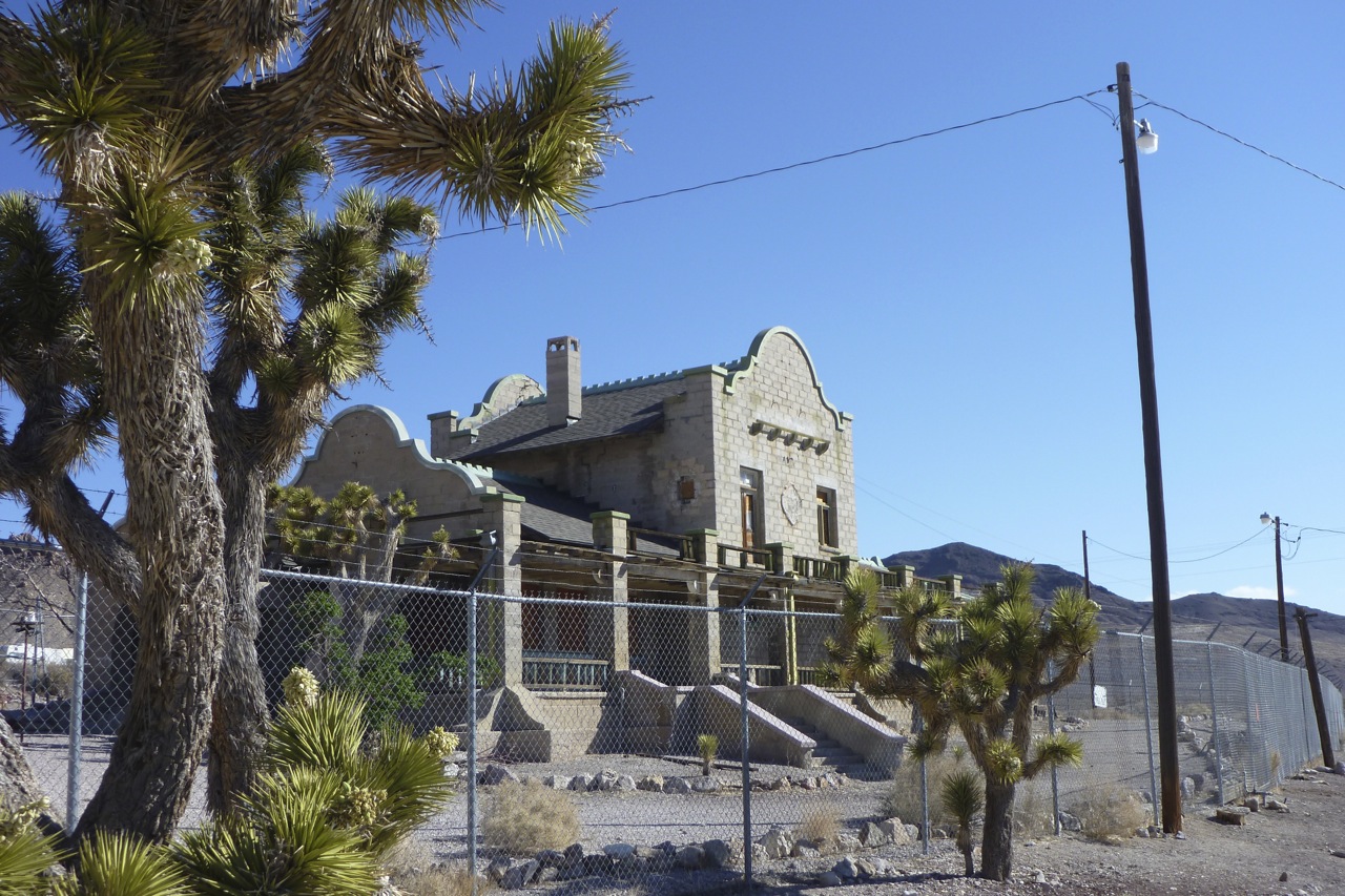
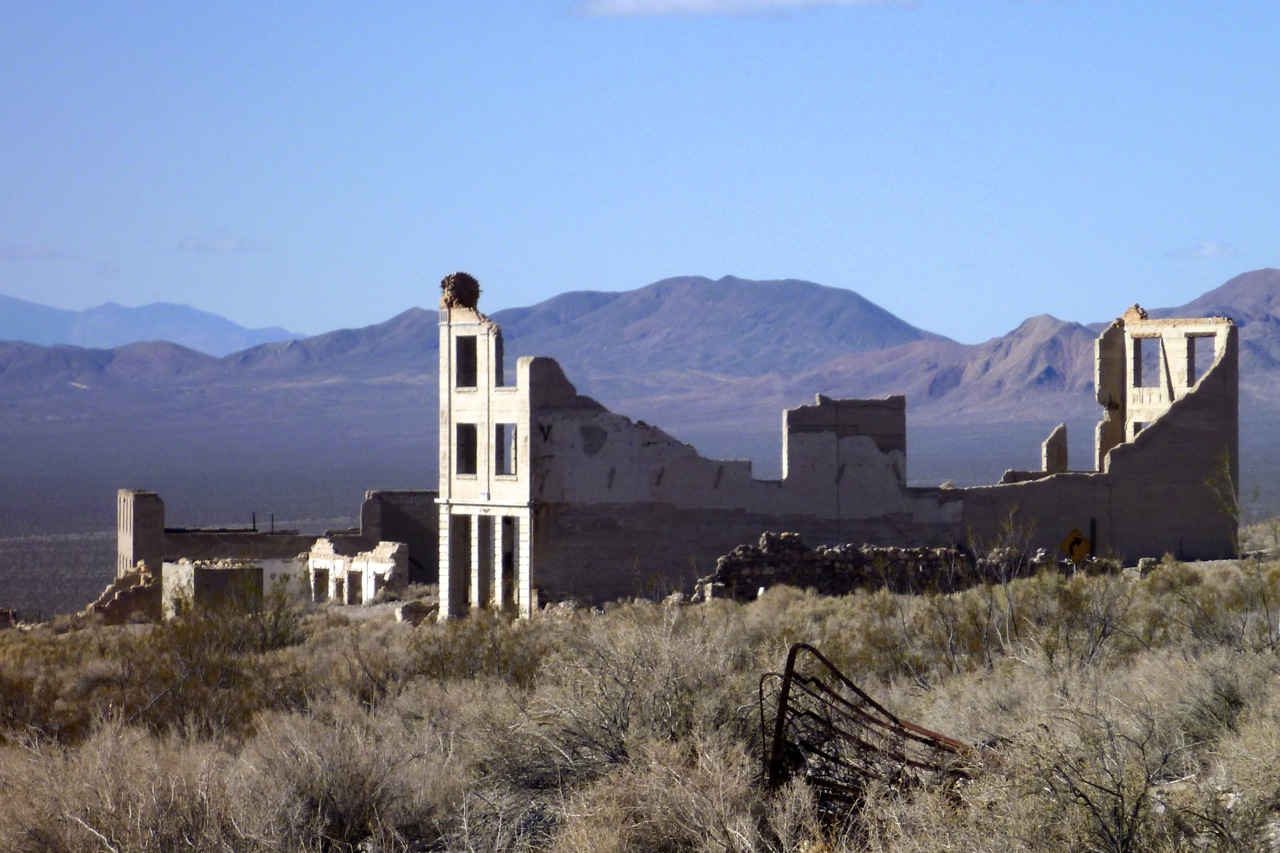
I should have booked a hotel – I forgot Saturday’s get busy near big national parks. Back at Death Valley Junction the colonnaded Amargosa Hotel looks great inside the lobby, but with that sort of historical ambience it’s as full as a visitors’ centre car park.
Jeez, is that the time? Must be overdue for a fill up again in Shoshone at more than double the usual price. There’s a WR250R doing the same. Turns out the guy picked it up only yesterday for $7k, equipped. I’m looking for one of these for an upcoming Sahara trip where anything heavier will be a liability – at least at my age. Nice to see a fresh WR in the flesh – a good omen I tell him. Triple clamps off a JCB, they make 30-odd hp, do 70 to Her Majesty’s gallon but don’t require WR-F-like levels of care. Or so they say. The guy is usually a Victory cruiser (like half US riders, it seems), but wants to explore the dirt side. Good on him, I say.
I try Tecopa Hot Springs, surrounded by a grubby, salt-caked wasteland, but it’s full of orange people swanning around in sarongs, and has no cabins to spare. My paper map shows a track / road heading southeast from here back to I-15. It’s getting late but could be fun. I try to follow it past the date farm but the orientation looks off. Later on, Google and Base Camp showed no link, but with a cig-packet sized screen it’s hard to work all this out on the move with seven-pound specs. Next time I’ll carry big-arsed Delorme/Benchmark road atlases, like I did on the CRF trip. Until they can beam out hologram screens, handy-sized GPS units just can’t give you the full picture. So it’s back to Baker under glowering skies and spots of warm rain.
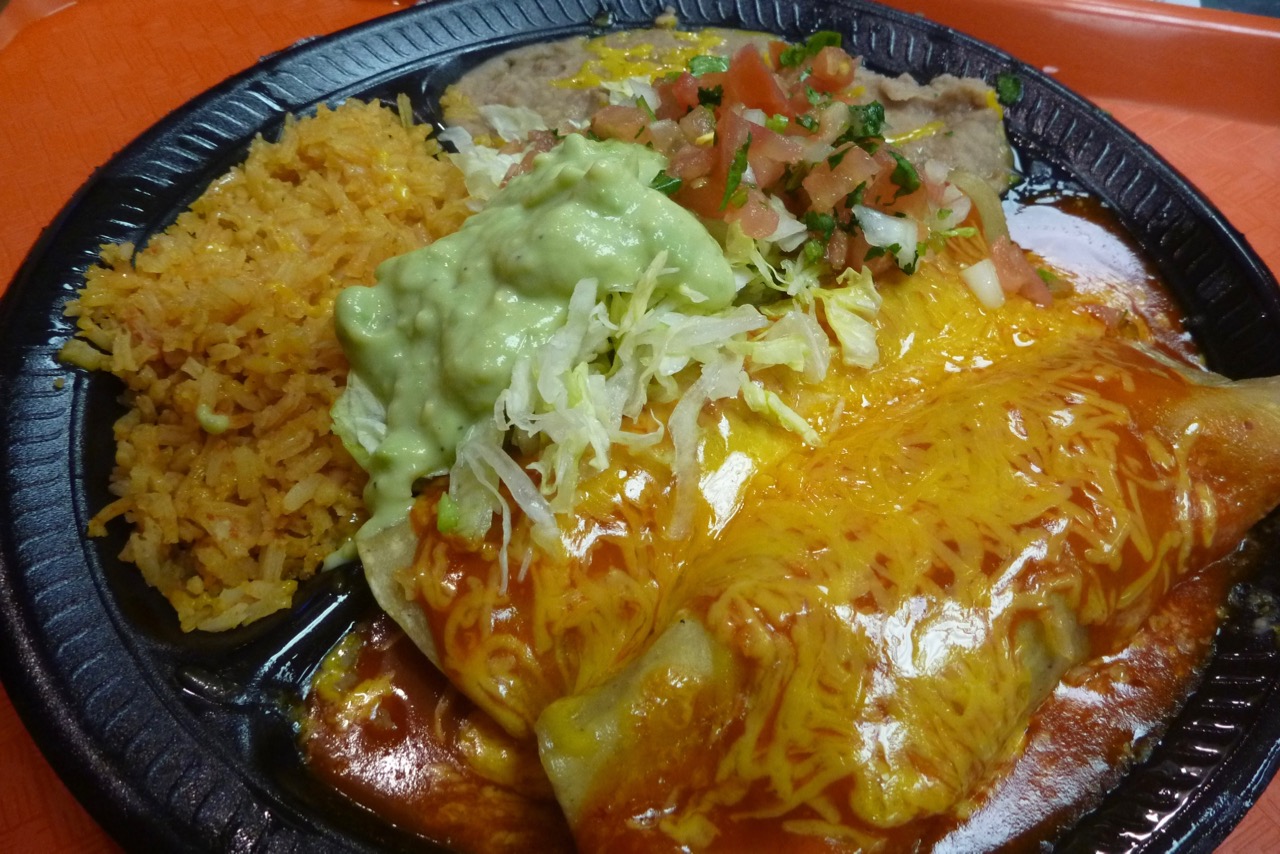
I’m resigned to dosing in an abandoned trailer or gas station, but Baker turns out to be less popular than I thought. At the motel he accepts cash and drops a card deposit as I’m ‘not a local’. Baker seems to have every brand of fast food going, apart from the Greek place. Over the road a waitress squeezes me out a Mexican meal from a big tube.
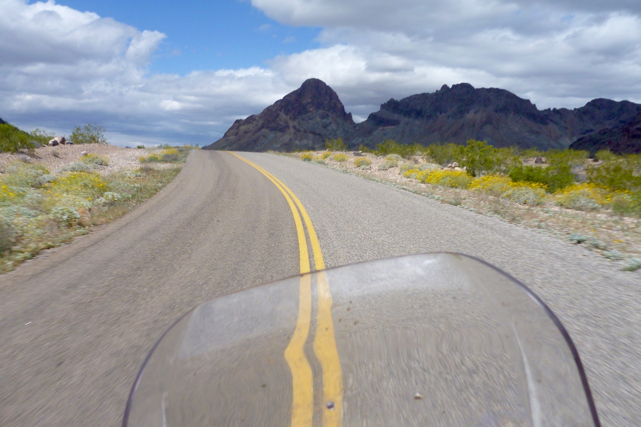
Next day many people warn me of the strong winds, but apart from a few side sweeps, all it did was slow the KLX down to 49mph in places. I try to plan a route using the backwind and avoiding interstates, but at times there’s no getting away from either. The deserted Nipton Road (old cafe sadly dormant) leads me back past joshua trees into NV and a fat brekkie at Terrible’s Roadhouse in Searchlight. Then it’s back over the Colorado and another refill in Golden Shores to follow windy and windy old 66 via kitschy Oatman where the weekend hoards are lapping up the whole gun-slingin’, gold-pannin’, bar-fightin’ sideshow.
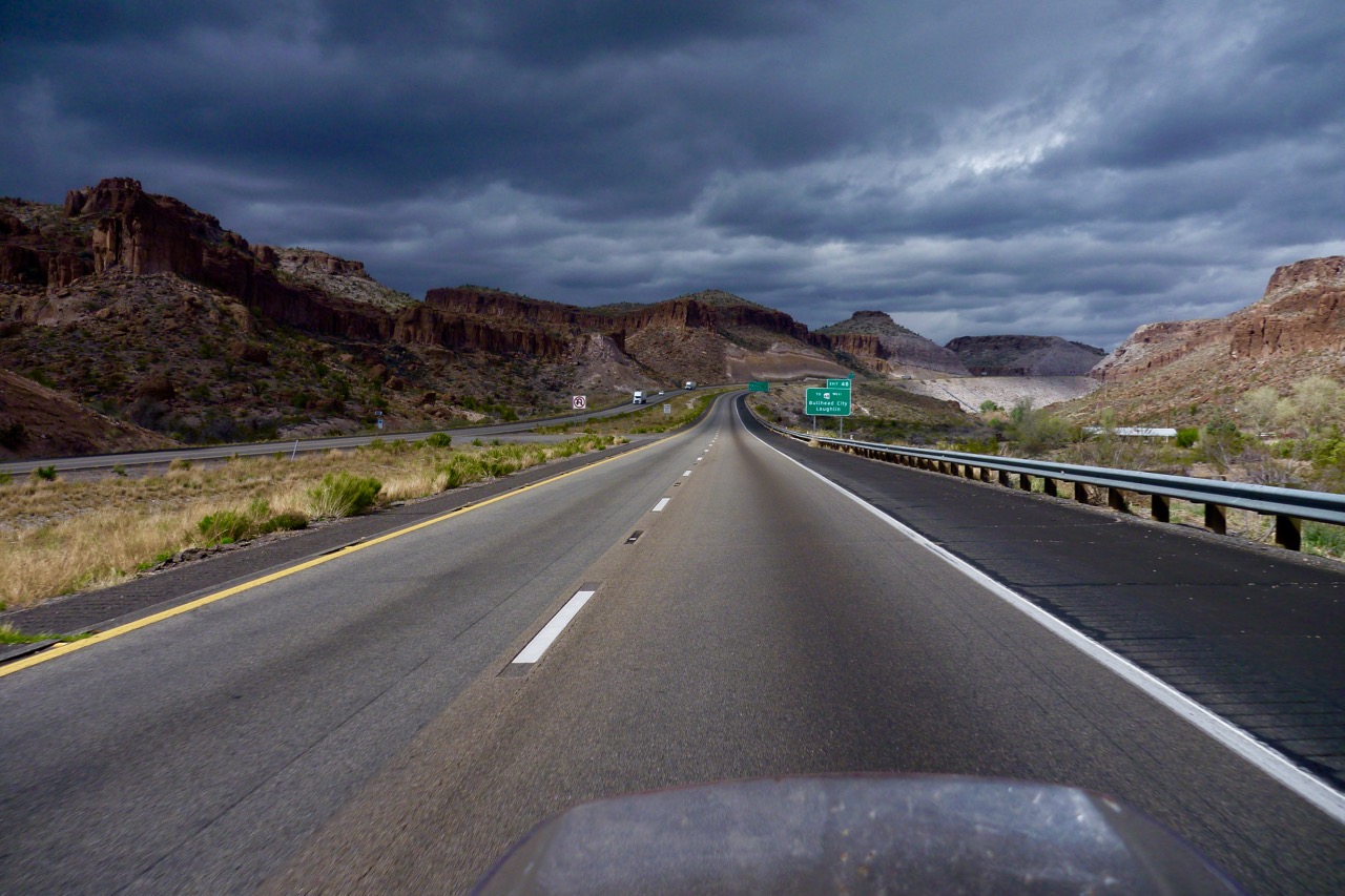
Near Kingman dust storms are hurtling around the valley looking for something to blow over. East along 1-40 I am sailing but turning south onto 93 it’s largely in my face and when it’s one lane I sense the tailback’s trigger fingers getting itchy. It’s the occasional price you pay for riding a 250. It rains a bit but I dry off even quicker and ease into Wickenburg on fumes.
The day turns into a tiring 9-hour, 350-mile haul of wind-surfing with the butt clearly getting acclimatised to the KLX perch. All up not so bad on a weedy 250. Must be high time to tank up.