Let me tell you, I’ve done my share of mind-blowing desert biking, seen attack ships on fire off the shoulder of Orion and all that, but Utah’s WRT will be among the best 150 miles you’ll ever ride in a day.
Bike mag, November 2021
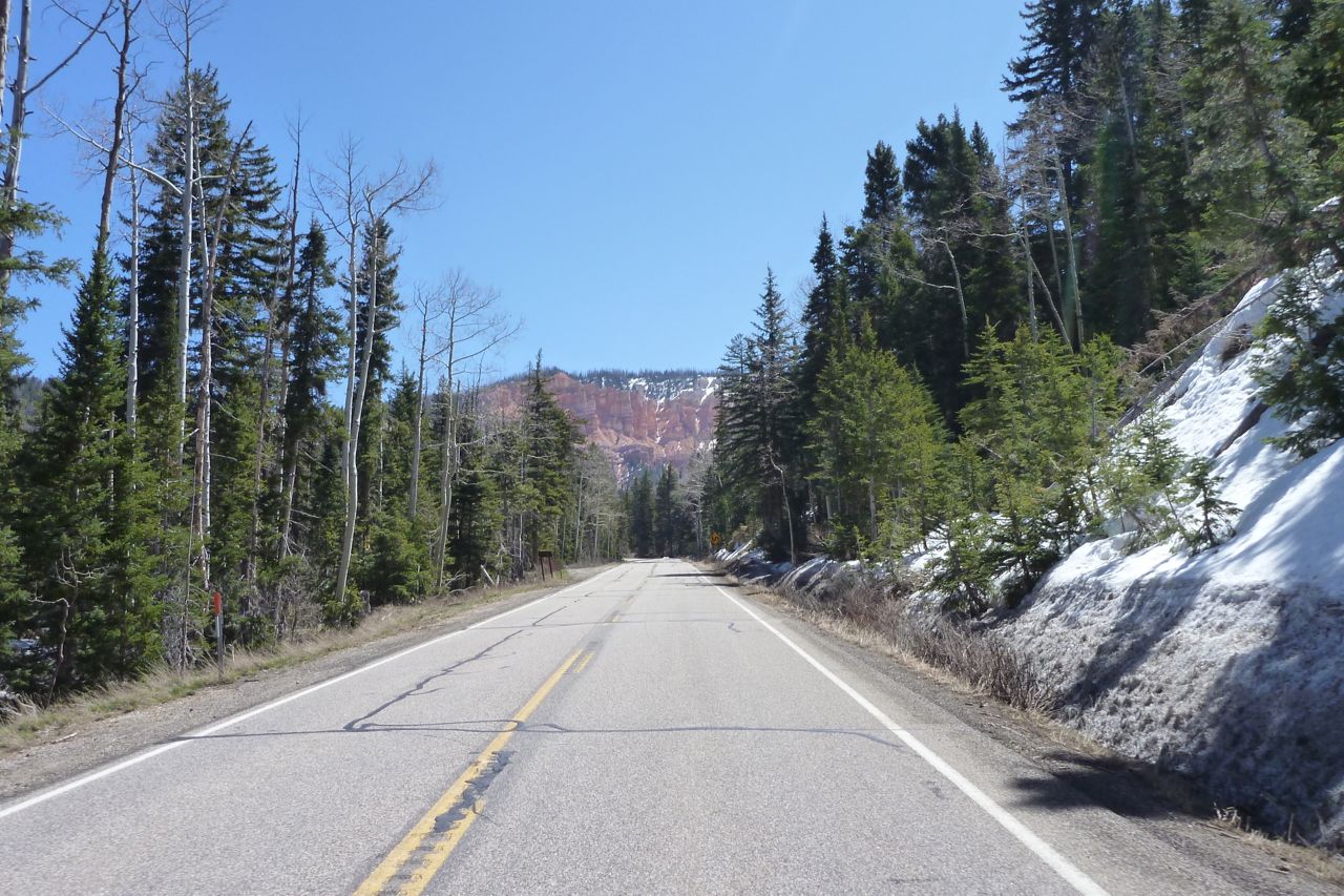
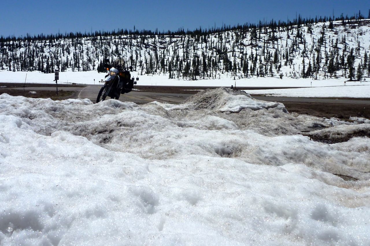
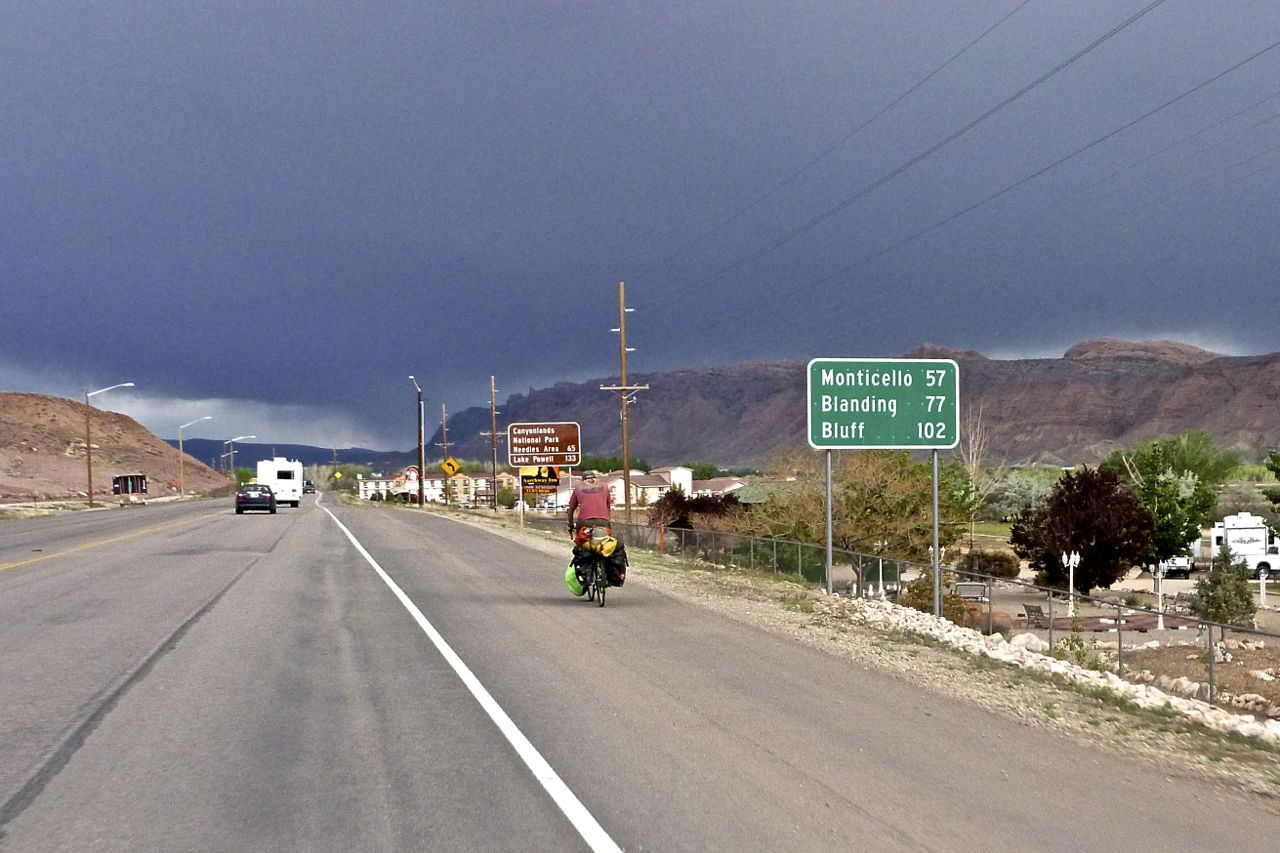
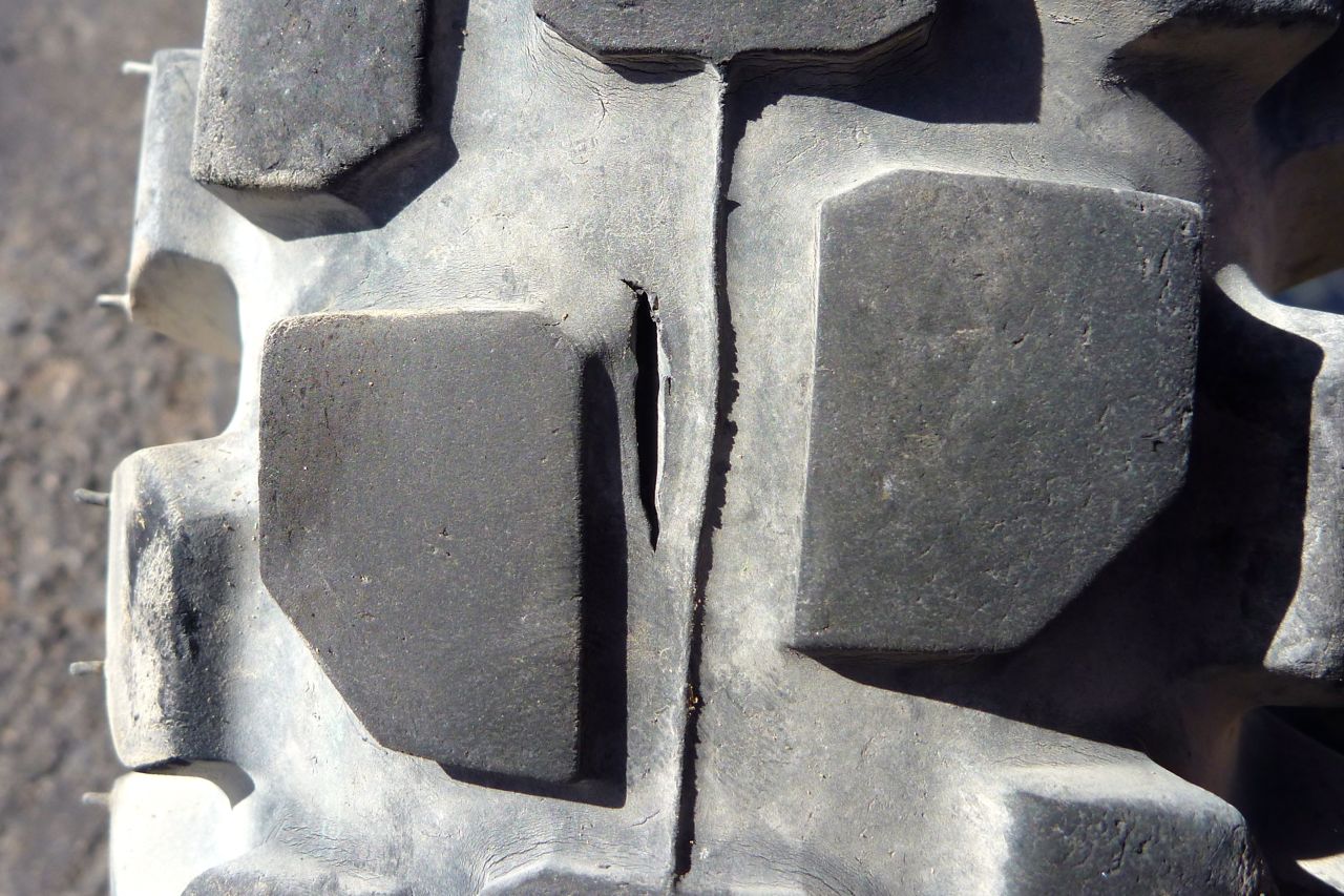
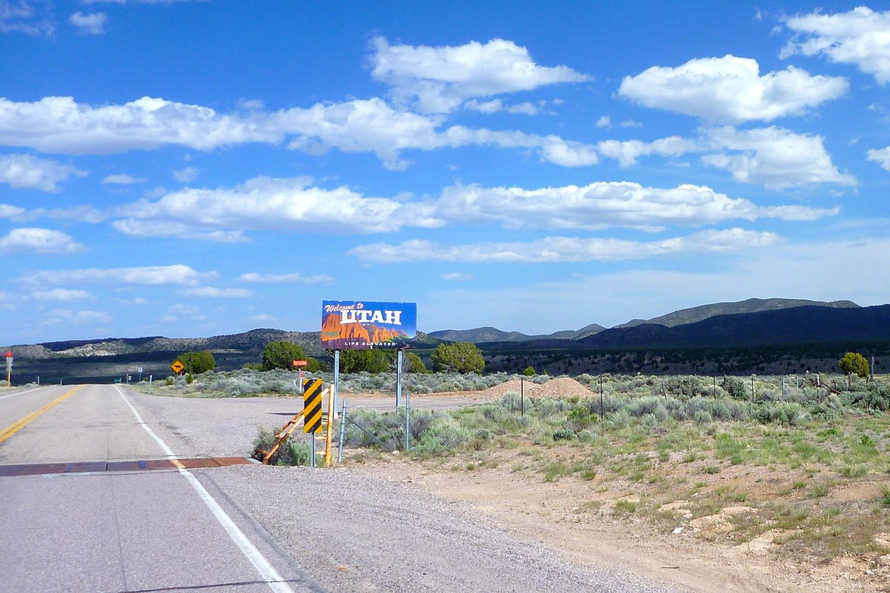
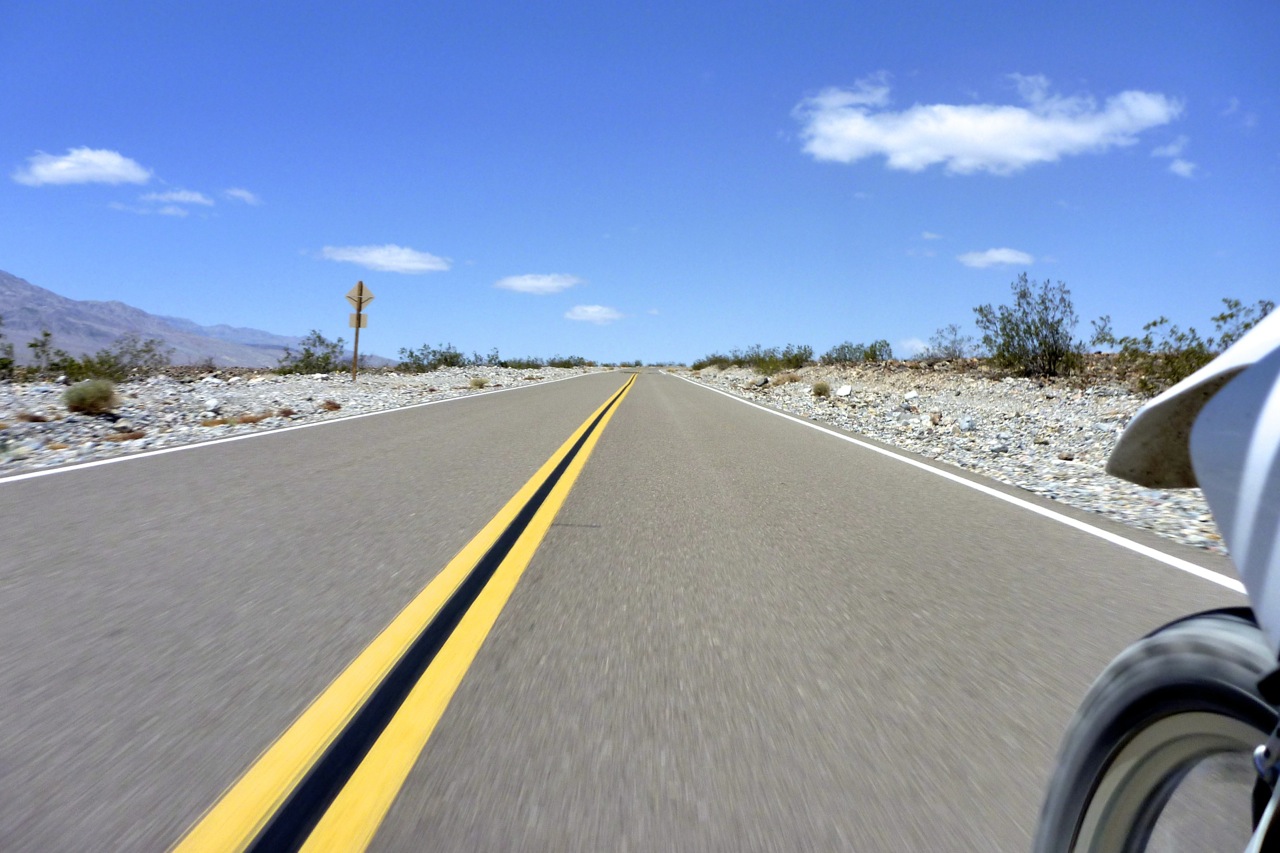
You left me crossing into Utah trapped inside the lyrics of the Long-Legged Guitar Pickin’ Man. The rear tyre split hadn’t grown and overnight in Cedar City the temperature dropped by over 30 Fahrenheits to less than 50; good for tyre longevity. So I plugged in my Aero’ Kanetsu electric vest and took off up UT14 into the pines planning to follow 143 over the Cedar Breaks and down to Panguitch.
Even before I got to the turn off, it was getting on for 10,000′ but the CRF held its own. Altitude doesn’t really affect it – just strong winds and steep hills.
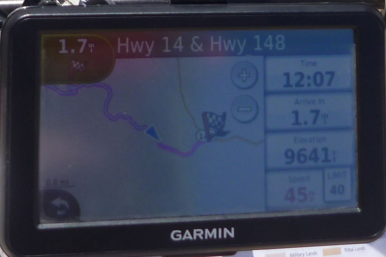
But at UT148 junction the snow barrier was down.
As I stopped, KTM man from yesterday in Pioche rocked up, this time on his Multistrada 1200, Ducati’s answer to the big GSs. Never actually seen one of these being used.
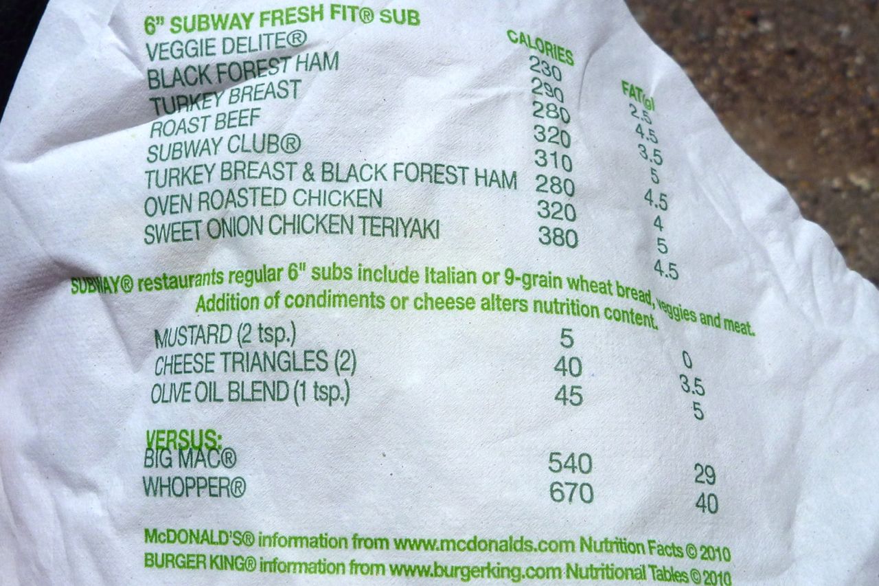
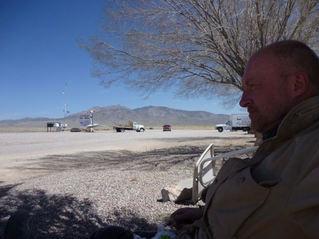
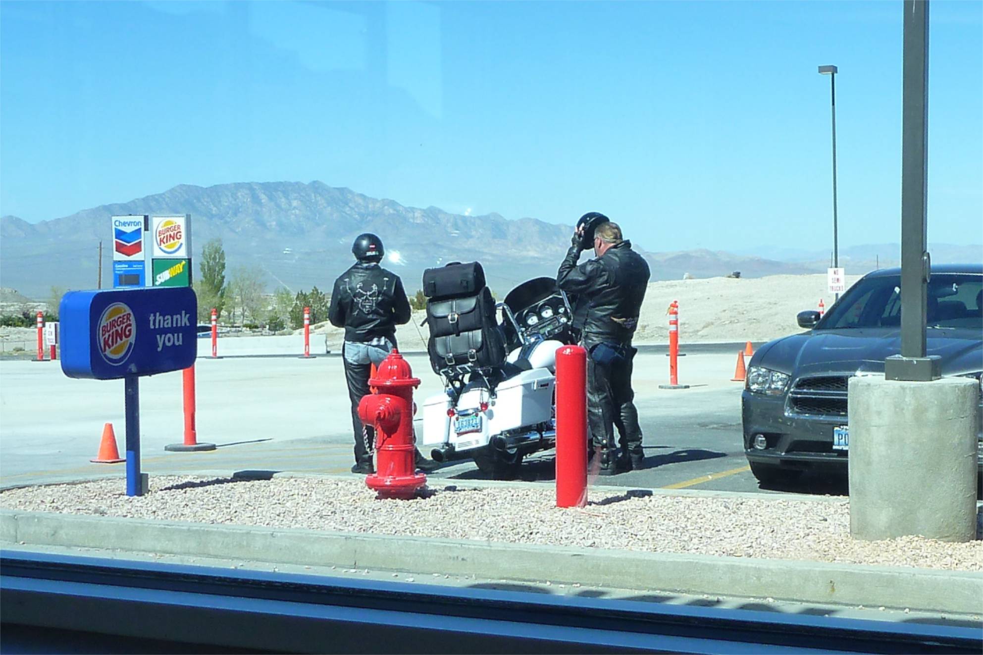
On the far side at the roadhouse on 89 I tucked into my daily Subway against a warm sunny wall. I have convinced myself they’re a healthy form of cheap, fast food.
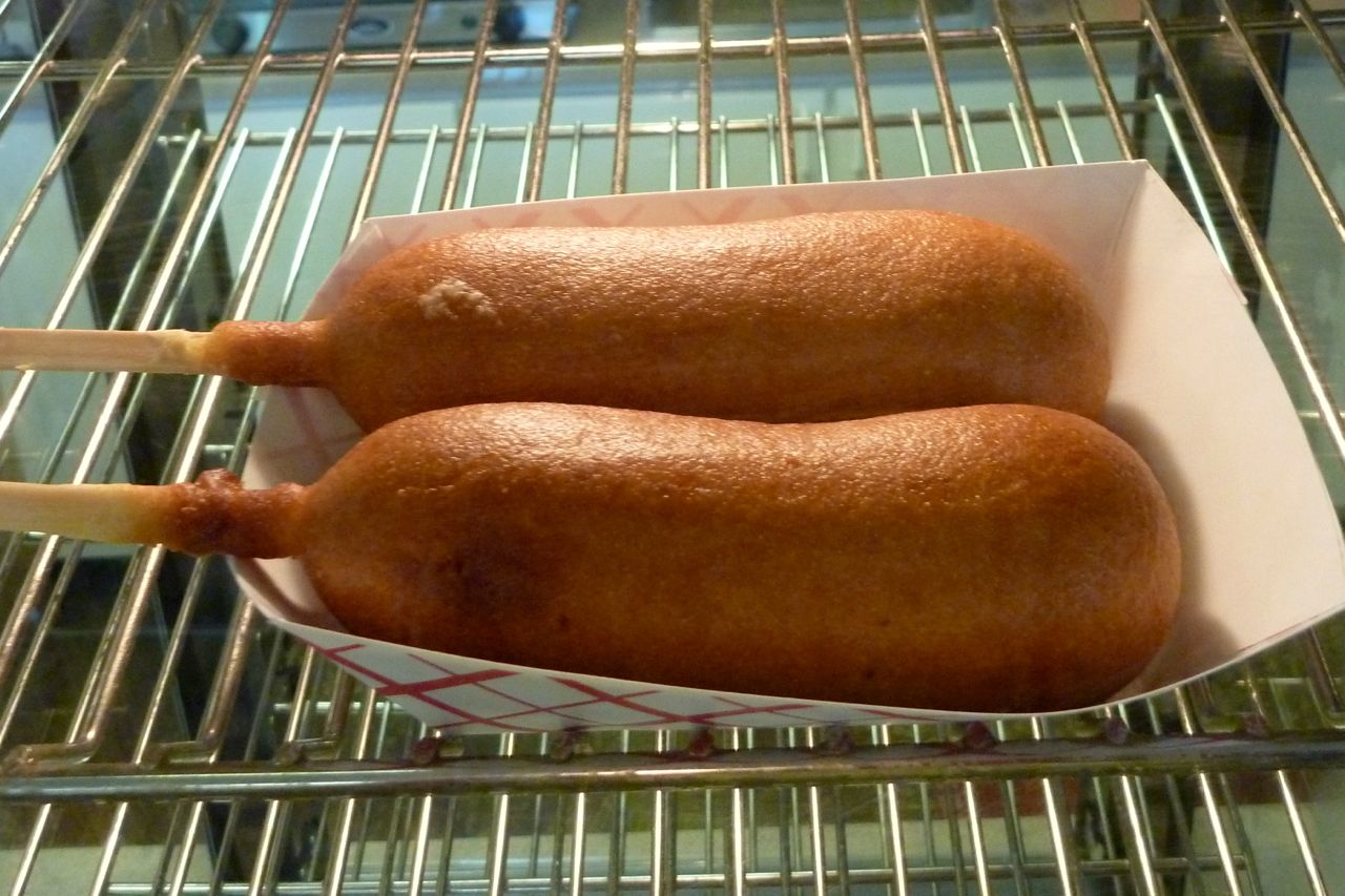
Certainly healthier than these unidentified objects – battered lamb’s testicles on a stick?
North now, into the fierce and freezing northwesterly. By the time I got smart and added another layer, my arms were quite numb from the cold.
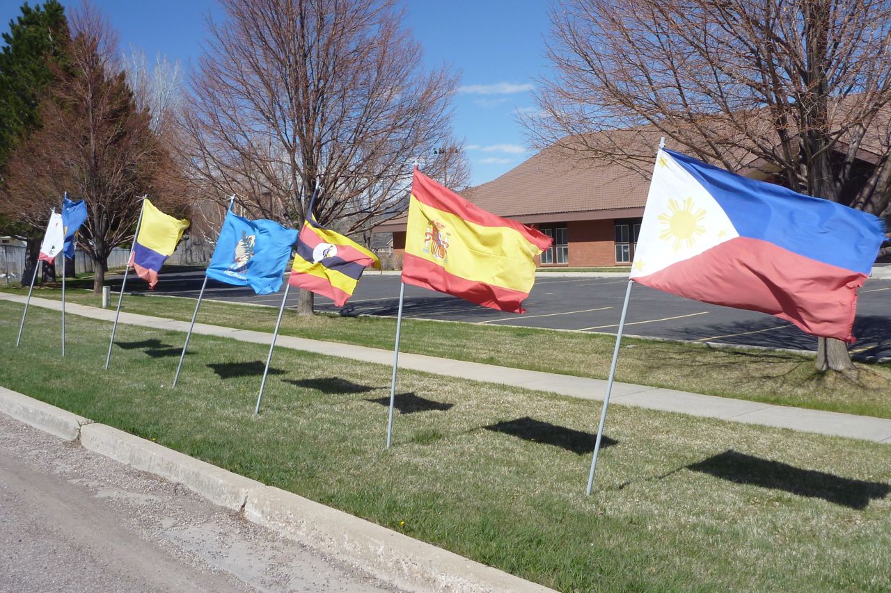
Did I say it was windy? The Flags of the World do not lie.
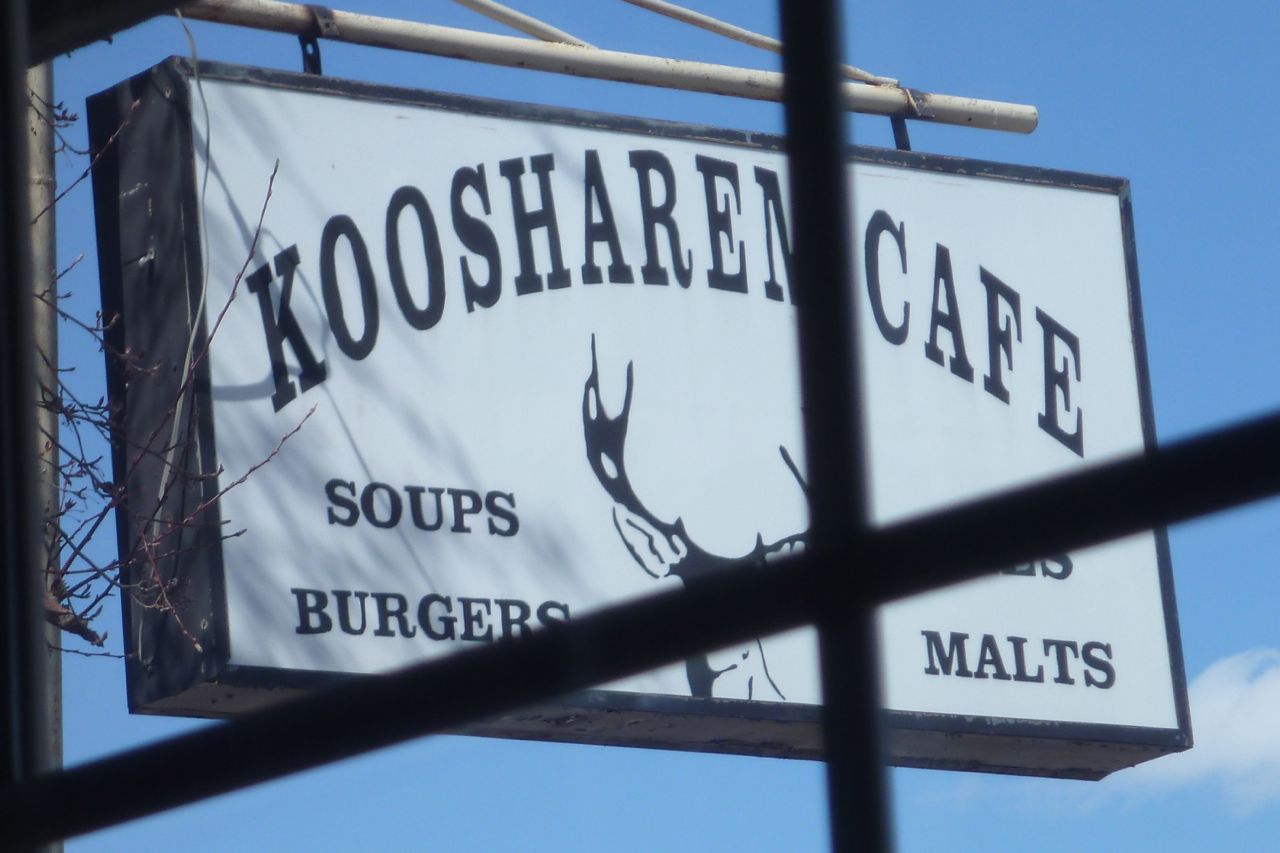
I stop off at Koosharen (pop: 327) for a one dollar coffee and a warm up. ‘Ain’t it cold on that li’l cikle?’ asked a man in a John Deere cap. A small shed of his had just blown off down the road.
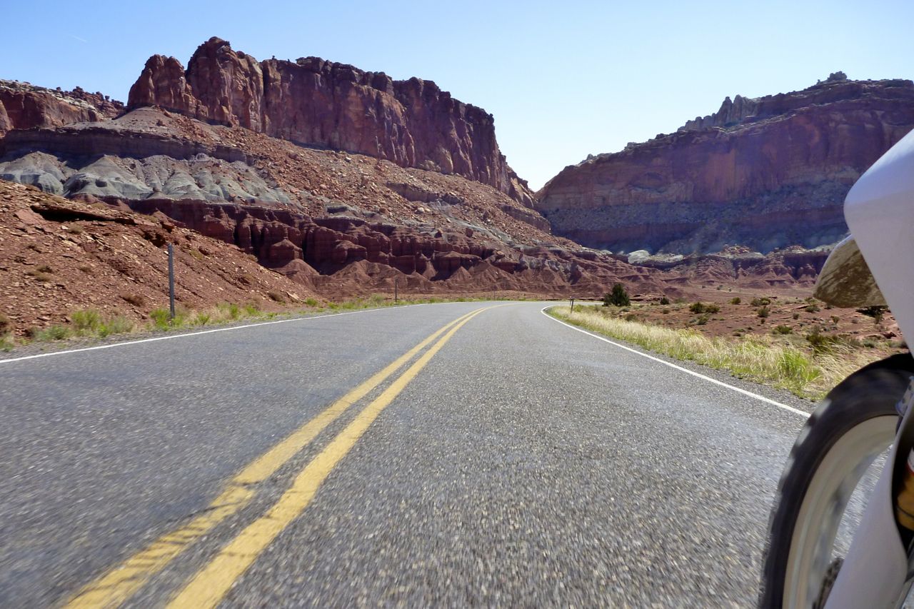
Next day, out of Torrey on the edge of Utah’s Tourist Zone, but even here they have a Subbie! (There are no less than 40,000 franchises in 99 countries RTW). From here farming and mining takes a back seat to scenic drives past red rock cliffs and canyons.
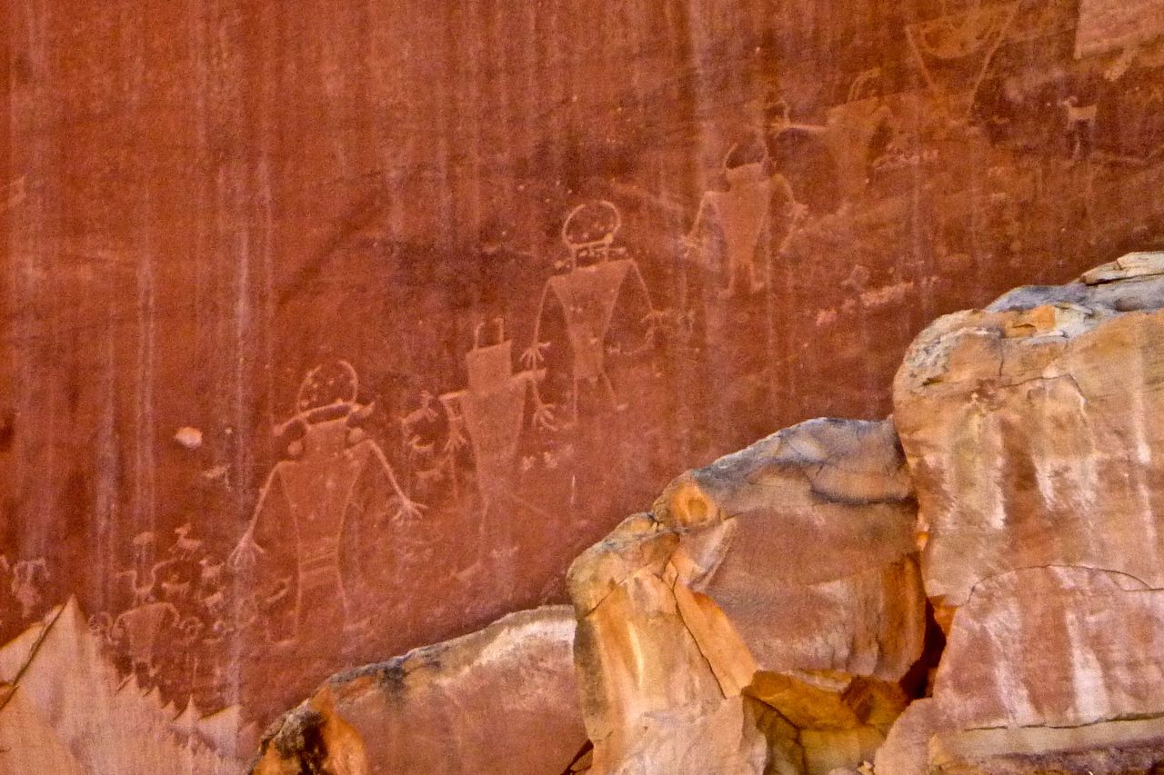
I follow the Fremont River after which the pre-Anasazi Indian culture was named. Their enigmatic petroglyphs adorn the canyon walls.
I detour down the Goblin Valley Road and doze out of the wind and in the sun for an hour. Then I cut off along an old road that leads to Green River, avoiding unnecessary interstate. I like these old roads with grass growing up through the cracks.
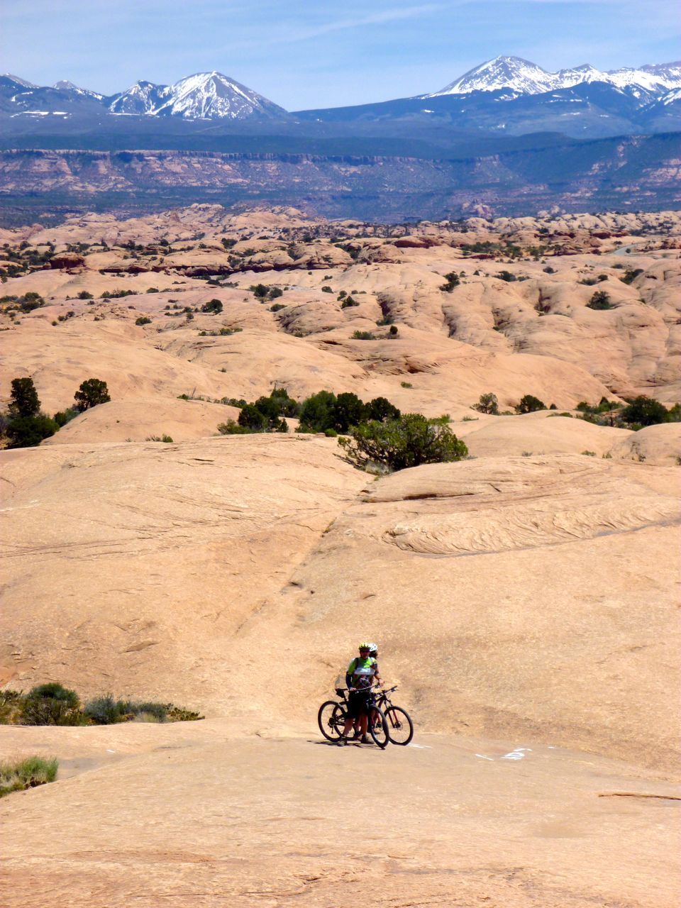
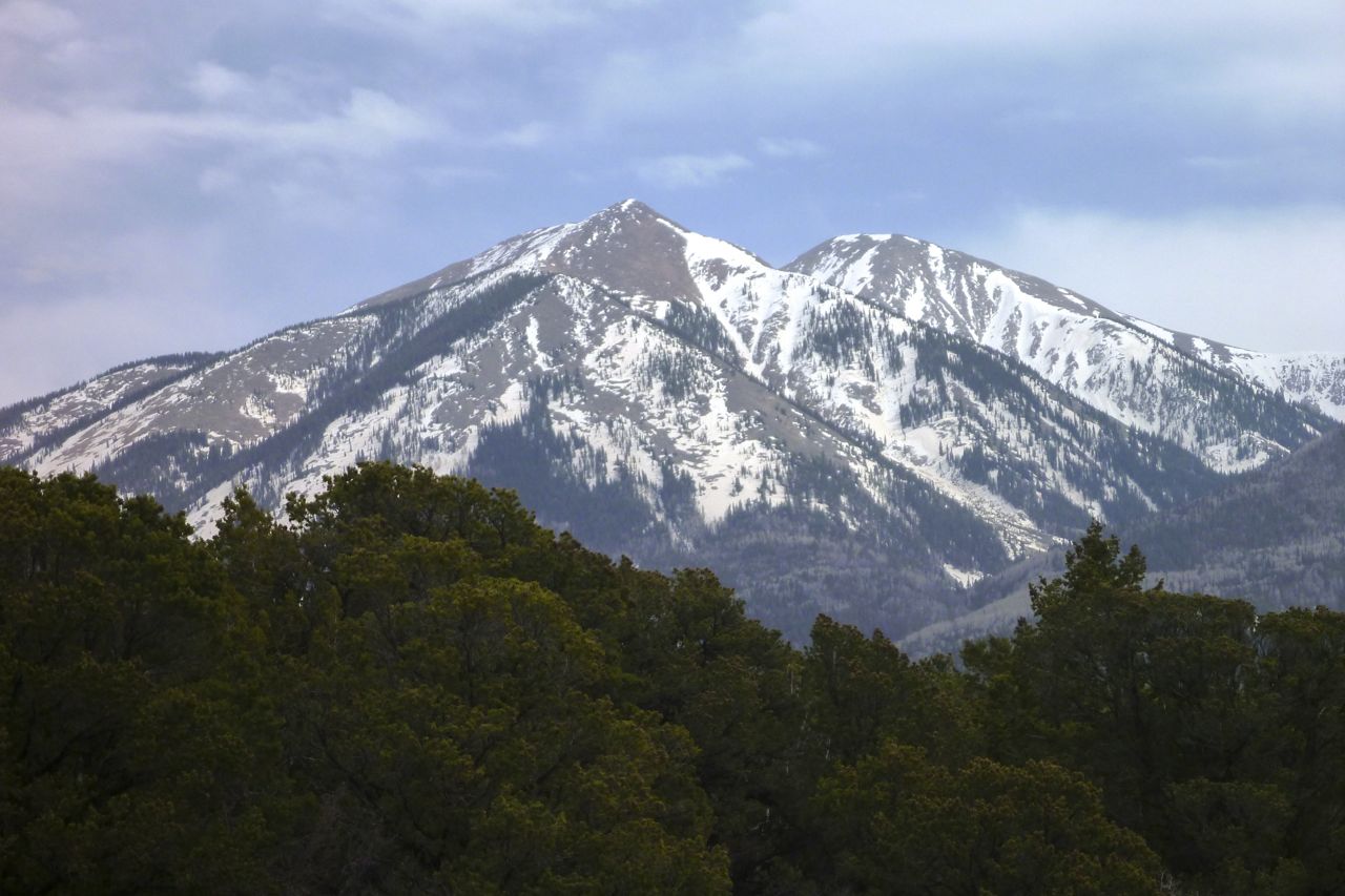
At the back the snowy La Sal mountains rise to nearly 13,000′
Green River has its own hooning hill. I like to think it helps reduce anti-social behaviour.
In Moab I score a cheap private cabin at the old Lazy Lizard hostel. I stayed here 20 years ago, but the Lizard has not responded to the ‘flashpacking’ boom; in Moab no one has yet. The Lizard is like an old style hostel, which is both good and bad. Then it dawns on me I’m in outdoor adventure central with a trail bike, cheap accommodation and time to spare; I better book up all the nights they got!
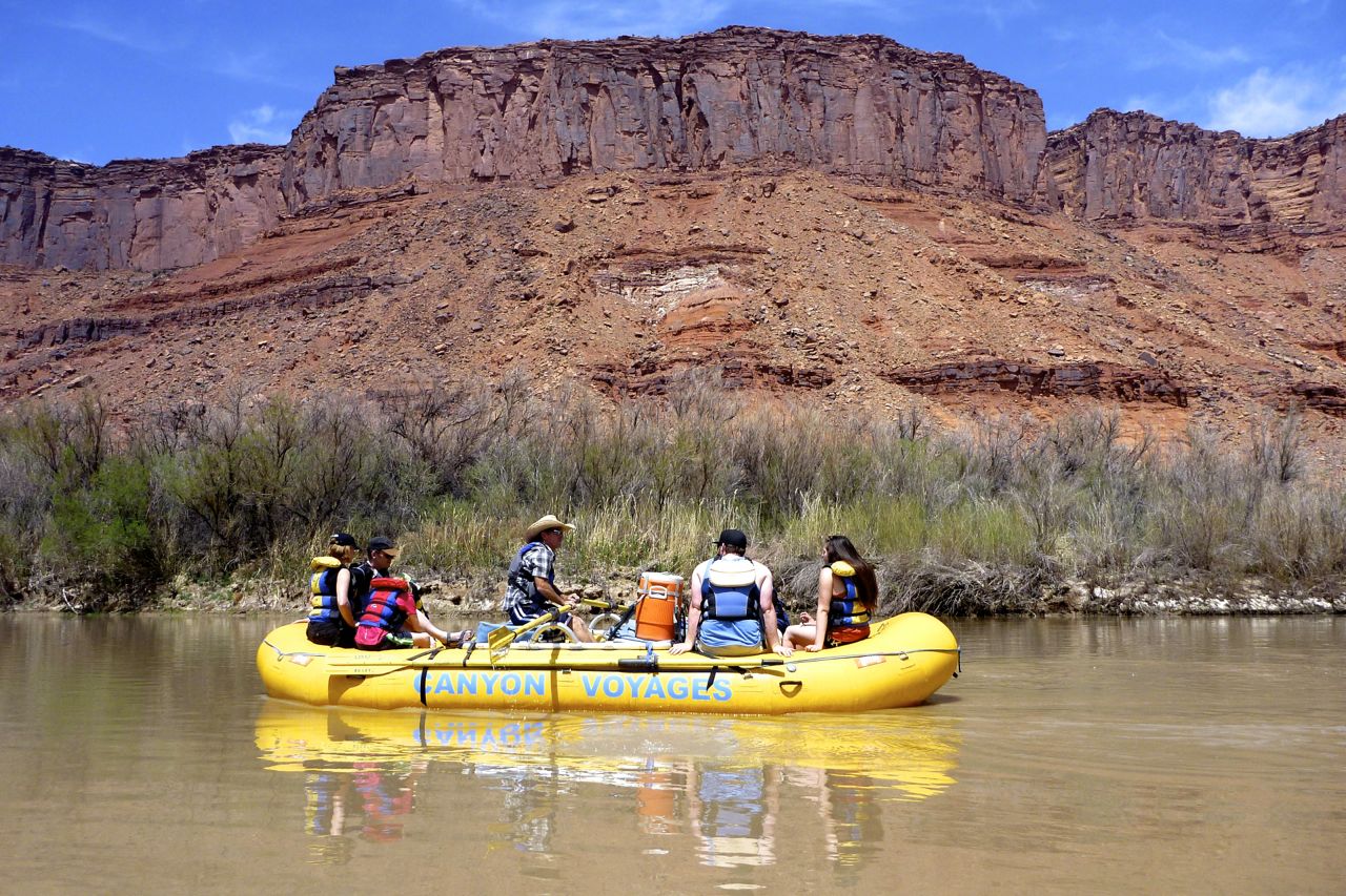
I join a rafting trip on the Colorado just out of town, with an inflatable kayak alongside for those who want it.
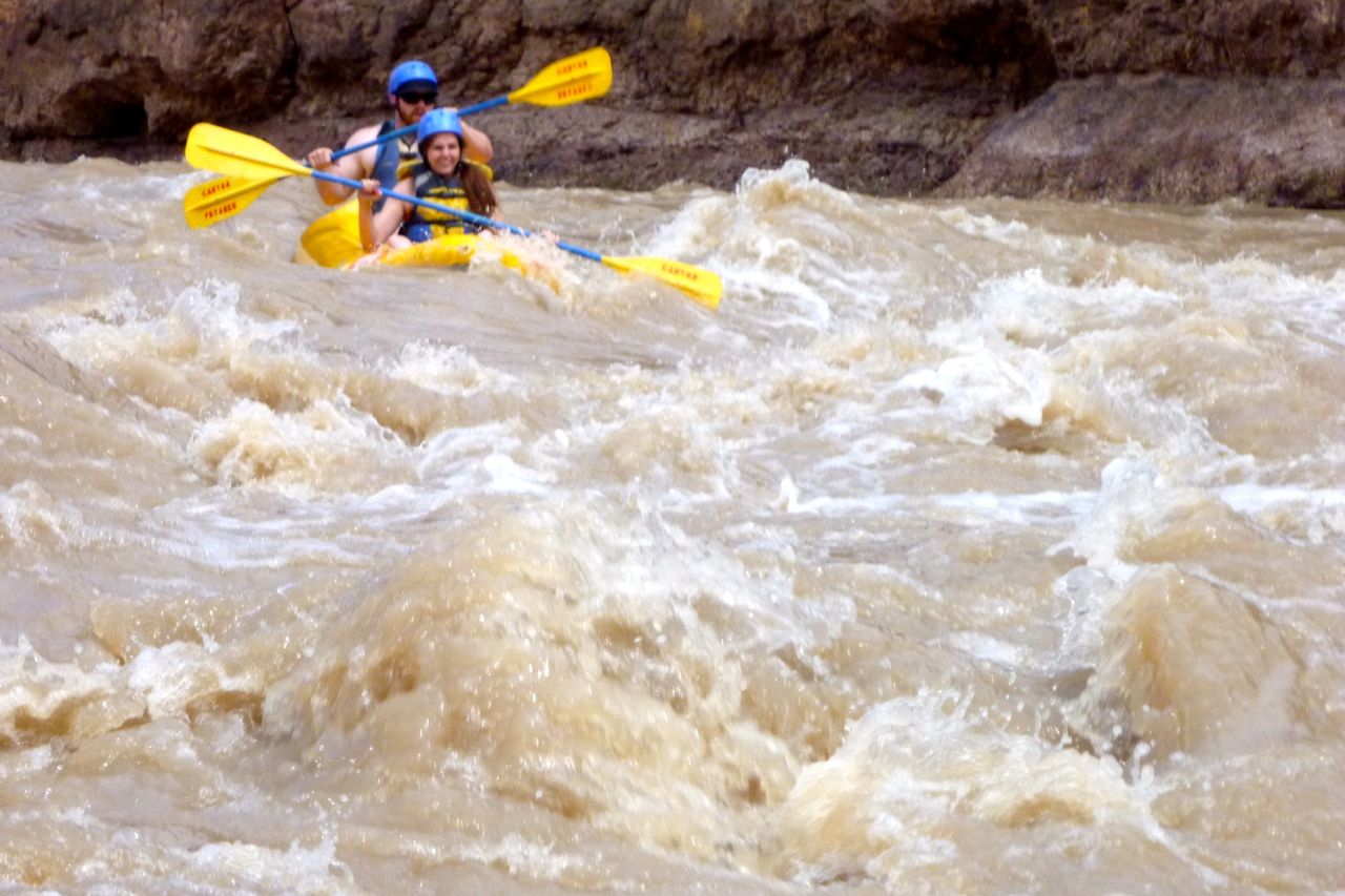
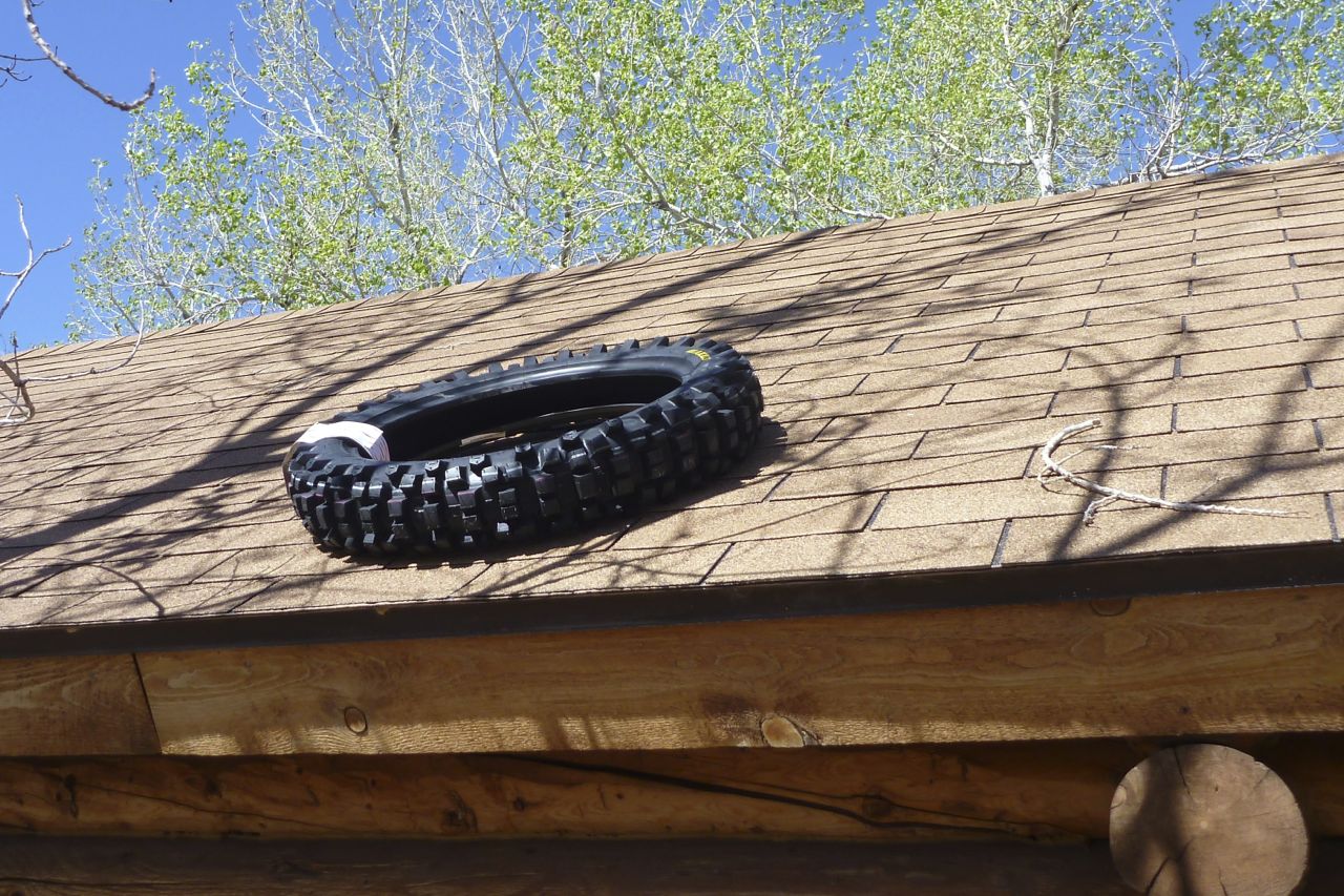
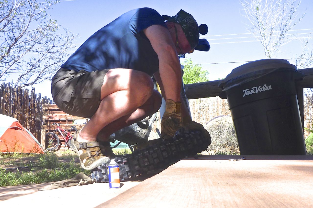
Annoyingly this couple from SLCity were in the IK for the best bit – rats!My cheap online Kenda tyre won’t be here for another few days so I buy a Maxxis Desert up the road for around $110 and leave it on the roof to soften up. It’s an old Indian trick.
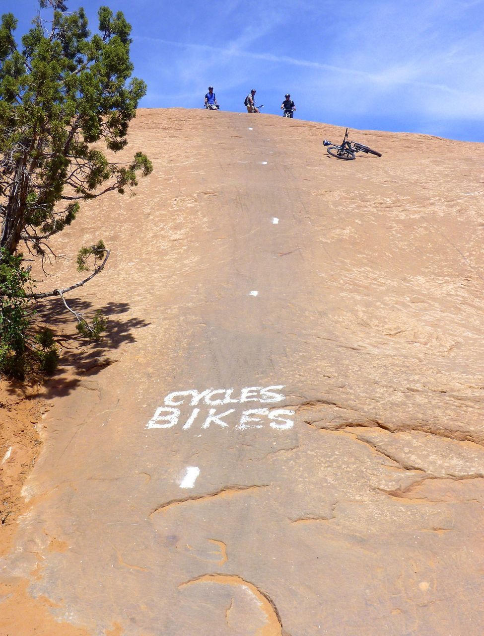
Then I go and rent an MTB and have a crack at the Slickrock Trail I remember well from ’94. I don’t get so far – it’s got a lot steeper over the years; I blame erosion caused by global warming, though other age-related scenarios are possible. But on a $2000, full-susension Santa Cruz SuperLight 29 with more traction than a gecko on a jam jar, it’s a lot of fun.
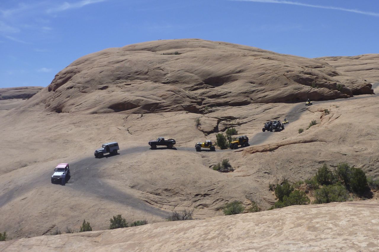
Creaking and screeching 4x4s share the Slickrock but not the same trail, although motos can ride the cycle trail. In fact, the Trail was invented by motards back in the ’60s. I wonder about coming back on the Honda, but even unloaded I don’t want to risk the clutch on some of the sudden, very sharp ascents.
If you dig MTBs you must come to Moab for the Slickrock and all the rest.
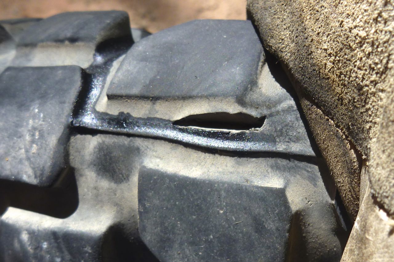
That split never grew in 500 miles but I still think the right flake on a dirt road would have nabbed the tube, Slime or no Slime.
The Maxxis is a 110/100 – the worn OE was a 100/80, so new tyre is a bit taller but still black and round and on the road has been just as smooth and predictable.
Even once sun-warmed it’s a stiff tyre, but with technique and a bit of WD40 it slips on with just two levers.
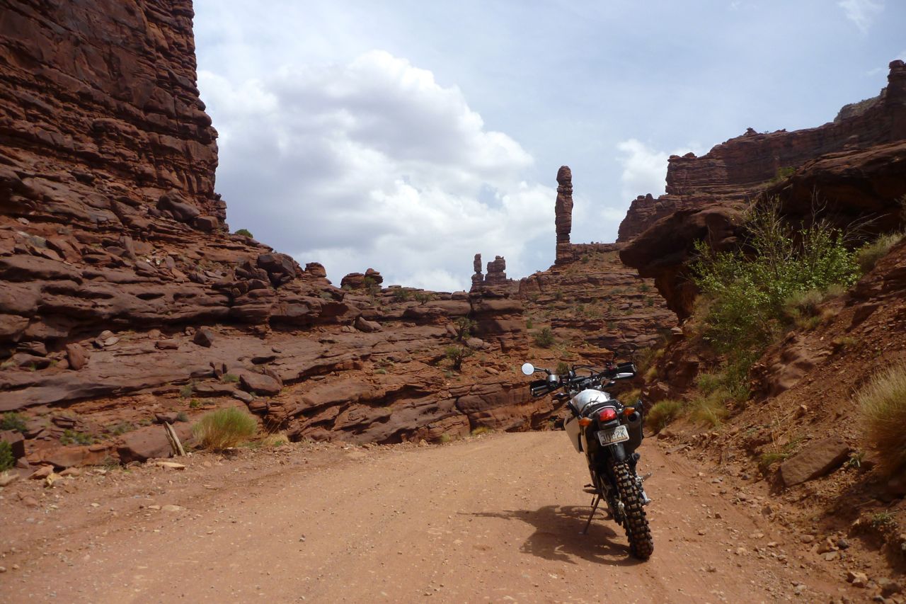
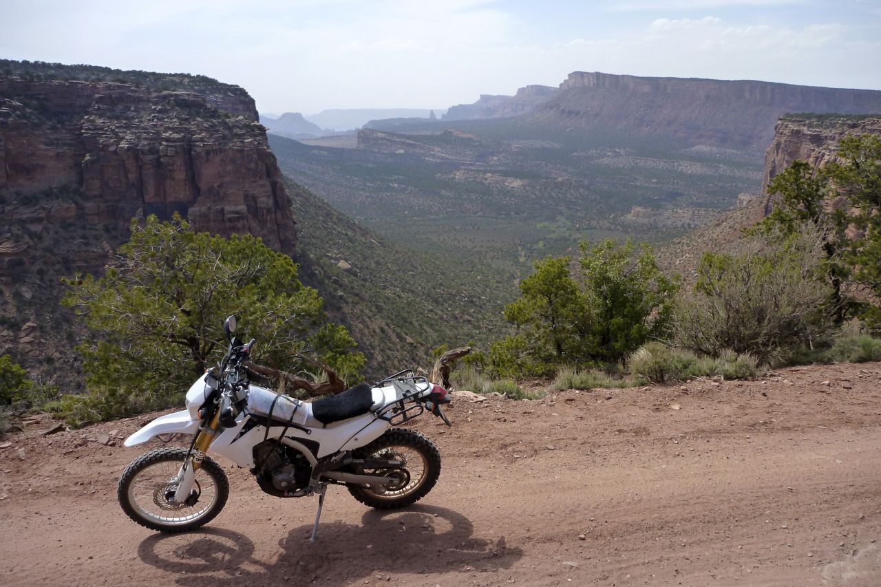
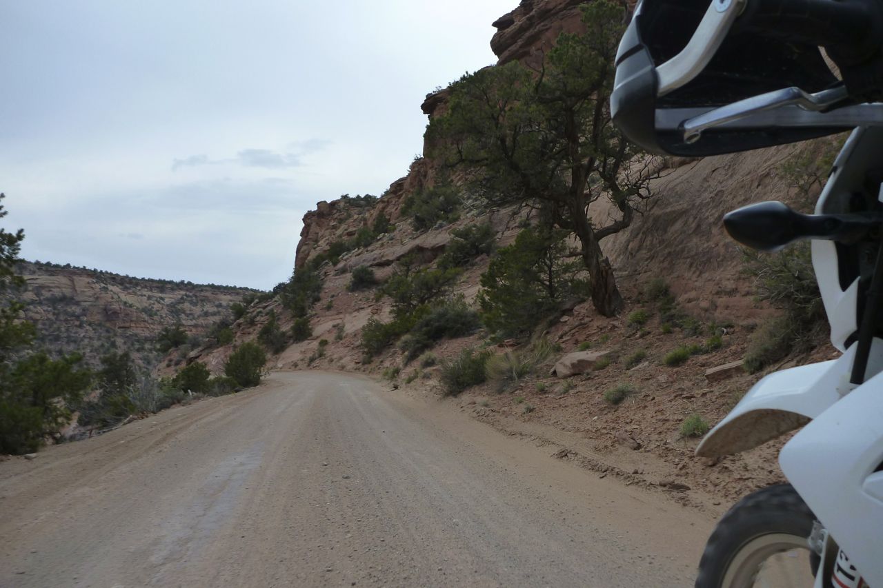
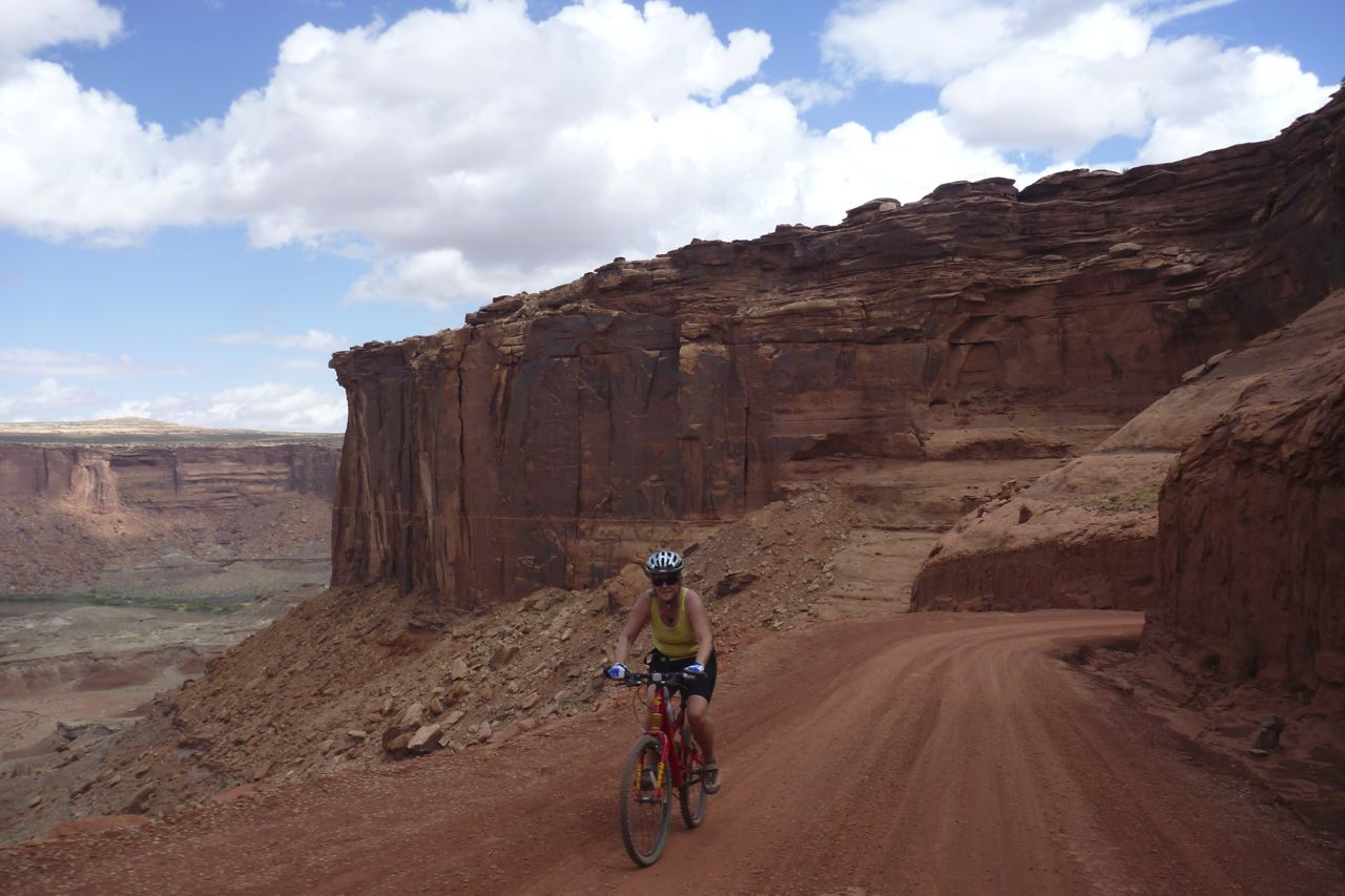
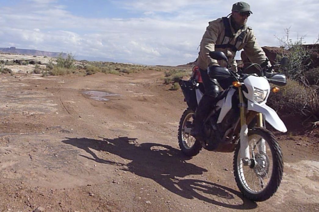
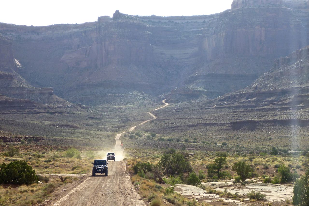
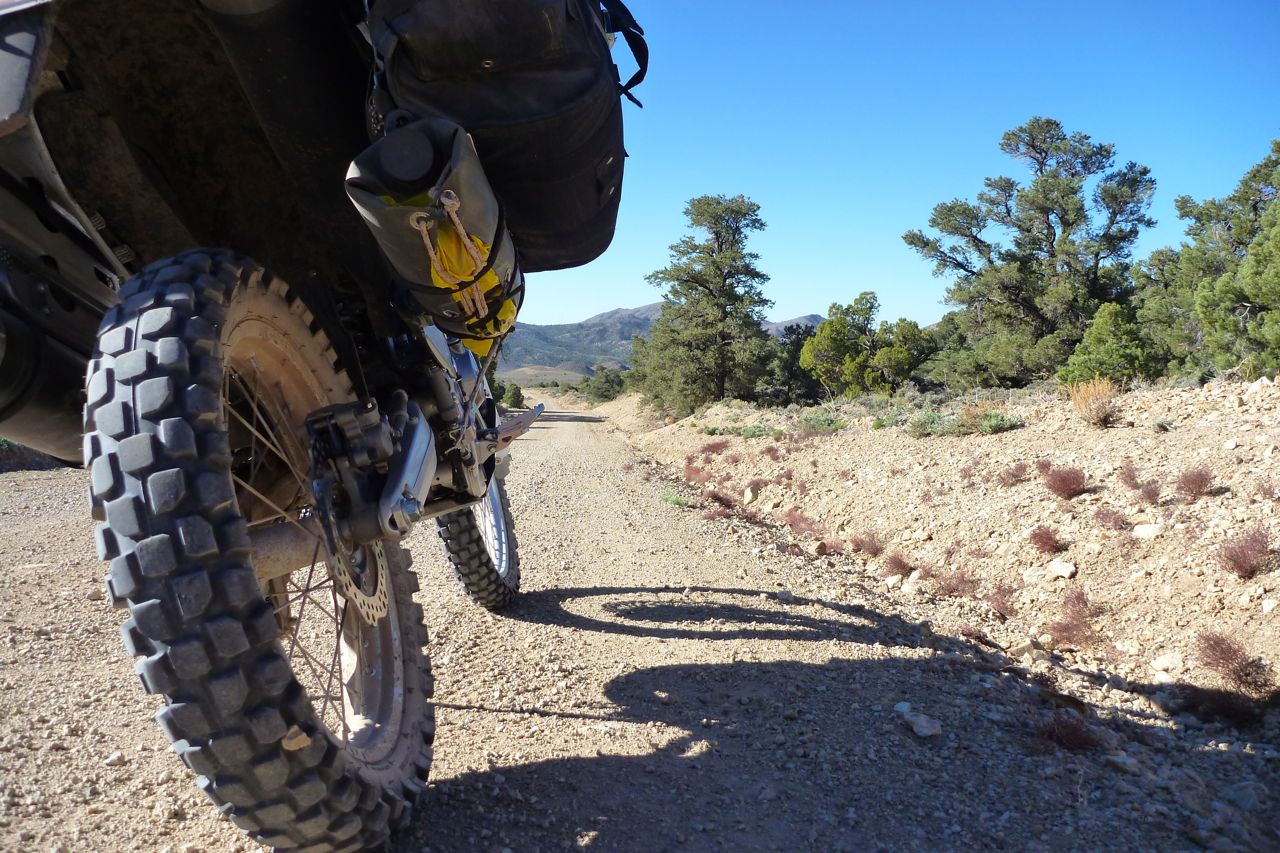
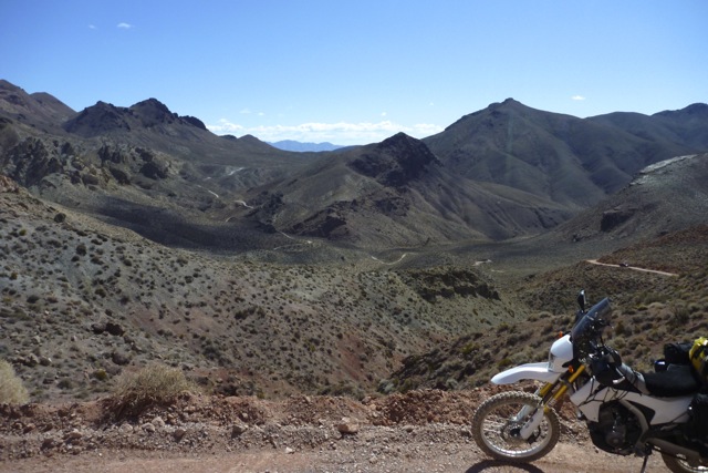
Time for a ride. I set out on a 90 mile loop, part of the UTBDR north of Moab.
Up lovely Onion Creek with a dozen or more shallow fords to cool the feet.
Then steeply up onto the La Sals at some 8000′. A bit chilly now and the over-sprung shock chatters on the rocky ascents.
La Sal – don’t know which one.
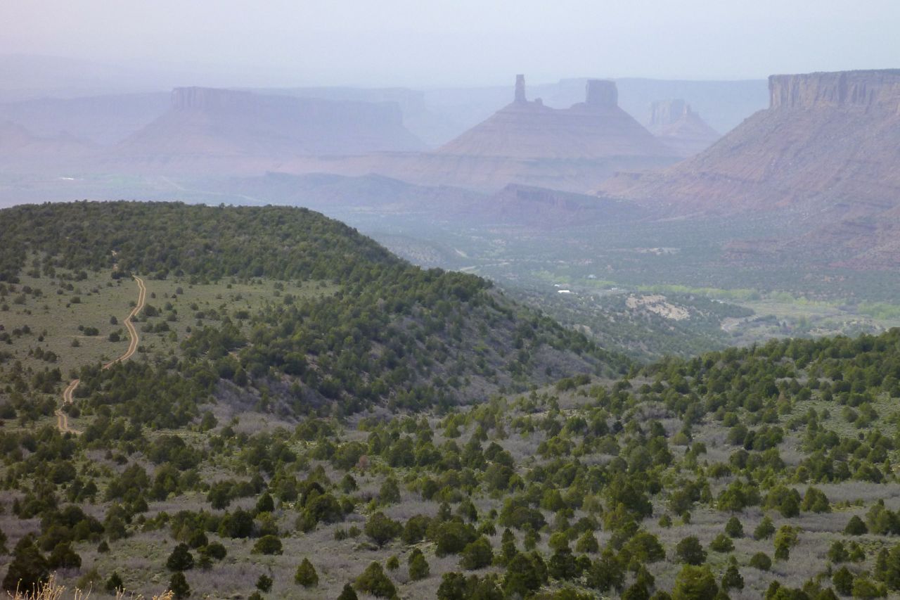
Castle Valley, I do believe.
Helmet-free riding is a rare pleasure, especially when doing errands round town.
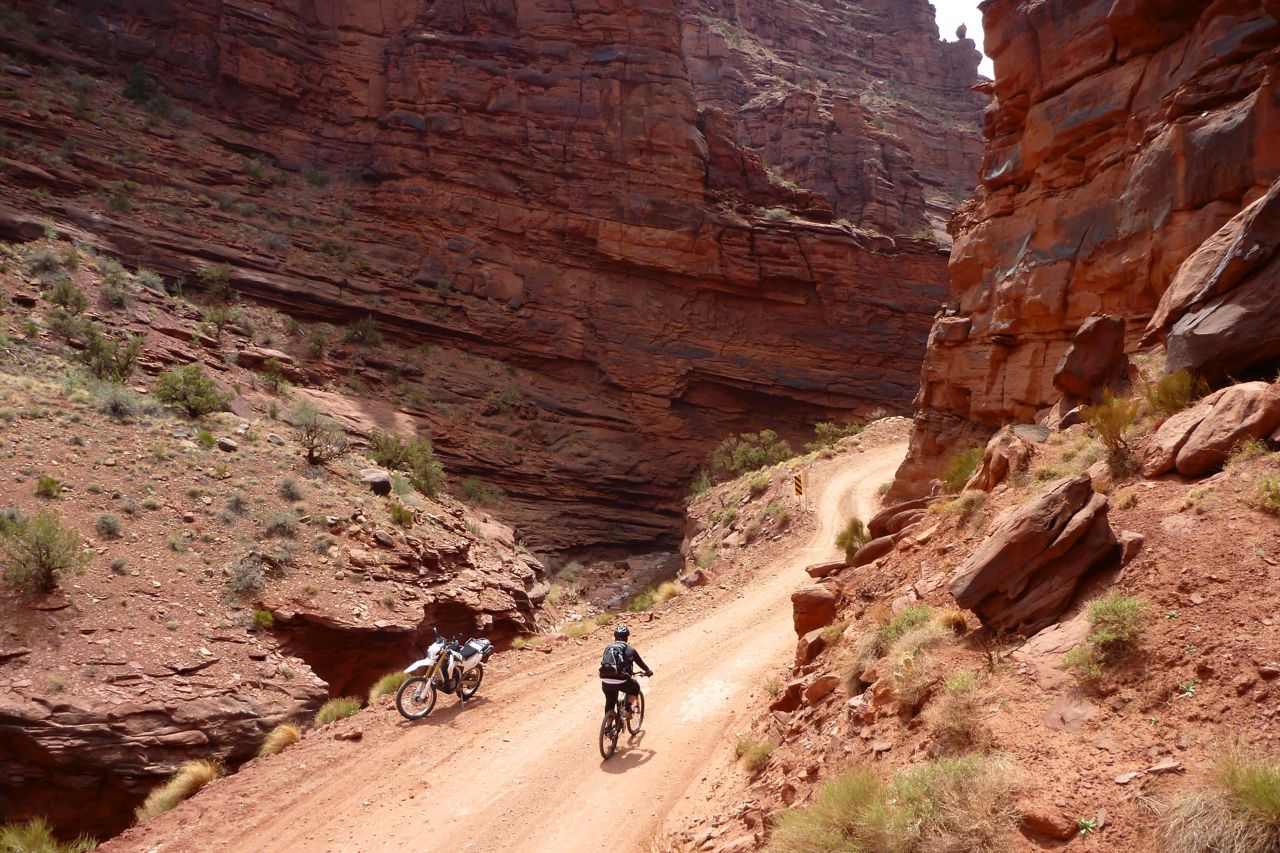
And back east, down part of the MTB Kokopelli Trail and along easy Sand Flats Road past Slickrock where I detour for a quick one, just to say I did it.
In town I spotted this old 136cc 2WD Rokon on a trailer. Little changed from the 1960s, I think you could call that a ‘functional-brutalist’ design. They still make them today: rokon.com.
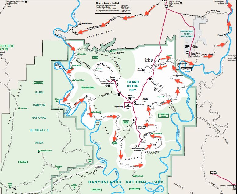
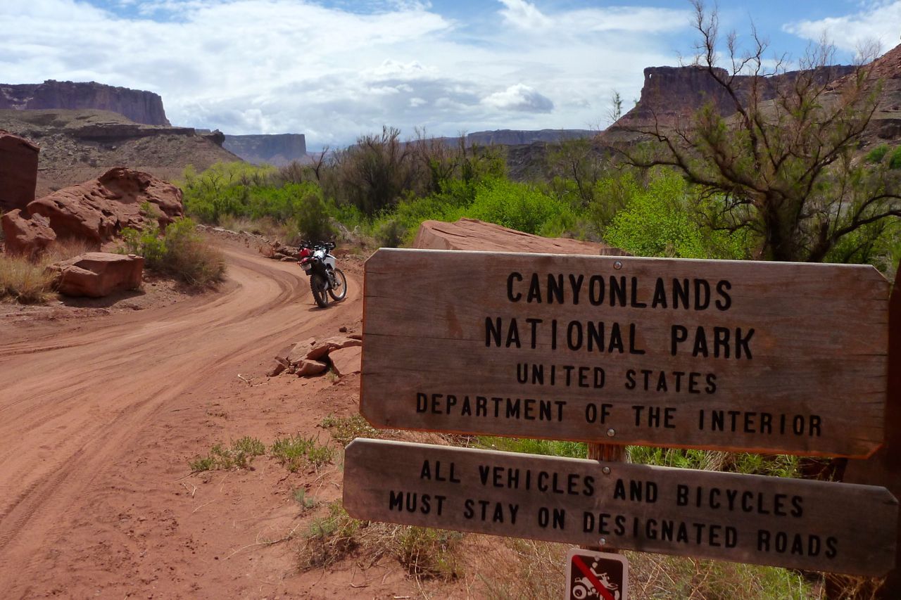
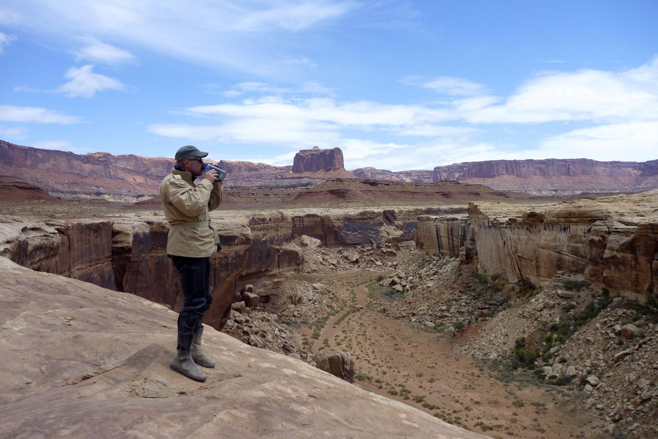
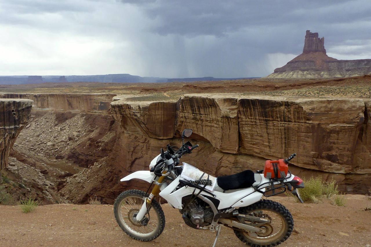
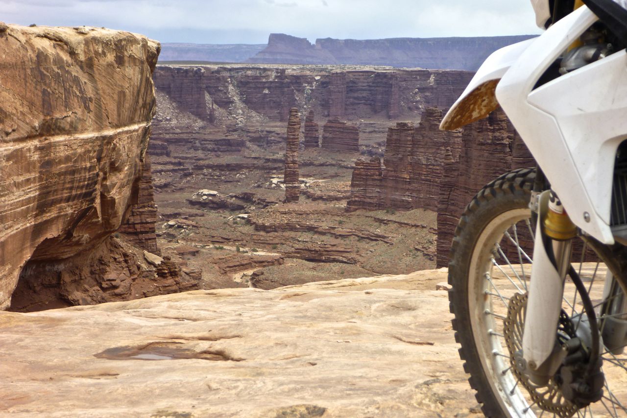
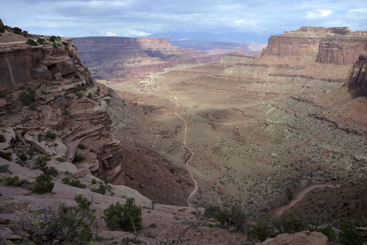
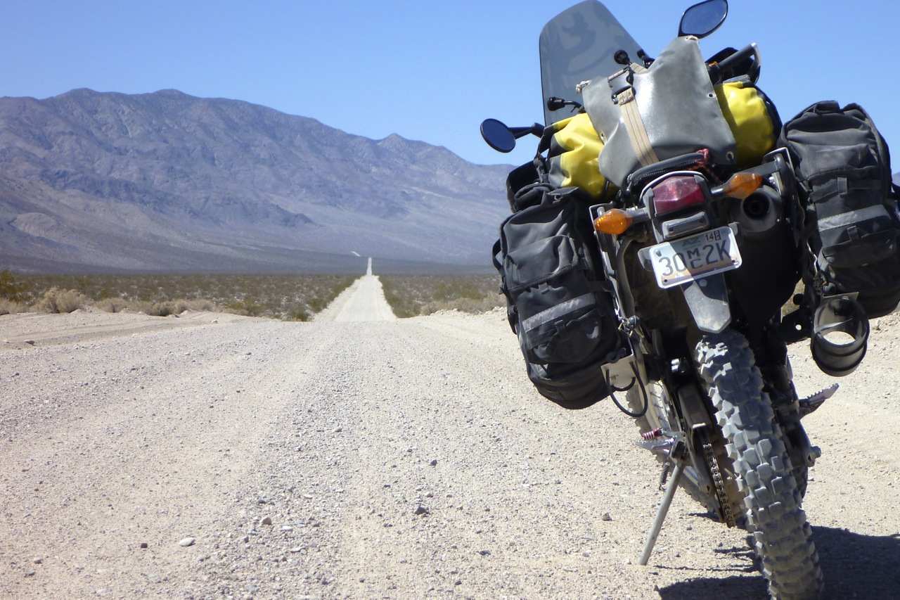
It’s time to finally tick off the White Rim Trail. Twenty years ago I tried to rent an XL500 off Arrowhead to do the WRT but the guy was not so keen. Even today it’s hard to rent a road legal trail bike in Moab. Plenty of other OHV stuff to be had if you have a trailer or a ute, but they’re not allowed on the WRT.
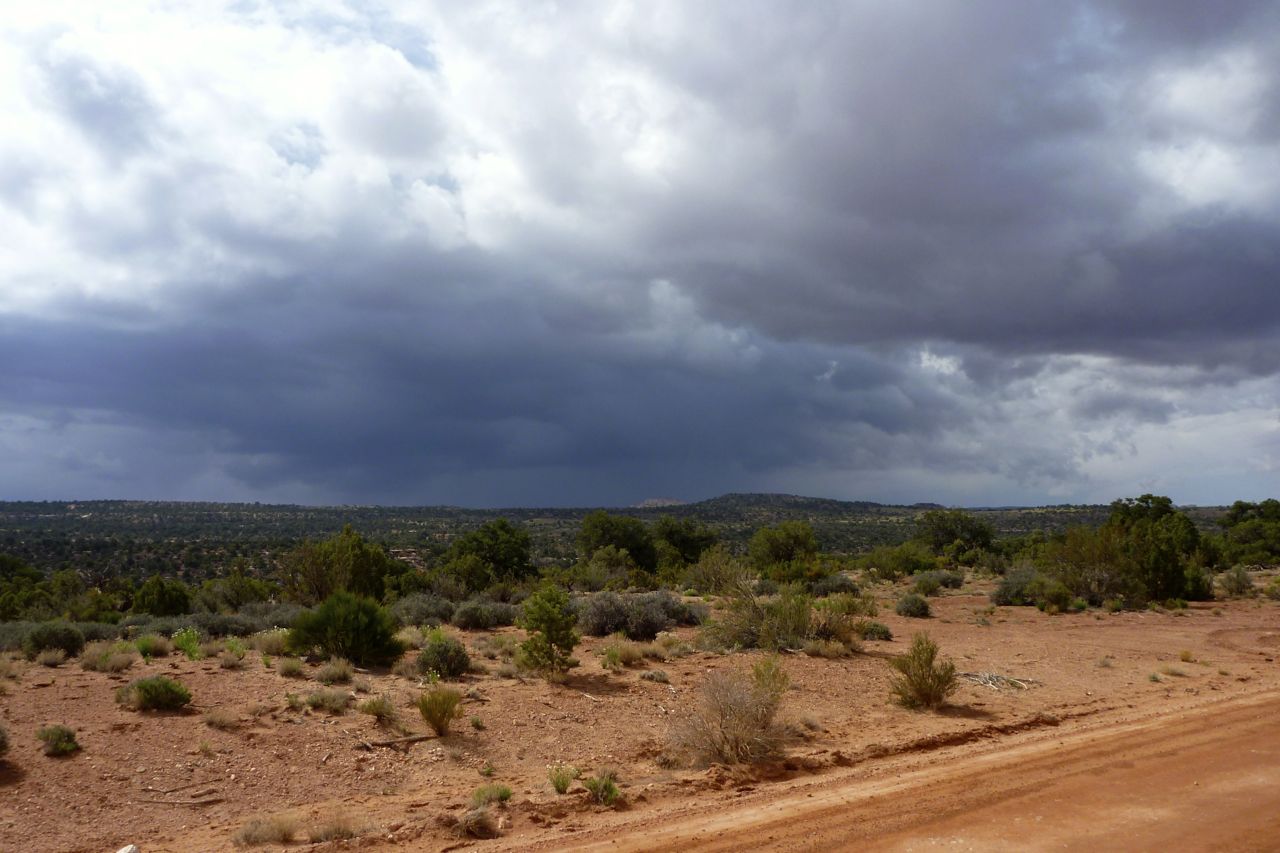
The weather was not so good; it had rained overnight, hopefully enough to settle the sand and dust but not turn it into mush. I saw a few bolts of lightening through the day but only got rained on for a few minutes.
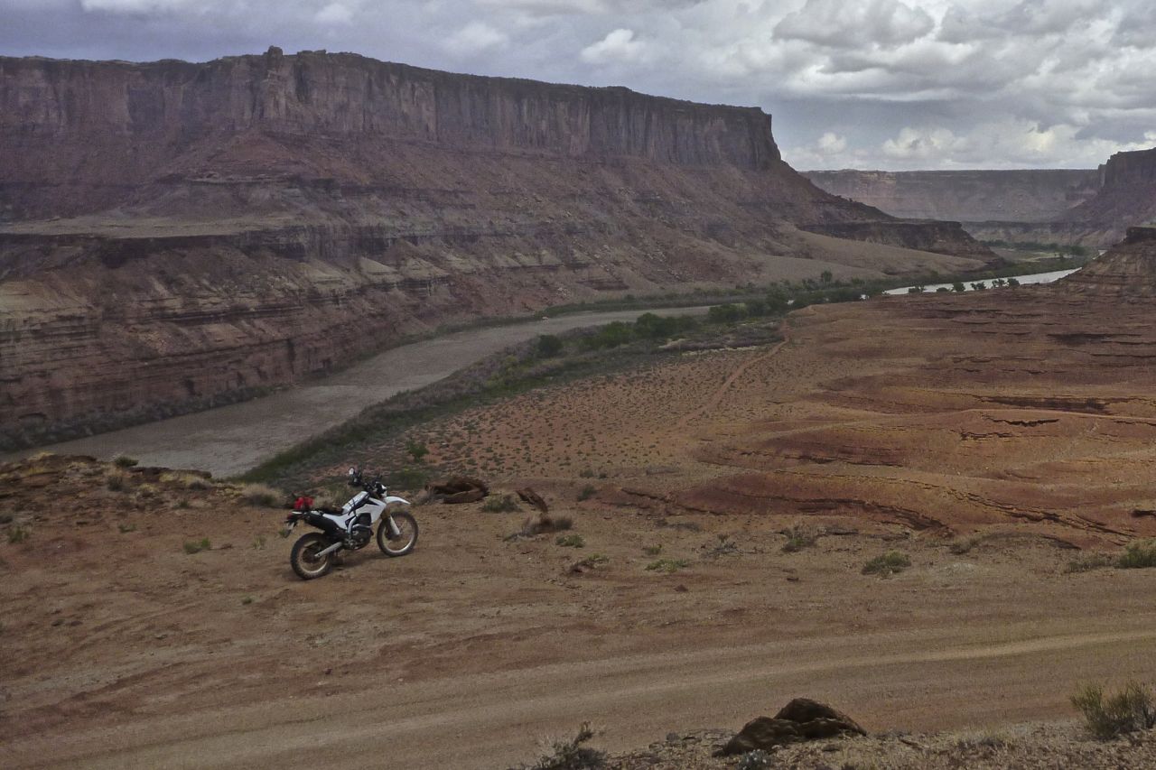
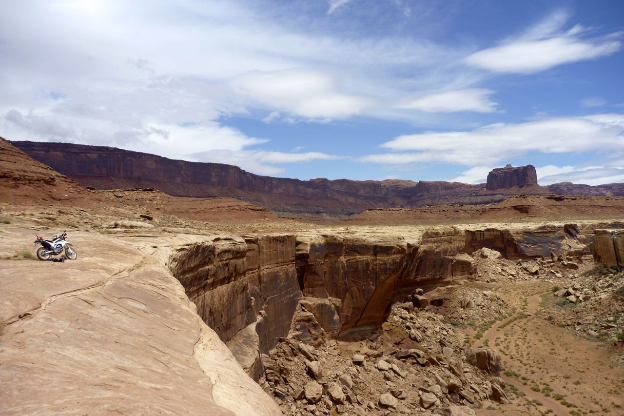
At the end of Mineral Bottom Road is the big drop to the Green River valley.
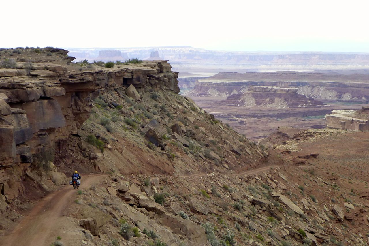
A plucky MTBer takes the last big climb after 3 or 4 days on the WRT.
From then on, it was kind of sandy, but only for 200 yards at a time. No rain dampening here so to be on the safe side I paddle laboriously. I hoped it wasn’t to be a 100 miles of this… How do these MTBers manage?
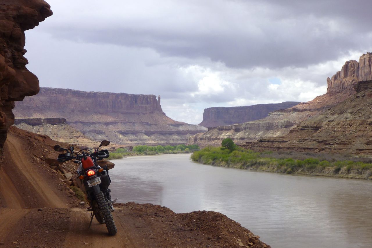
At times you’re right by the Green River; lose the front and you’ll make a splash. Elsewhere you climb ‘inland’. I think it was the tricky climb up Hardscrabble Hill that made me glad I wasn’t towing luggage or another 1000cc. I actually stopped and looked back over my shoulder at the 1:2 sandy hairpin on the way down and thought, cripes, that would have been hard to get up.
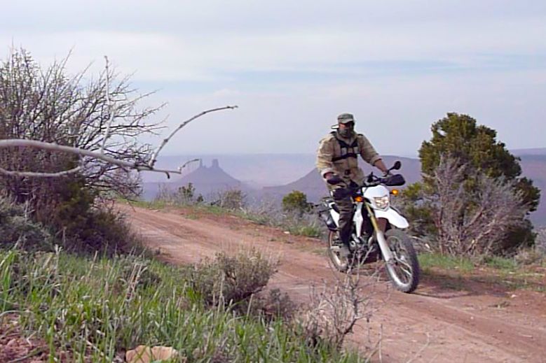
I’ll let a few pics do the talking… (but note: parking among vegetation off the trail is bad form)
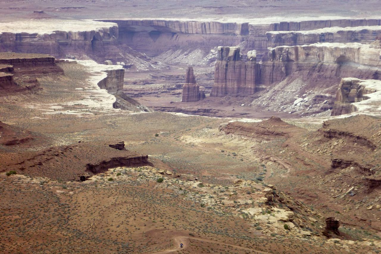
At the top of another long climb, Murphy Hogback around Mile 70, I meet a guy on a fully laden 1150. And I mean fully loaded like he was going to Alaska. On Anakee tyres too…
I didn’t know it then but I’d nearly completed the harder, sandier half of the WRT which he was heading into. I warned him about Hardscrabble Hill and doubted that tank would make it, but he seemed a confident rider.
The 1150 is a speck at the bottom of the photo.
Soon, I turn back north at the halfway point: White Crack turn off. I stop to fill up the tank and finish off my footlong Sub. Someone had advised not to bother with this side – I presume because it’s easier?
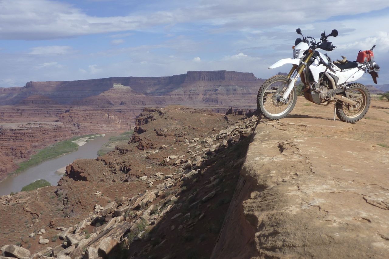
But that suited me just fine at that stage; I was riding more fluidly after the morning’s efforts and the spectacles kept on coming, now with the Colorado River on my right.
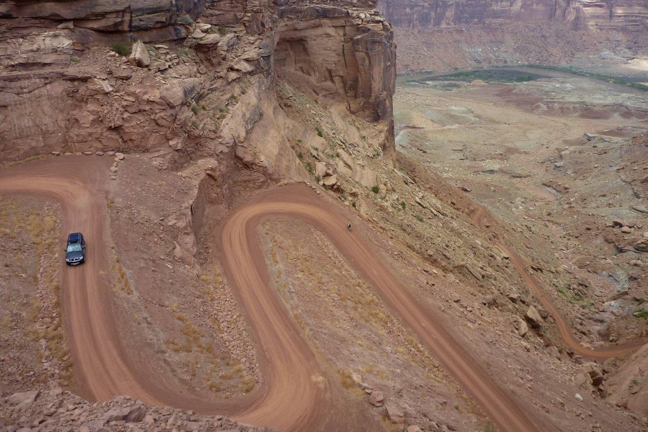
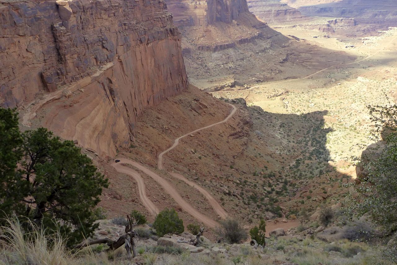
I reached the Shafer Trail turn-off about 5pm; the Trail seemed to disappear into the cliffs. Many rave about the Shafer Trail.
So I rode up to the top; Island in the Sky.
And coasted back down to keep the brake pads warm in the evening chill.
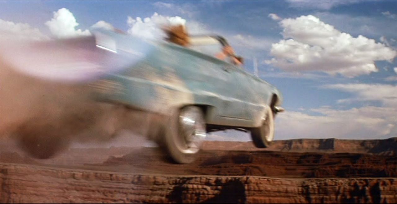
I learned later that I’d passed under the rim of Dead Horse Point where Thelma and Louise took their fateful leap, gunning their Thunderbird into the abyss, yelling “You’ll never take us alive!”. For a Hollywood movie, that was a great ending. I continued along the Potash Road, 30 miles back to Moab; a bit rough, or I was starting to feel the miles by now.
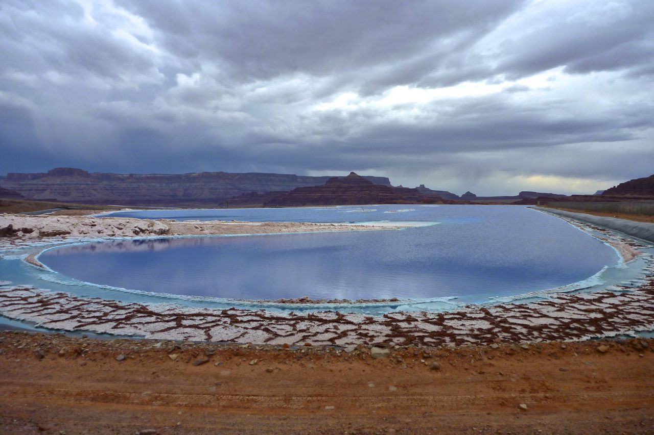
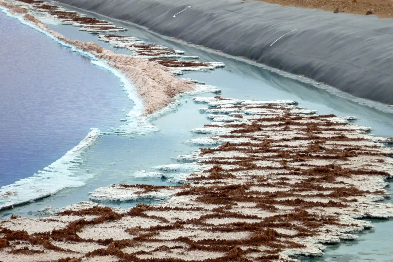
The mining works after which the Potash Road is named were originally a regular digging mine. Then they adapted it to effortless ‘solution mining’ by dissolving the subterranean potassium out with the aid of brine, pumping it up and then allowing the water to evaporate and the minerals to crystalise in shallow ponds.
Blue dye is added to help the solar process. They separate the salt from the potassium later.
I rode back into town nine hours after setting out, just as another deluge got ready to drop its pants over Moab.
Let me tell you, I’ve done my share of mind-blowing desert biking, seen attack ships on fire off the shoulder of Orion and all that, but the WRT will be among the best 150 miles you’ll ever ride.
I’m now waiting for the weather to clear before heading down through Canyonlands’ Needles District and on to the AZ border. It seems the temps are about to take another 20°F hike up the scale.
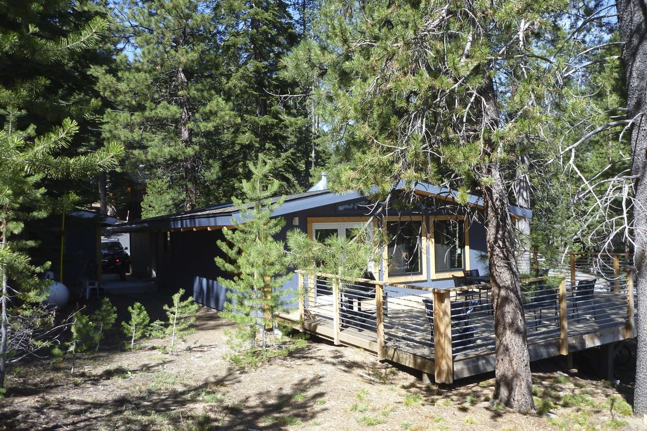
After a week of good living in a mate’s cabin out of Truckee it was time to get going again.
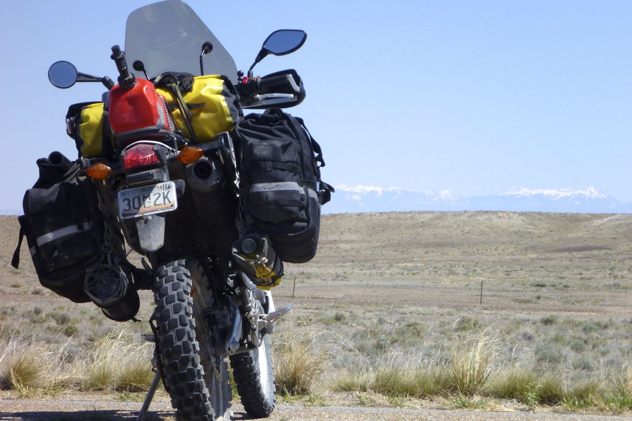
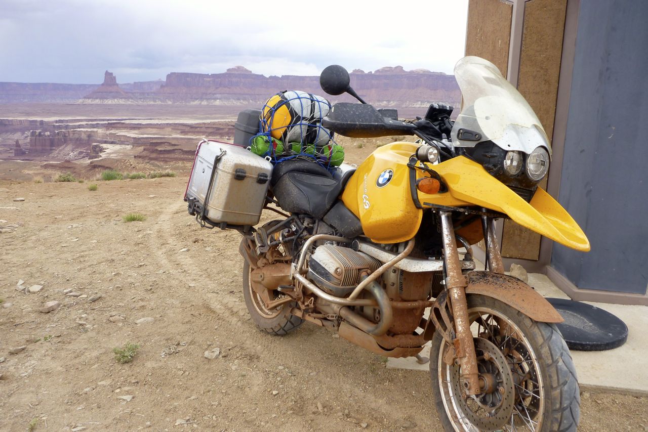
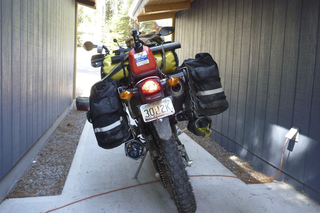
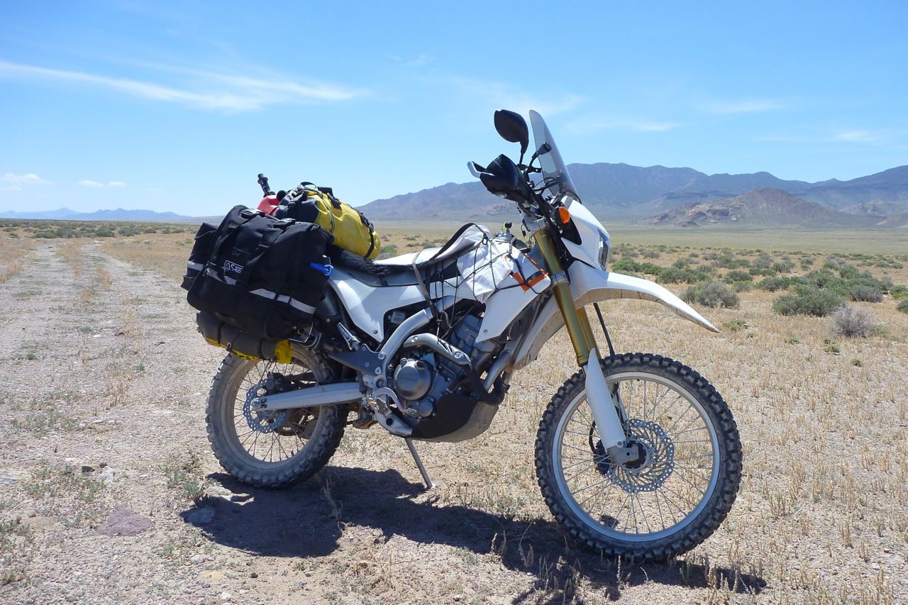
The CRF is poised on the launchpad, showcasing v2.1 of the packing system with double undertubes and a fuel can instead of that tedious fuel bag. On the CRF I have to fill up 2-3 times a day. The good thing is it makes the seat more tolerable.
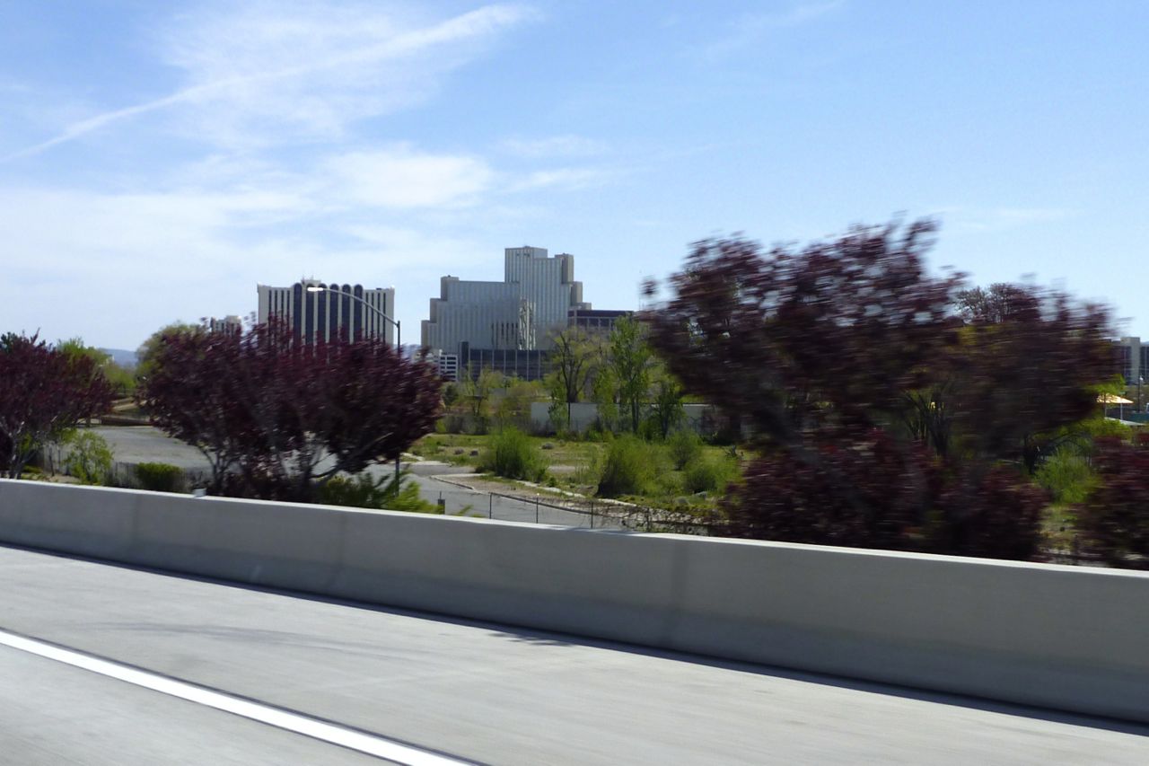
Out past Reno which I rode through last week on a day ride to Virginia City, a mining boom town that, architecturally at least, seems to have missed out on the 20th century (other touristic aspects have kept up). It’s a fun, bendy ride up to V City, btw.
The trouble with Reno is I ended up with “I shot a man in Reno…” in my head for the next couple of days, but there are worse songs to be stuck on. Well I know I had it coming, I know I cain’t be free But this song keeps a playin’ And that’s what tor-chures me…
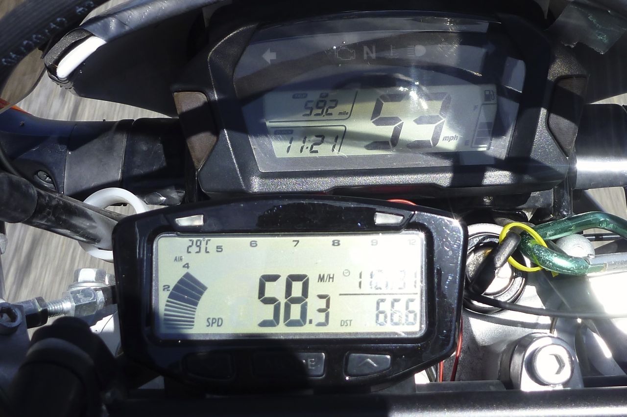
Look at the error on the Honda – shocking – and the odo is even worse, some 12% under. All verified with GPS, TT Vapor and freeway mile markers and SMSs from the Pentagon.
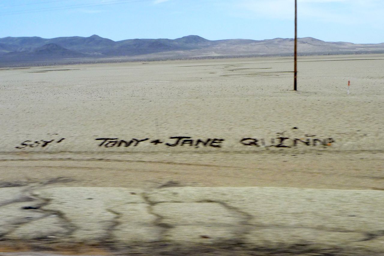
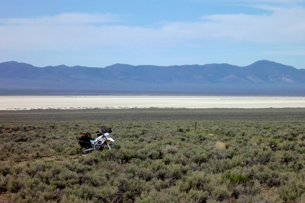
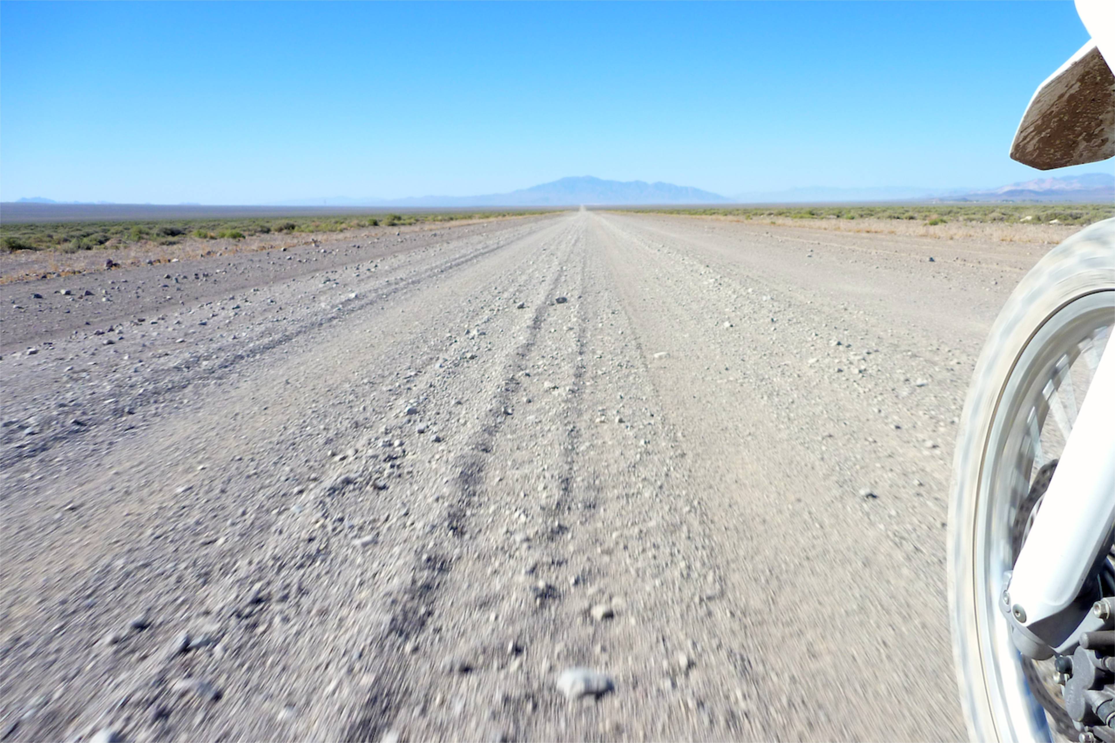
I turn off 80 to 50 – much less traffic. After Fallon range follows basin, follows range. Some basins have a salt pan and all along this one people had left messages in black stones.
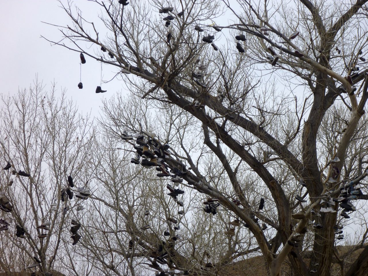
Soon I pass the Nevada Shoe Tree. Got some smelly old trainers? Chuck ’em up here.
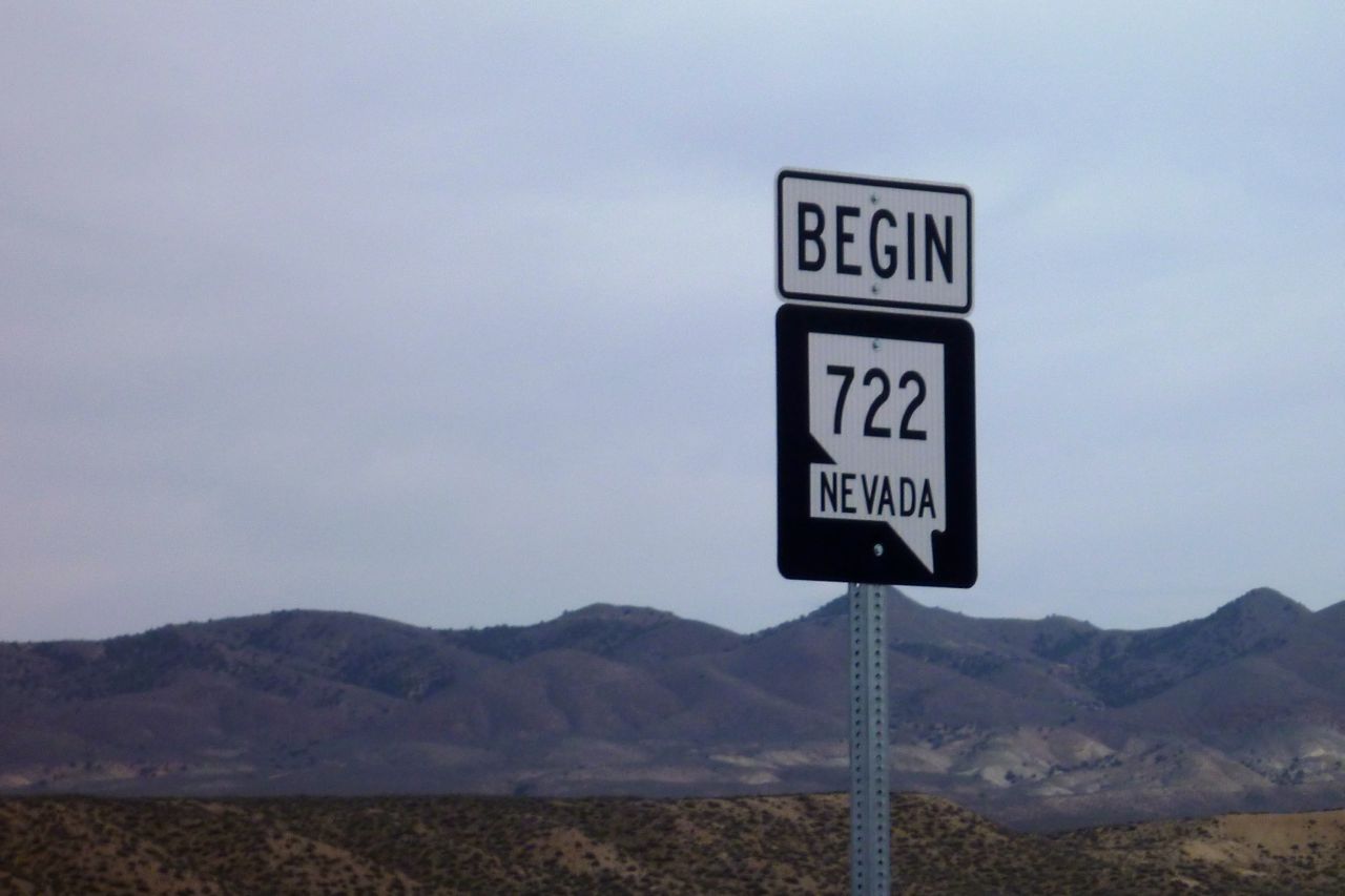
I then turn off 50 onto ‘Old 50’ or 722.
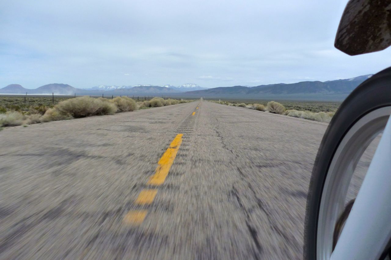
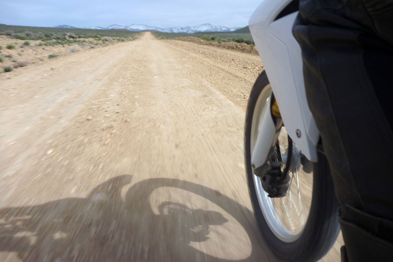
Looks like pictures of Route 66 but traffic is close to zero so I can go as slow as I like. With a hot backwind 55 feels good.
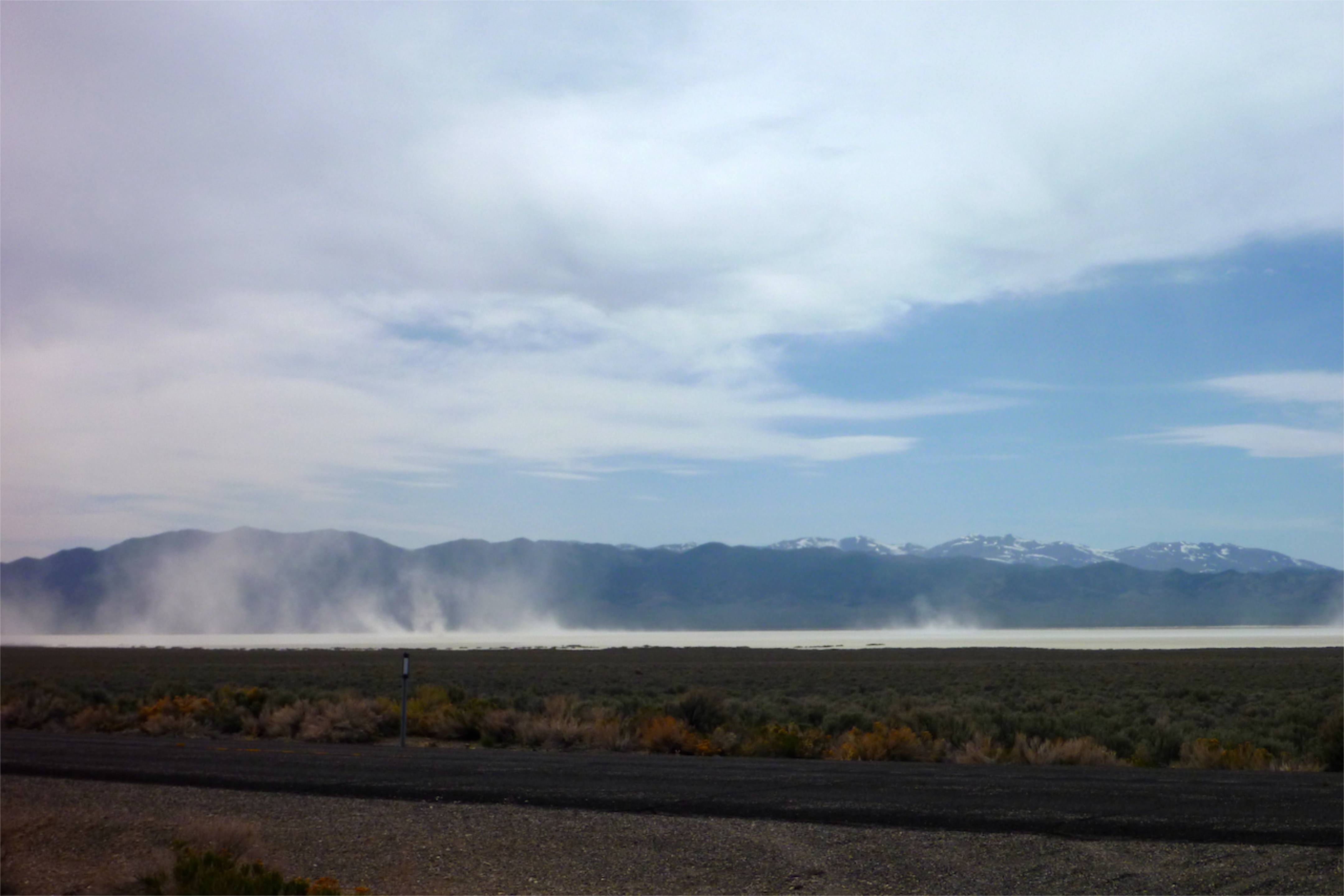
Over there the heat is stirring up dust devils on the pan. The Vapor says ambient is low 30s C – what’s that, getting on for 90?
I’m eyeing up a track over the range to the next valley. This one looks a bit thin but I give it a go. Within a mile it peters out. I have committed the cardinal navigational error of pre-emption. I tell you what though, that sage sure smells nice once your panniers brush past it.
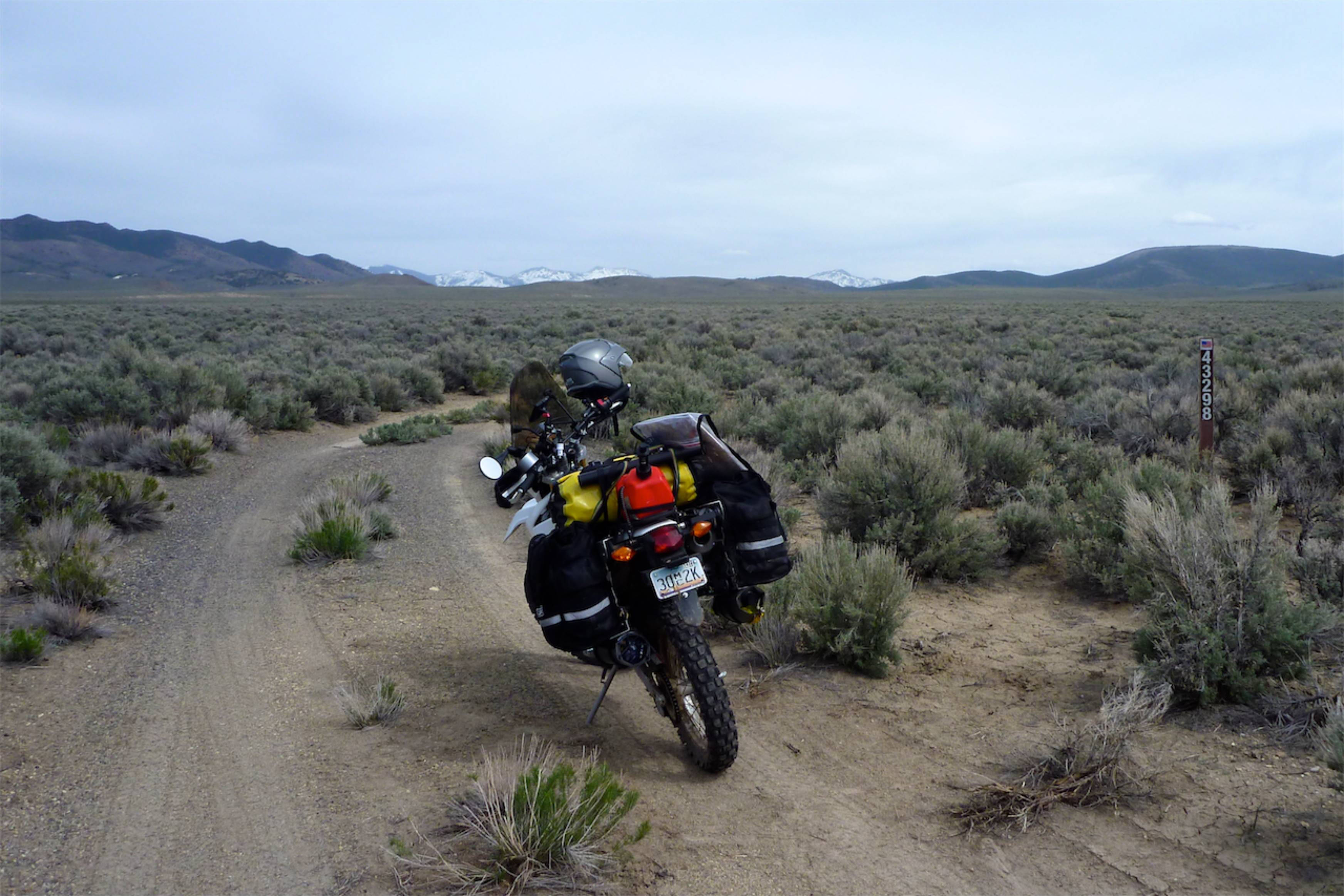
The Nevada flag – or it ought to be. Blue blue-grey over Salt over Sage.
This is the right track heading east to the next valley. I hope to cross that range at the back, but despite me sweating like a kipper it looks a bit snowy up there and on the far side it’s only tarmac. My new ankle-level shooting technique. What else can you shoot when alone? When this is all done I’m going to produce a photo moto book: Southwest Ankle USA.
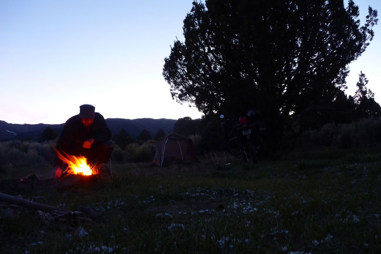
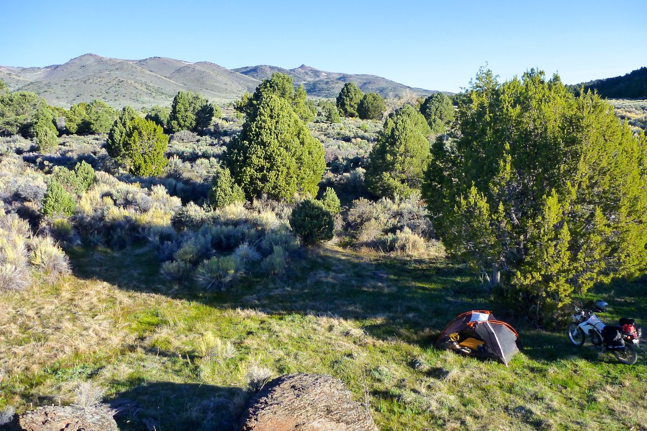
On the far side I take the dirt road south, passing a few ranches, like where The Virginian used to work. Benchmark maps are a great nav resource when combined with a Nuvi, but I could be on the limit with fuel although it’s getting much more economical. I poured in a gallon can after 80 miles and the tank was full. Here I am updating my fuel log. I was going to camp here but…
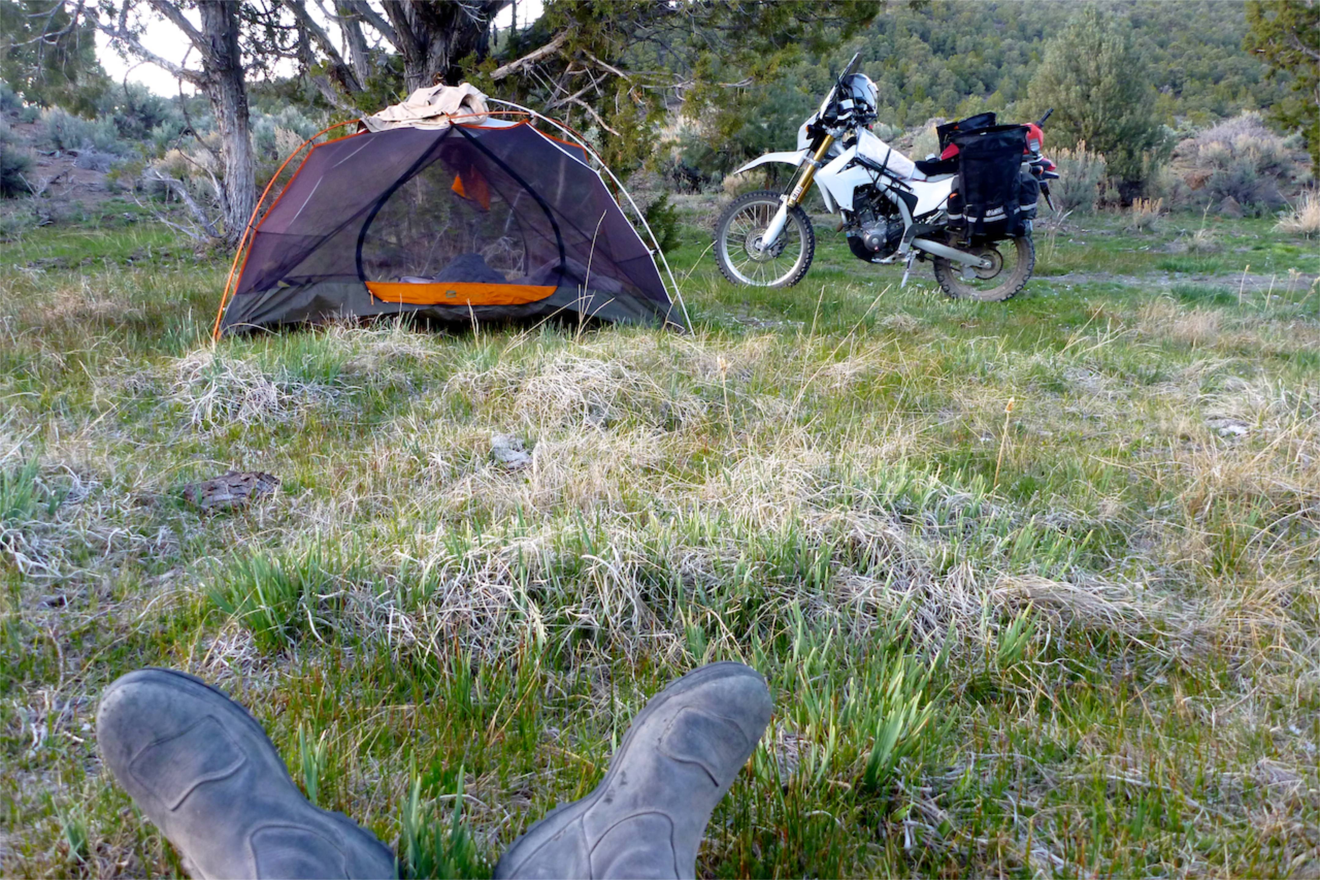
… I went for a wander and found a much nicer and more protected spot 5 mins away. It was still 7500′ – a week or two ago and only 100 miles from here I turned away from camping at that height, but I guess Spring has finally sprung.
I make a fire, ignoring the beer bottles in there. After about half an hour one explodes like a shotgun cartridge. Luckily I wasn’t staring wistfully into the flames at the time. What sort of rank idiot wastes a full bottle of beer? There was another one in there – pretty cooked by now. There was also a packet of sausages lying around – I threw them in too and they exploded, splattering me in smoked hickory sausage fat. Better than broken glass I suppose. I hope I didn’t wreck someone’s upcoming picnic stash…
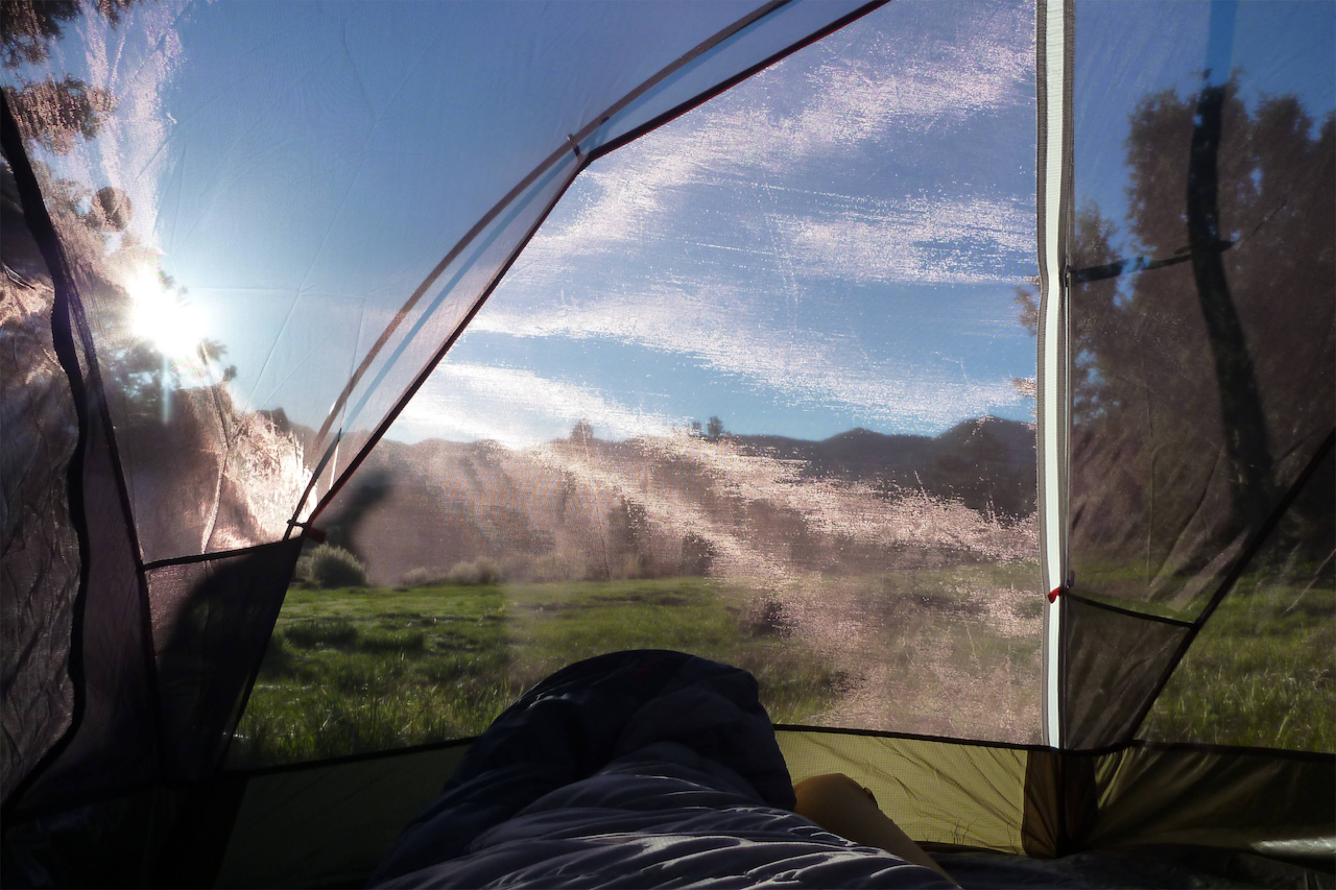
I thought I brought my fly sheet only (more space) but I had my inner (less bugs). As long as it’s not raining it’s a more agreeable way to wake up.
Besides flat ground, all you need is grass and a few trees to make an ambient camping spot (no, really!). Trouble is in Nevada you have to climb to over 7000 feet to find both. Below that is sagebush and dirt. Not nice Saharan sand, just dirt.
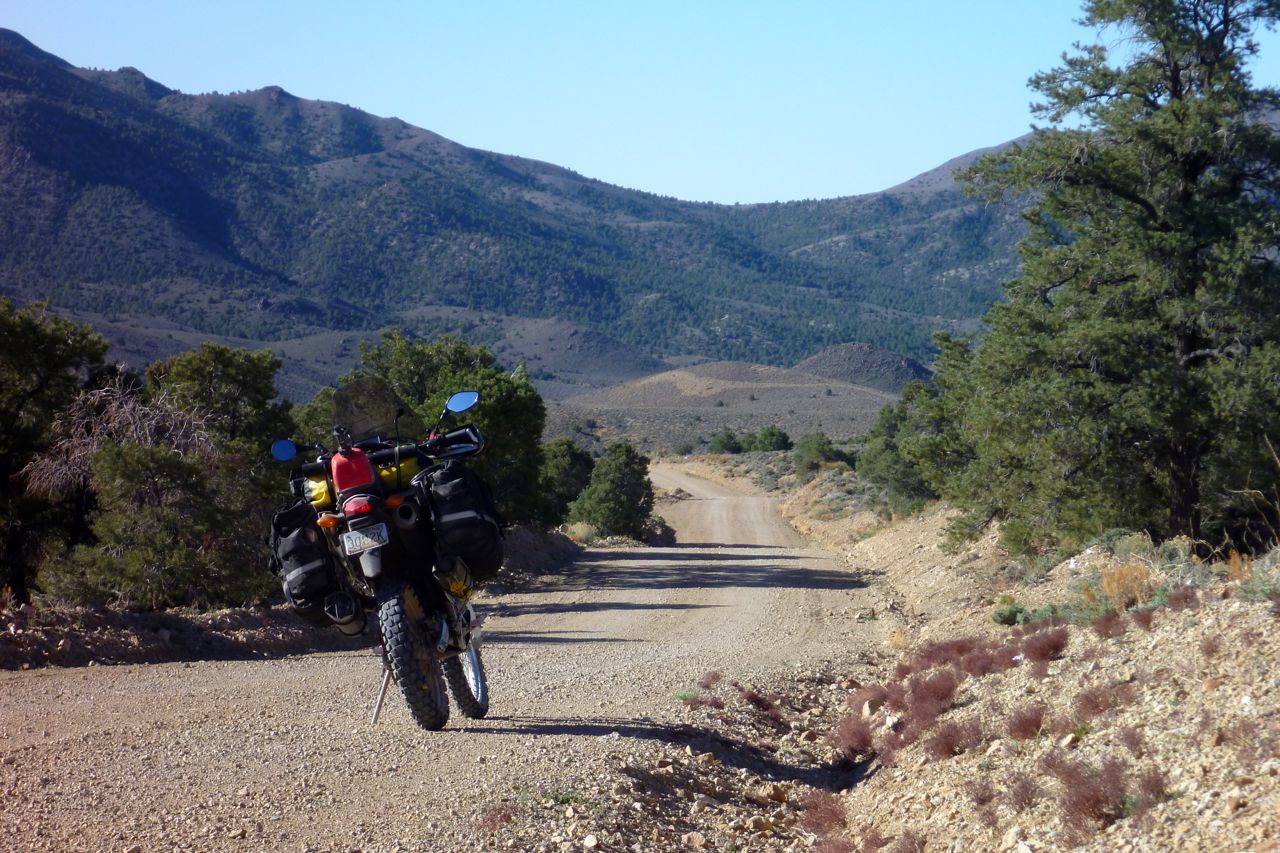
I ride on south on this GS12-able track. A lovely clear day after yesterday’s muggy overcast. The good thing with camping is you’re on the road early.
I notice my back tyre is wearing very fast. 2500 miles from new and it’s got 5-6mm left. I better do something about that quick.
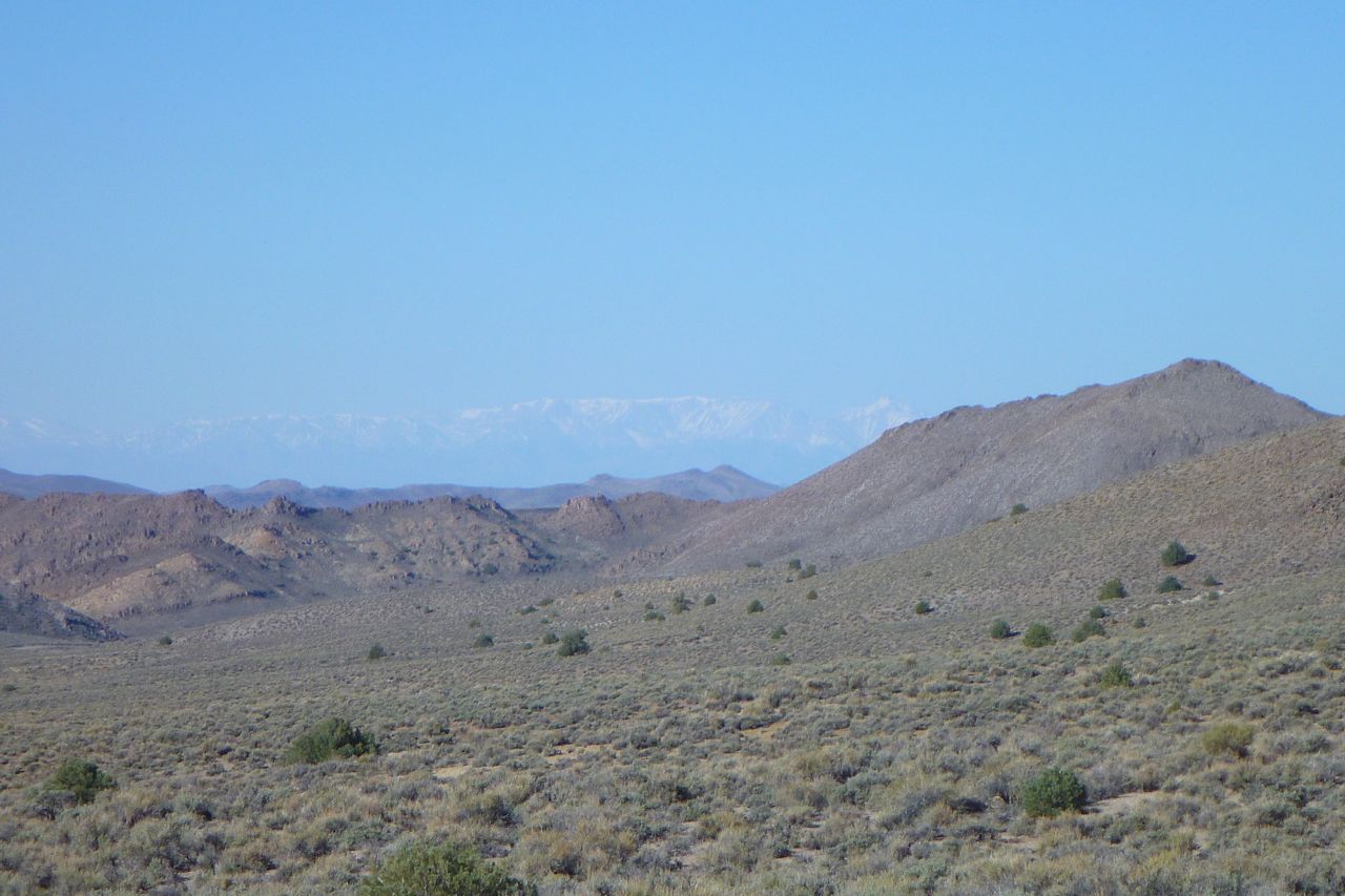
Far in the distance the snowy Sierra Nevada on the other side of Death Valley where I was a couple of weeks back.
I emerge from the mountains and follow a network of gravel tracks south to Tonopah where I hope they have wifi with the fuel.
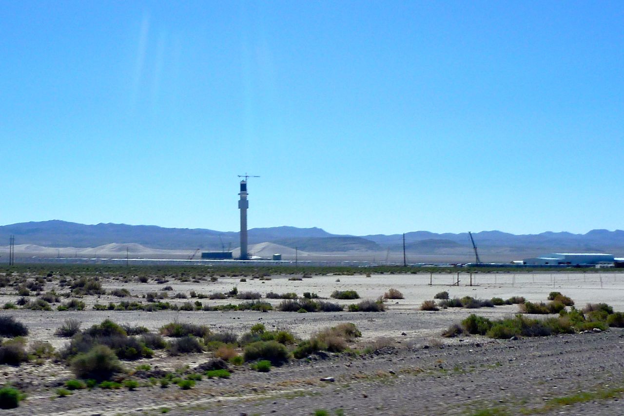
I pass this strange tower. I am just north of ‘Area 51’ – anything could be possible. Turns out it’s one of those parabolic solar generators. An array of mirrors on the ground focus on the tower top like magnifying glasses and generate intense heat and I presume steam. The Southwest should be covered with these, IMO. You barely even see a solar panel out here…
Most of the bikes otr are Harleys. This one’s rear luggage arrangement caught my eye. It looks way out back there, like a luggage vending machine, but on a full dress Hog it probably doesn’t affect the handling noticeably – and anyway is something to lean on. Outside of a Freddie Mercury video I’ve never seen assless chaps before either.
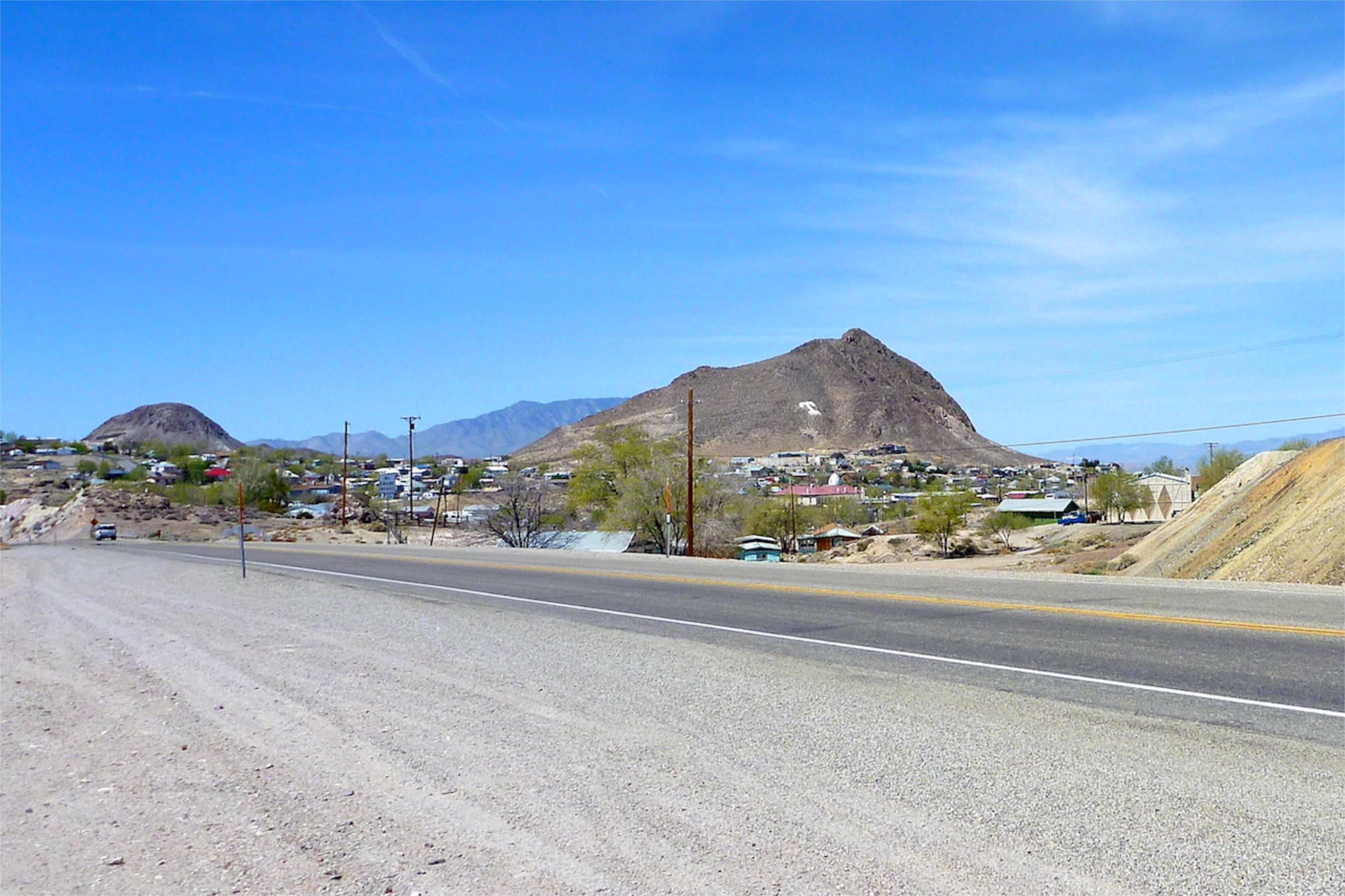
Tonopah turned out to be an old mining town – rather more characterful than Fallon. It reminded me of Tennant Creek in northern Australia. But no wifi at the servo so I jog on.
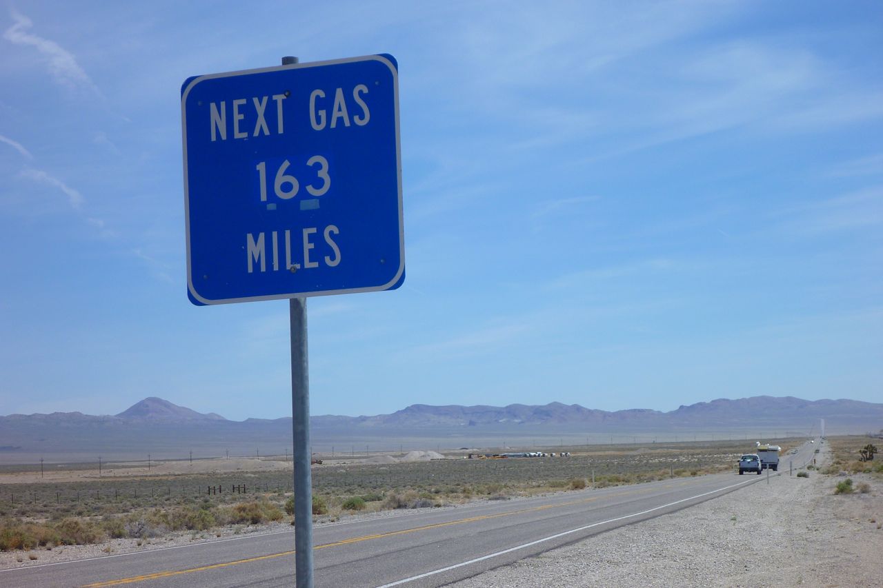
Really? Oh dear – let me recalculate. Well I can theoretically get that out of the 2 gallon tank now and have a can on the back so I should make it.
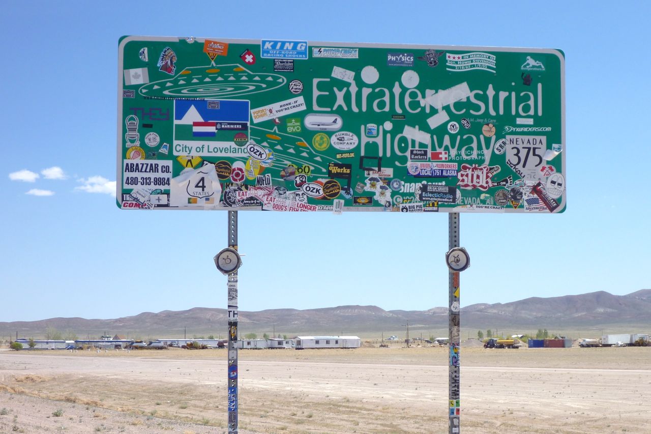
This is the ‘ET Highway’ to Rachel, north of Nellis AFB and it is hot enough to melt a flying saucer.
I pull over at 83 miles and can’t even get 1.1 US gallons in there. Hot backwinds are helping me get nearly 100 miles to the Queen’s gallon. If it’s over 30C at 5000+ feet in April, what is August like?
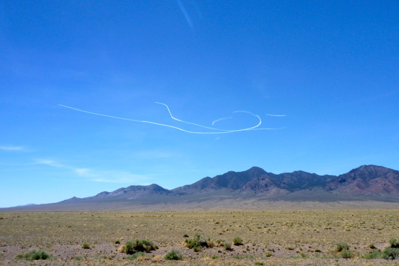
As I pass Nellis I wondered whether I’d see any sign of the sinister activities that make the place famous amongst the tin foil hatters. Those vapour trails are not a Boeing 787 being put through its paces, that’s for sure. Two jets fly off into the ionosphere at high speed.
This must be Rachel, NV. Again, reminds me of the Wycliffe Well roadhouse south of Tennant Creek, NT. Same silly UFO theme to lure the weary and bored off the highway.
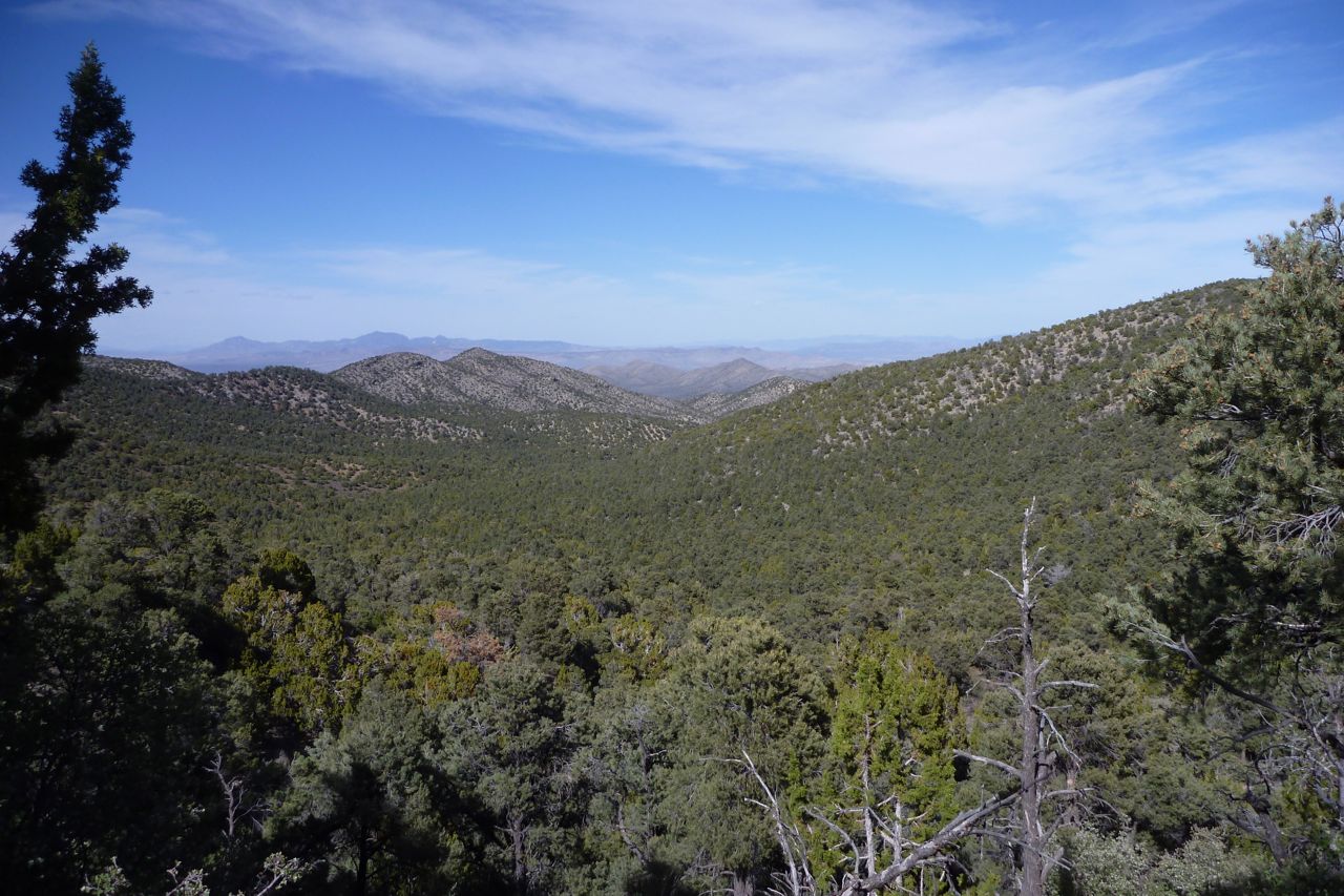
I find some welcome shade to eat and drink. I’m heading over those ranges in the background on a 60-mile dirt road. Let’s hope it’s cooler up there.
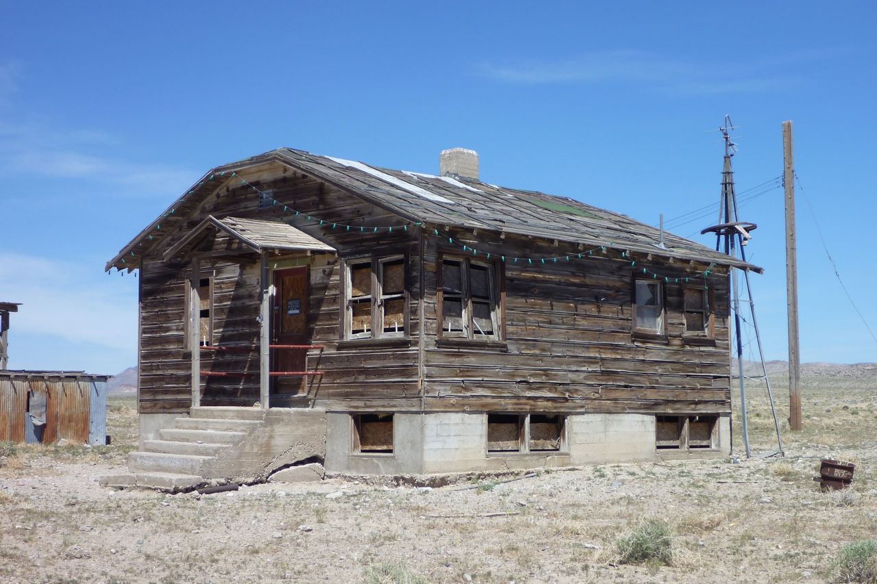
It’s an old ranch house (though in fact these dilapidated old cabins are all over the west). I notice they call the bigger ones ‘stations’ out here too.
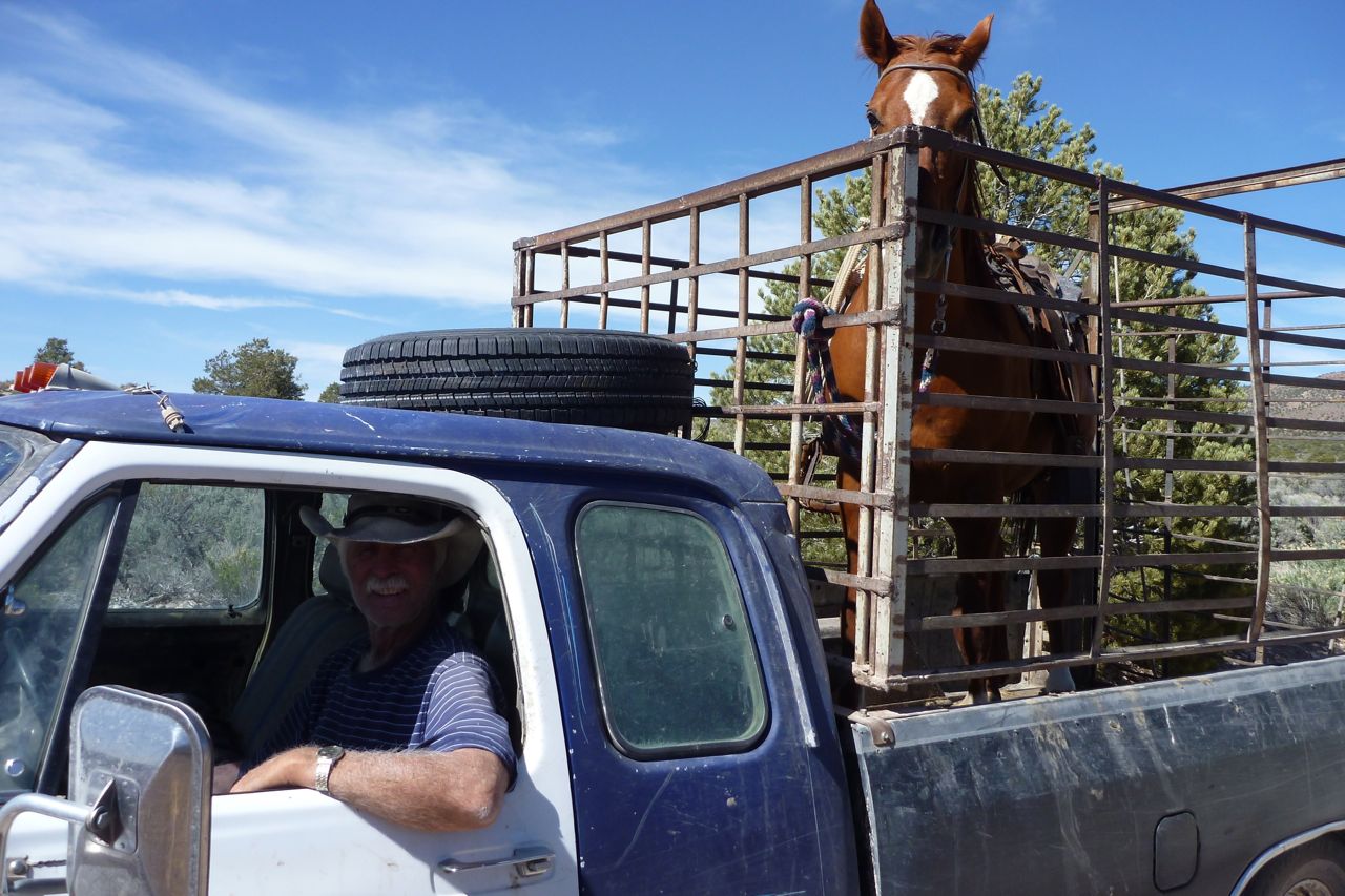
I meet a man taking his horse for a drive. Yes the road goes over the pass and down the other side, he reassures me. Are those ass-filled chaps you’re wearing there, son?
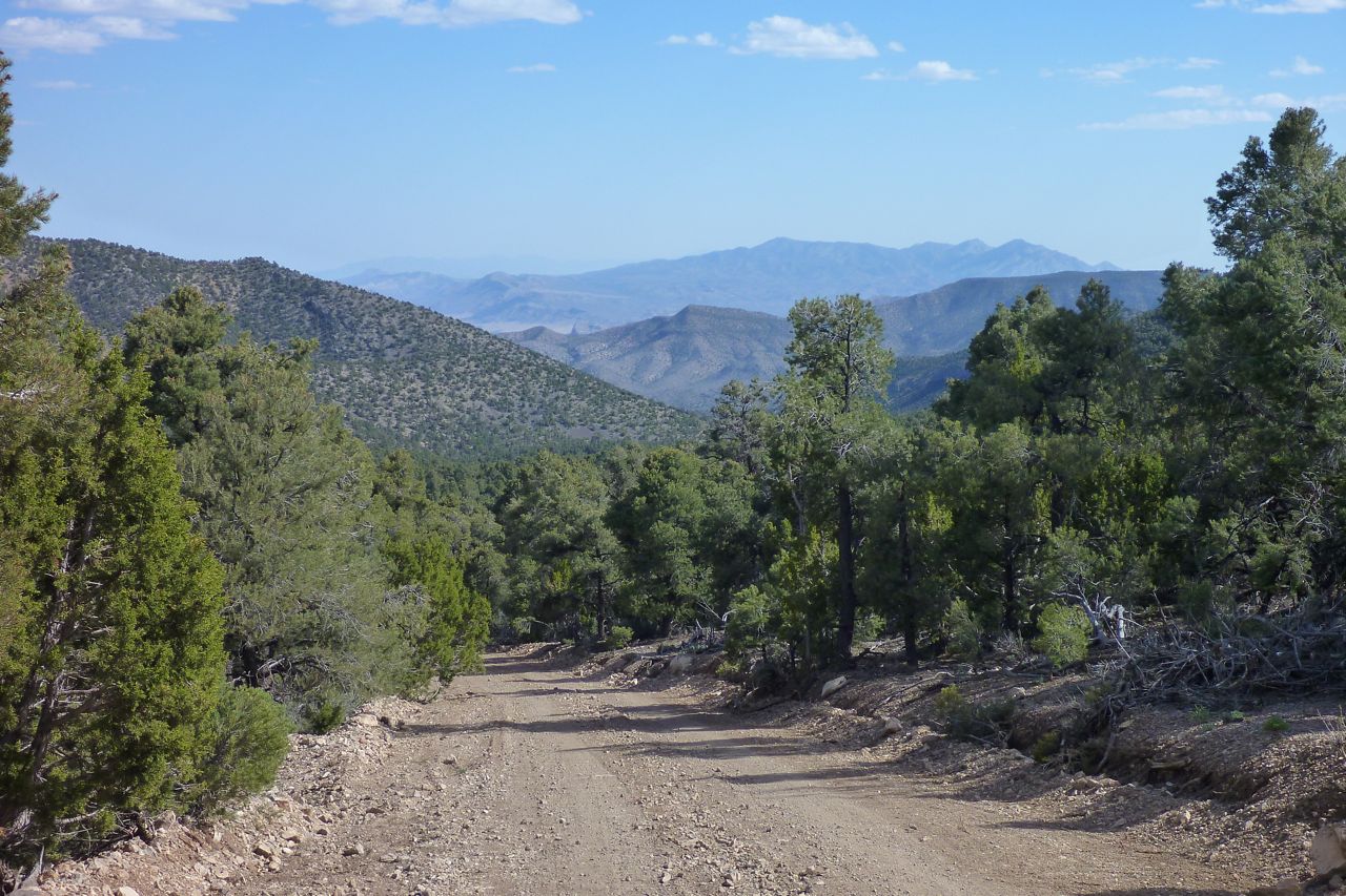
Did I say it was hot? It’s a tad gnarly too, and the Honda struggles with its wide road gearing on the dirt. Some climbs I’m in first and have a few front end moments. I ride watching the temp read-out and when it gets to 100°C I turn it into the wind for a bit. I may put in some thicker 10-40 oil in Moab. Nice views up top, but.
Down the other side I coast to cool the motor. I tell you I would have been in a right old muddle up here without the Nuvi, even though it cuts out a lot from the vibration. My Nuvi only shows dirt roads when you ‘Go To’ but was still $70 well spent. Tracks in all directions, you see. You still need the Benchmark for planning though.
Out of the hills and I need a drink right now. My head is nearly as red as the fuel can.
Coming down to the highway I see either a blue wall of some kind of lake. It’s Lake Nesbitt! I ride right through the gate for a mini wash. That’s better; time now to look for a motel. I am shagged out.
Down in Ash Springs its 82 mpg at the servo. (98 UK) Amazing but then that’s why one compromises on a 250. Though on the dirt it’s no compromise at all. The man recommends the Alamo Motel down the road: great spot and a friendly guy. Later I wander off to the gas station for a treat and find a huge supermarket/hardware/cafe/auto store/green grocer/bakery behind the counter. In a little two-motel town? I suppose like a loan, they consolidated all their stores into one manageable item, bigger than my local Safeways.
Today I had a great ride planned over to Utah, crossing the border on a 80-mile dirt road. But as I check on the state of the back tyre I’m not too surprised to see a nasty 2cm gash in the middle of the tread probably picked up on that ride out of Rachel. I’ve already ordered a new tyre to arrive in Moab c/o a helpful advrider, but looks like I better stick to the highways across Utah or I’ll end up like Everett Ruess. Luckily south Utah is not the worst place to be stuck on a road. I marked the gash to see if it grows, as they can do. If it grows too fast I make have to think of something else before Moab.
Nevada border – report ends
I hear that train a comin’ It’s rolling round the… SHUT TF UP!!!
My bike came with the commonly fitted Stage 1 performance kit: an EJK fuel controller, FMF Q4 pipe with MegaBomb header, drilled air box sides, spark screen removed from air filter element and a 13T sprocket. All probably great for recreational dirt biking; not so well suited to slow backroad touring where fuel economy and not breaking something is a priority.
To help ensure the former I’d done my old trick of marking the throttle (right) to see at a glance how open it is. In a headwind or on a gentle upgrade it’s possible to not realise you’re unnecessarily WFO, bogging the motor and possibly wasting fuel.
Before I even rode the bike I refitted the original 14T, and after a dirt ride in the Phoenix hills I knew that FMF pipe had to go too, even after we tried quieting it. I was also not so keen on extra holes in the air box sides; that’s the last thing you do for long-range desert riding, though apart from sandstorms, it’s trailing others’ dust that’s usually the problem.
So when I left Phoenix I was on the original heavy but quiet pipe, the non-standard air box holes taped up but with the EKJ programmer unmodified (i.e.: still set at Stage 1 settings). I kind of hoped the ECU might deal with it, but realistically expected the bike to run rich now it was ‘choked up’ to near original specs. Heading into Nevada against strong winds, sudden increases in elevation, a full payload and little experience of what was normal, it was hard to tell how the bike was running but it didn’t feel fabulous. After a couple of days blown around at 55mph and with mpg as low as 42US (50UK) and even just 54US (65UK) while coasting 5000 feet down to Death Valley and dirt road plodding, I was ready to try something and improve things.
After Death Valley I pulled off the air box tape and immediately thought it ran better. Sure enough, the bike climbed steadily along Highway 395 from 4000′ to nearly 8500′ in the Sierra Nevada after which I stayed at 7000′ most of that day at up to 65-70mph. The tank was now returning 58US or 70UK mpg, peaking at 73US/88UKmpg around Lake Tahoe. That was more like it.
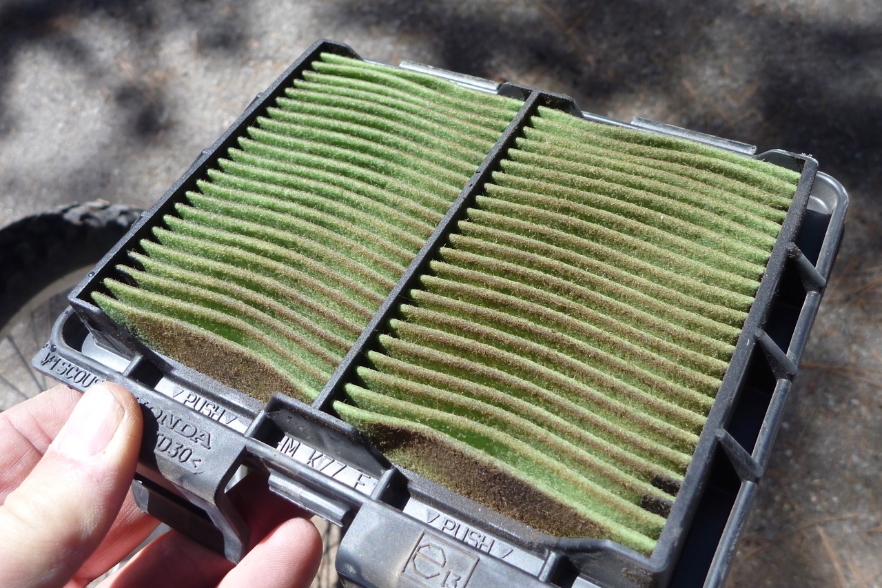
I could have left it at that, but preferred to tape up the non-standard air box holes to preserve the air filter which was already a little grubby (right), having followed Al on his KLX250 and Christian on his KTM950 along dusty dirt trails for a couple of hours. This of course would require leaning out the EJK programmer which was initially confounding; I’d not come across these ‘black boxes’ before.
In fact they are exactly what they claim: an ‘electronic jetting kit’, just like swapping jets, needle heights and float levels on a carb to get your bike running better following performance mods or as a response to radical altitude variations. Only now it’s done by simply pressing buttons on a black box to tune three fuelling modes: cruising; acceleration and WFO – as well as the rpm ‘switch’ point between those modes. Importantly the EJK (Gen. 3) only increases fuel delivery (richens) – it does not lean out the Honda’s original settings which as we all know are probably leaner than a kangaroo steak.
It took me a while to get my head around modulating the EJK, not wanting to bugger up the settings and end up with the CRF running like a tractor. The online guidelines, videos and users’ versions were a little unclear or contradictory, but once you’re pretty sure what to do, it’s easier than most TV remotes. One source of confusion is the so-called ‘yellow’ light mode (acceleration) which is more orangey-red (left) although red (wide open, max power) is clearly red.
I presumed my EJK was on the Stage 1 settings as shown left: 3 cruise, 3 acc, 6 WFO with switching at 5, 4 and 4.5.
An email to Dobeck who make EJKs (my red unit is branded ‘FMF’ but is an EJK) came back with a very quick response suggesting: 1.5, 1.5, 2.5 and with the switch points unmodified.
So, running at tickover, Light 1 flashes slowly in green; blip the throttle and it flips up to three green lights then down to one or two green lights.
Press the Mode button once and you should get three green lights flashing quickly (‘3 cruise’ Stage 1 setting). It means the green mode is live and ready to be modified with the + or – buttons to either side. But as Dobeck admit, the sensitive Mode button can jump to the next ‘orangey-red’ yellow phase. No worries, either scroll through the other 5 modes by pressing Mode until it comes back round to 3 greens flashing. Or do nothing for a few seconds and mode change will deactivate and revert to whatever the settings were. There is nothing to be risked pressing Mode to see what happens or just to establish your settings (mine were indeed set at ‘Stage 1’ as above). Only pressing + or – buttons will modify things. And of course best of all there is no need to plug into a laptop, smart phone or remote programming device; it’s a self-contained programable unit.
Once I understood all this I went back to first three green lights flashing in Mode live, and pressed minus until it was flashing green between lights 1 and 2 which equates to 1.5 as Dobeck suggested. Press Mode again and the same setting change for yellow (orangey-red) mode. And then Mode again for the big drop from wide open red (which I rarely use) from 6 to 2.5. As mentioned, Dobeck recommended not changing the three rpm switch points so that was it. Once understood it took less than a minute. After cleaning out the dusty air box and greasing the inner surfaces to catch dust before it got to the element (below left), I taped up the six 1-inch holes on the air box side lid and went for a run.
I’m at 5500 feet right now, among hilly backroads and it was a chilly morning, but a short run showed the bike running a little quieter (less induction throb with the taped airbox) while it cruised and accelerated up to 65 as well as ever, if not better.
The Dobeck man did say running stock with his suggested settings would improve torque and that was my impression (or it’s what I want). The next few mpgs will tell; I’m expecting it to stay at around 60USmpg (73UK) or above – just what you’d expect from an efi 250. To optimise everything I may even nip over to Reno and buy a new air filter element (but then grind off the restricting spark screen, as most users do).
When efi came on the moto scene some complained that meddling with the fuelling was no longer possible. Clever techy types soon came up with aftermarket software to do just that, but the foolproof, self-contained, adjust-on-the-fly EJK black box has got to be the best tuning solution so far. Off course it cannot alter timing to deal with very low octane fuel in the AMZ, but the CRF-L runs a low-compression engine that needs only 86 RON or more. That leaves ECU-generated error codes disabling the bike, but again the Honda seems simple in this respect. Certainly swapping pipes didn’t cause the ECU to flip out and anyway, it seems lately that vehicle manufacturers have learned their lesson and ‘limp home’ modes (where present) are only implemented as a last resort.
Finally you ask, is the EJK as it is set up now substantially better than the stock bike? Is it worth spending $225 without taking the full Stage 1 route which includes modifications less suited to overland travel? I guess I’d have to ride a stock CRF alongside my current bike to find out but I suspect there’s something in it – perhaps 10% more power with fuel economy barely altered, compensating for the stock super-lean fuelling. If an EJK hadn’t come ready-fitted to my bike I’m not sure I’d have bothered; if I wanted more power I would have bought a bigger bike. But as it is now I’m pleased it’s there and is so easy to retune further down the road. It seems to run about the same as the press bike I tried in February, but as said, I suspect that bike was tuned a little above standard and possibly as result returned fuel consumption a good 20% below what I’d expected.
Next day I follow dirt tracks over to Reno, highways out to Virginia City and back on the freeway (no luggage or screen: 69US/83UK ;-).
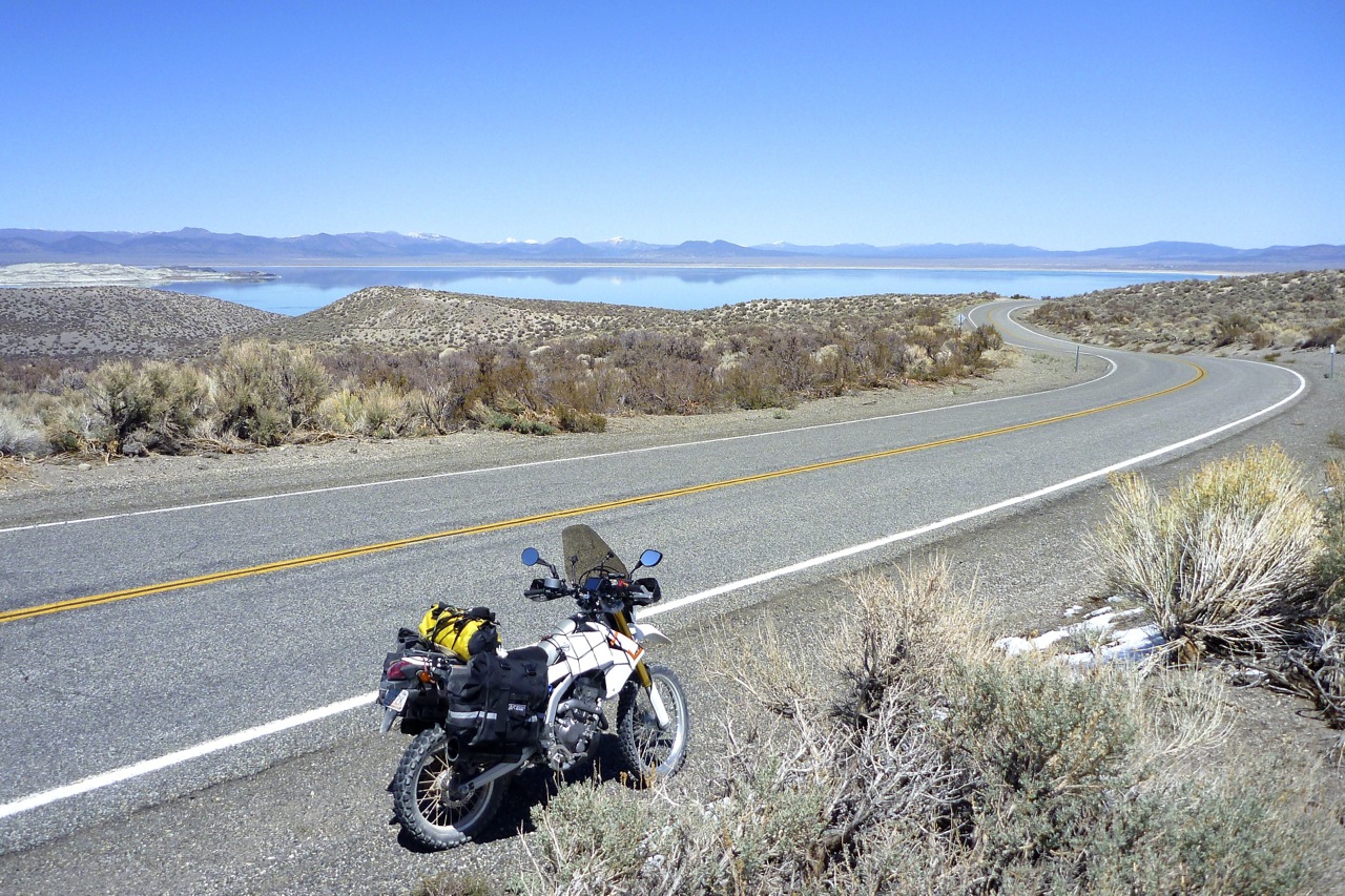
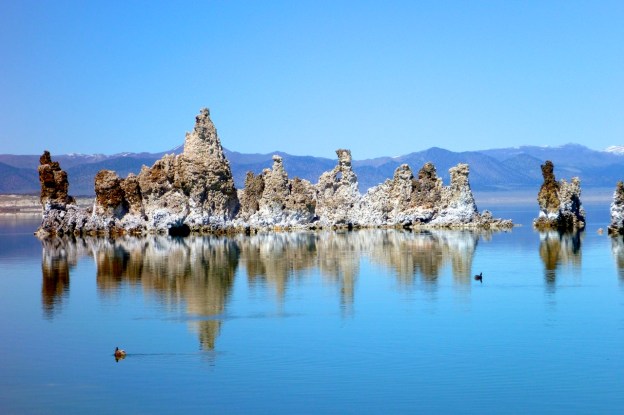
Wasn’t sure where I was heading today other than up Highway 395. I had two days to get near Roseville near Sacramento for a talk at a moto shop. Al had recommended a ride up to Mammoth Lake and I wanted to check out Mono Lake which I’d read about recently in Mark Twain’s Roughing It.
First I needed to find a new o-ring for the Leaking Containment fuel bladder, or better still a regular red plastic fuel can. I’ve lost faith in the LC. It’s definitely the answer for occasional use, but not every bleeding day! I was getting tired of petrol splash. A rigid can may be more bulky but will be easier to lash down securely. Anyway, a guy at a tranny shop in Bishop gave me a seal and up the road a couple of Subways would placate the day’s appetite.
Just after I’d left Big Pine I remembered to deploy Plan B – untape the extra holes drilled into the air box to lean out the mixture. My immediate impression was a bit more induction growl and perhaps it was running better – hard to tell for sure as you always think that with more noise. But out of Bishop on the long climb from 4000 to over 8000 feet the L was indeed trucking along and headwinds notwithstanding, was touching 70 on the downgrades (all speeds are true, read off the Trail Tech not the under-reading Honda speedo).
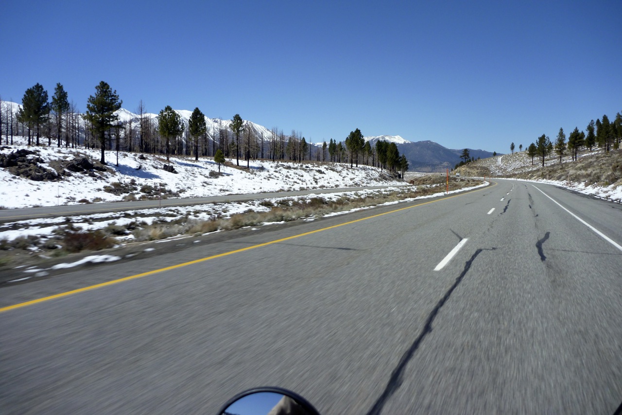
By the time I got to Mammoth town I had some power loss but I’ll accept that – I wasn’t feeling so sprightly myself. Mpg at the servo clocked in at 58US or 70UK – that will do nicely. The snow barrier was only a couple of miles on at around 8500′ and to me was just your regular alpine scenery – pretty enough but nothing very Yosemite on this side at least. I swung back down to the 395 and continued north sitting at around 7000′, snuggly wired in to my Aero Kanestu vest. Where yesterday I could barely crack 40 now it was pulling up to 65.
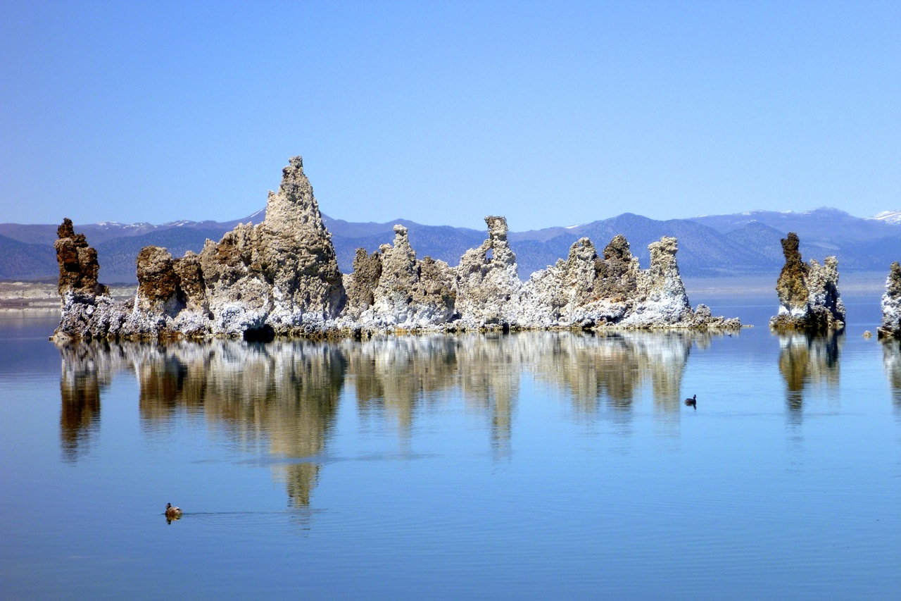
Mono Lake was an eerie spot, if for no other reason than the wind had dropped out of sight. The strange tufa columns exposed after LA’s water department drained half the lake in the 1940s added to the ambience. I’m sure the Owens Valley was mentioned in Chinatown, set in that era just as LA started booming.
That’s the great thing about riding around the US of A; from The High Chaparral to Breaking Bad I’m as steeped in modern US cultural iconography as the rest of the world. It’s not unusual to find a place that’s in a movie, a TV series or mentioned in a great song. The fabulous theme from Chinatown itself is surely in that category.
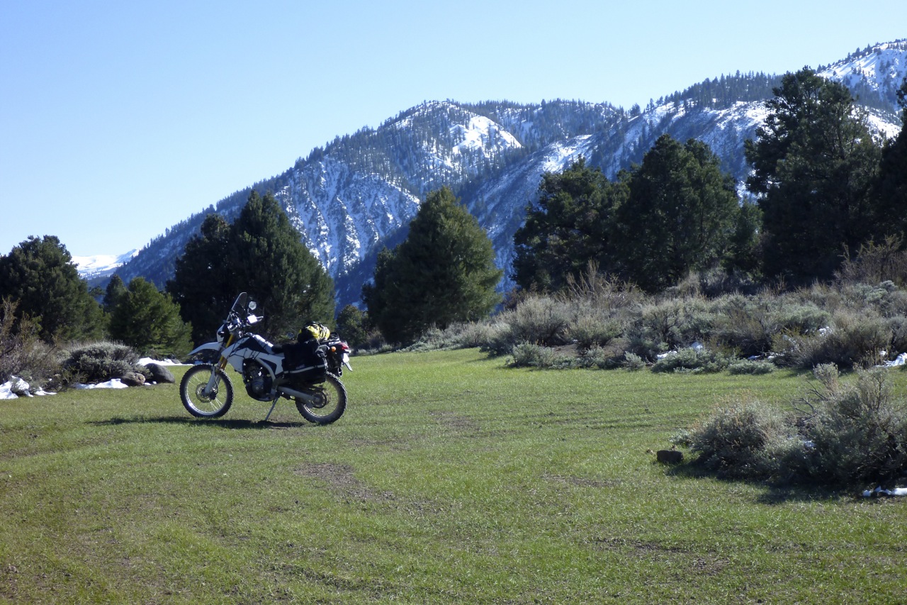
Al had suggested I swing out to Bodie ghost town but I wasn’t sure of the fuel situation, having given my bladder a day off. Plus I don’t think I’ll be short of ghost town action on this ride. Instead, I filled up in Bridgeport where mpg was still a promising 58 and where they advised I head another 40 miles plus two feet over the border to Lake Topaz Casino, NV, if I wanted cheap lodging. I set the satnav but a few miles up the road a dirt track heading in the right direction caught my eye. Shall I, shan’t I, it’s getting late, WTH, let’s do it – satnav suggests it’s only an 8-mile detour.
There’s got to be a name for the sort of dirt you get up here in the high pine country – a kind of sandy loam that agrees very nicely with the L’s tyres. Soon I passed a parked up MAN overland truck – Germans to be sure saving a penny and having an adventure. Then up ahead I came to a flat grassy clearing and wondered should I camp – this nightly moteling is getting expensive after all. The place was on a pass, exposed and with little cover from the wind, but dry and with some firewood. I dithered and looked for a sheltered spot but then checked the satnav again: 8034′ – I don’t think so. It will freeze for sure and with only my flysheet for a tent I’d spend the night huddled against the chill. It will warm up somewhere sometime soon.
Chilly camp spot
Down the far side of the pass there were still patches of snow and muddy ruts to navigate. I came across an even more idyllic pitch at only 6500′ plus tree shelter and snow to melt (above). And like the other place, there was not a speck of rubbish. Well it’s good to know these places are out here.
I carried on downhill through more mud and snow and rock falls and had a mini panic when at 8 miles it was another few miles of dirt. But round the ridge and riding along the top, down below I could see the road to Topaz that I was cutting around.
Pleased with my late afternoon adventure, I pulled into the casino which was no real bargain at $70. Plus it felt like the sort of place I’d want to take all the luggage indoors.
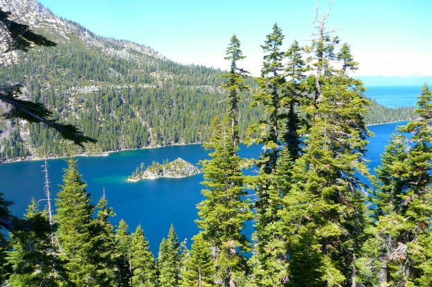
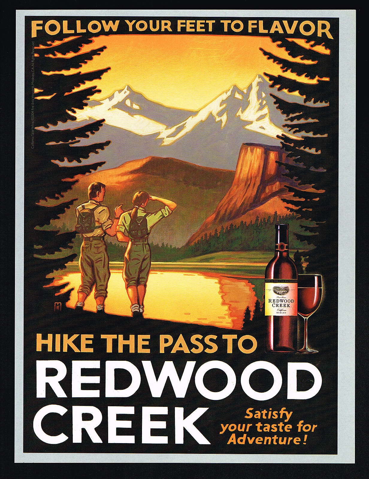
Next day I chose to forsake the Chevron and take off up over US89 towards Lake Tahoe, but soon regretted it when the two villages up the road weren’t serving fuel. Let’s see if the satnav can help. “7-11, Gardnerville Ranchos, 12.3 miles”. So it was, plus a quick snack and then over the windy pass into Lake Tahoe’s pine-rimmed bowl where the air was sharp enough to slice week-old tomatoes and the scenery redolent of a Redwood Creek poster.
I pootled round the east shore, past glittering Emerald Bay, ending up at a mate’s cabin out of Truckee, scoring a record 73US or 88mpg on the mpg-o-metre. Opened out airbox holes have fixed the mpg and power. Now I have to fix the air box holes.
Before I had a chance to do that, Christian insisted we go out for a burn up in the woods, him on his 950 Adventure. OK then. Unhitch the bags and off we go – me soon eating dust spun off his TKC as wide as my head. As before on the dirt, the Honda’s wide gearing was exposed and so was the harshness of my jacked-up rear shock (see this). Still, I’m not complaining – the bike is as light as a feather and the preload is keeping the loaded bike level. Too hard is better than too soft. Plus I’d just read on Thumper Talk that Hyperpro in the Netherlands have brought out a fully adjustable shock for the CRF (unlike Race Tech’s basic unit). So it’s there if I want it.
The little L was being hung out to dry by the KTM, but that 950 has got to be running five times the horsepower with only half as much weight and top-of-the-range suspension. A decent shock would sure improve CRF-L dirt riding at this sort of pace, but it wasn’t all bad; I was lucky enough to have a few days’ house sitting for Christian – a chance to reorganise and sort out that fuelling once and for all.
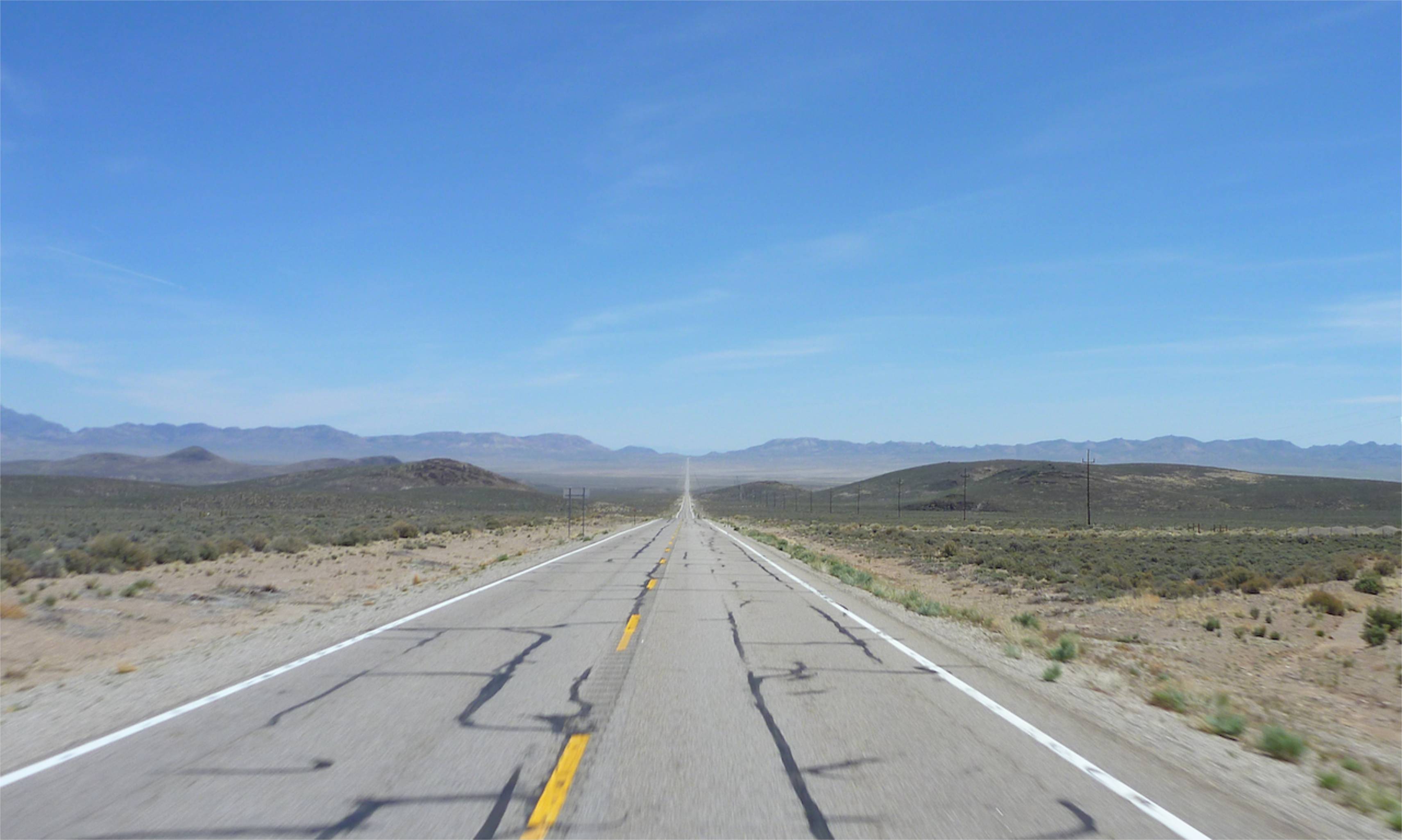
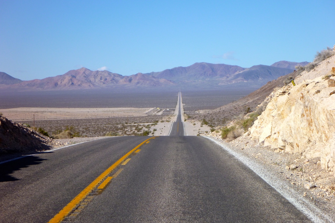
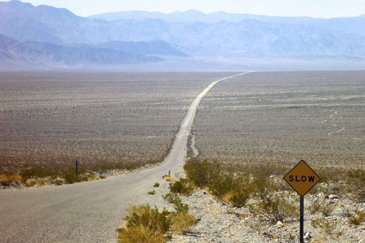
You can tell from the picture on the left that today was going to be a good day. An empty road reaching across the high desert to a vanishing point in a distant mountain range. Winding my way through Titus Canyon to the other side of the hills, the land dropped to below sea level – Death Valley, where I’d turn north over more dirt roads and ranges to Big Pine in California’s Owens Valley.
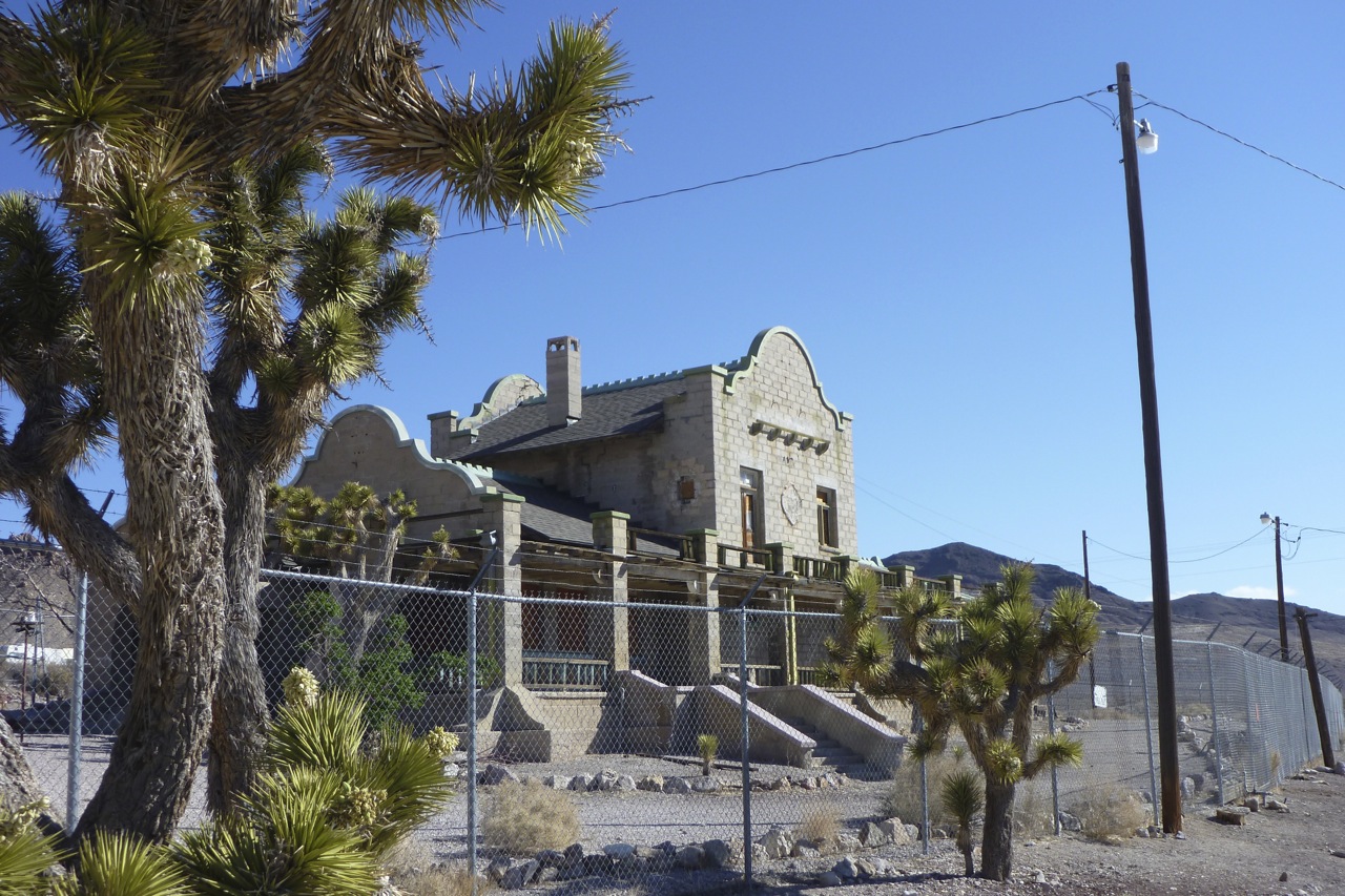
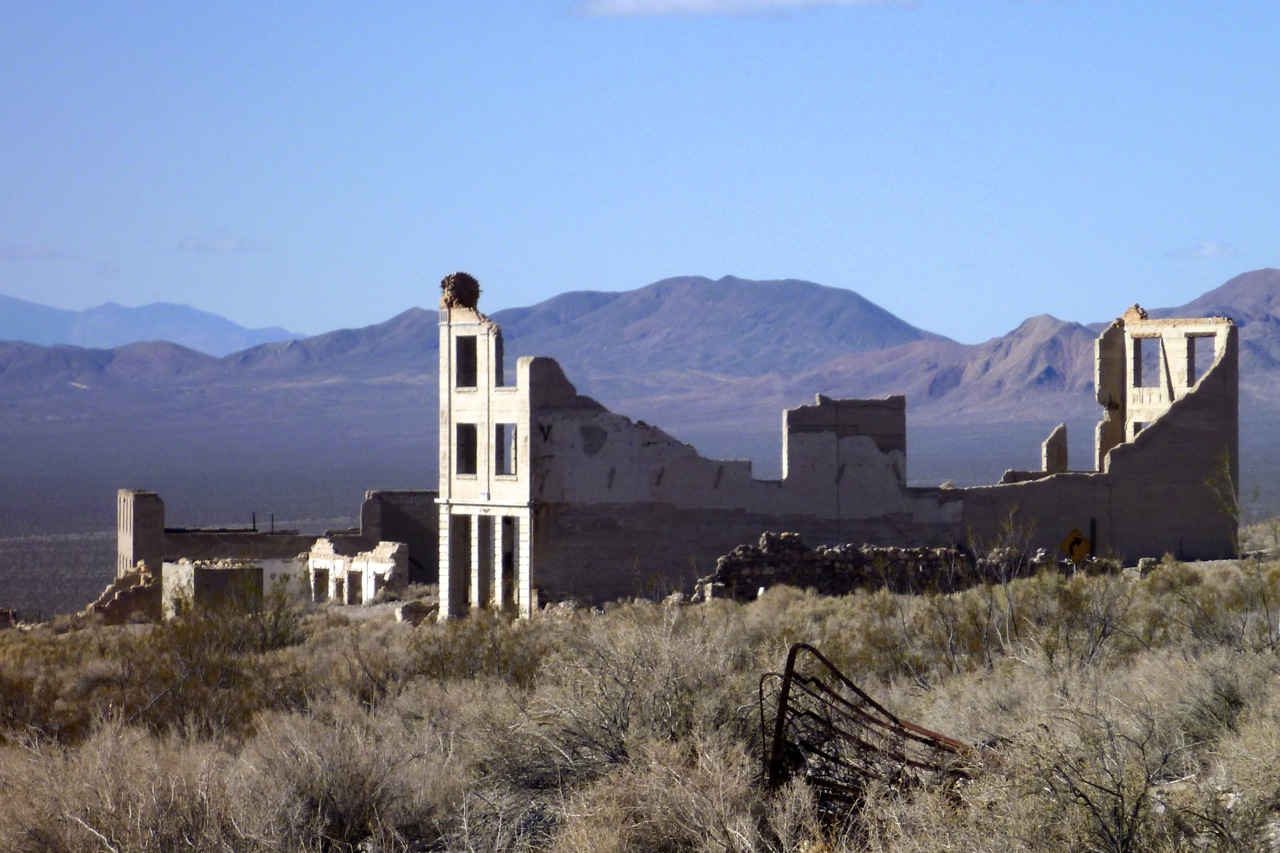
Before that and still in Nevada, I popped in to Rhyolite ghost town which in the early 20th century managed to go through its birth–boom–bust cycle in just six years. Disappointingly, the crumbling gold rush ruins were all fenced off, making it less of a ghost town and more of a hazardous site.
There was a ruined school (left) and a nice-looking hotel amid some Joshua trees (top right) with a curvy, Spanish colonial-era facade. It would have been more fun to stay in than last night’s Motel 6, but clearly Rhyolite has had its day.
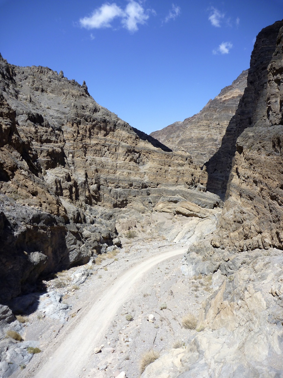
Titus Canyon to Death Valley Just down the road was the turn-off for Titus Canyon which Al had recommended as a great way to slip into Death Valley. SUVs followed me in and initially the stony, corrugated track was not in harmony with my jacked-up suspension and road-pressure tyres. Some tracks are like that or just required acclimatising to, but soon the trail began to climb into the Grapevine Mountains where the colourful rubble glowed rich with mineral promise.
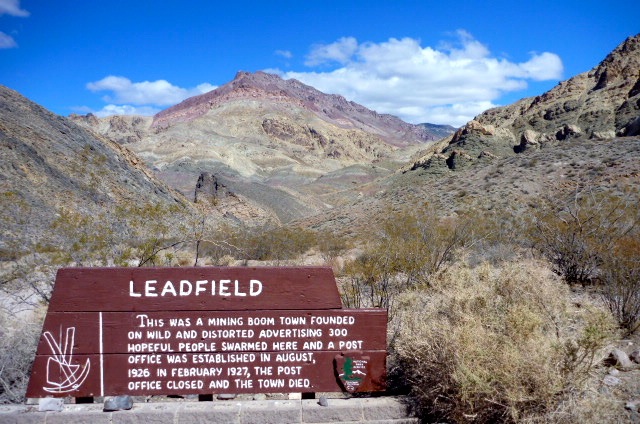
I came across the remains of Leadville, site of another brief episode of mineral mining madness in the 1920s; now just a couple of shacks and a heavily barred shaft penetrating the hillside. As has proved the case in similar places I’ve visited in Western Australia, the easily mined stuff usually gets cleared up before word gets far, and very often the best money was made providing services to the hopeful miners until they stampeded off to the next rumoured strike. In the UK or even Europe there’s no such tradition of mineral booms or ghost towns. A couple of centuries ago your lot was pretty much set from birth which must have made emigrating to the New World colonies in North America and Australia to chase riches all the more tempting.
It was all downhill from here to near sea level. A good chance then to stick it into neutral or turn off altogether and try to save fuel as I wasn’t sure how far I’d get or how much I’d consume getting to the next point, probably Big Pine at least 100 miles away (the satnav couldn’t calculate it on my dirt road route, despite fiddling with the settings and ‘avoidances’).
Titus Canyon is designated as one-way running west, as once it gets towards the end it’s bending left to right every 50 yards and narrows to about 20 feet wide – not enough for a pair of your typical local 4WD trucks to pass each other. Coasting down the box canyon bends, I took a strolling couple by surprise as they’d walked up from the mouth of the canyon for a look inside.
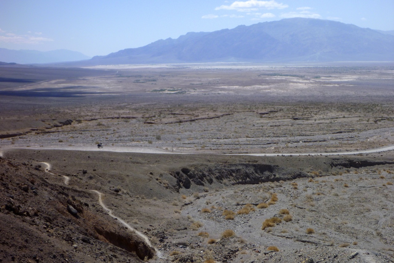
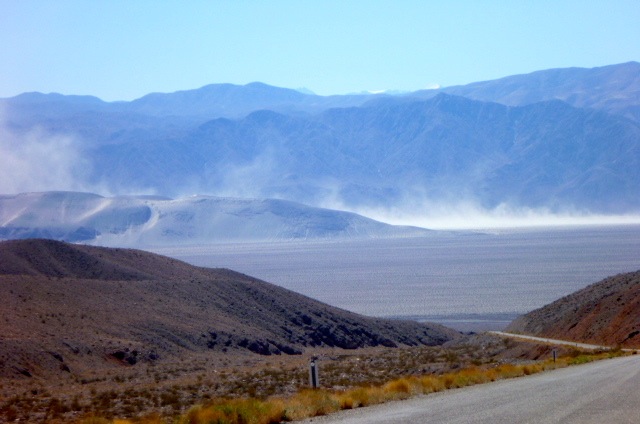
Out at the mouth, Death Valley (map) stretched across the horizon with the Panamint mountains as a backdrop (below). To the south lay Stovepipe Wells (fuel, though I didn’t know that then) and beyond that the salt-caked playa of the Badwater Basin; the lowest point in the US.
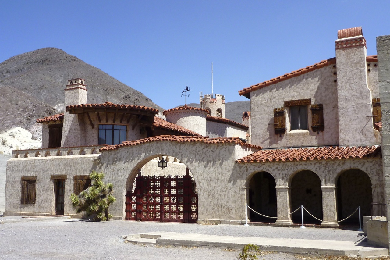
I first came here in the mid-90s and recall camping somewhere up the side of the valley; it was October but at 3am it was still about 30°C or 86. The Valley was a lot cooler today and there was now a smooth paved road running up the middle. Heading north the annoying wind was still in my face but I figured I’d risk a detour to Scotty’s Castle, expecting some naff, faux-medieval folly. In fact it was just the grassy, palm-shaded lunch spot I was looking for. There was a crude, concrete castle possibly housing a power house, but much more interesting was what looked like an Italianate villa built between the wars.
I was still in DVNP and asked the ranger how far Big Pine might be via the northern road. He wasn’t sure but in the end guessed it was less than 100 miles which was probably within my range once I’d used the fuel bag.
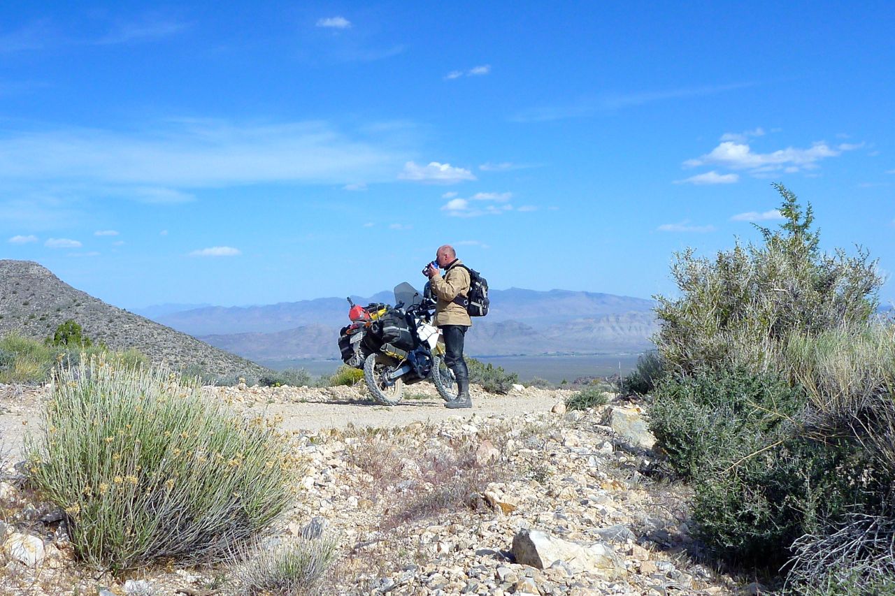
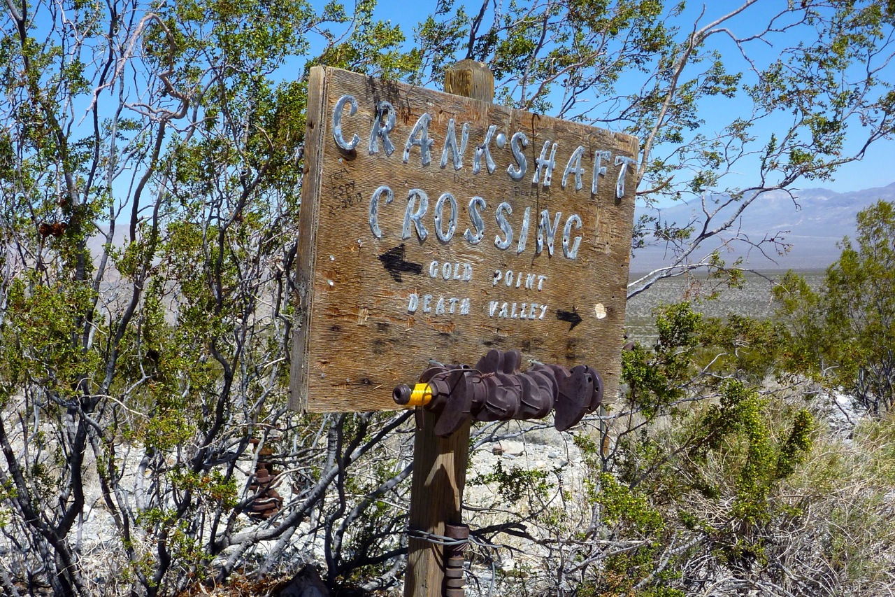
Coasting where I could, I turned off the paved Ubehebe Crater road (wish I’d gone to the crater now) and onto the rough dirt road leading up to Crankshaft Crossing. A sign said Big Pine something like 87 miles so I knew I’d make it. A dirt rider soon came the other way with a wave, and near the Crossing came another guy braving the gravel and washboard on a V-Strom.
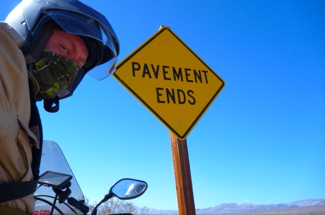
Crankshaft was another place I recalled from 1995. Back then I’d scrawled ‘Yeah!’ under a ‘Pavement Ends’ road sign. The photo had been featured on the back cover of AMH3 a year or two later. Could you believe it, but it came to my attention that those rats at Aerostich went right ahead and made a sticker out of my razor-like roadside wit, an entrepreneurial snatch which helps keep Rider Wearhouse afloat to this very day. I’m not bitter and anyway a lawyer advised me that writing messages on highway road signs was not a valid basis to instigate legal action, unless it was being aimed at me by the sheriff of Inyo County. I’m over it now and for old time’s sake shot against an ungraffitied sign just up the road.
I knew there was a range or two to cross to get to Big Pine but I’d again underestimated how high it could get; my maps only show peaks and less often pass heights. It’s much more than I’m used to climbing in the Sahara or even Morocco. The ill-tuned CRF, gagging on too much gasoline croaked uphill, dropping down to 40mph at 7500 feet (~2300m) which seems to be a bhp watershed for the Honda.
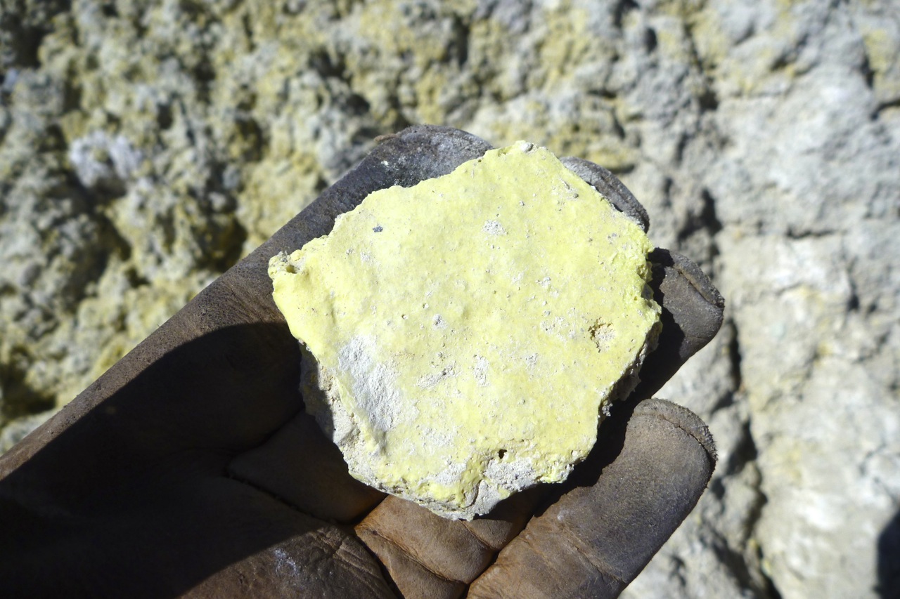
Up ahead the wind blew a flurry if white dust and with it a familiar smell from schoolday chemistry. Rounding a bend revealed an old mine by the road. Rusted machines were subsiding into the fine white powder which I rode across raising another billowing cloud.
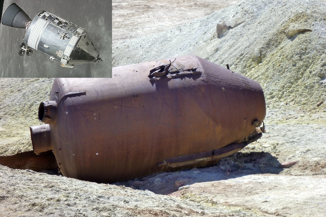
Finding a rock to perch the stand on, pale yellow rocks at my feet explained the smell: sulphur, above left). (Or for those that use them, the map also says ‘Sulfur Mine’). I’d never seen natural sulphur before; if only old gold mines had debris like this! Over there it looked like a prototype of NASA’s Apollo Command Module had fallen intact into the dirt (right).
Over the pass I dropped into the Eureka Dunes valley where the wind was whipping up the grains and hurling them south (right). Not a place for a drilled out airbox and anyway, I’ve seen my share of sand dunes. But taking advantage of the lee of a signboard, I tipped the fuel bag into the tank and then set off along that very rare thing – a freshly graded track!
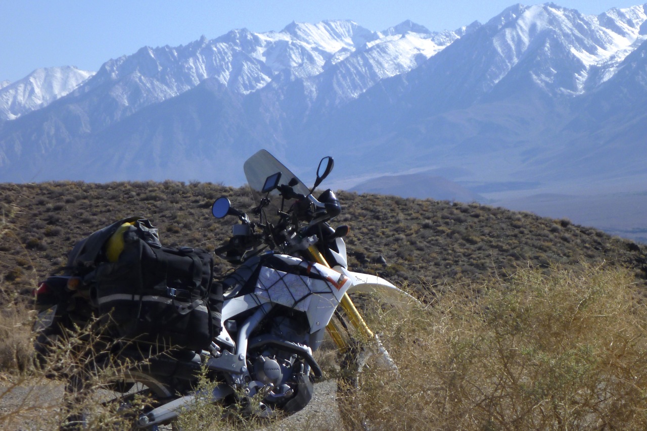
That lead, by and by, over another range which turned to reveal the snowy Sierra Nevada to the west (left) and Big Pine at its feet. Not far away was the 14,505′ (4421m) summit of Mount Whitney, the highest point in the contiguous US and just 80 miles from Badwater Basin. How’s that for a ‘land of contrasts’?
I’m no expert but the people in Big Pine, CA seemed different from Nevada, a bit more prosperous and less out back. Once I worked out how to make the pump work, the news was rather poor: despite all the coasting and gentle dirt roading all I’d managed was 54USmpg (65UK). Clearly coming over the Panamints and Inyo ranges had been an effort for the Honda, but the way I rode I should have managed 65US. Tomorrow I’d have to deploy Plan B.