Tag Archives: white rim trail

KLX 250S – mountain and desert

• KLX250S main page
• KLX in Mohave
KLX – Baja Gallery
coutmap

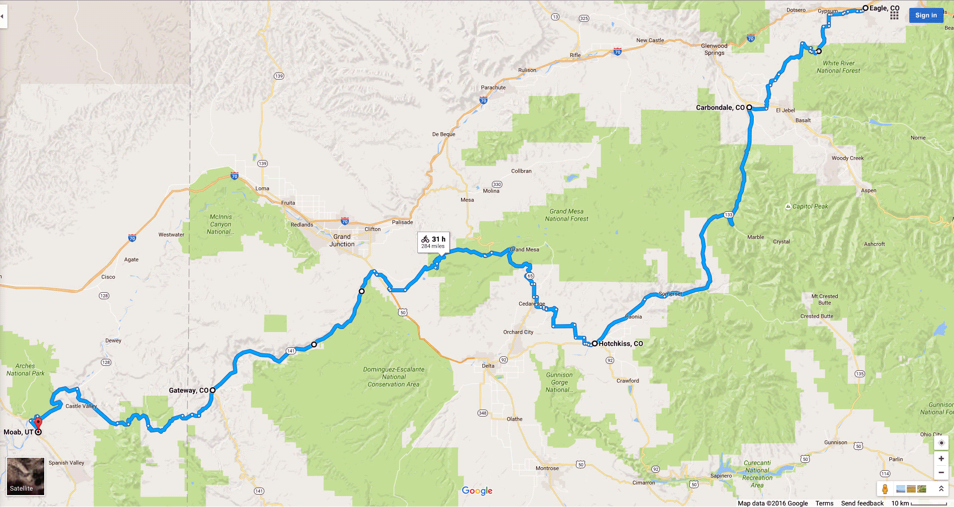
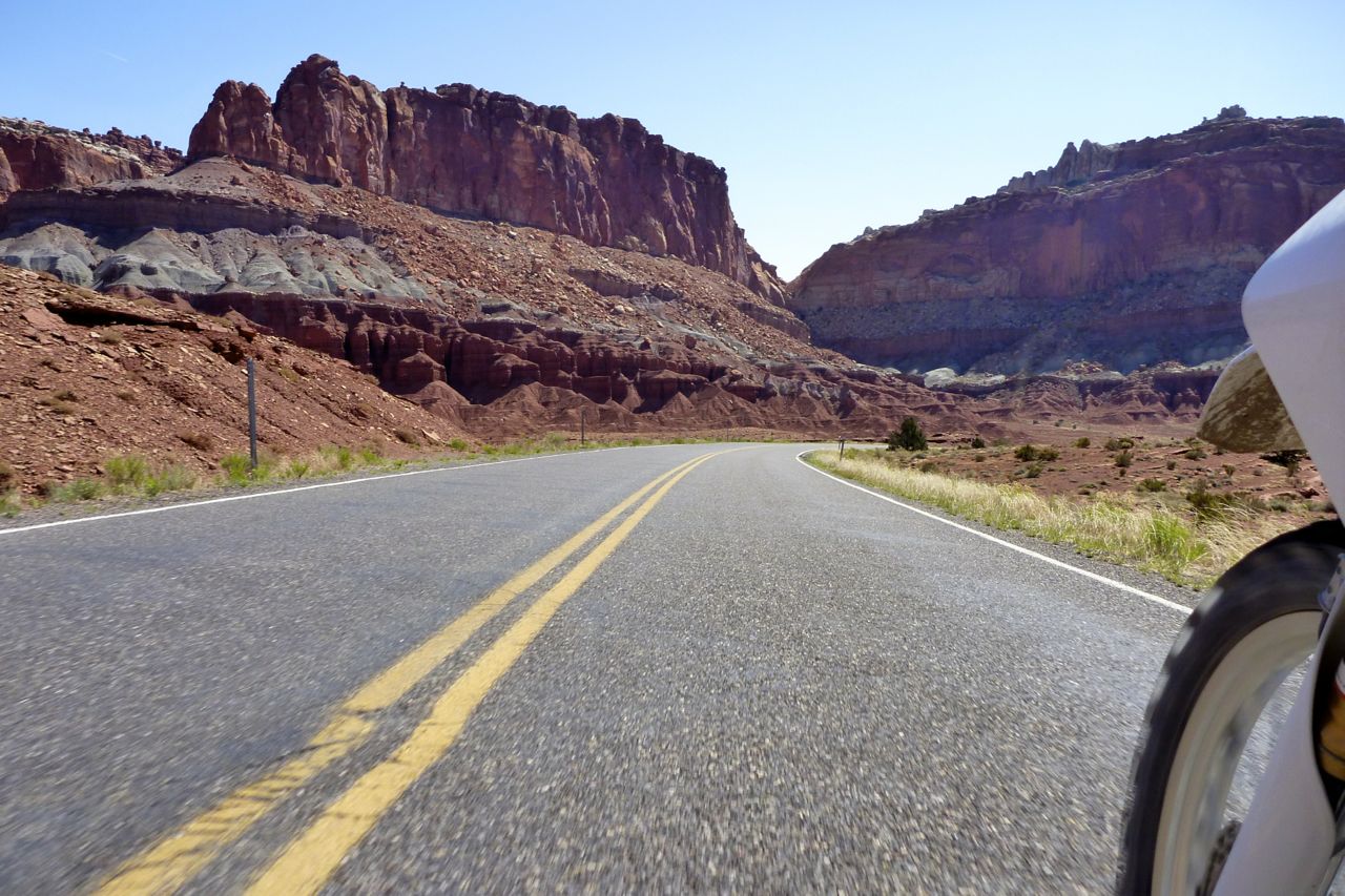
Parachute blind somewhere into SW USA, spin a bottle and head that way. Chances are in a short time you’ll be riding through epic scenery. Whether you ride road or trail, there are no bad routes out here, and over the summer I got my KLX relocated to the west Colorado to knock out the classic Rocky Mountain passes. But as it was now a bit late in the season, that plan got downsized to riding back to Phoenix via Moab, UT. It still couldn’t fail to be a great ride.

macys-logo

From Eagle, CO I’d pre-mapped a 300-mile network of backroads and trails (above left) towards the La Sal Mountain Loop just out of Moab which I did one brilliant afternoon on the CRF a few years back.
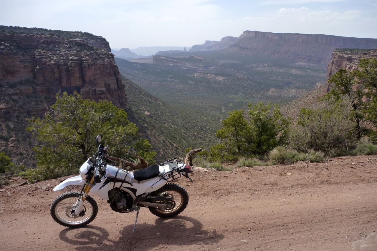
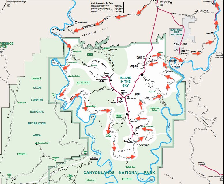
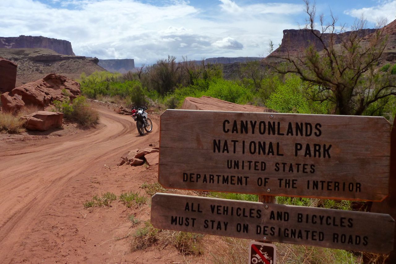
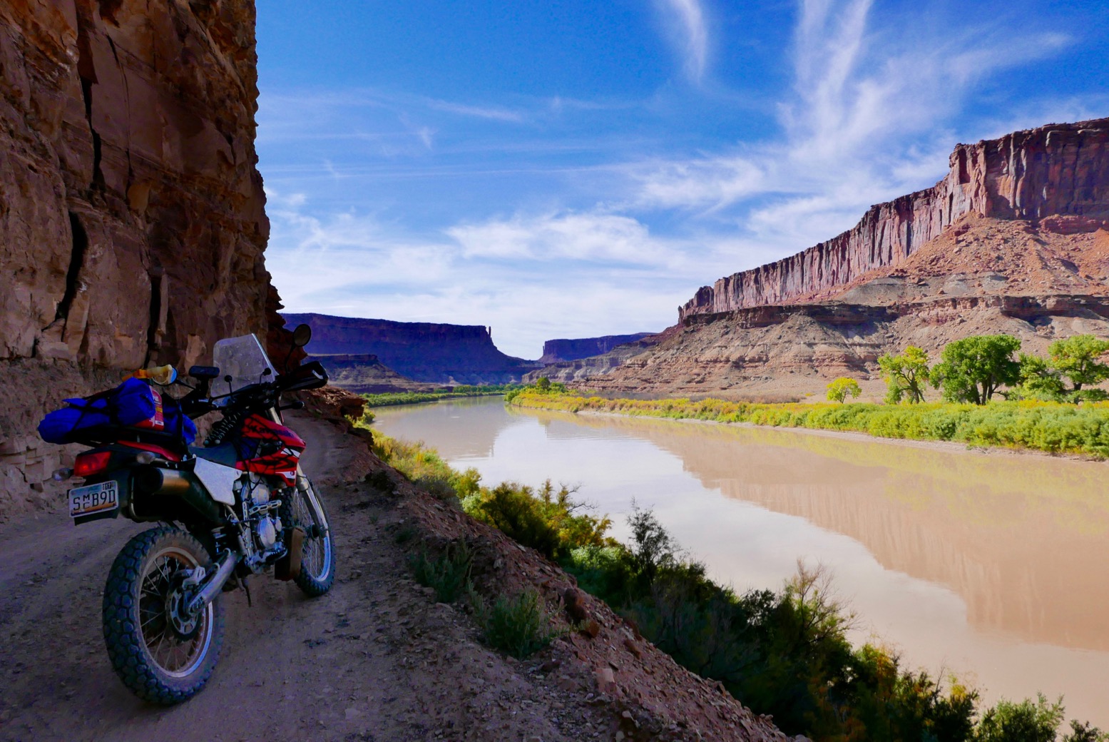
And out of Moab I could think of nothing better that riding the White Rim Trail again, then continuing down through the Lockhart Basin on the Utah BDR towards Monument Valley. from there nip over to Macy’s in Flagstaff for a snack, and it’s all downhill to baking Phoenix from there.

krigdupak

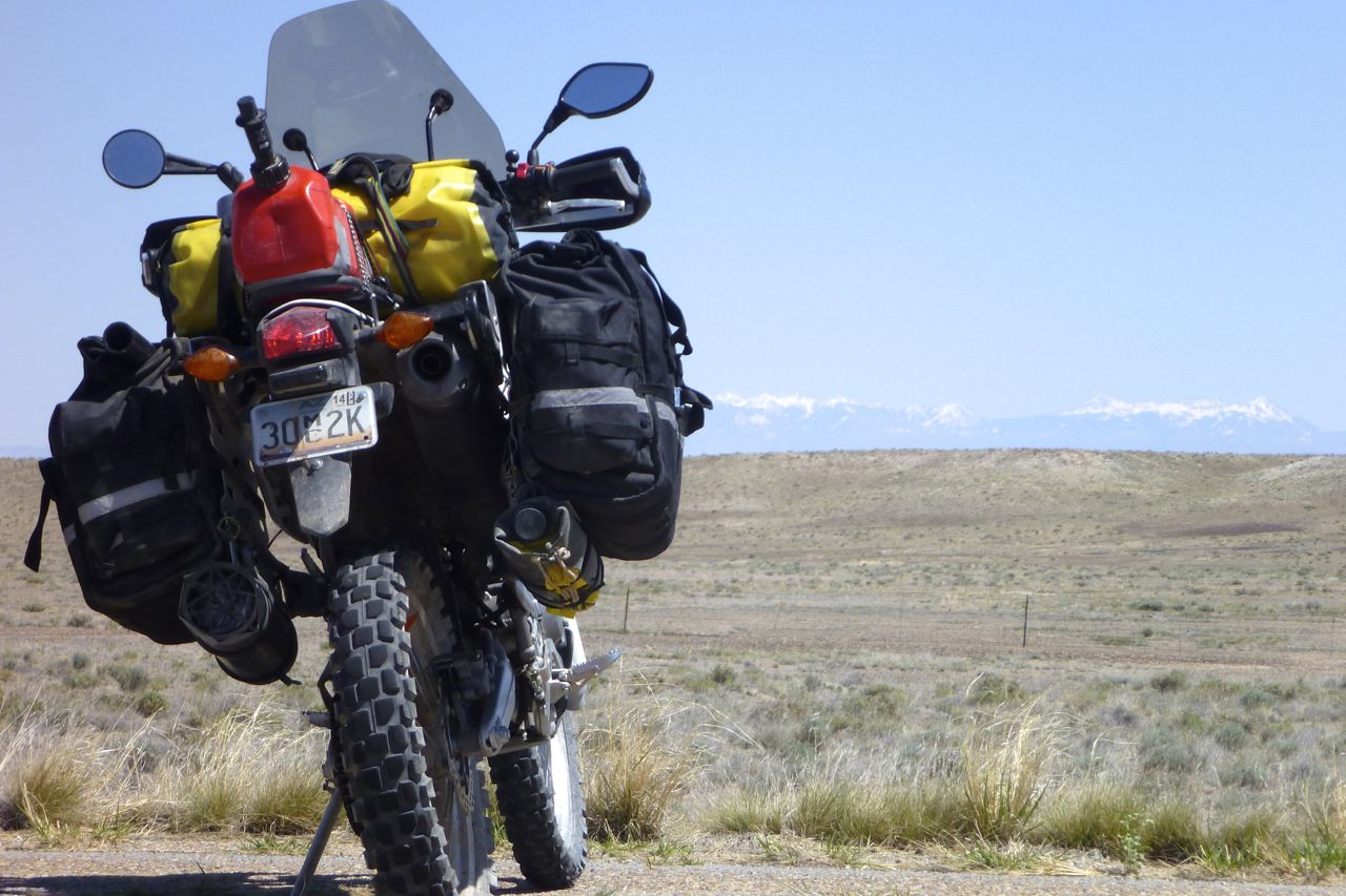
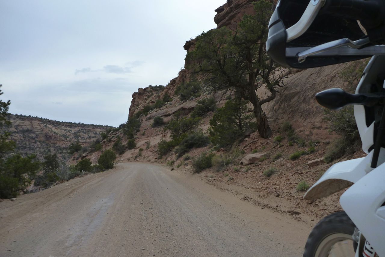
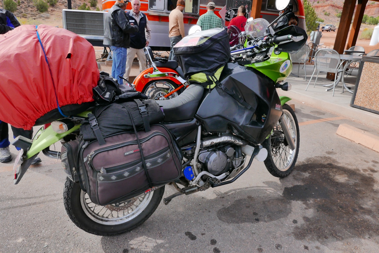
Rocking up on the outskirts of Eagle one freezing morning, the KLX’s battery was as flat as trampled roadkill. Even if it recharged, it would be a risk while riding alone en brousse, so at the quad shop downtown I fitted a new one for $35 and set off along Cottonwood Pass Road. The aspens were on the turn and shimmered when backlit by the low autumn sunshine. Maybe it wasn’t so late in the season after all?

klx-3

Annoyingly, the map tile I was on didn’t display on the Montana GPS so I was riding on the memory of the Google Map and blundering around a bit. I should have picked up a Colorado Benchmark or similar, but I was only one day in the state so would muddle through. From Carbondale, 133 lead south along a chilly valley, then switched back up the 8700-foot Ragged Mountain Pass which had the KLX down to fourth, but still plugging away at 45mph.

klx-6

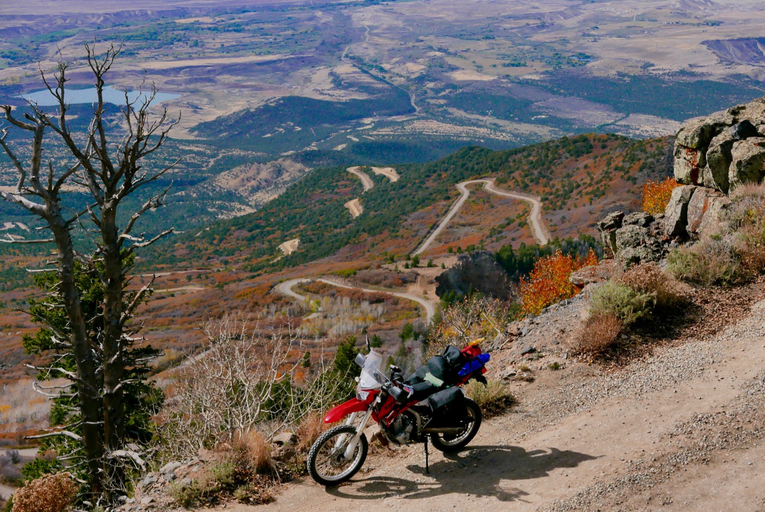
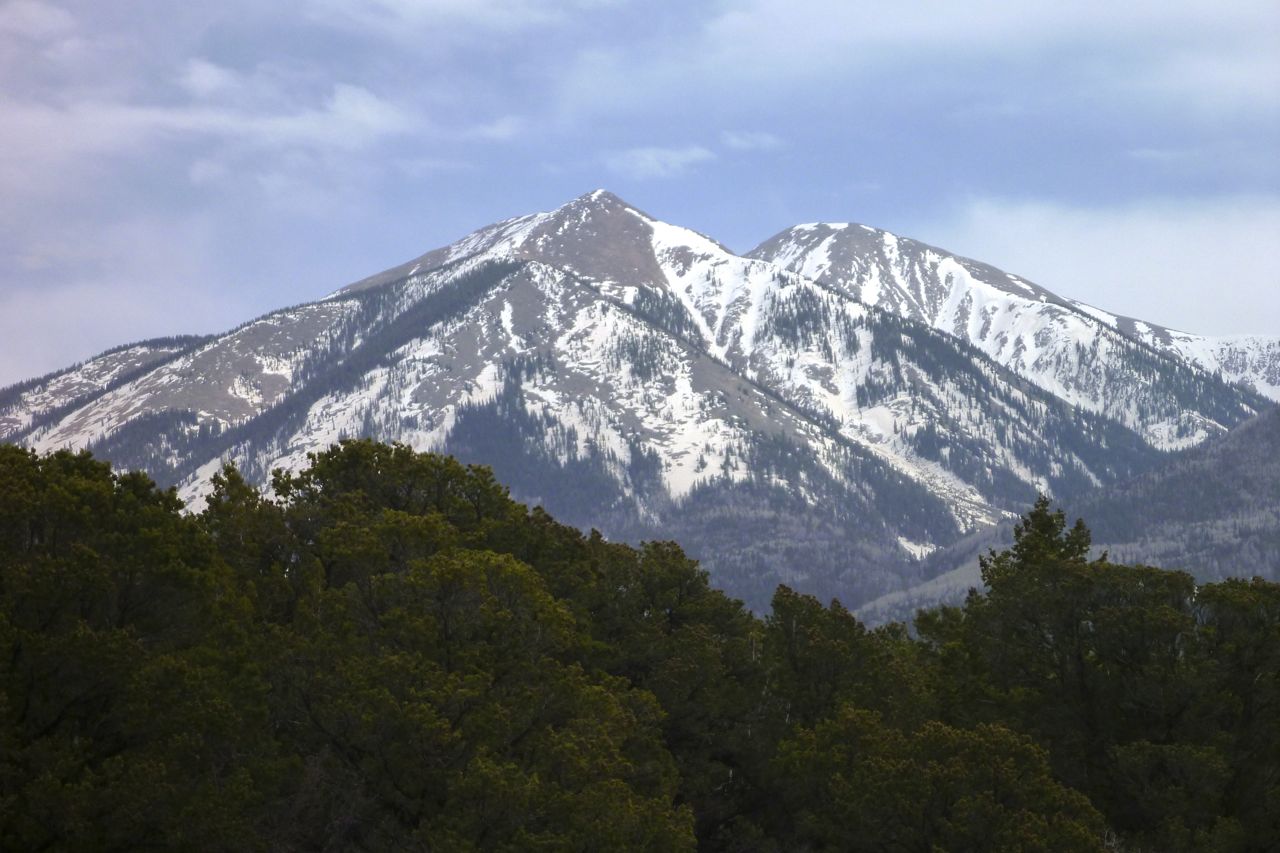
Next morning in Delta, it didn’t look like the Grand Mesa to the north was snowed-over yet, so the little 250 chugged up to nearly 11,000′ (3300m) where an easy dirt road contoured past the thin snow to the plateau’s southern rim, before dropping down spectacularly at Lands End Observatory (left). On the level at this height the KLX again managed surprisingly well, but some inclines and another few thousand feet would have had it struggling, I’m sure.

klx-8
klx-7
bedro

A quick blast in the slow lane up Highway 50 led to 141, apparently a well-known bikers’ road. At Gateway general store (right) there were more bikes than cars: a CB500X, MV triple, an H-D plus an intrepid Ozzie couple on a KLR (above).
The food van here made an outstanding bacon-avocado wrap and proper chips but, as I’ve often found, the fuel in these outback places is often rough as well as expensive, even so-called 91 premium. Perhaps it sits in the tanks for too long.

liz

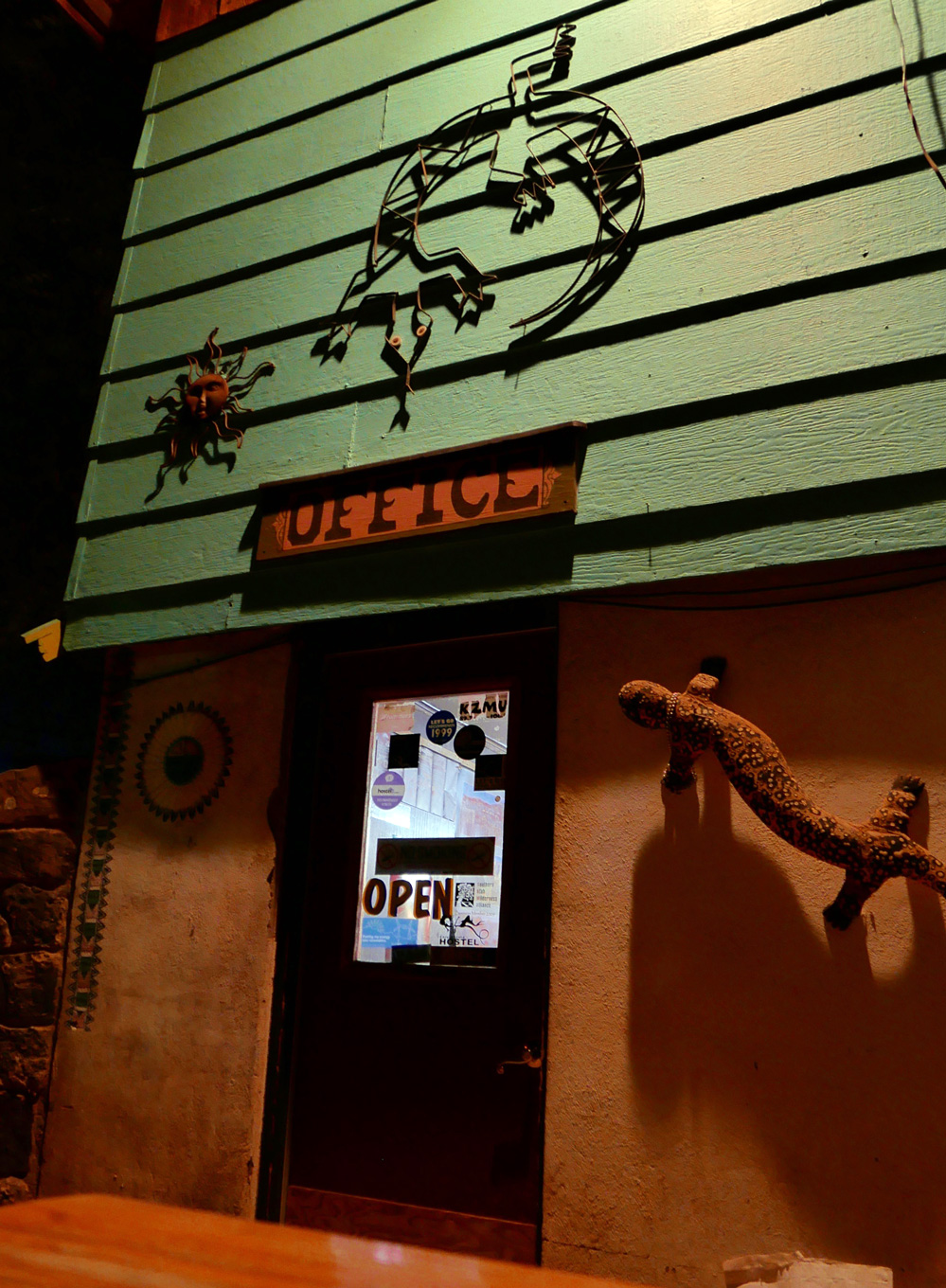
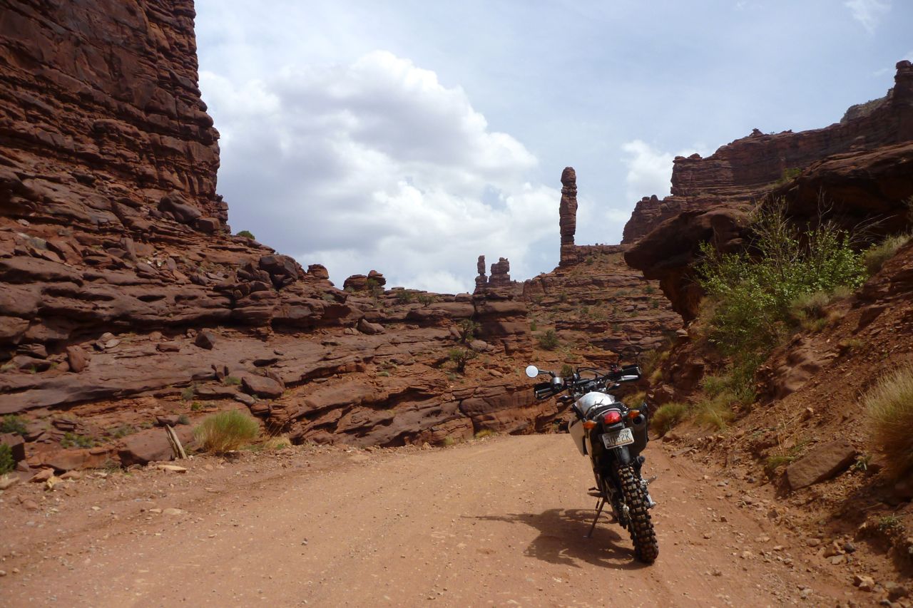
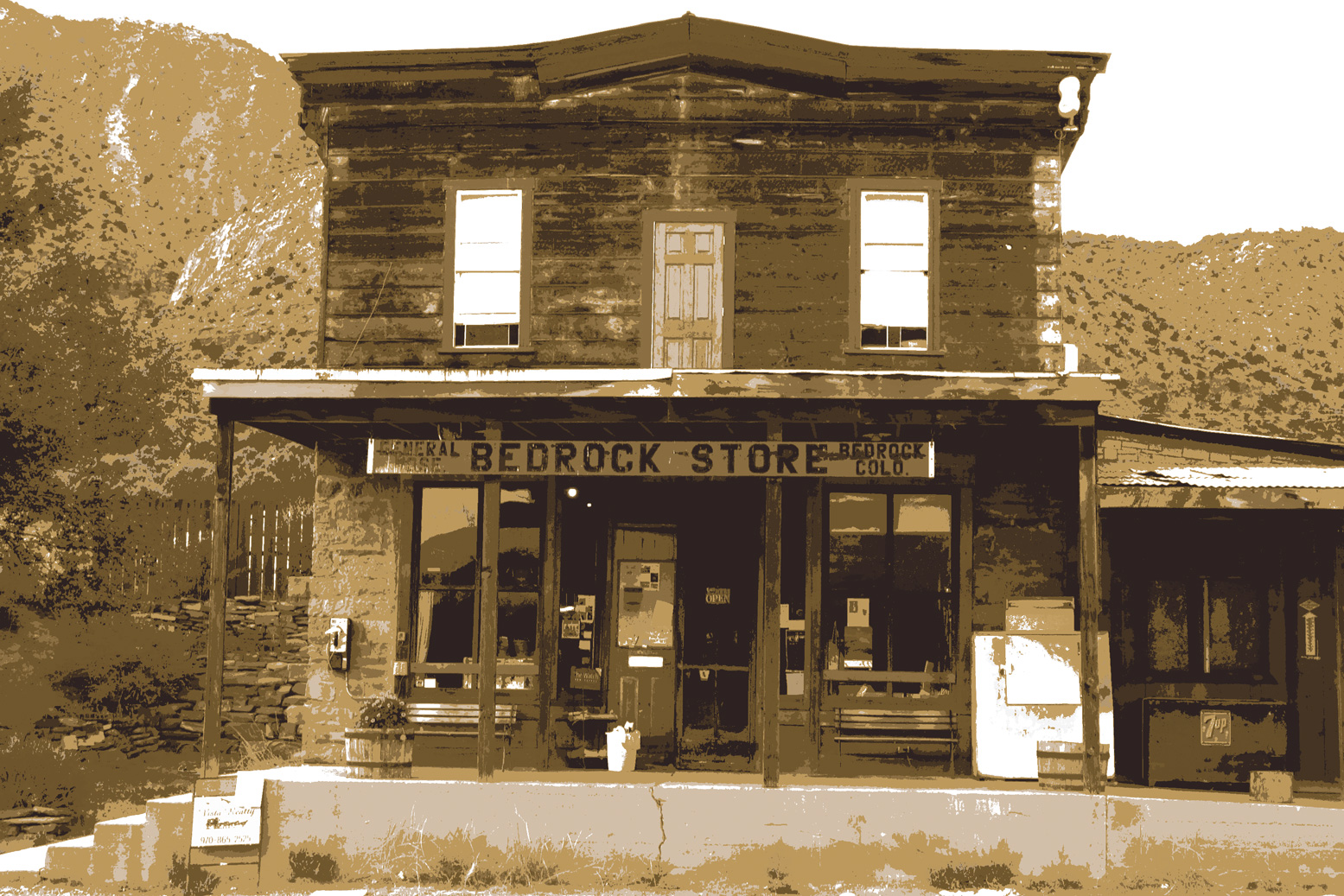
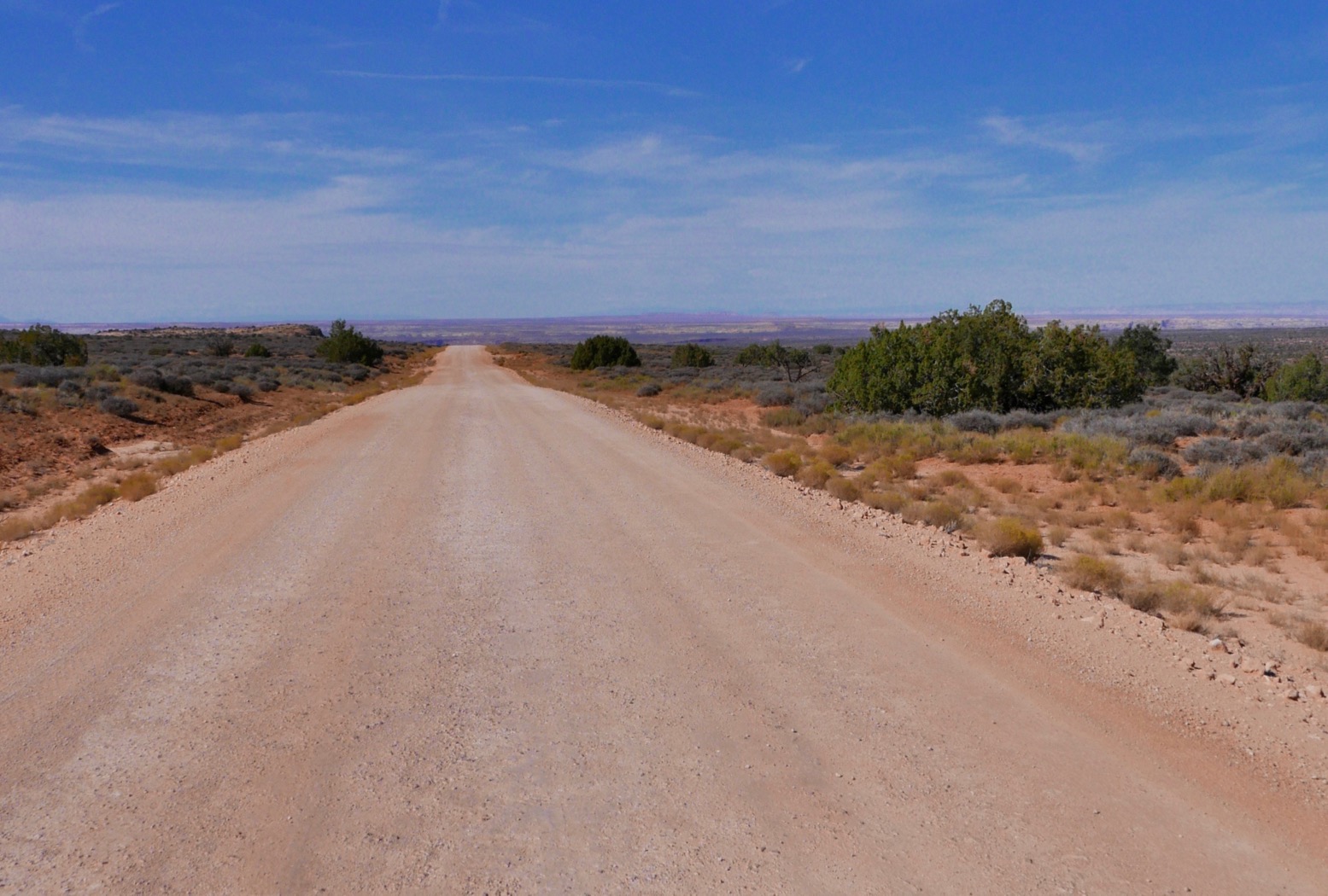
I was looking for something called 4.4 Road to connect with the La Sal Loop for Moab, but still off the map tile, I blundered up 42.10 instead. The nav felt off but it took me ten miles to admit it, and by the time I found 4.4 it was too late in the day to risk unravelling what looked like a mass of tracks to get to Moab before the slavering coyotes came out. So I carried on along the much longer 141 bikers’ road – nice, but nothing special – then swung back west via Bedrock and Paradox. Somewhere here I had a gas and lodging moment; none of either in Paradox, so I turned down the wick, slipped between some kamikaze deer while faffing again with the GPS, and rolled into Moab’s Lazy Lizard on fumes.

wrtmap

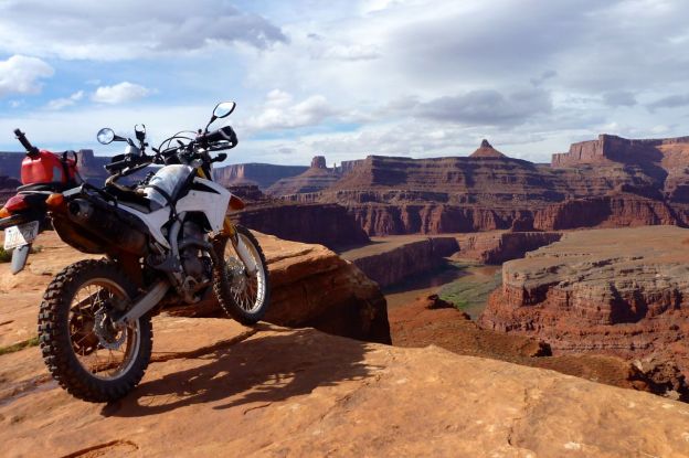
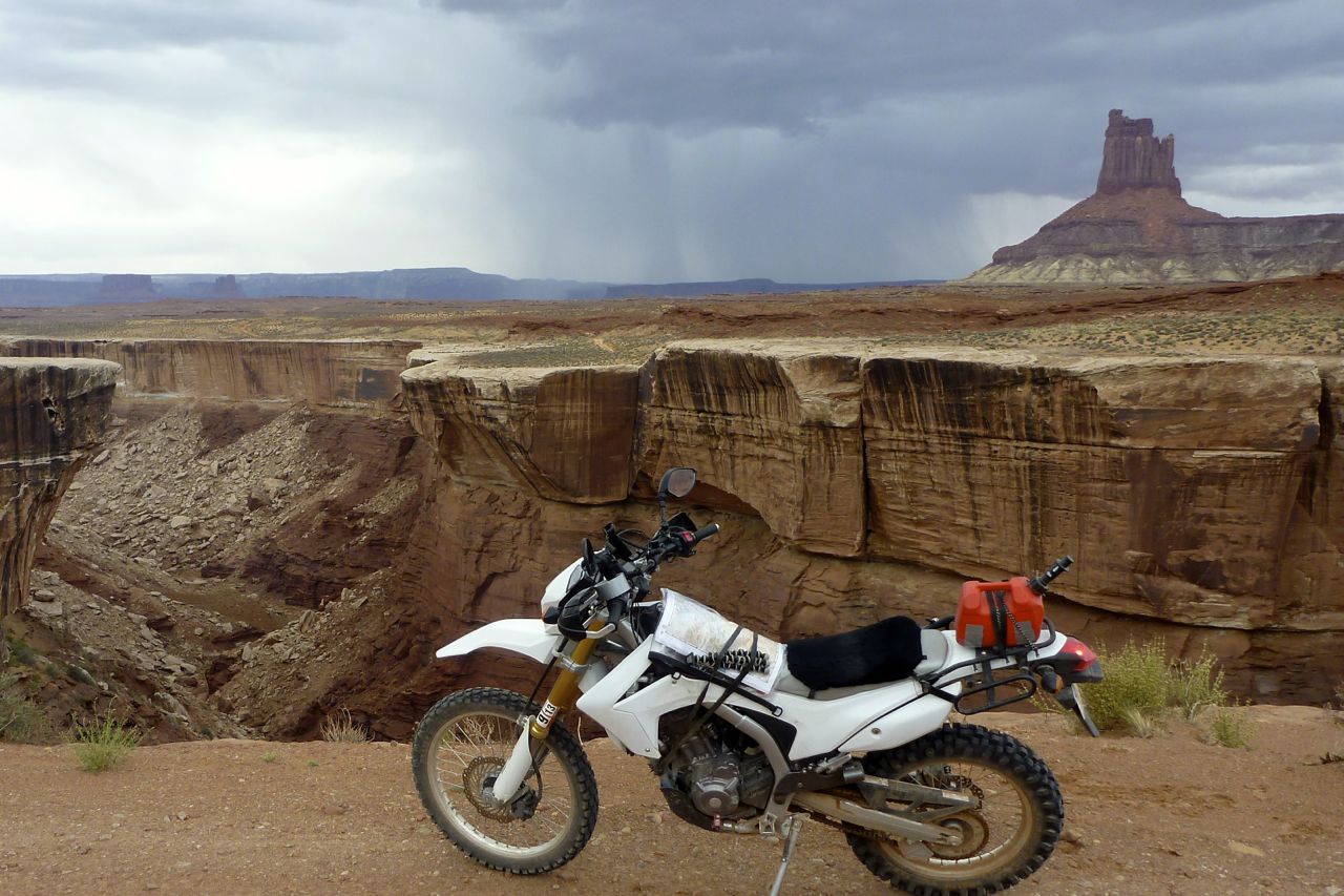
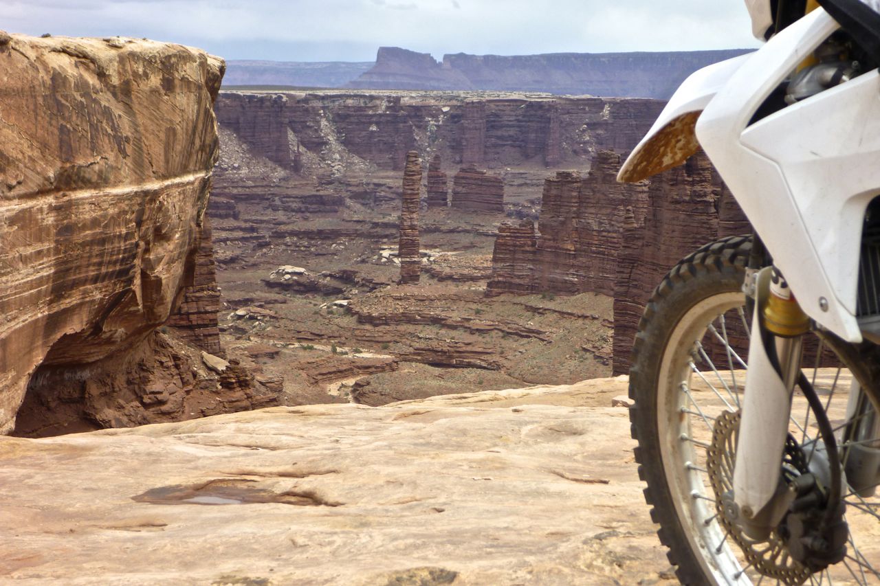
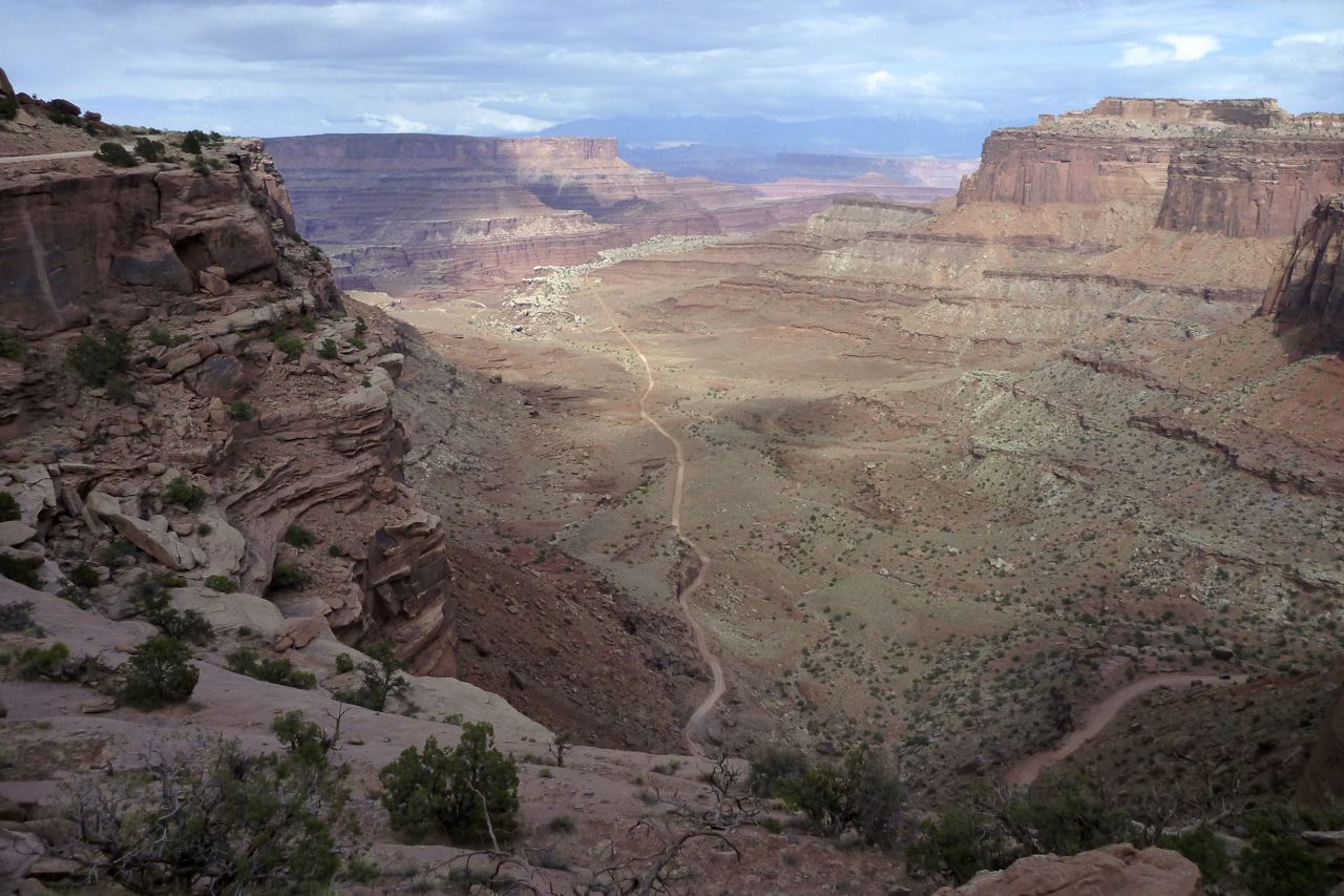
Next day I ditched the baggage and set off for the White Rim Trail, a 150-mile round trip from Moab. An old uranium prospecting road built in the 50s, half the distance is the off road and all of it is like turning the HDR setting to 11.
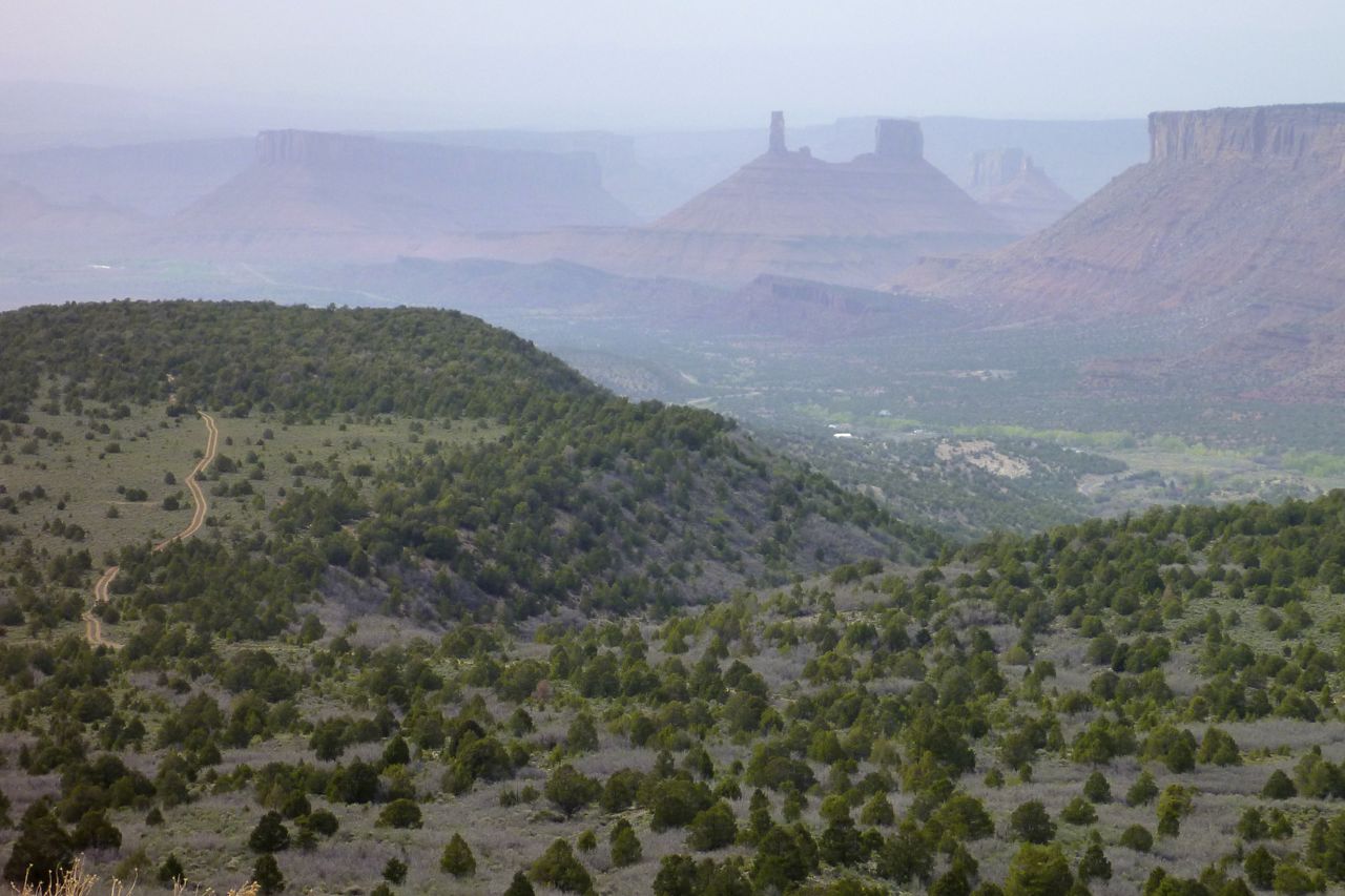
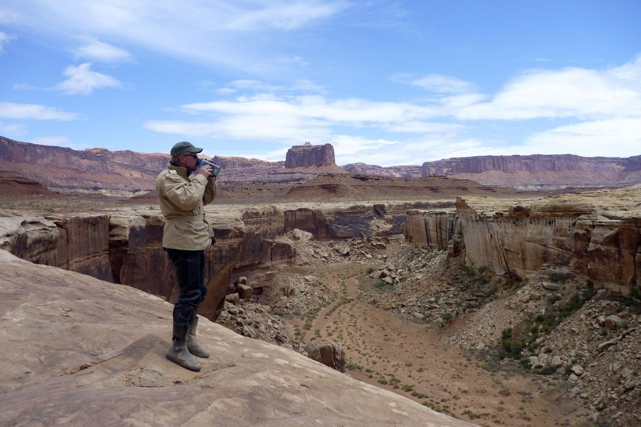
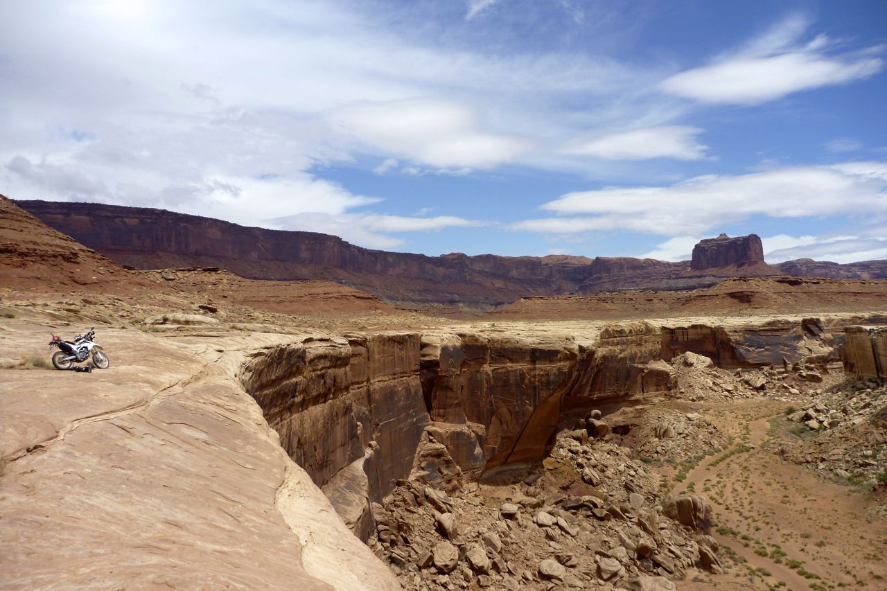
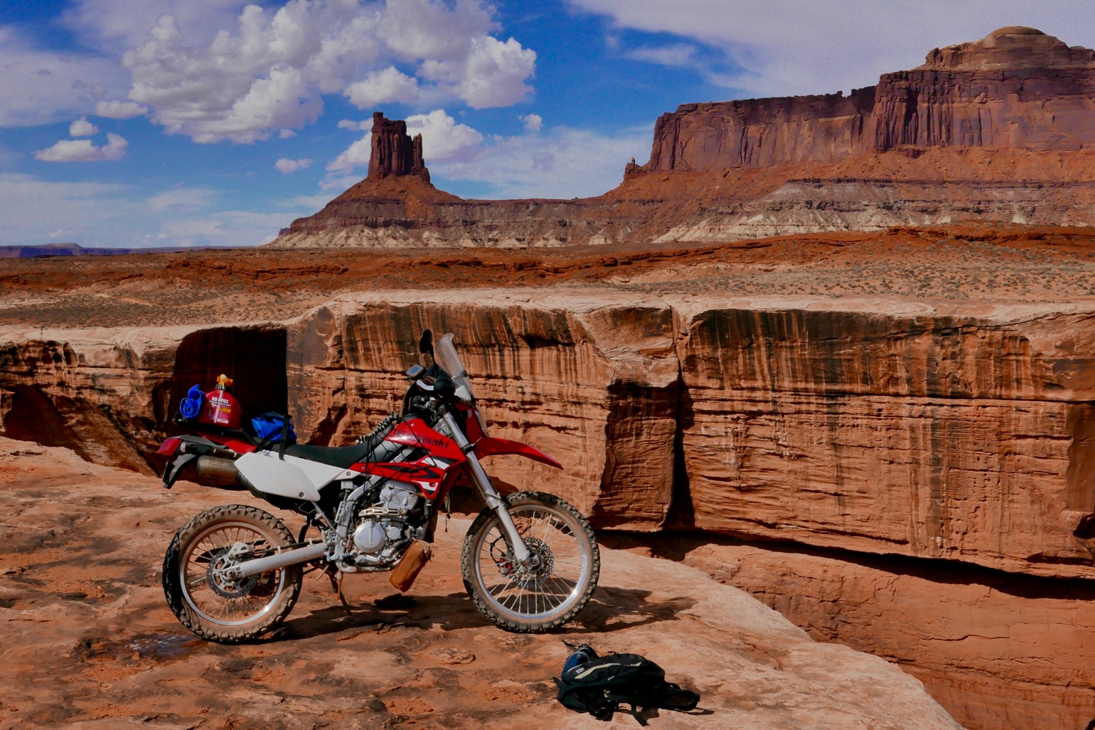
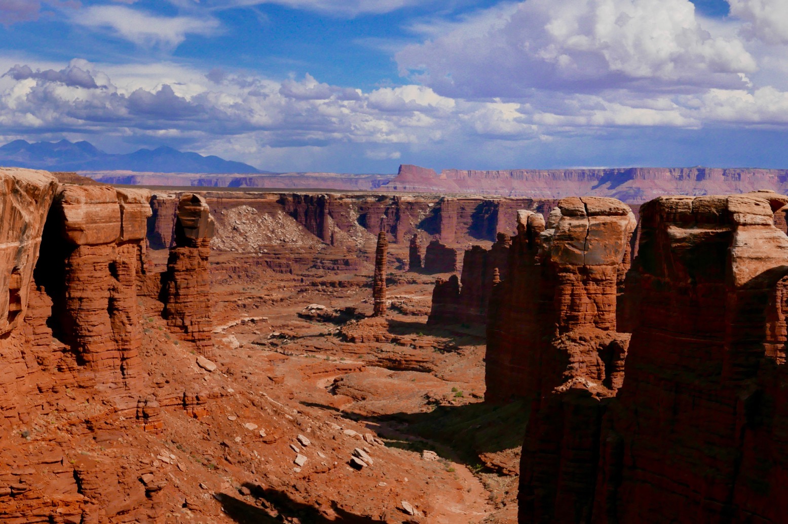
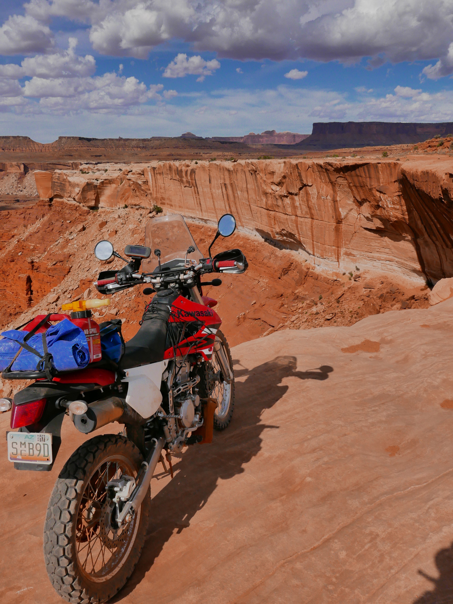
Most of the time the trail traverses a broad ‘white’ sandstone terrace – hence the name. And every once in a while the track comes right to a cliff edge with staggering vistas over eroded buttes, mesas, canyons and pencil-thin spires as far as the eye can see. And all without a single warning sign, guardrail or any signs at all. It all helps you feel you’re out in the wilds and, along with the ease of the riding, it’s the frequency of these mind-boggling outlooks that gives the WRT its well-earned reputation.

klx-15

A light trail bike can manage the WRT in about seven hours. A full-on OHV dirt bike will be faster but won’t have the fuel range – and anyway there’s a 15mph speed limit. MTBs take days or do sections with support, and 4x4s typically take two days. You can average about 25mph on a bike, which is a realistic top speed on the dirt too, depending on what you’re riding.

klx-11
klx-9

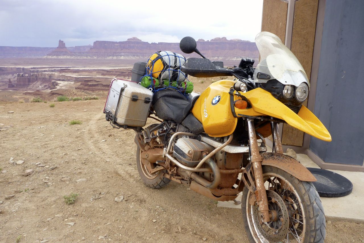
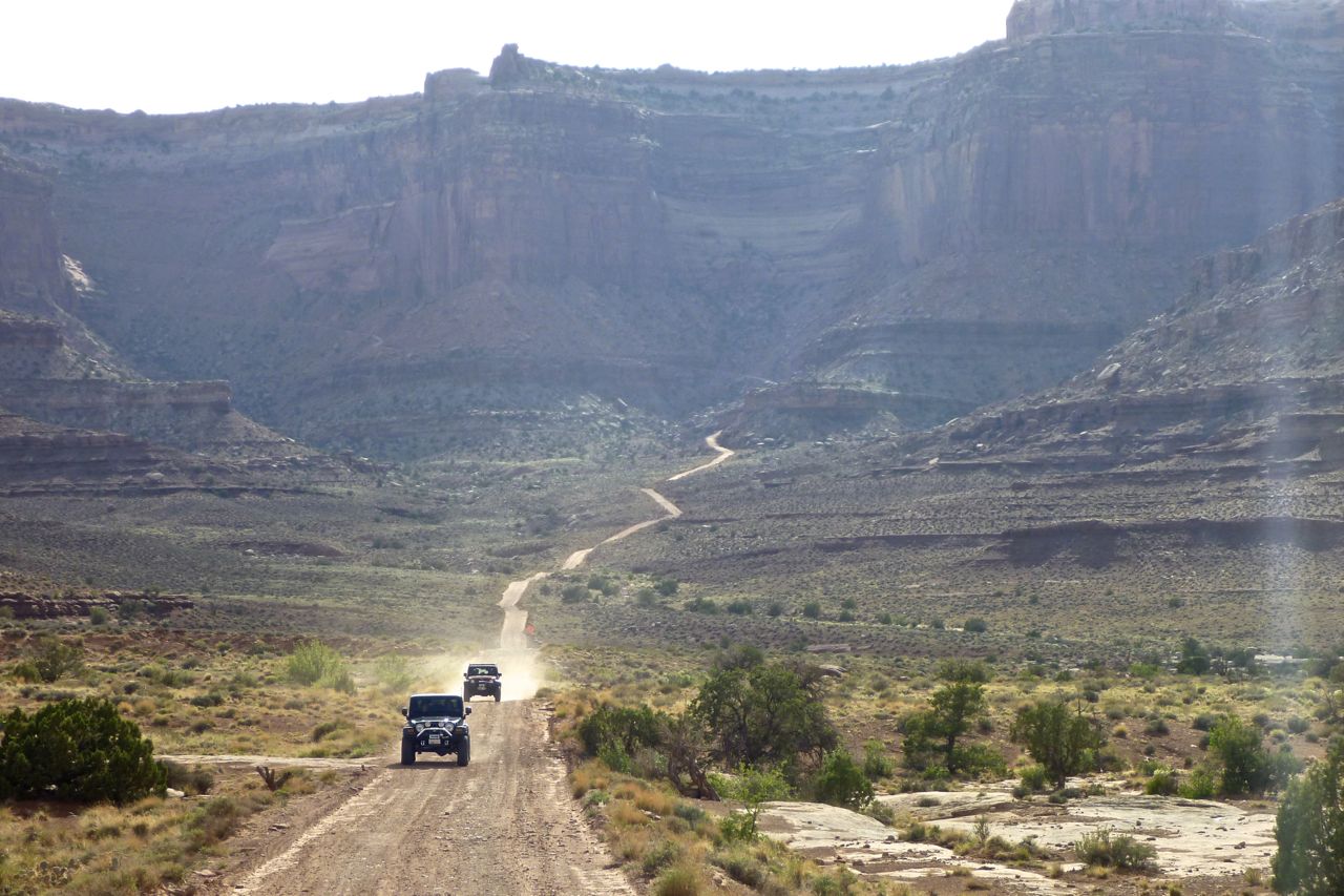
A bunch of big 800-1200 advs flew past me on the wide track heading to the start of the trail proper (right). Rather them than me, I thought, but what do I know? They could be old enduro pros looking for some exercise.

klx-12

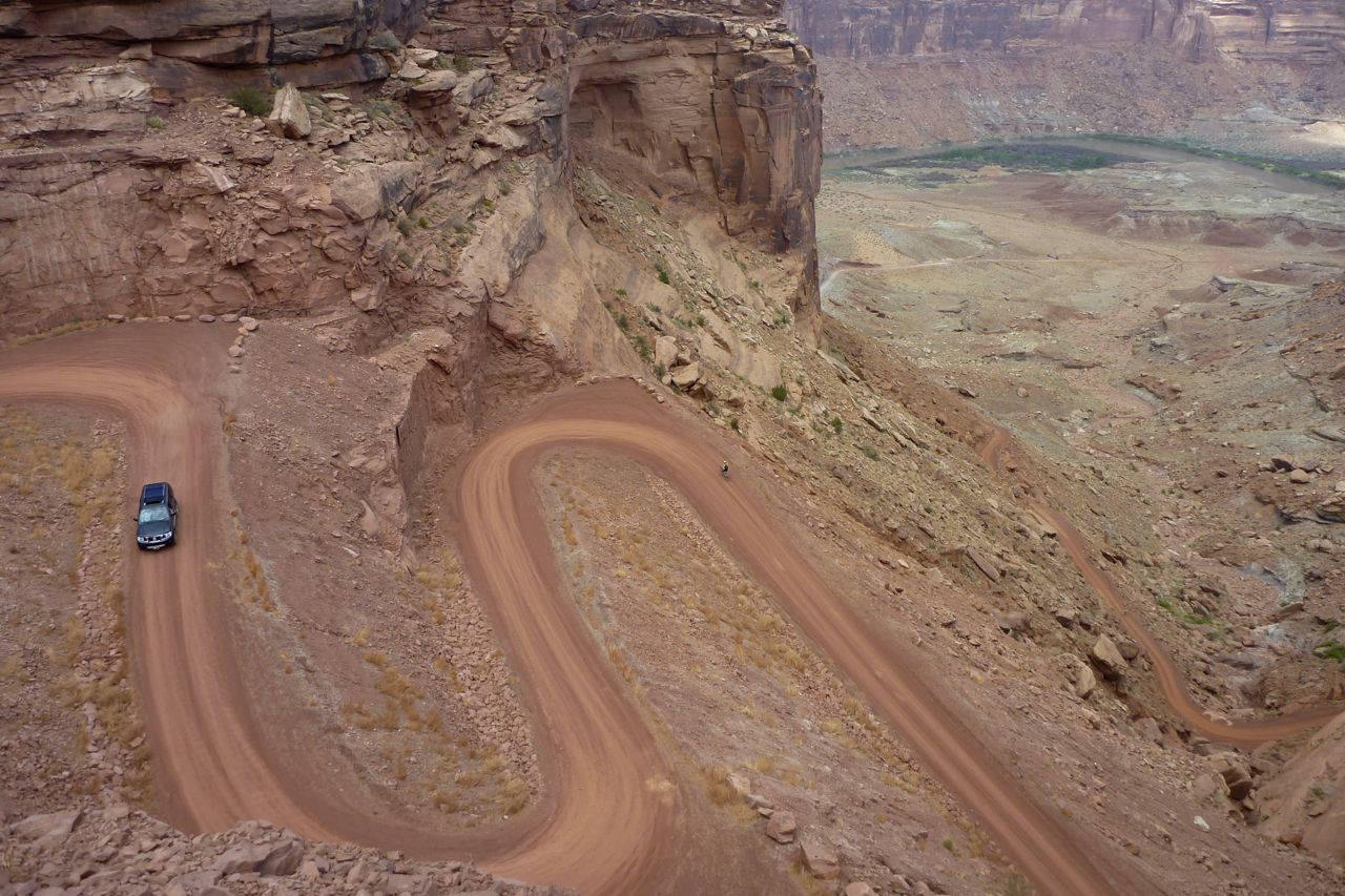
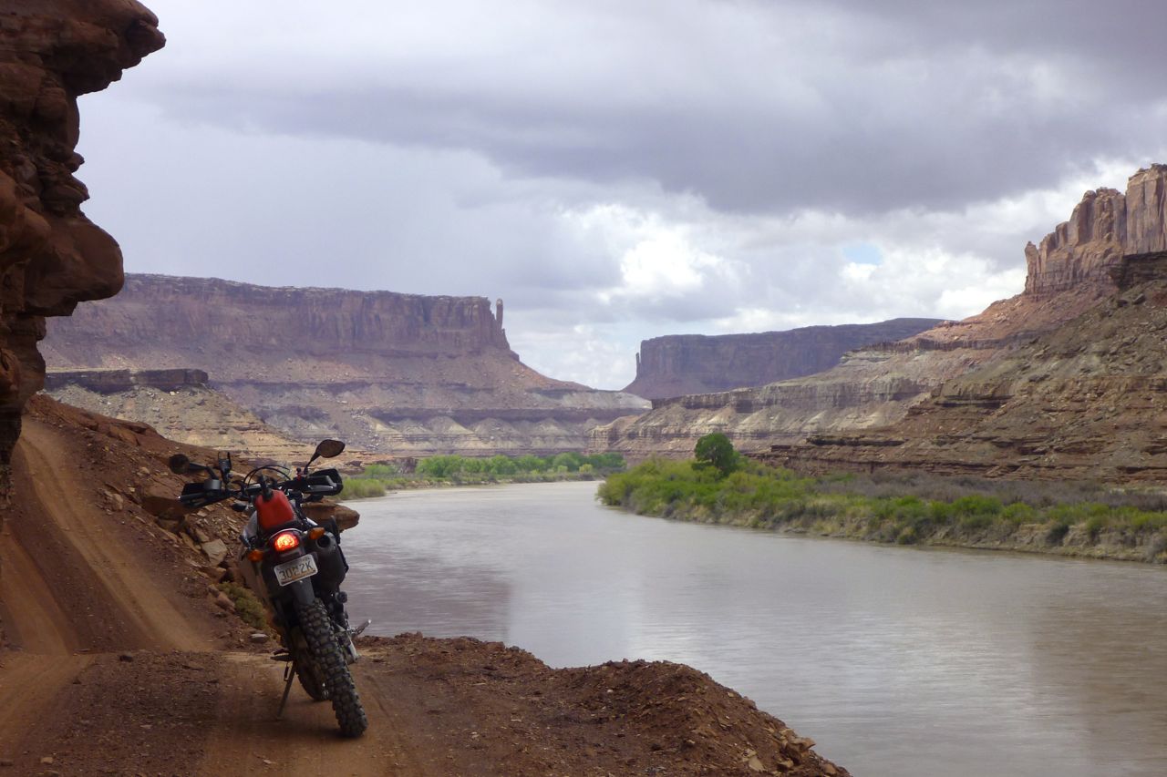
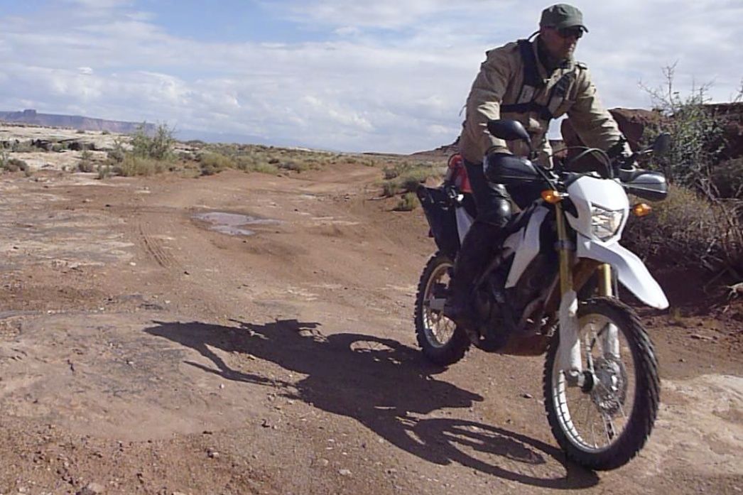
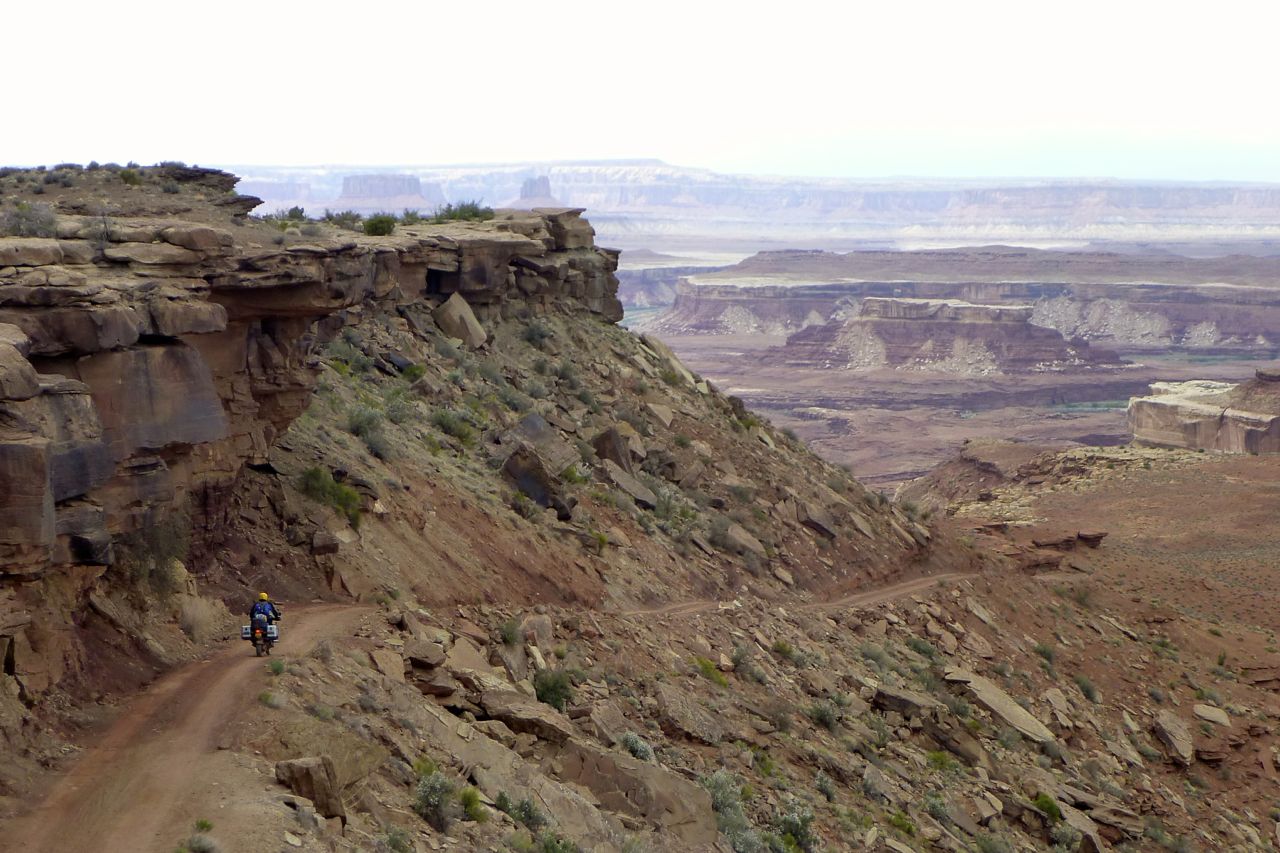
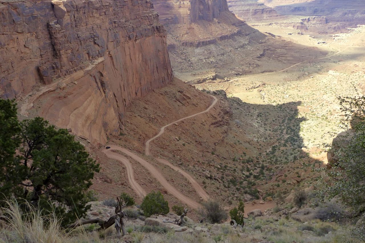
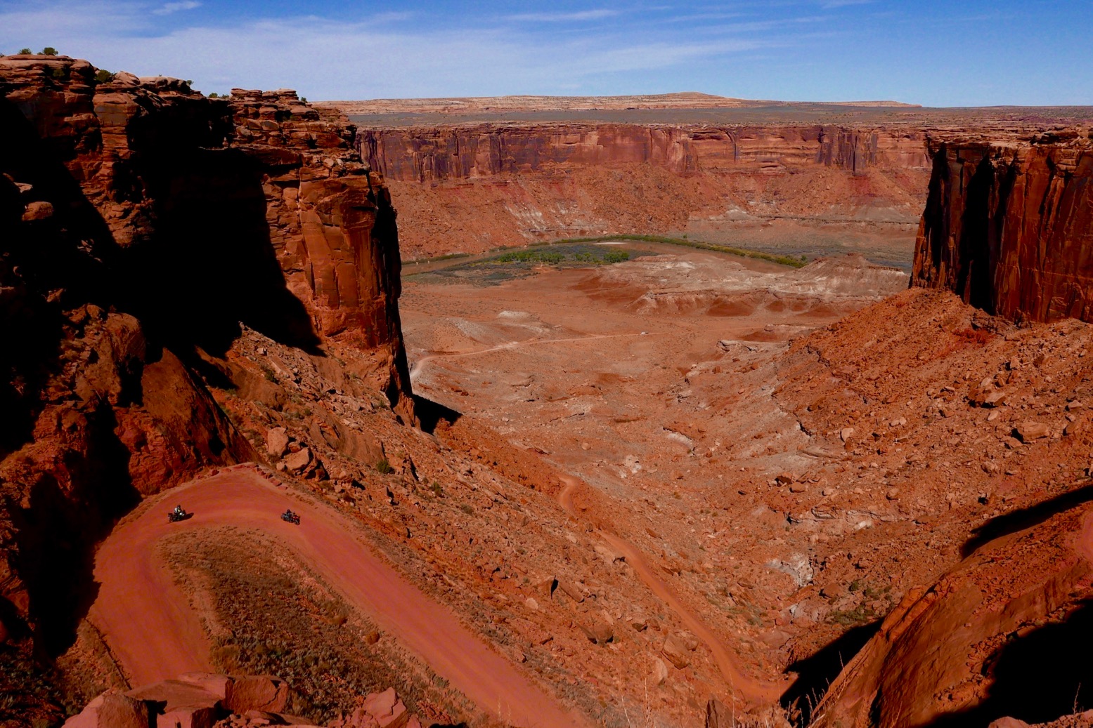
The WRT starts with a stunning switchback drop into Mineral Canyon (left) and the banks of the Green river which it then follows for a few miles (left). It was definitely sandier than when I did it one spring on the CRF-L. Perhaps summer storms wash silt down. But even at road pressures on worn trail tyres, the KLR was easy to balance in the ruts, and this felt like ‘good’ sand – more crystalline and ‘grain-locking’ so less sinky than weathered and rounded Saharan sand.

klx-13

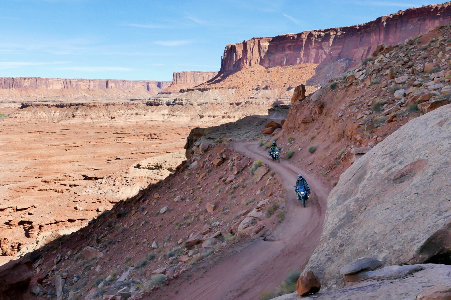
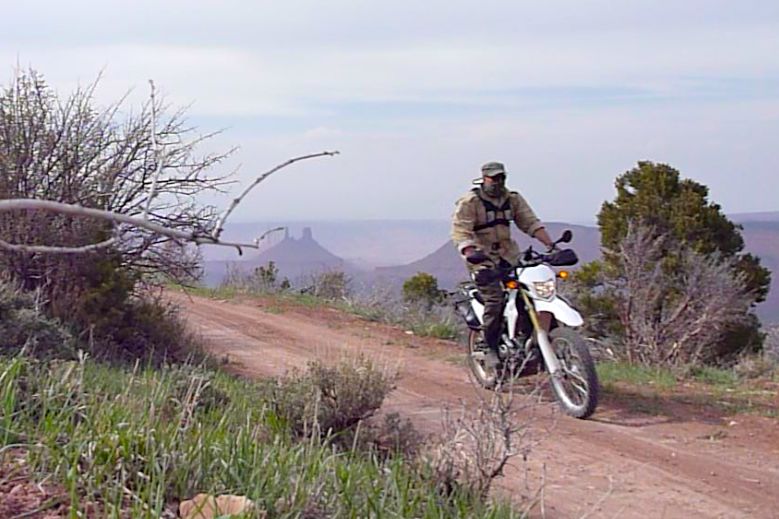
At one point the trail climbed steeply onto a shelf, not something you want to cock up. I passed the big bike group (left), had a little chat, but never saw them again after that. Soon a steep, 4×4-gouged drop led back down to the terrace, followed by a few short sandy sections before we were back on the bedrock.
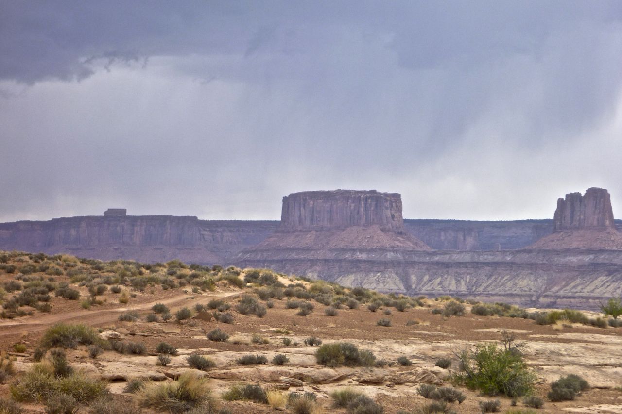
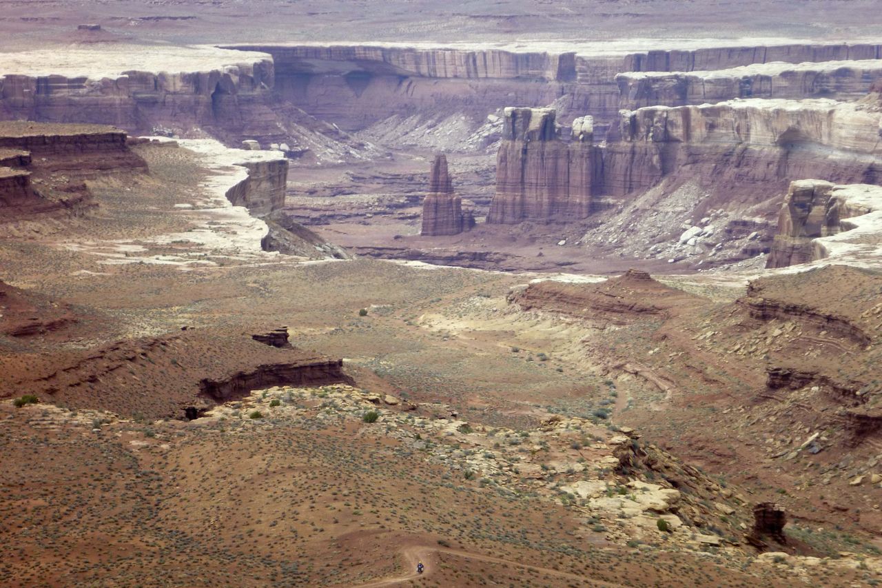
Many stunning vistas, like the one below, pass by before the other major climb and drop over Murphy’s Hogsback. The climb is easy enough providing you attack it and there’s no one in the way. The descent felt a little more thought-provoking this time round. My KLX stalled on a washed-out hairpin, but was light enough to roll down without drama. I did wonder how those big advs would manage this bit.

klx-19
klx-conflu
klx-23

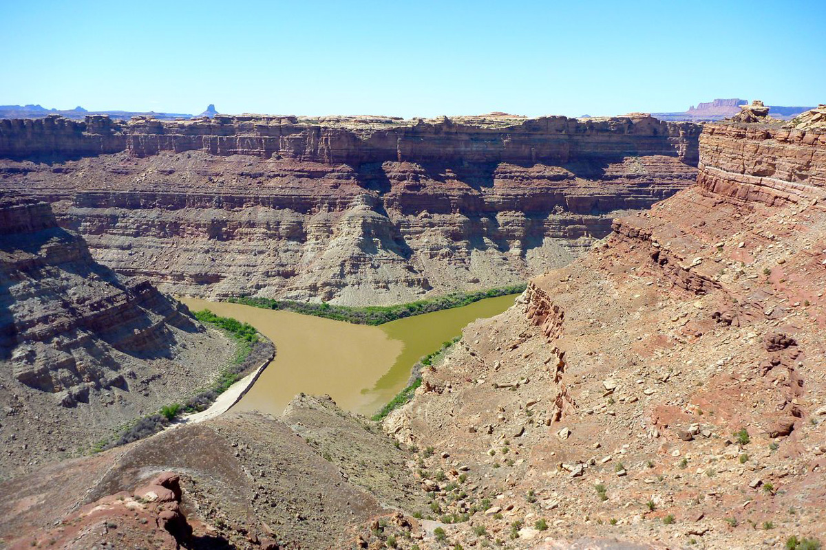
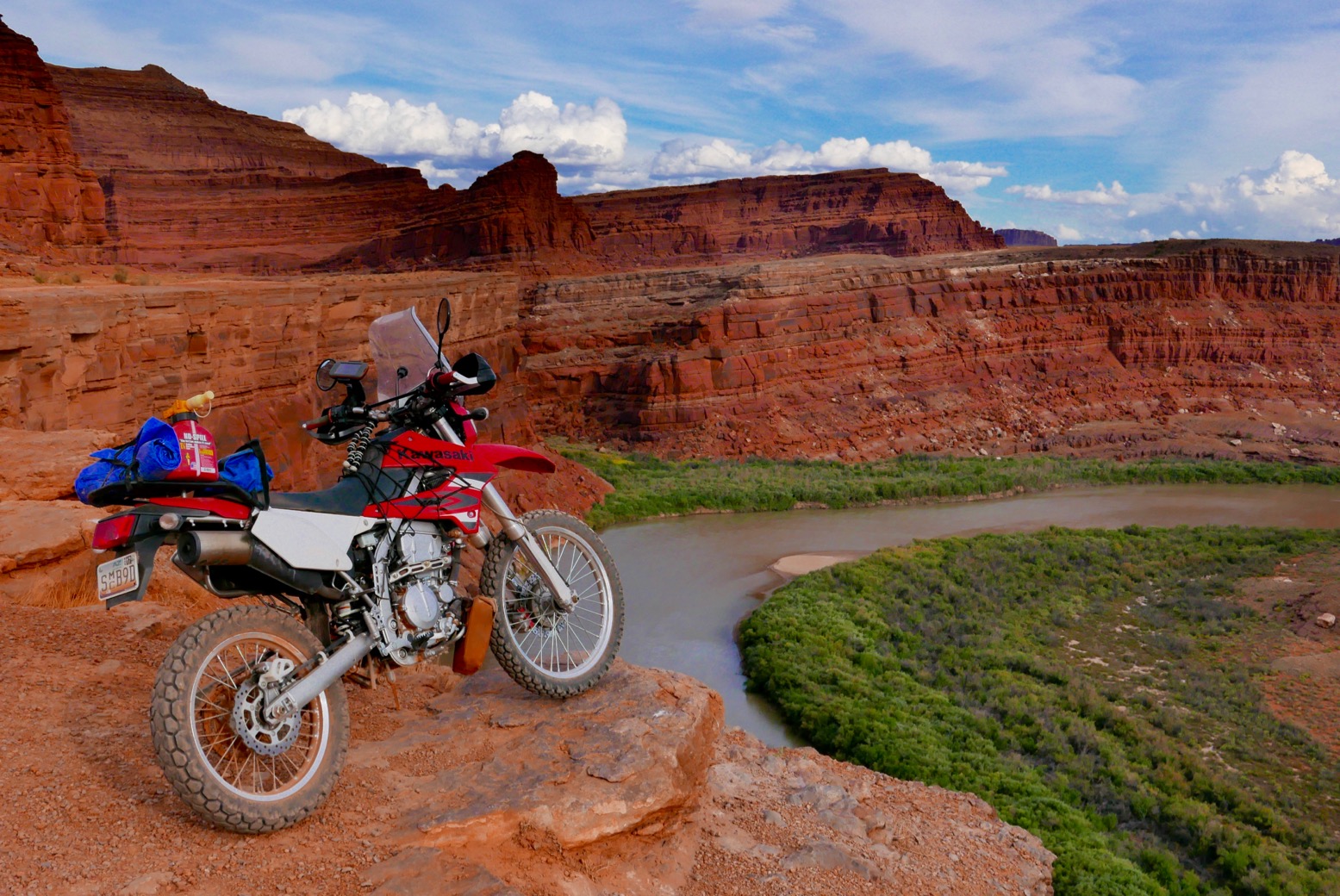
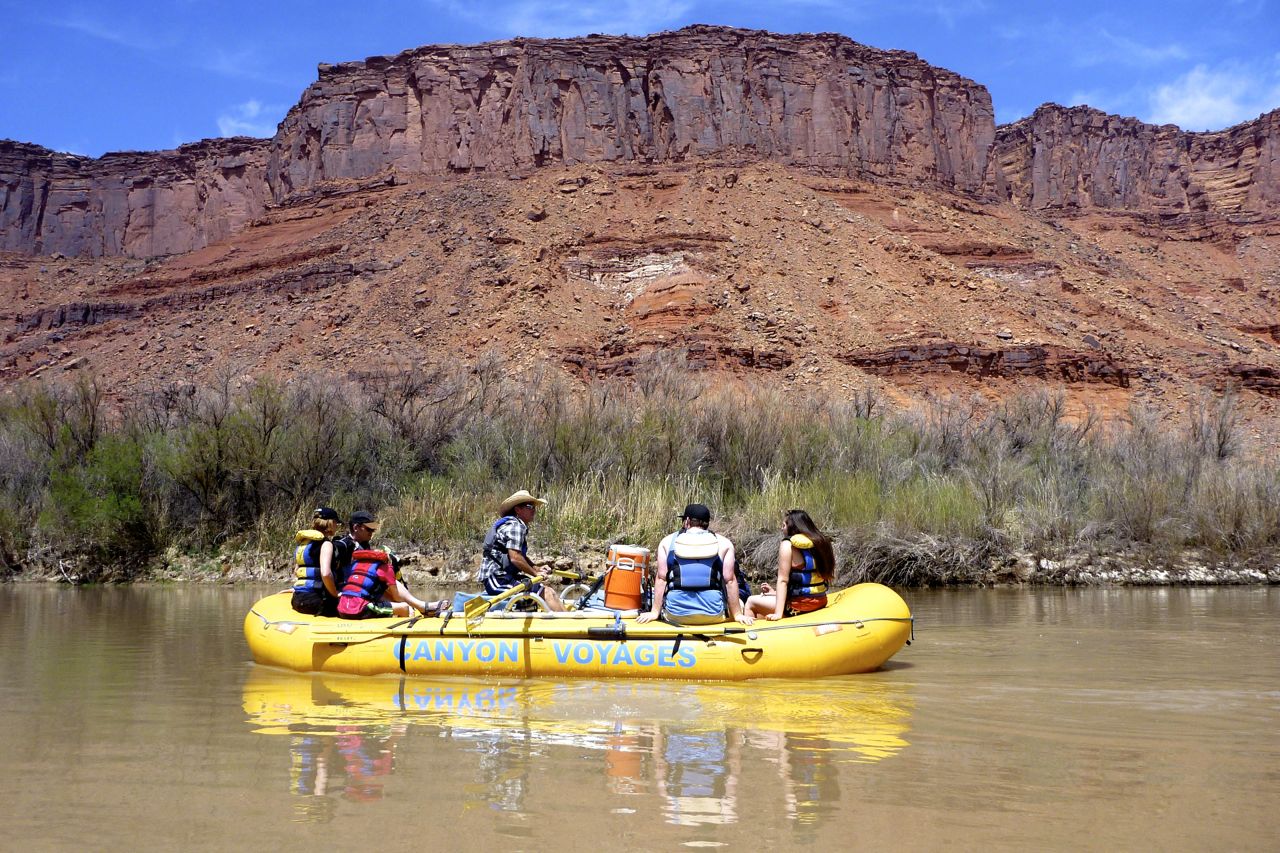
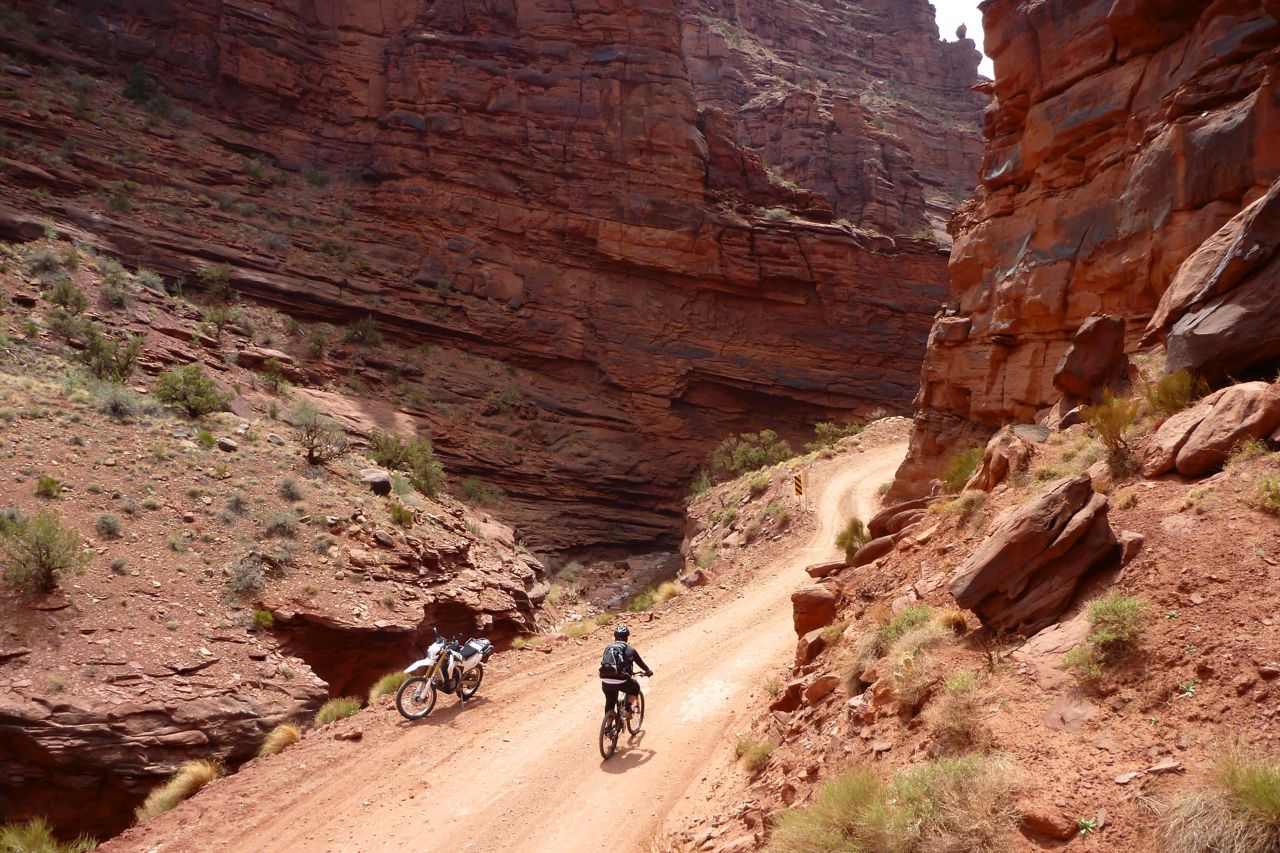
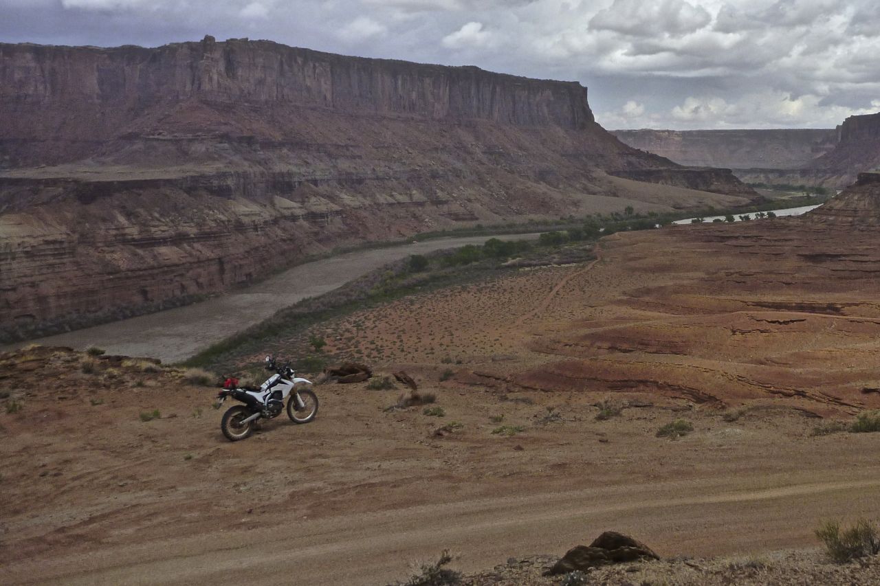
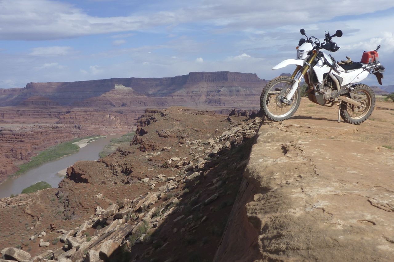
By now you’re past the unseen confluence of the Green and Colorado rivers (right, on another trip) and are heading back north towards Island in the Sky – way above. This is the place where regular day-tourists congregate; down here there’s no one. Glimpses of the Colorado river appear (left), the track levels off and stays that way, often crossing bare rock. I’d have found it a cushier ride on aired-down tyres, but was prepared to suffer a little to avoid punctures.
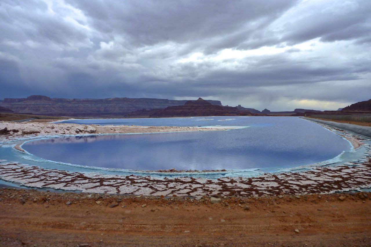
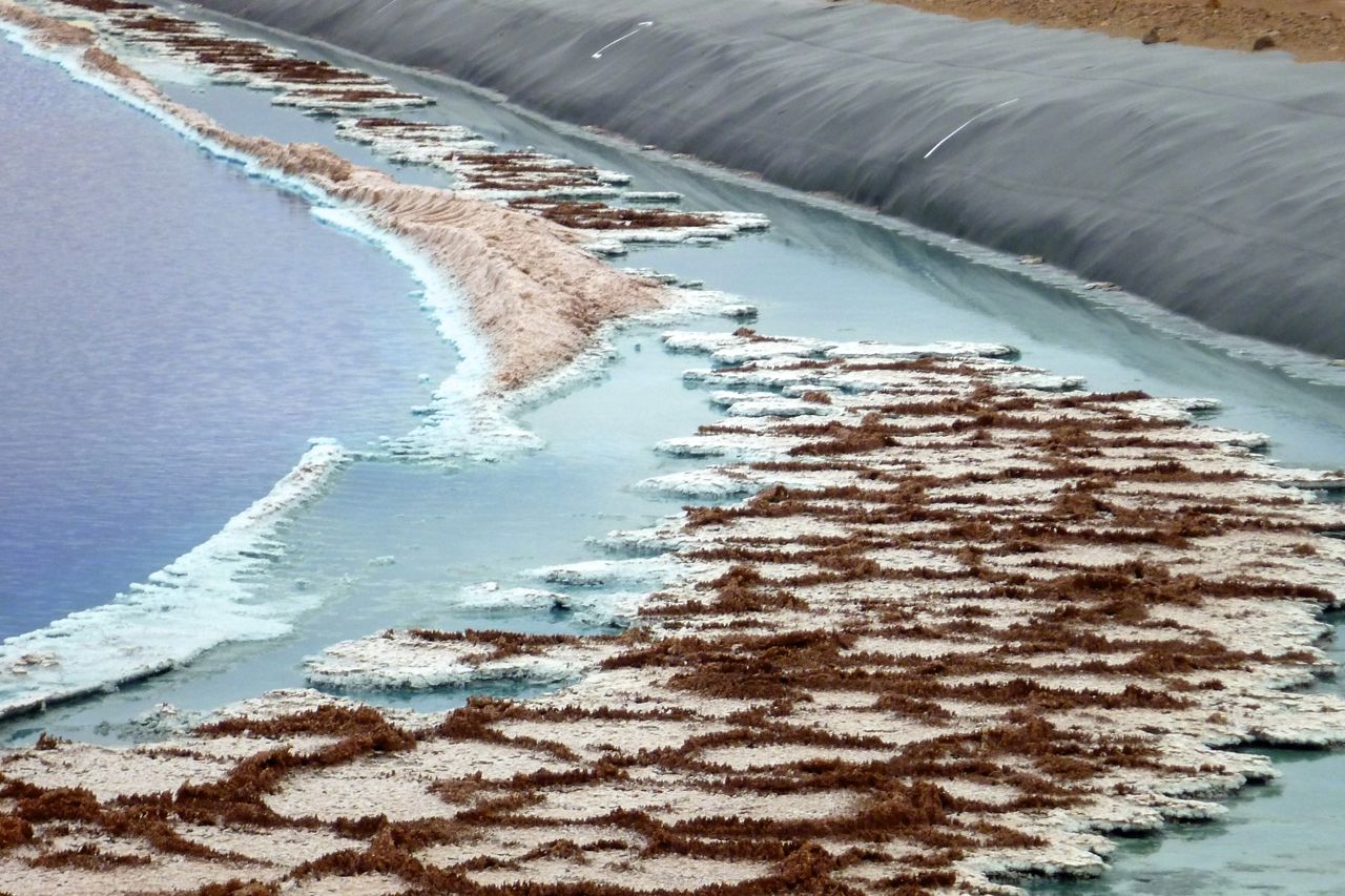
At a junction the Shafer Grade lies straight ahead to climb 1300-feet up the cliff into national park babylon. I went up and down it last time, but it was late now, I was a bit weary and fuel was low, so I took the Potash Road back east to town via the salt works. What a great day out.

p1150982
klx-26
klx-25

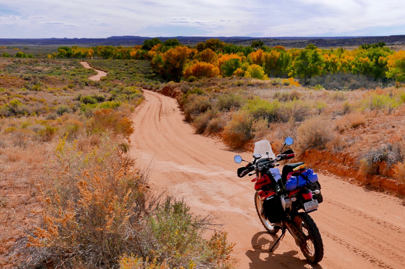
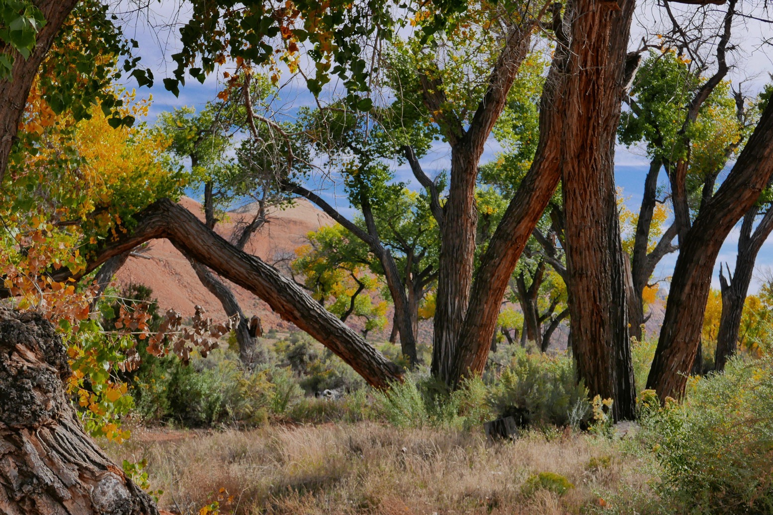
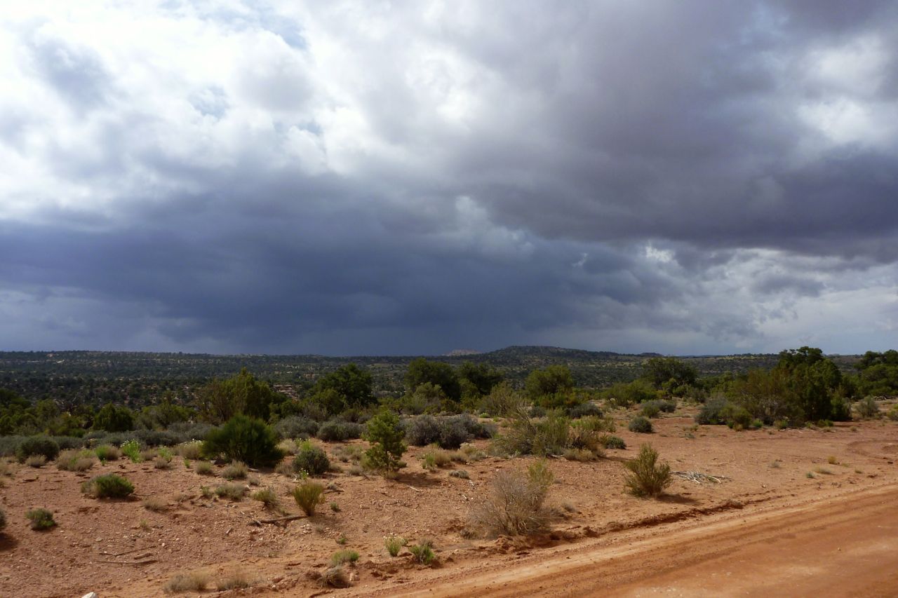
Next day the BDR trail into the Lockhart Basin was closed. Still off the tile, I didn’t have the wits to find another way round so instead road-hauled south to Blanding and worked my way towards a little sandy valley I discovered last time (left). I parked up under the rustling trees, read a bit, ate a bit, dozed a bit and moved on.
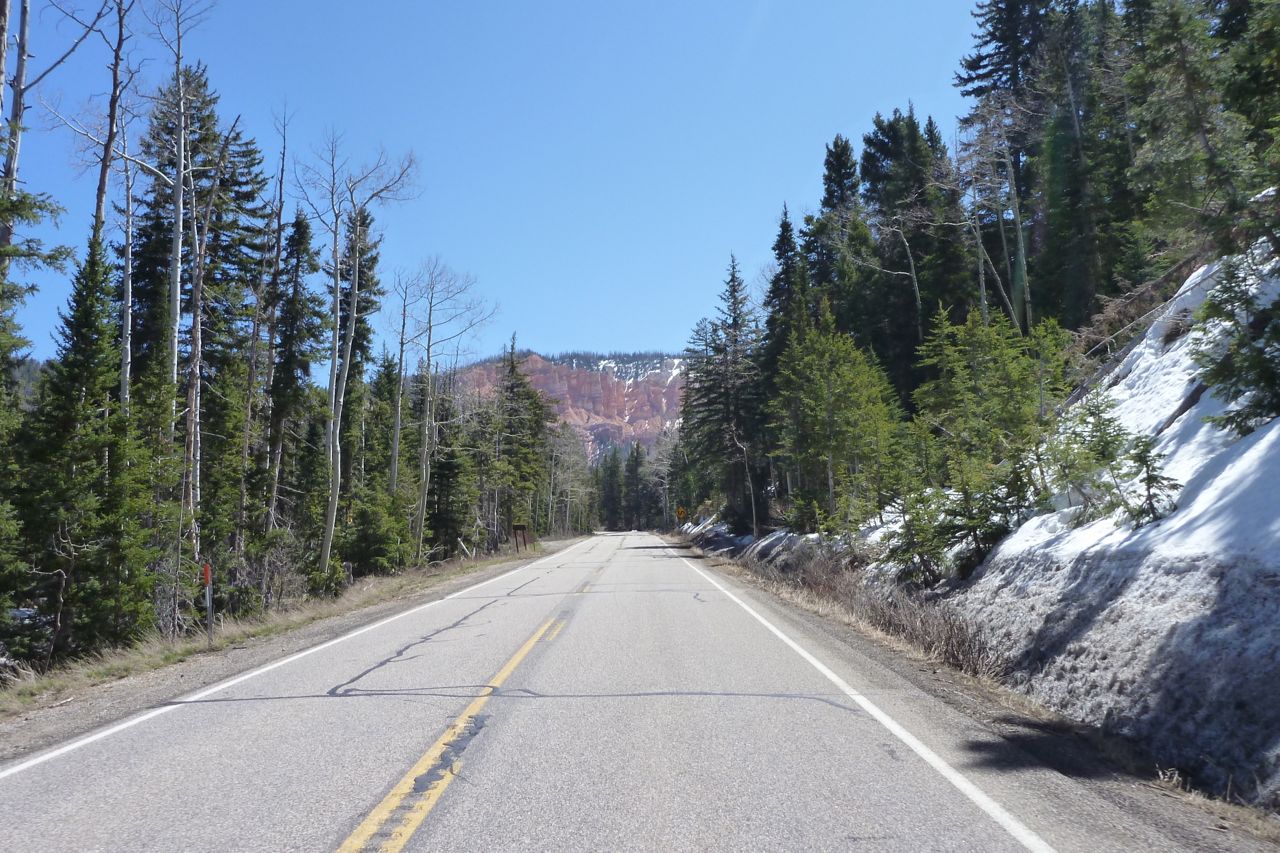
At the far end I took a ‘wrong’ turn onto the road, but it’s all good around here as long as the fuel lasts. Riding next day up to the 7000-foot rim on which Flagstaff rests, it was one final blast of cool air before rolling down into the 36-degree cauldron of Phoenix. Oil change, jet wash, pack up, fly home.

klx-28
klx-27

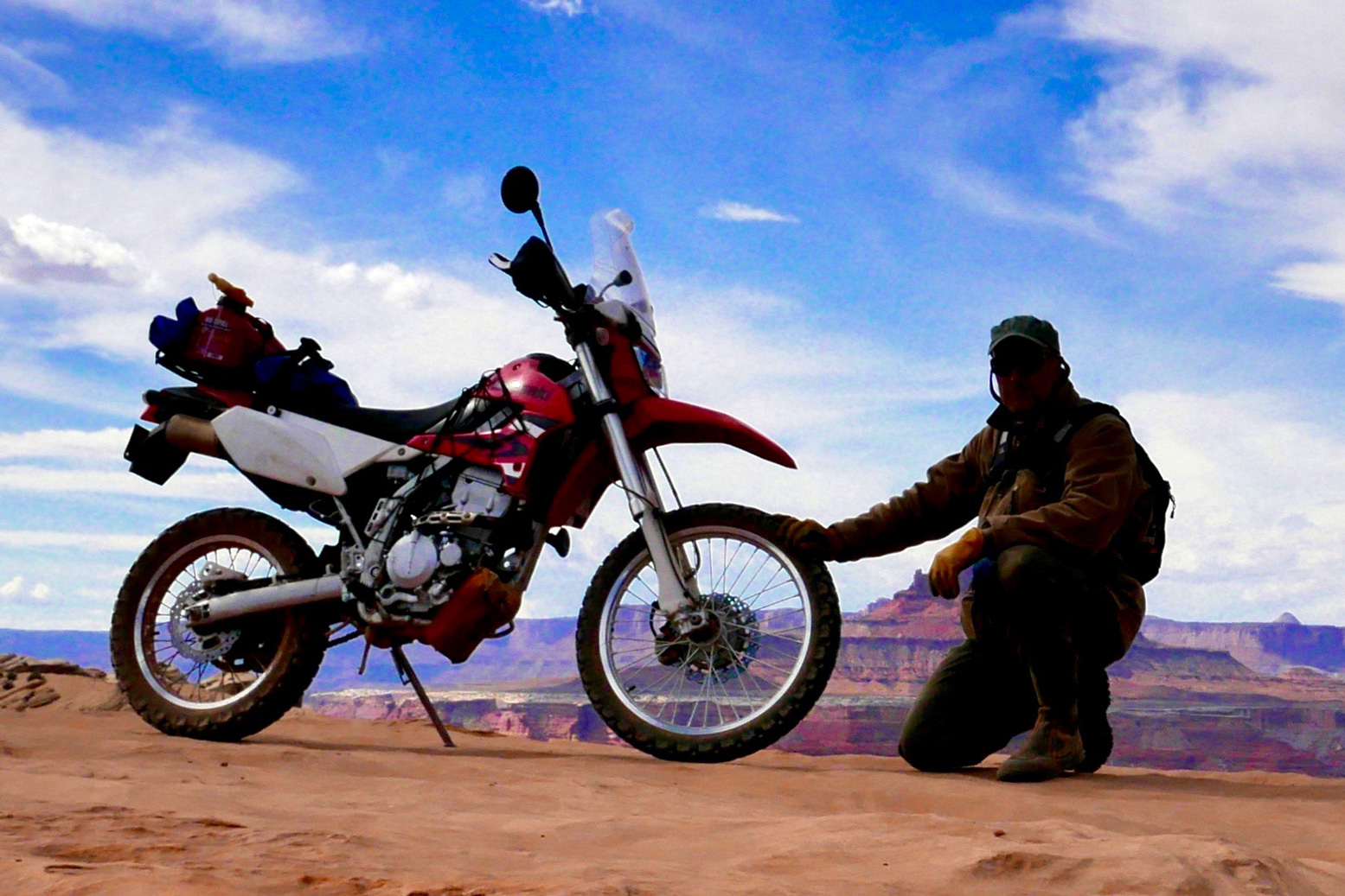
After 4000 miles I feel the same way about the great little KLX250 as I did following last February’s rides. Compared to the very popular CRF-L, it’s an under-rated 250 that’s almost certainly all the better in efi form sold in the Uk for years and now available in the US.

tikLight
Fully adjustable suspension
Looks good in red
Seems to run cool
crosWould prefer the efi model (now sold in US)
Seat as bad as they get, but lycra cycling shorts work wonders
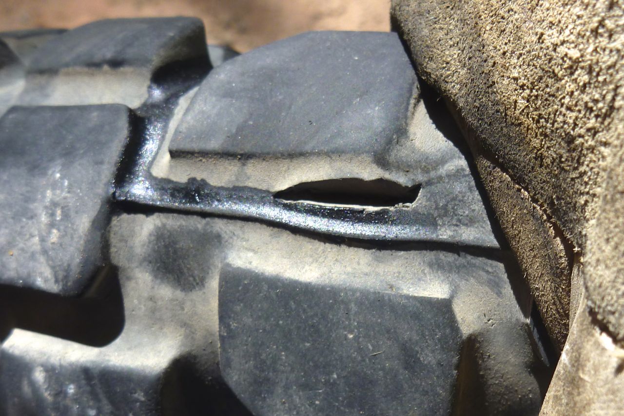
Tiny tank. The biggest aftermarket tank is only 50% bigger but the same size as my $20 can
Tiresomely tall at normal height, but [mine] easy to lower
ertt.jpg

CRF250L Mile 2121: Moab and the White Rim Trail

CRF250L INDEX PAGE
See also: White Rim Trail with KLX

Let me tell you, I’ve done my share of mind-blowing desert biking, seen attack ships on fire off the shoulder of Orion and all that, but Utah’s WRT will be among the best 150 miles you’ll ever ride in a day.

Bike mag, November 2021

You left me crossing into Utah trapped inside the lyrics of the Long-Legged Guitar Pickin’ Man. The rear tyre split hadn’t grown and overnight in Cedar City the temperature dropped by over 30 Fahrenheits to less than 50; good for tyre longevity. So I plugged in my Aero’ Kanetsu electric vest and took off up UT14 into the pines planning to follow 143 over the Cedar Breaks and down to Panguitch.

doomo01
doomo02
Even before I got to the turn off, it was getting on for 10,000′ but the CRF held its own.
Altitude doesn’t really affect it – just strong winds and steep hills.
doomo03
But at UT148 junction the snow barrier was down.
doomo04
As I stopped, KTM man from yesterday in Pioche rocked up, this time on his Multistrada 1200, Ducati’s answer to the big GSs. Never actually seen one of these being used.
doomo05
On the far side at the roadhouse on 89 I tucked into my daily Subway against a warm sunny wall.
I have convinced myself they’re a healthy form of cheap, fast food.
doomo06
Certainly healthier than these unidentified objects – battered lamb’s testicles on a stick?
doomo07
North now, into the fierce and freezing northwesterly.
By the time I got smart and added another layer, my arms were quite numb from the cold.
doomo08
Did I say it was windy? The Flags of the World do not lie.
doomo09
I stop off at Koosharen (pop: 327) for a one dollar coffee and a warm up.
‘Ain’t it cold on that li’l cikle?’ asked a man in a John Deere cap.
A small shed of his had just blown off down the road.
doomo10
Next day, out of Torrey on the edge of Utah’s Tourist Zone, but even here they have a Subbie! (There are no less than 40,000 franchises in 99 countries RTW).
From here farming and mining takes a back seat to scenic drives past red rock cliffs and canyons.
doomo11
I follow the Fremont River after which the pre-Anasazi Indian culture was named.
Their enigmatic petroglyphs adorn the canyon walls.
doomo12
I detour down the Goblin Valley Road and doze out of the wind and in the sun for an hour.
Then I cut off along an old road that leads to Green River, avoiding unnecessary interstate.
I like these old roads with grass growing up through the cracks.
doomo13
At the back the snowy La Sal mountains rise to nearly 13,000′
doomo14
Green River has its own hooning hill. I like to think it helps reduce anti-social behaviour.

In Moab I score a cheap private cabin at the old Lazy Lizard hostel. I stayed here 20 years ago, but the Lizard has not responded to the ‘flashpacking’ boom; in Moab no one has yet. The Lizard is like an old style hostel, which is both good and bad. Then it dawns on me I’m in outdoor adventure central with a trail bike, cheap accommodation and time to spare; I better book up all the nights they got!

doomo24
I join a rafting trip on the Colorado just out of town, with an inflatable kayak alongside for those who want it.
doomo25
Annoyingly this couple from SLCity were in the IK for the best bit – rats!
doomo15
My cheap online Kenda tyre won’t be here for another few days so I buy a Maxxis Desert up the road for around $110 and leave it on the roof to soften up. It’s an old Indian trick.
doomo17
Then I go and rent an MTB and have a crack at the Slickrock Trail I remember well from ’94.
I don’t get so far – it’s got a lot steeper over the years; I blame erosion caused by global warming, though other age-related scenarios are possible.
But on a $2000, full-susension Santa Cruz SuperLight 29 with more traction than a gecko on a jam jar, it’s a lot of fun.
doomo18
Creaking and screeching 4x4s share the Slickrock but not the same trail, although motos can ride the cycle trail.
In fact, the Trail was invented by motards back in the ’60s. I wonder about coming back on the Honda, but even unloaded I don’t want to risk the clutch on some of the sudden, very sharp ascents.
doomo20
If you dig MTBs you must come to Moab for the Slickrock and all the rest.
doomo21
That split never grew in 500 miles but I still think the right flake on a dirt road would have nabbed the tube, Slime or no Slime.
doomo22
The Maxxis is a 110/100 – the worn OE was a 100/80, so new tyre is a bit taller but still black and round and on the road has been just as smooth and predictable.
doomo23
Even once sun-warmed it’s a stiff tyre, but with technique and a bit of WD40 it slips on with just two levers.
doomo26
Time for a ride. I set out on a 90 mile loop, part of the UTBDR north of Moab.
doomo27
Up lovely Onion Creek with a dozen or more shallow fords to cool the feet.
doomo28
Then steeply up onto the La Sals at some 8000′. A bit chilly now and the over-sprung shock chatters on the rocky ascents.
doomo29
La Sal – don’t know which one.
doomo31
Castle Valley, I do believe.
doomo30
Helmet-free riding is a rare pleasure, especially when doing errands round town.
doomo32
And back east, down part of the MTB Kokopelli Trail and along easy Sand Flats Road past Slickrock where I detour for a quick one, just to say I did it.
doomo33
In town I spotted this old 136cc 2WD Rokon on a trailer. Little changed from the 1960s, I think you could call that a ‘functional-brutalist’ design. They still make them today: rokon.com.
doomo34
It’s time to finally tick off the White Rim Trail. Twenty years ago I tried to rent an XL500 off Arrowhead to do the WRT but the guy was not so keen. Even today it’s hard to rent a road legal trail bike in Moab.
Plenty of other OHV stuff to be had if you have a trailer or a ute, but they’re not allowed on the WRT.
doomo35
The weather was not so good; it had rained overnight, hopefully enough to settle the sand and dust but not turn it into mush.
I saw a few bolts of lightening through the day but only got rained on for a few minutes.
doomo36
At the end of Mineral Bottom Road is the big drop to the Green River valley.
doomo37
A plucky MTBer takes the last big climb after 3 or 4 days on the WRT.
doomo38
From then on, it was kind of sandy, but only for 200 yards at a time. No rain dampening here so to be on the safe side I paddle laboriously. I hoped it wasn’t to be a 100 miles of this… How do these MTBers manage?
doomo39
At times you’re right by the Green River; lose the front and you’ll make a splash. Elsewhere you climb ‘inland’. I think it was the tricky climb up Hardscrabble Hill that made me glad I wasn’t towing luggage or another 1000cc. I actually stopped and looked back over my shoulder at the 1:2 sandy hairpin on the way down and thought, cripes, that would have been hard to get up.
doomo40
I’ll let a few pics do the talking… (but note: parking among vegetation off the trail is bad form)
doomo42
doomo43
doomo44
doomo45
doomo47
doomo48
At the top of another long climb, Murphy Hogback around Mile 70, I meet a guy on a fully laden 1150.
And I mean fully loaded like he was going to Alaska. On Anakee tyres too…
doomo49
I didn’t know it then but I’d nearly completed the harder, sandier half of the WRT which he was heading into. I warned him about Hardscrabble Hill and doubted that tank would make it, but he seemed a confident rider.
doomo50
The 1150 is a speck at the bottom of the photo.
doomo51
Soon, I turn back north at the halfway point: White Crack turn off. I stop to fill up the tank and finish off my footlong Sub.
Someone had advised not to bother with this side – I presume because it’s easier?
doomo52
But that suited me just fine at that stage; I was riding more fluidly after the morning’s efforts and the spectacles kept on coming, now with the Colorado River on my right.
doomo54
I reached the Shafer Trail turn-off about 5pm; the Trail seemed to disappear into the cliffs.
Many rave about the Shafer Trail.
doomo55
So I rode up to the top; Island in the Sky.
doomo56
And coasted back down to keep the brake pads warm in the evening chill.
doomo57
I learned later that I’d passed under the rim of Dead Horse Point where Thelma and Louise took their fateful leap, gunning their Thunderbird into the abyss, yelling “You’ll never take us alive!”. For a Hollywood movie, that was a great ending.
I continued along the Potash Road, 30 miles back to Moab; a bit rough, or I was starting to feel the miles by now.
doomo58
The mining works after which the Potash Road is named were originally a regular digging mine. Then they adapted it to effortless ‘solution mining’ by dissolving the subterranean potassium out with the aid of brine, pumping it up and then allowing the water to evaporate and the minerals to crystalise in shallow ponds.
doomo59
Blue dye is added to help the solar process. They separate the salt from the potassium later.
doomo60

I rode back into town nine hours after setting out, just as another deluge got ready to drop its pants over Moab.

Let me tell you, I’ve done my share of mind-blowing desert biking, seen attack ships on fire off the shoulder of Orion and all that, but the WRT will be among the best 150 miles you’ll ever ride.

I’m now waiting for the weather to clear before heading down through Canyonlands’ Needles District and on to the AZ border. It seems the temps are about to take another 20°F hike up the scale.

Adios Moab. Last episode here.