Category Archives: UK Trail Riding

Tablet nav: OS (UK) vs GaiaGPS vs DMD2

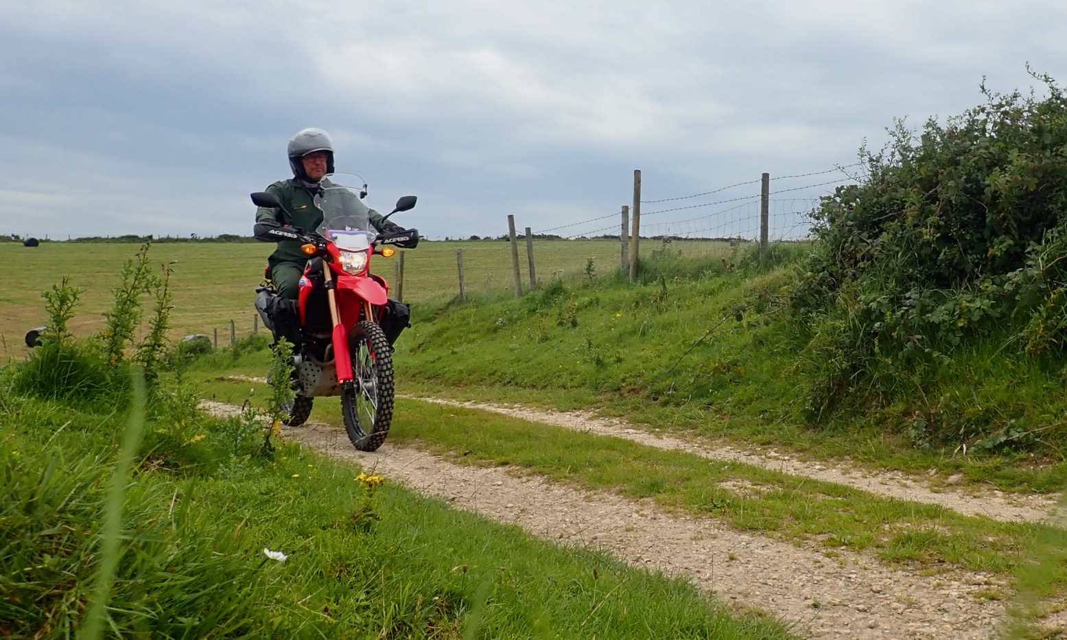
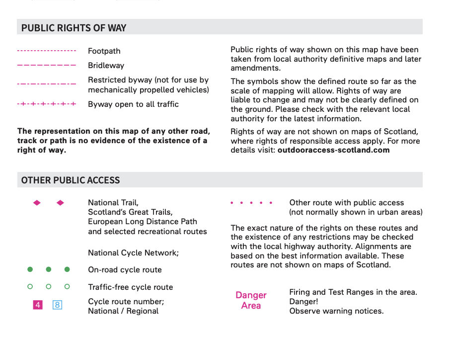
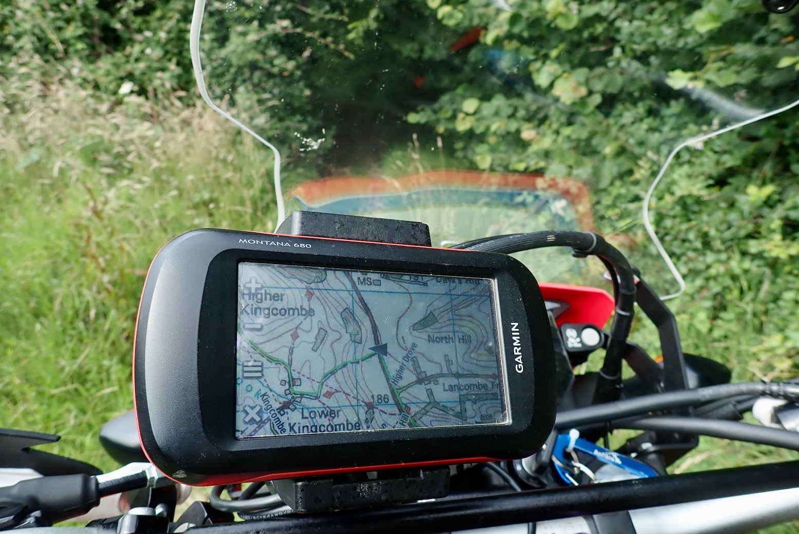
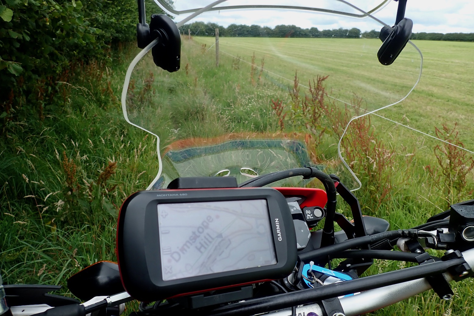
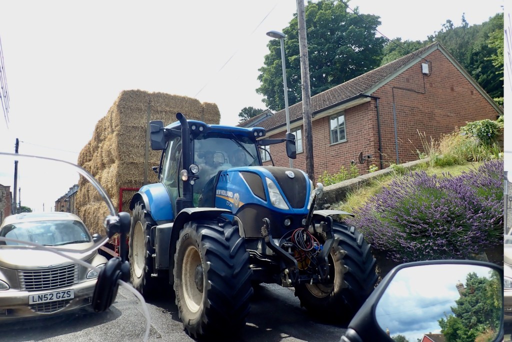
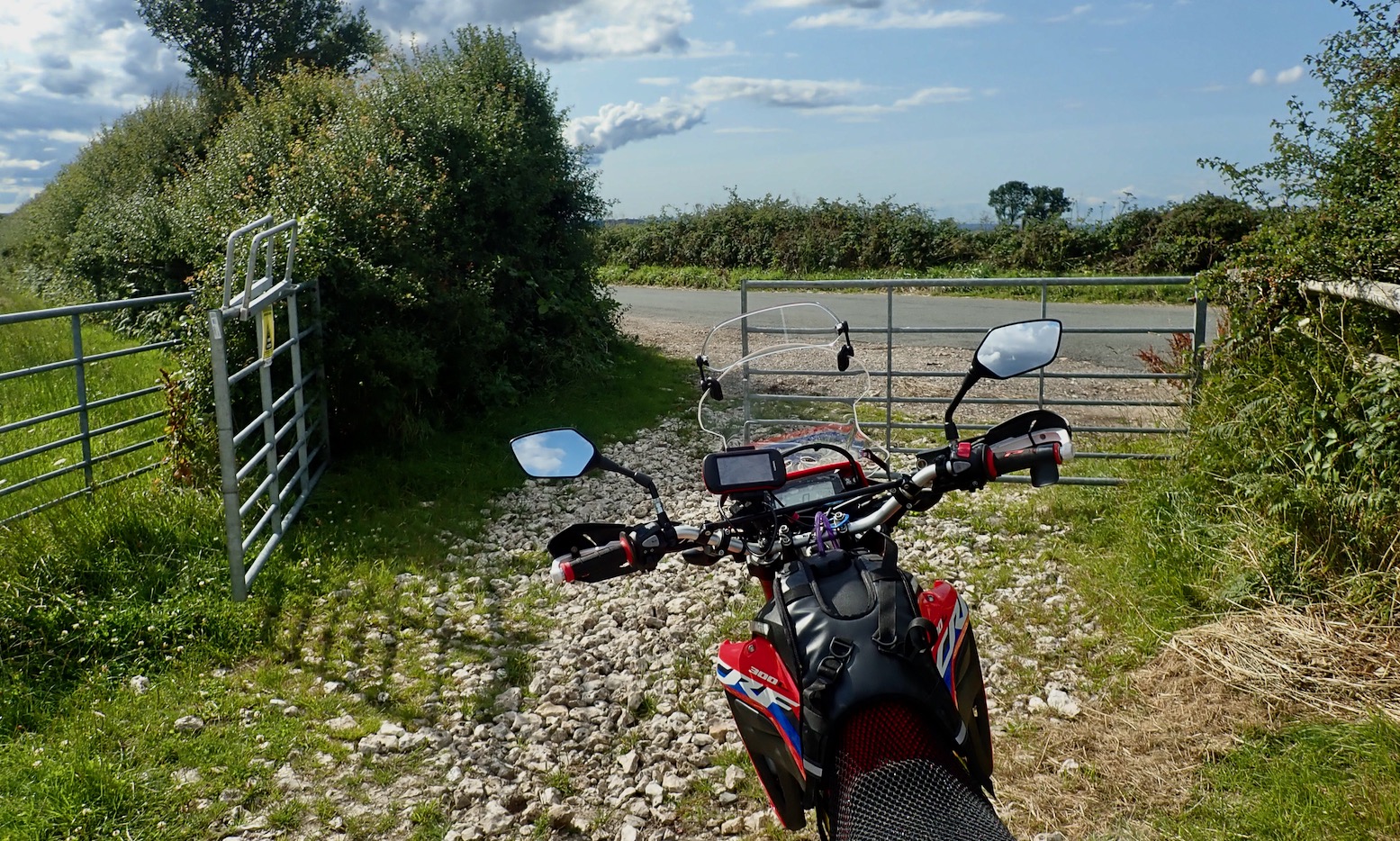
Garmin’s dominance in satnavs has surely peaked now that offline nav is yet another task we can do on our phones. I’ve been moaning about my flakey Garmin Montana 680 for years: screen too small and murky, occasional freezing, slow loading, and newer Garmins way too pricey for what they are. But along with travel biking, the rugged Montana remains usable for green laning, walks, MTBing and even paddling, while shrugging off the shaking, occasional dropping and salt water. It won’t overheat in the sun and batteries last all day, but trying an app on an inexpensive device I already own and use is a low risk experiment.
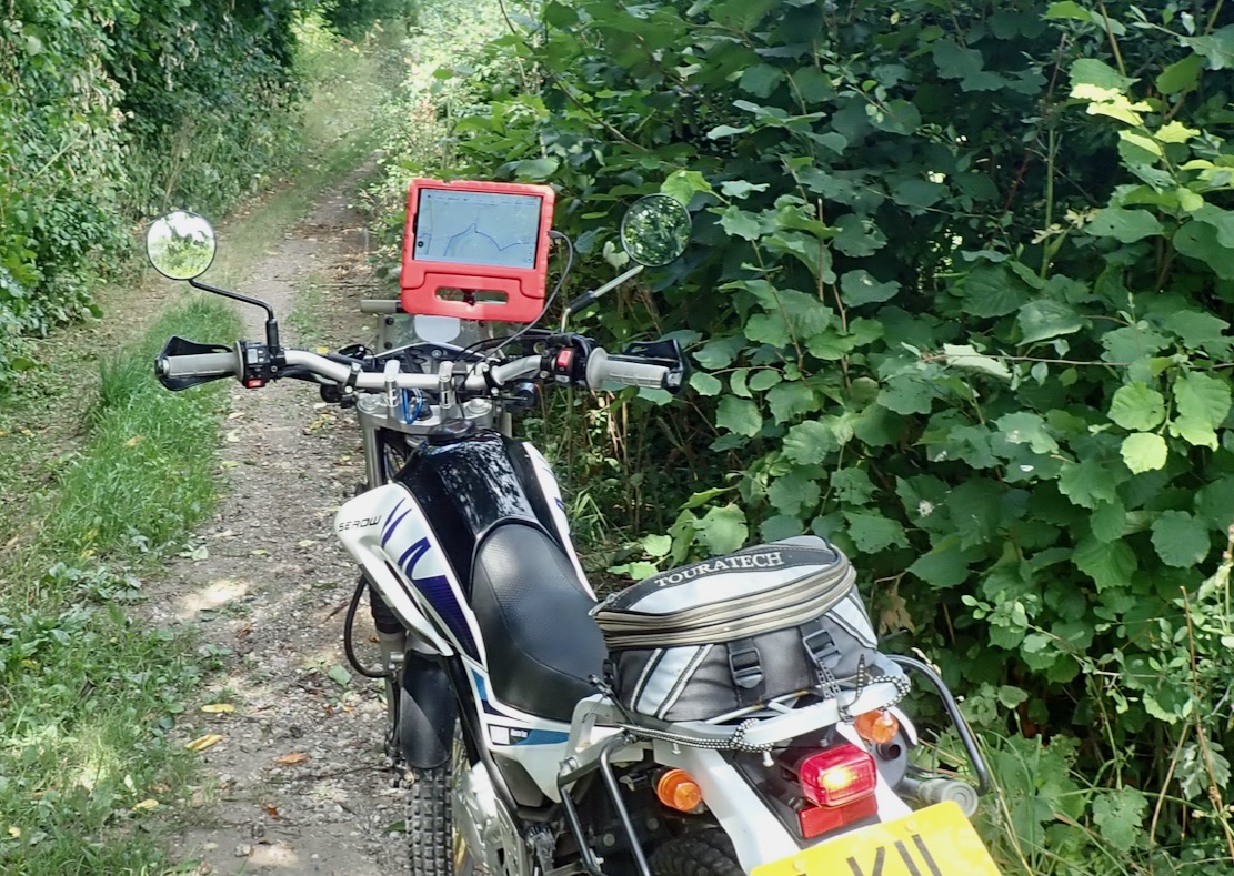
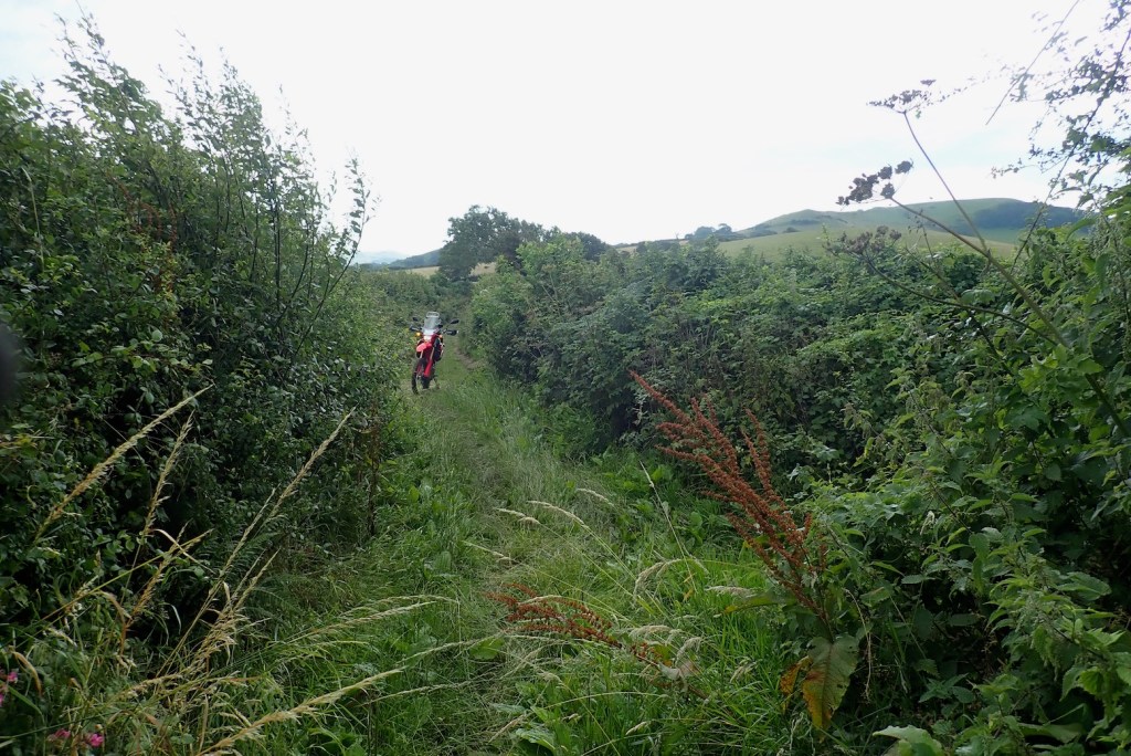
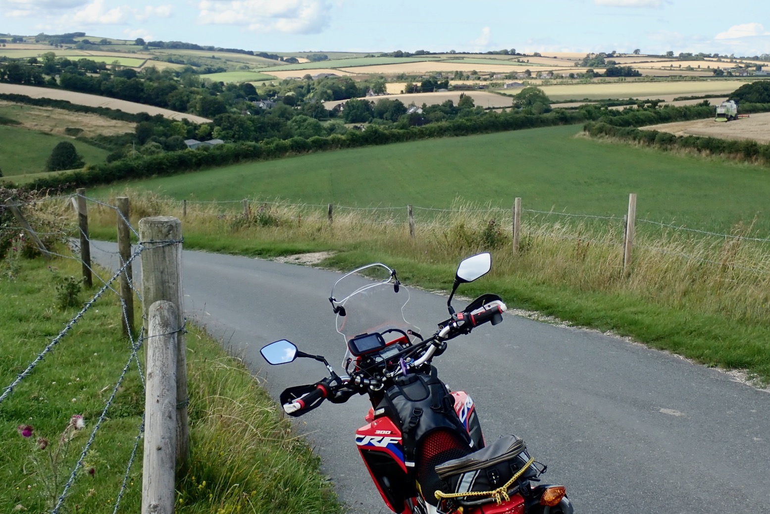
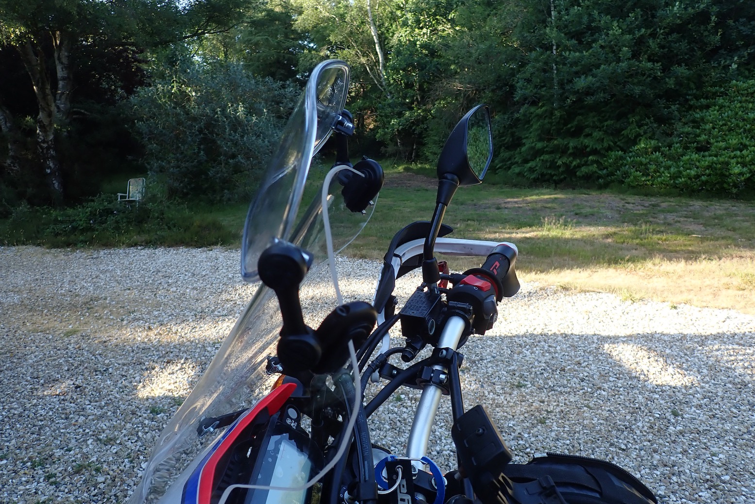
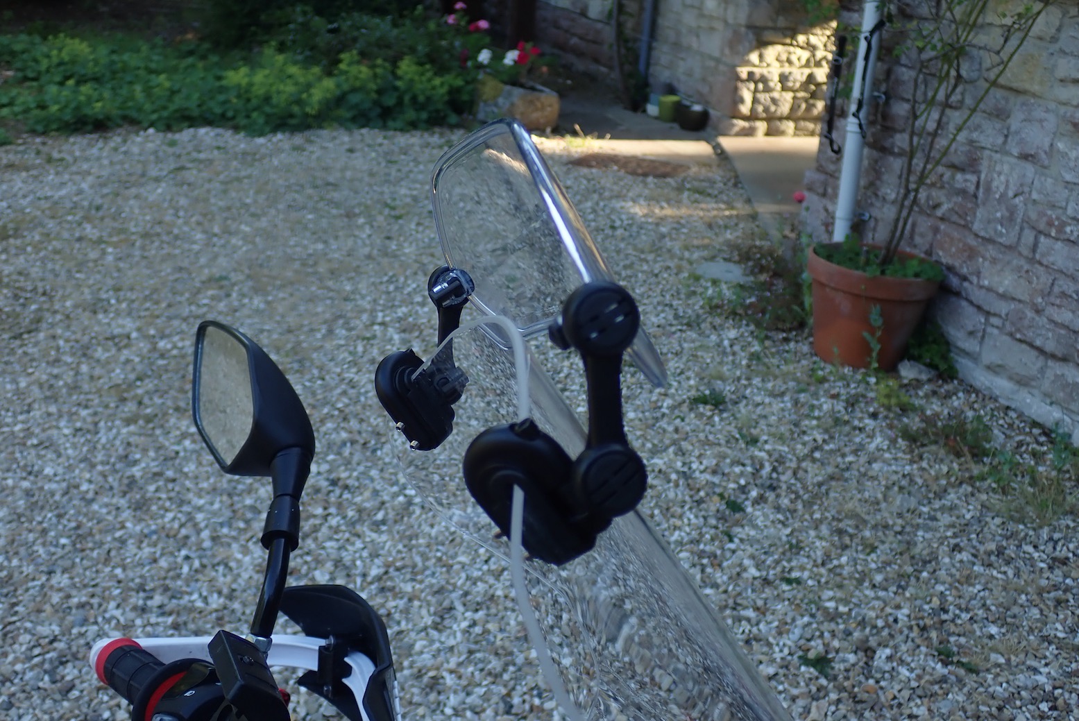
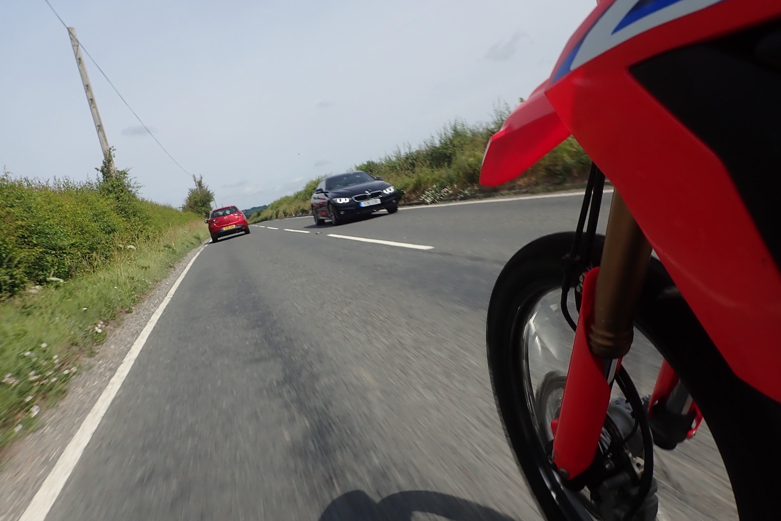
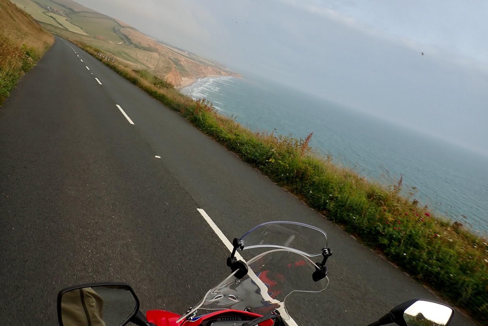
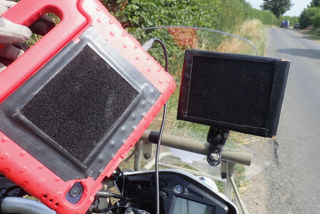
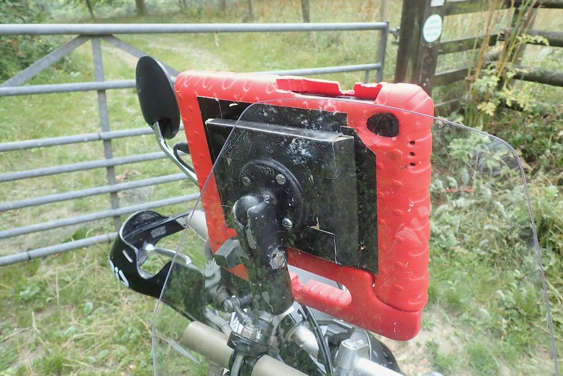
Recently I bodged a way of attaching my £85 Samsung A9 tablet in its child-proof case to RAM handlebar hardware using velcro, plywood and sticky-backed plastic. The A9 has loads of screen space – a bit too much, even; a 7-incher would do. A trail ride round the local lanes on the Serow and MTB proved my fittings held up, though weather and time might see to all that.

That done gave me a chance to try GaiaGPS (~£60 a year) which I know a little from Morocco, plus Ordnance Survey (£35) and DMD2 (£19) which I don’t.
This isn’t really a like-for-like comparison. The OS is pitched at non-vehicular, UK-only recreation, GaiaGPS and DMD2 maps cover the world; the former again more for hikers but with overlandy adds-ons, the latter is made by and for motards. But you can use switch from app to app on your device.

Ian Haslop

DMD do make their own DMD-T865X rugged tablet (right) for 850 quid. A mate is already on his second one. Then again, I’m on my third A9 in as many years; the motherboard or something packs up doing nothing more rugged than sitting on the bedside table.

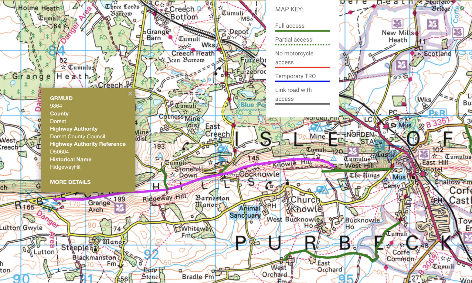
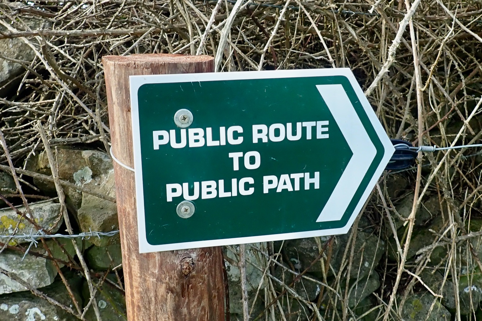
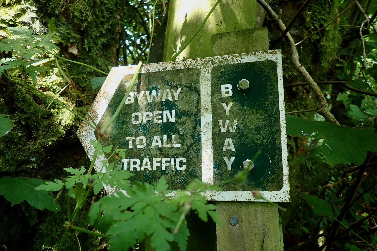
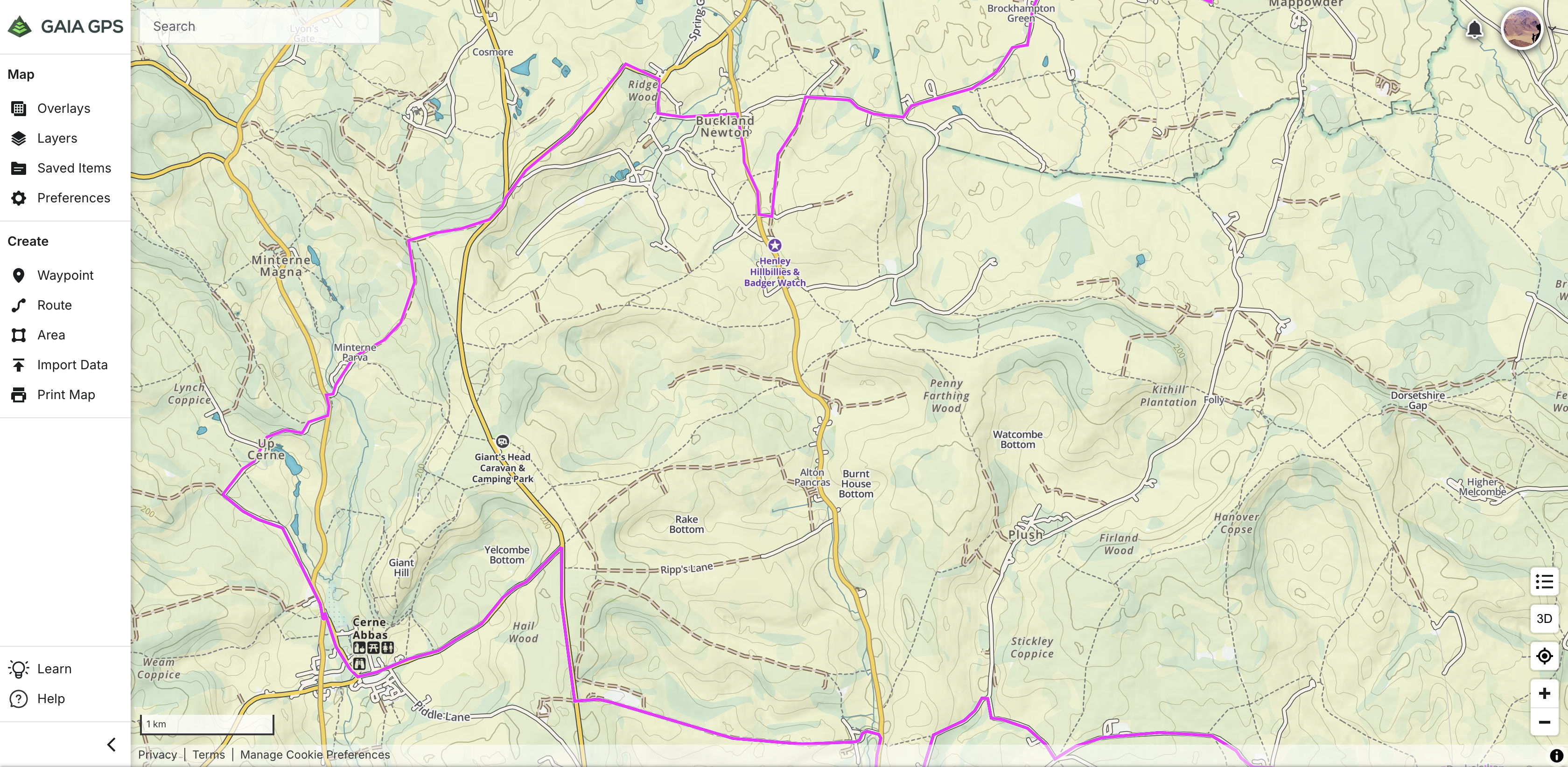
Based on the crowd-sourced or volunteer contributed Open Street Mapping database (‘the free wiki world map’), in the UK, neither Gaia or DMD2 accurately differentiate between the few legal byways and the zillions of footpaths.

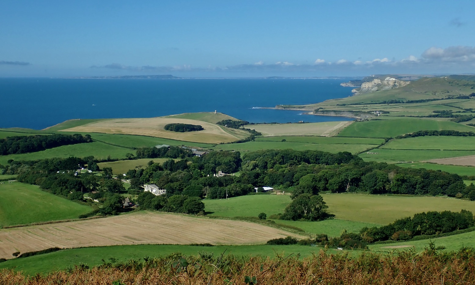
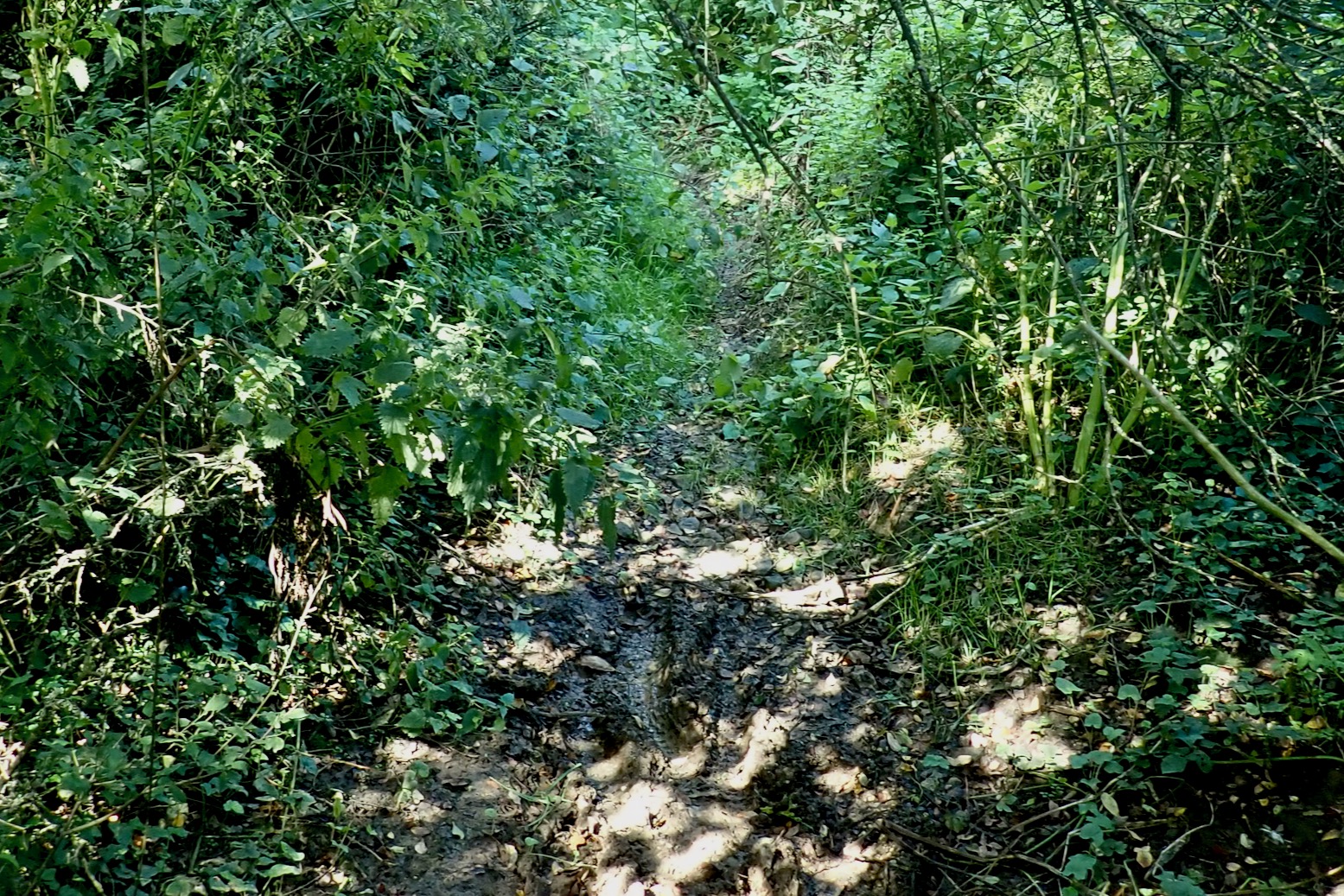
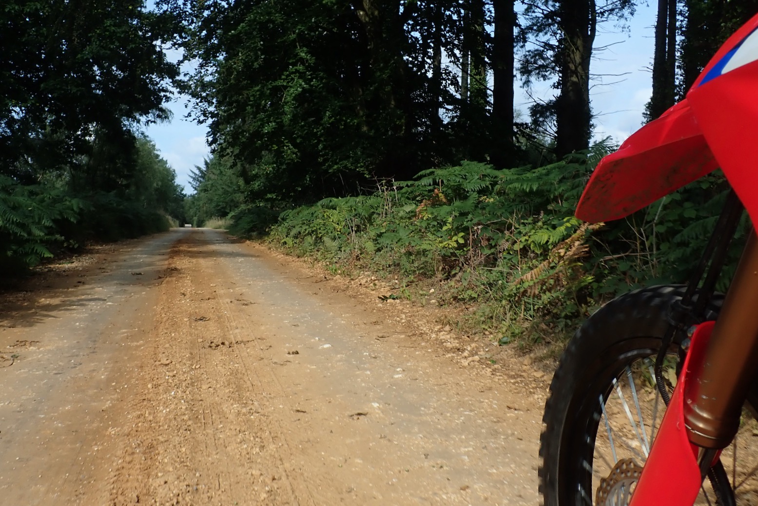
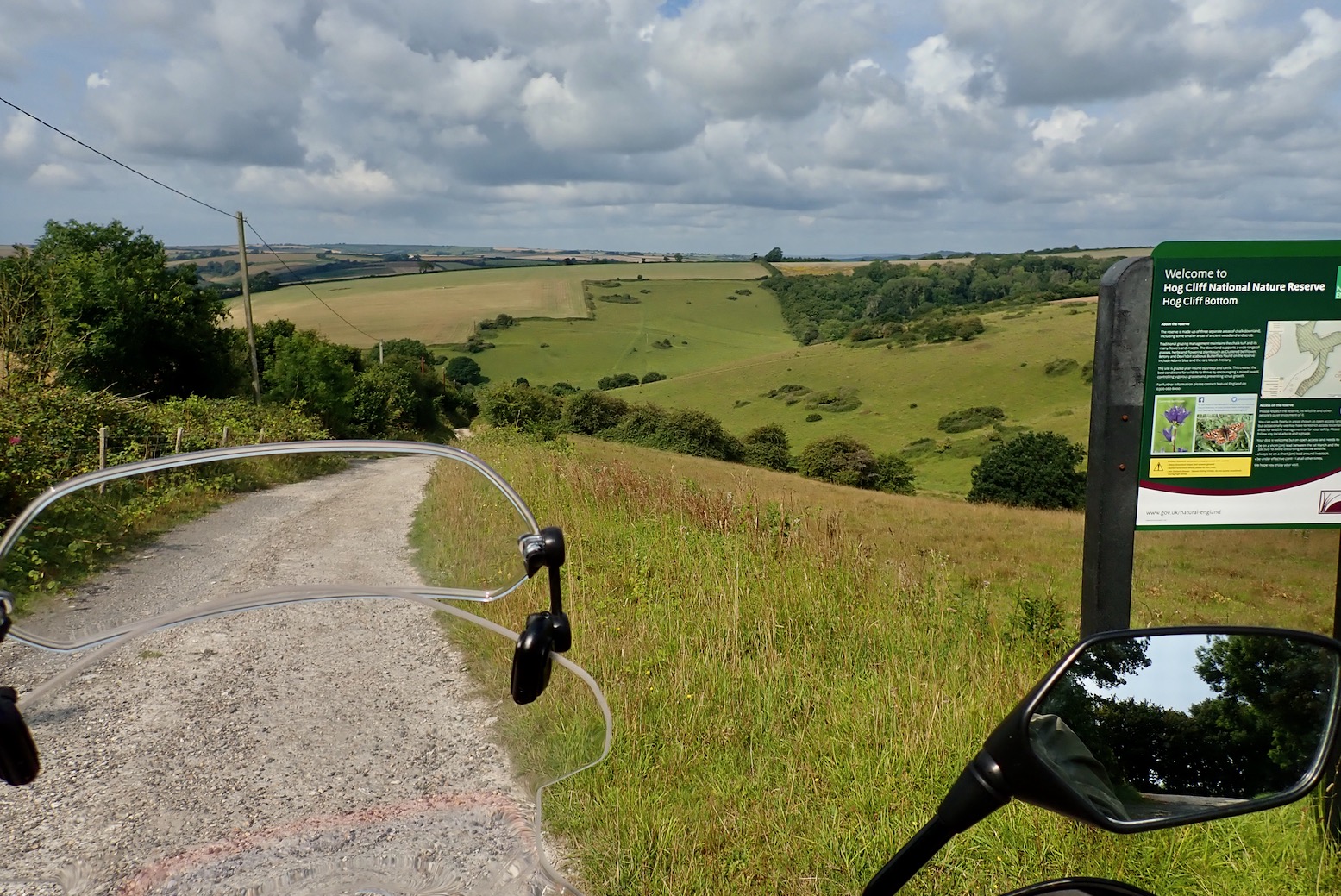
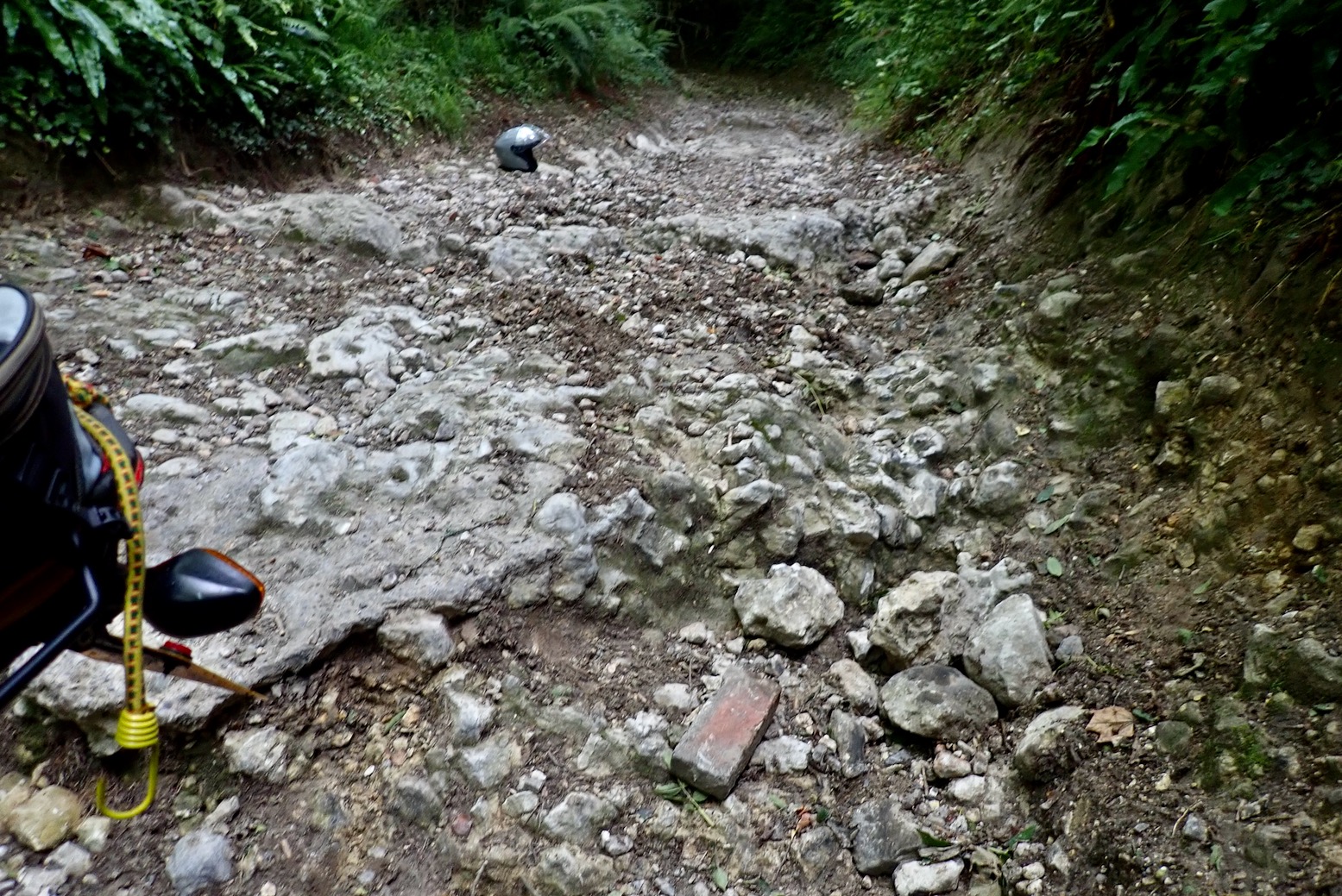
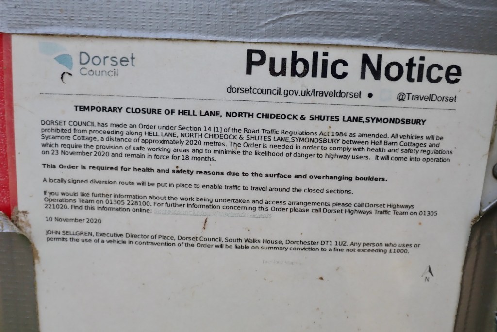
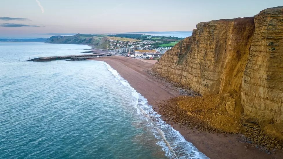
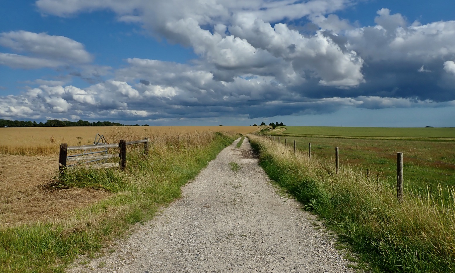
That said, with an imported and verified green lane gpx tracklog, you’re probably following a legal trail, so how the background map looks is less important. Meanwhile in southern Morocco and similar places, whether a track is actually passable on your machine is more important than rights of way – and that can change from season to season.
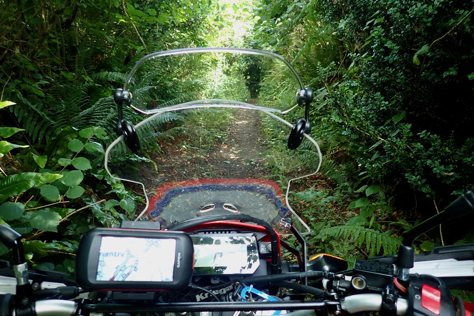
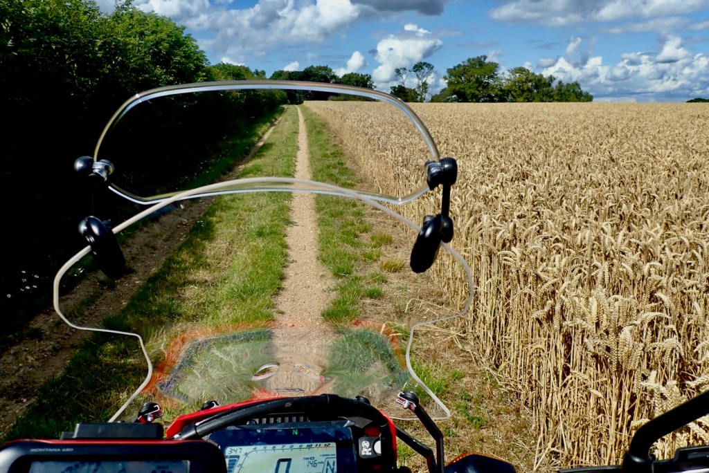
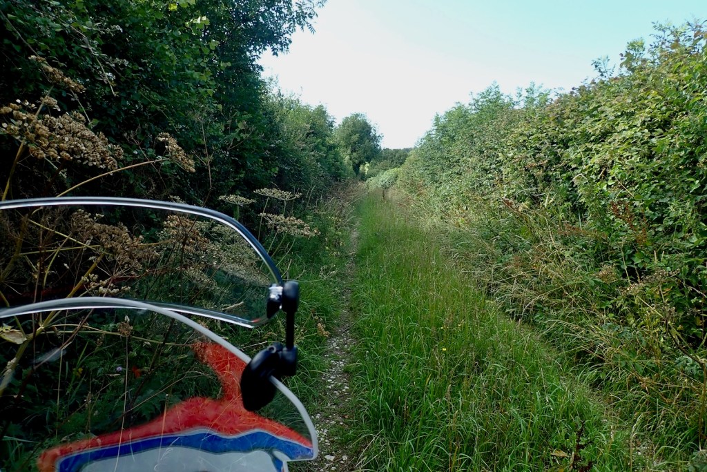
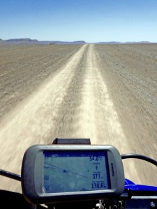
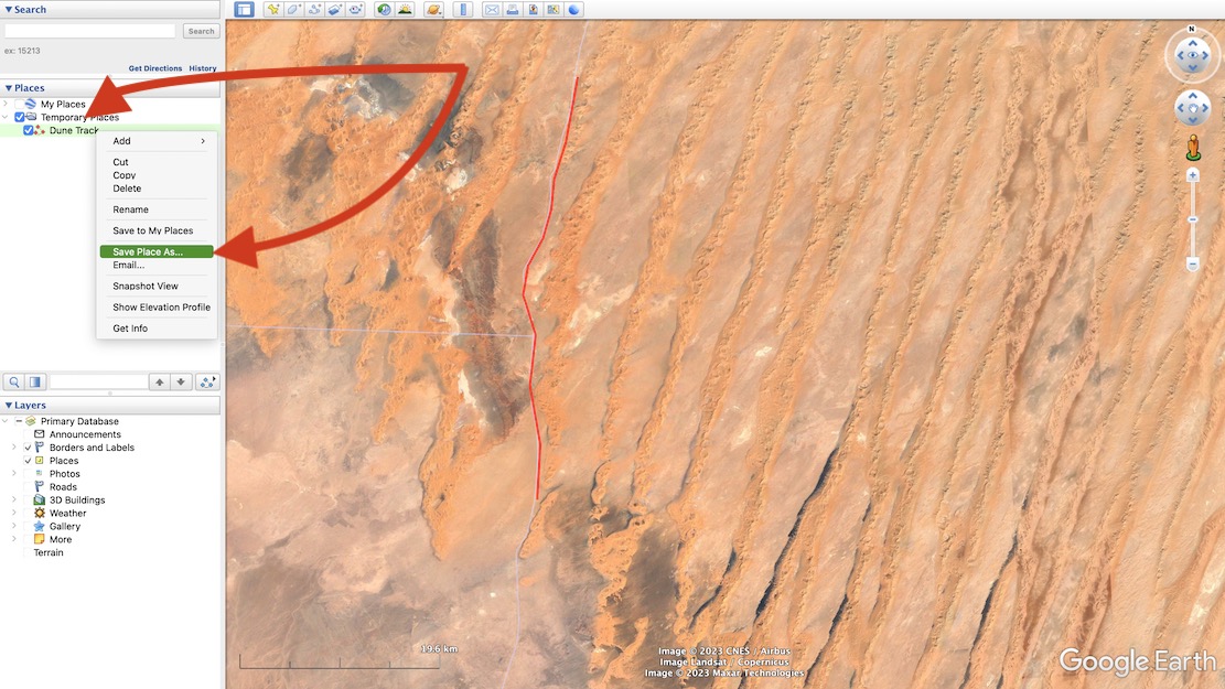
Even in Morocco I nearly always ride new routes with tracklogs traced off sat imagery in advance (above left), sometimes even the night before. As you’ll read, the trails that appear on OSM-derived maps out there are too inconsistent and unreliable.

Ordnance Survey (£35 a year)
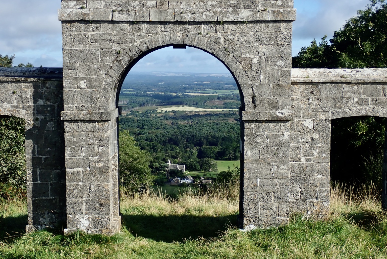
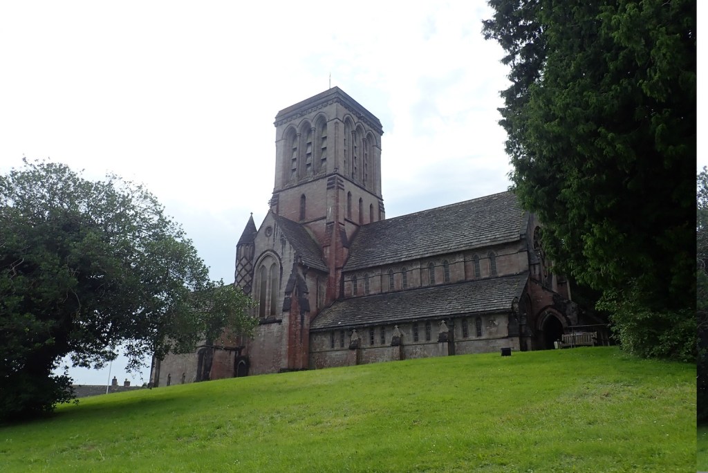
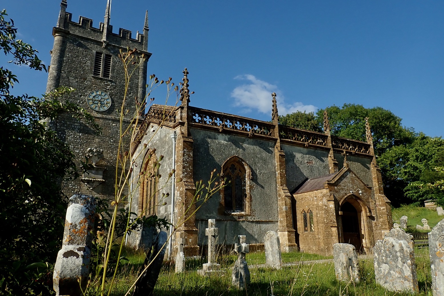
For UK green laning Ordnance Survey mapping is a no brainer, even if you didn’t grow up using OS paper maps and can still read them like a copy of the Beano.
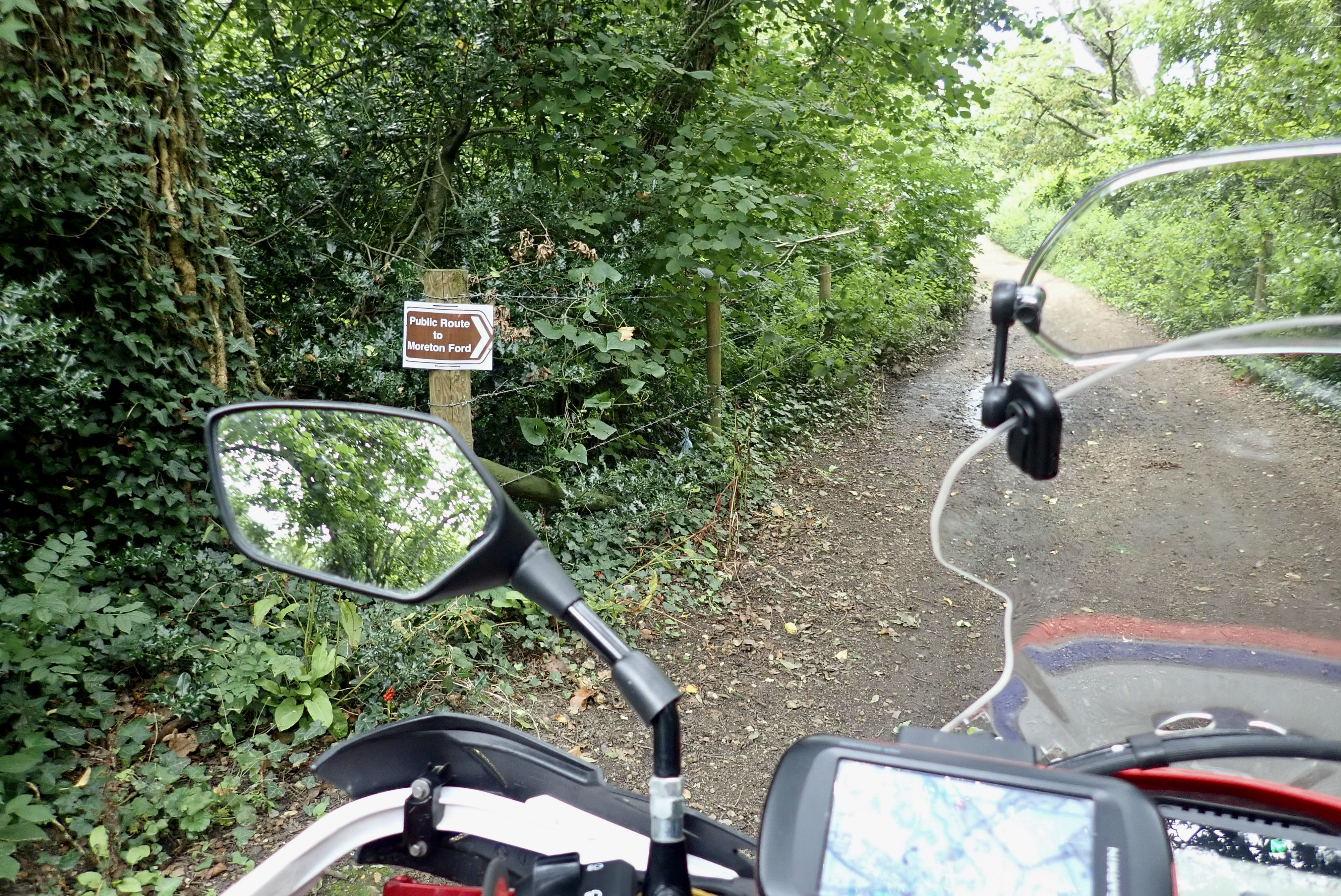
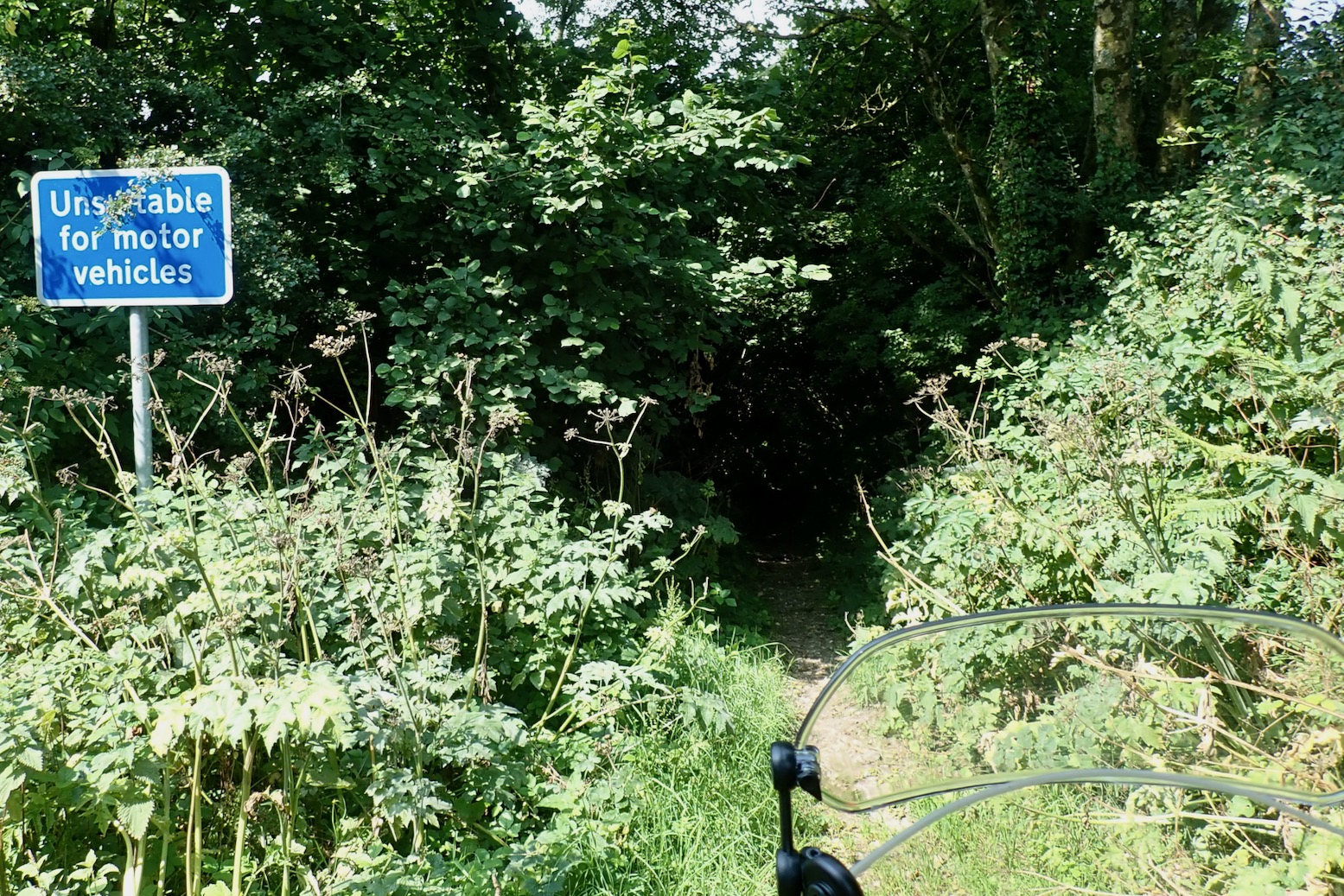
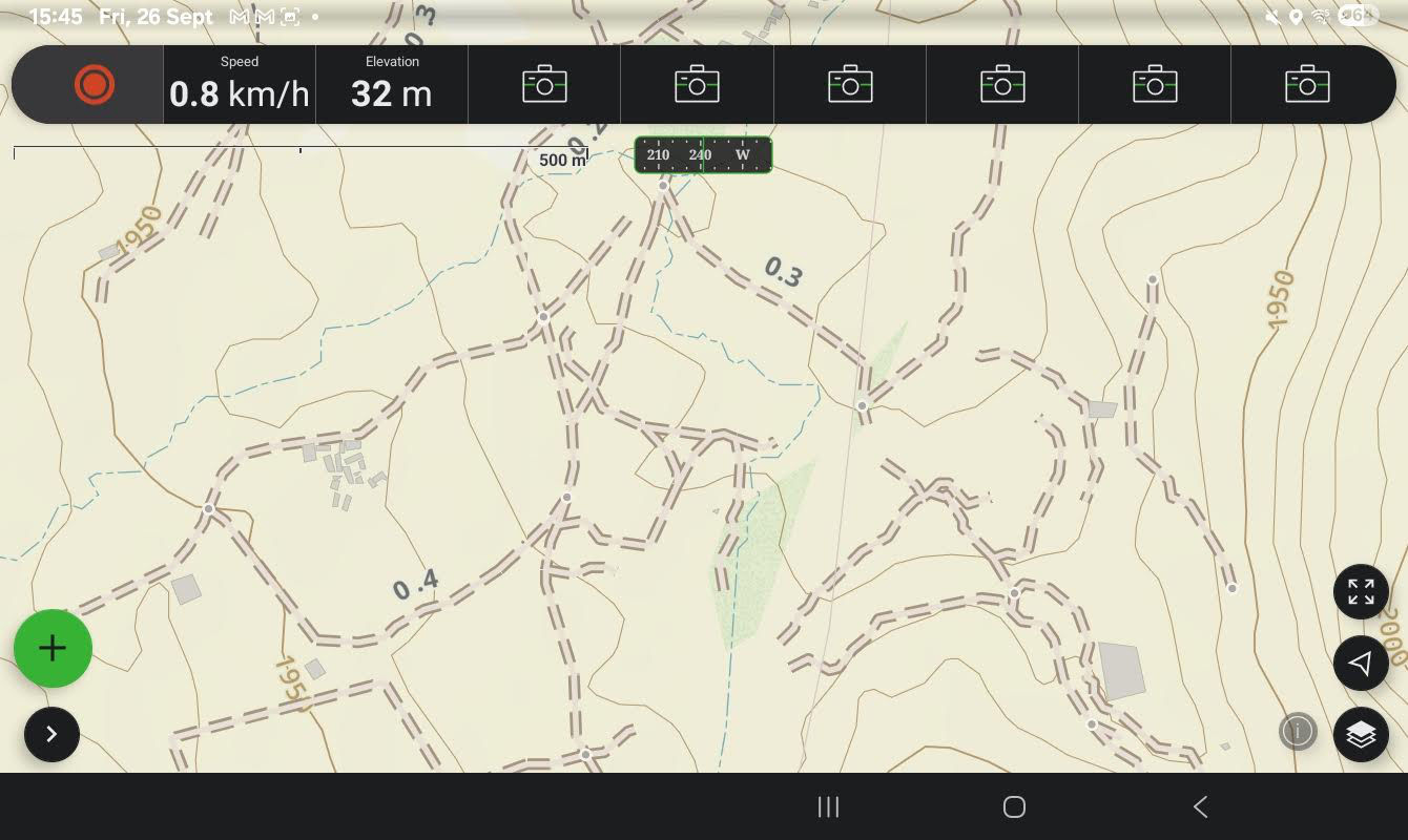
Thirty five quid a year is a great deal if you do a lot of UK outdoorsing in addition to motorbiking, I’ve found myself referring to it nearly daily, either planning MTB rides from home, or when out and about to check directions with the A9 or the Mrs’ phone (it will run on multiple desktops and devices). One reason I stick with my Montana is that it came with a ropey old copy of OS 50k UK mapping (new, an ‘all UK maps’ miniSD from OS costs 300+ quid). On an OS I know what most things mean at a glance, and in the UK Rights of Way (RoW) are important when it comes to touchy Byways and similar off-road trails.
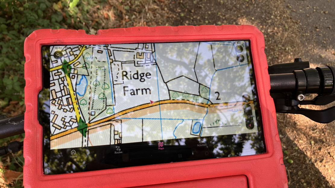
Tap Map and the OS app transitions from the big-picture/motoring 250k map to the well known 50k and 25k sheets, The image on my Samsung (below) is crystal clear, although the red location/direction arrow is fixed at a tiny size (usually in the middle, of course). If you forget your RoW hierarchy, the OS legend tab is easily accessed offline, and downloading a map for offline use is also dead easy, though it’s limited to about 45km wide or ~300mb.

Importing a gpx file is also intuitive and once loaded, you can view an elevation profile in a side bar (like on Garmin BaseCamp and Google Earth), plus do a 3D fly-through over aerial imagery (internet needed). I couldn’t work out how to do this over a less gimmicky OS map, not aerial – I think it’s not possible. Another thing OS won’t do is show more than one of your imported routes at a time. Nor will it do A to B road directions like a sat nav; it’s a recreational mapping app. But using the ‘road cycling’ option under Activities will snap to roads and so could work for motos, though it might be scenic backroads rather than ‘shortest’ or ‘fastest’, like a satnav. One thing I often use on my Garmin is tapping the screen to instantly get the straight line distance to a nearby point from my location. On the OS app you have to go to Create Route, then select a non trail Activity like `Paddle’ or ‘Other’ which won’t snap to a path or roadway.
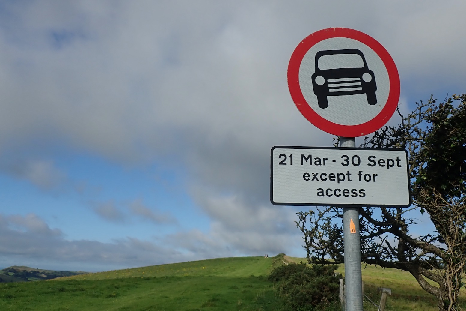
This ‘snap to path’ (or byway) feature can be hard to control off road, though I’ve learned small hops work. Set on MTB (roads/tracks), it routed me into an army tank training area, though it did try and keep me out of a nearby firing range – and to be fair the map was plastered with ‘Danger Area’ labels and irl there would be similar signs and fences. Recording your own route, saving it and sharing/exporting is also intuitive.
Because the mapping is so familiar to most Brits, for UK use it’s easy to get your head round the OS app, and unlike DMD it knows when to draw a line with ‘just-because-we-can’ added features which can just go too far. But other Open Street Map based apps will have endless POIs, and more functionality, like directions. You can of course switch to other apps on your device to find nearest fuel, for example.

GaiaGPS ($60 p/a subscription)
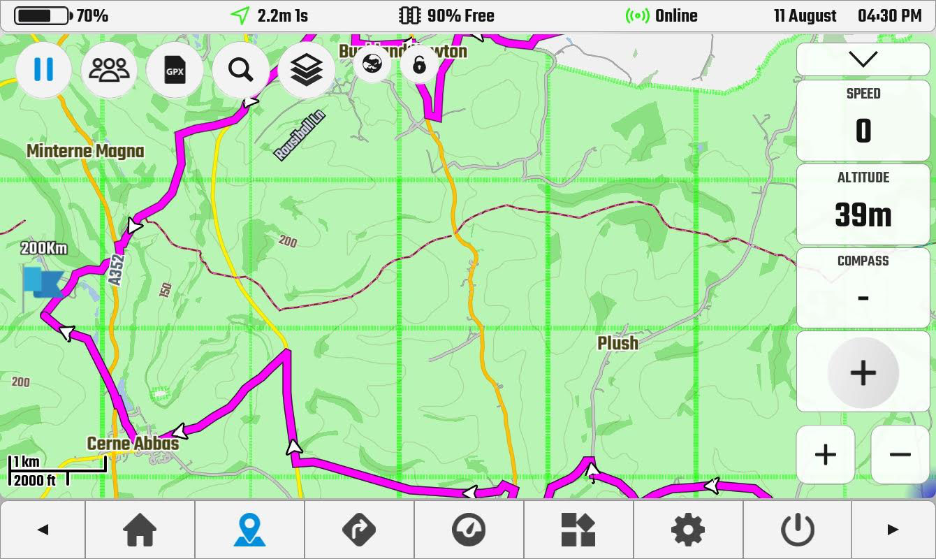
Produced (or owned) by Outdoor magazine in the US, normally I’d not look twice at Gaia, assuming, like other US entities, they don’t ‘get’ mapping in my parts of the world. But their Morocco Topo map is preternaturally better than many other also OSM based maps, showing loads of real trails with outstanding legibility. Someone there gets how to design a map. And there are loads more in the layers.

Gaia: nice enough but unlike OS, you can’t tell the BOATs from the trees.

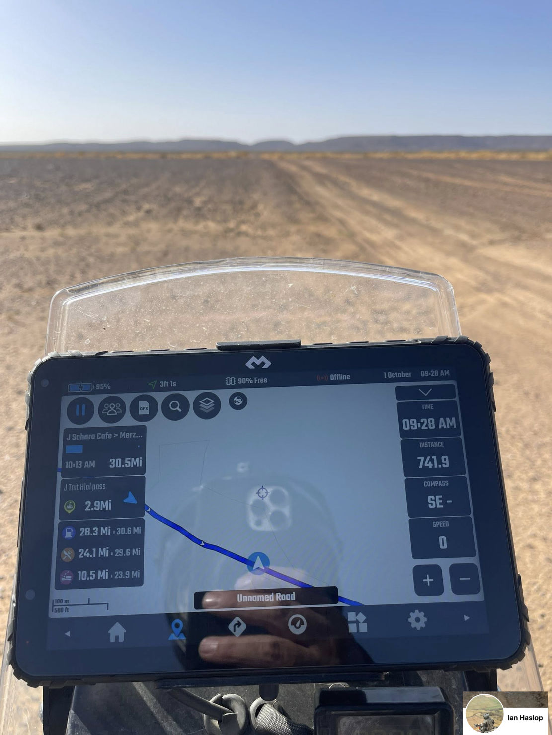
While offering routing options for every scenario under the sun (‘ice fishing’, ‘turkey hunting’, ‘streaking’ and ‘white water’), the app interface is clearly pitched towards hikers who can easily read the screen on the move with device in hand. On a moto (or anything similar at speed) the info across the top (speed, distance, etc) is just too small to be easily read and can’t be enlarged. Even the Montana is better at this.

Top info data designed for phones in walker’s hand; barely readable on a moving moto

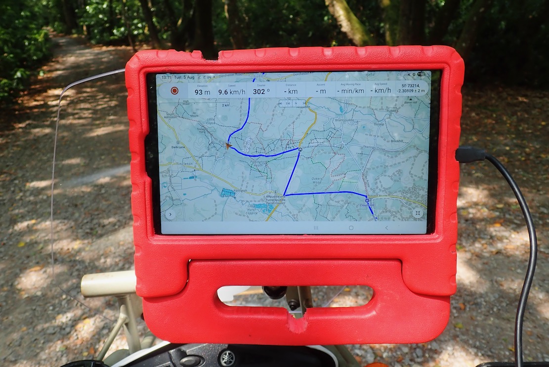
But it sure is nice to have all that space to foresee the twists and turns of a loaded gpx trail, and with good brightness. Wearing a dark main visor on the HJC took the edge off this; next time I’ll fit the clear visor and use less good but in-built tinted visor.
When I’d done enough green lane exploring I decided to try out the routing feature to get me home. It didn’t seem to work, even when set for ‘buffalo rustling’. I worked out later you need to tap the map exactly on a road for it to calculate a route.
There’s probably a very lengthy list of other features on GaiaGPS, but me I’m just navigating trails from A to B, not trying to calculate my average elevation while ice fishing before the sun sets. All I know is that the Morocco map is one of the best out there.

DMD (£19 p/a map subscription)
Made by motorbikers and loved by motorbikers. How would DMD2 stack up for UK green laning? £19 is quite cheap but this is only to open the maps and route yourself – good enough for most. There’s a Roadbook plug in to save on lunchboxes and rolls of paper, and an OBD plug which opens up the whole world of bike telemetry – TPMS, coolant temp, mpg – a lot of stuff that’s probably on your dash menu, assuming you’re not riding an air-cooled dinosaur.
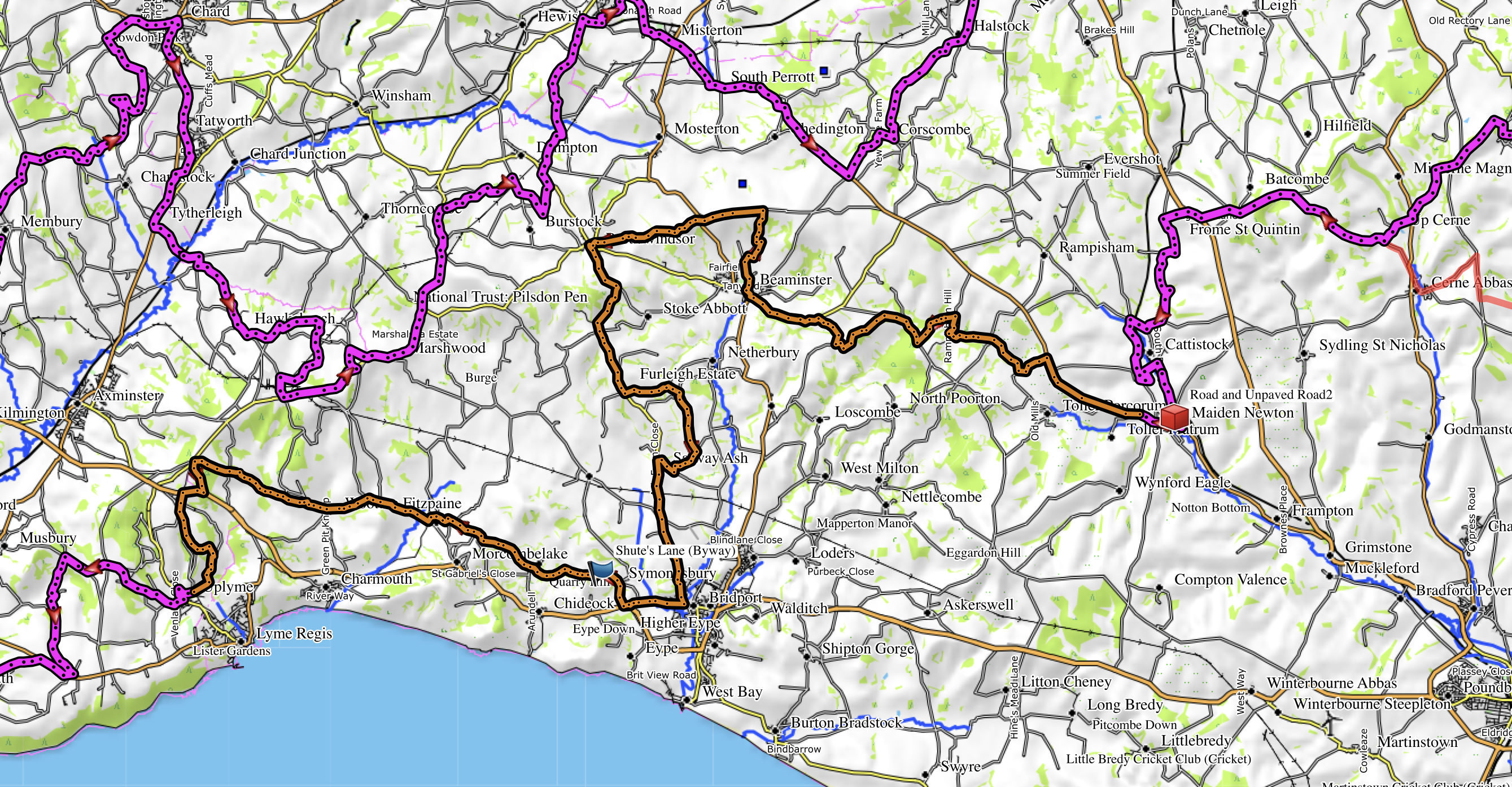
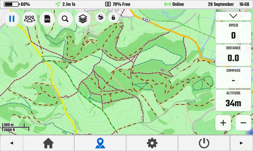
You download maps by the country. I did UK and Morocco, some parts which I know well, and did a test. It looks like DMD have simply loaded everything off the OSM base map with little filtering. In Morocco it’s evident from the many disconnected scraps of track added by pedantic contributors misinterpreting aerial imagery or the meaning of useful contributions. What use is 450m of ‘track’ on a remote hillside going from nowhere to nowhere? Actually, I see Gaia (below right) is the same, but makes them far less conspicuous – the key to legible cartography – while often managing to get the real, useful or main tracks right. This extraneous clutter is something that’s unique to little-scrutinised Morocco on OSM. In Europe, such nonsense would never go unchallenged, as the UK map below shows.

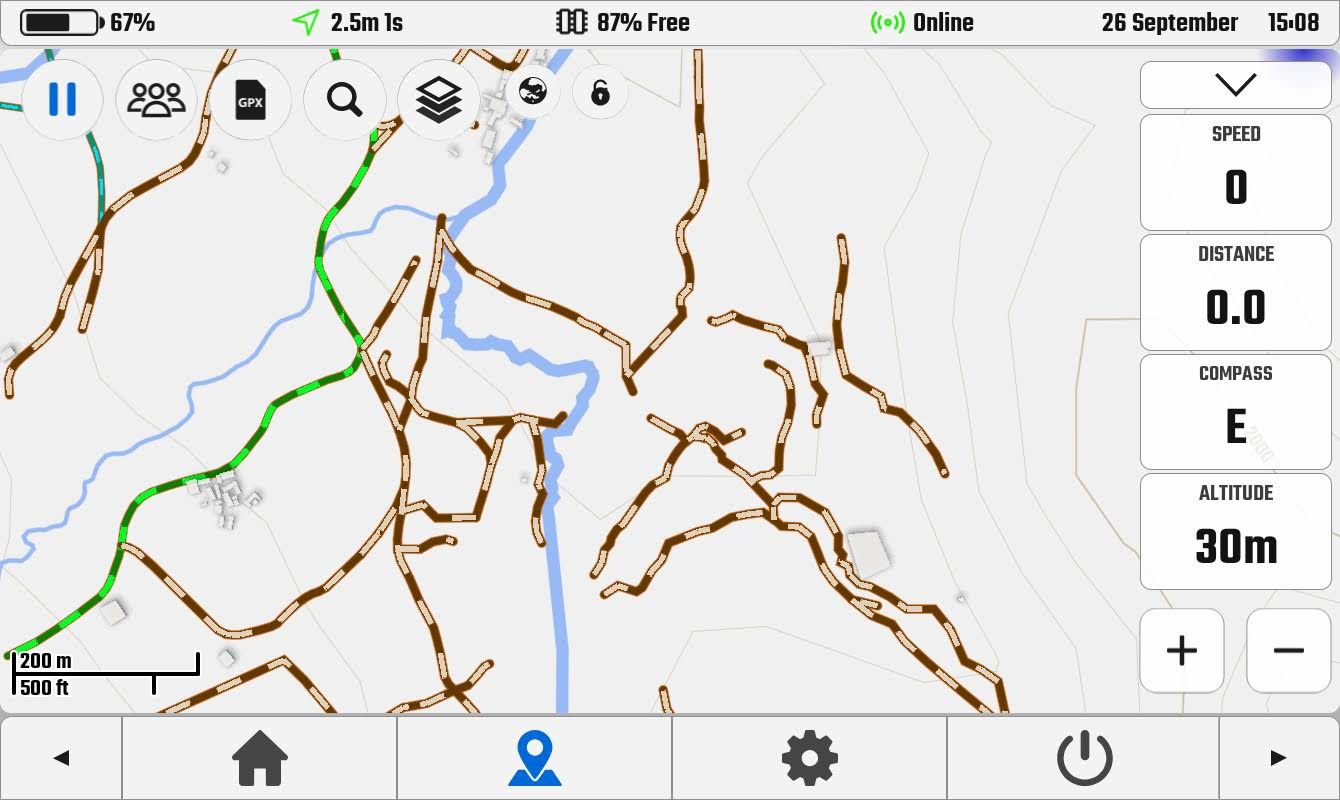
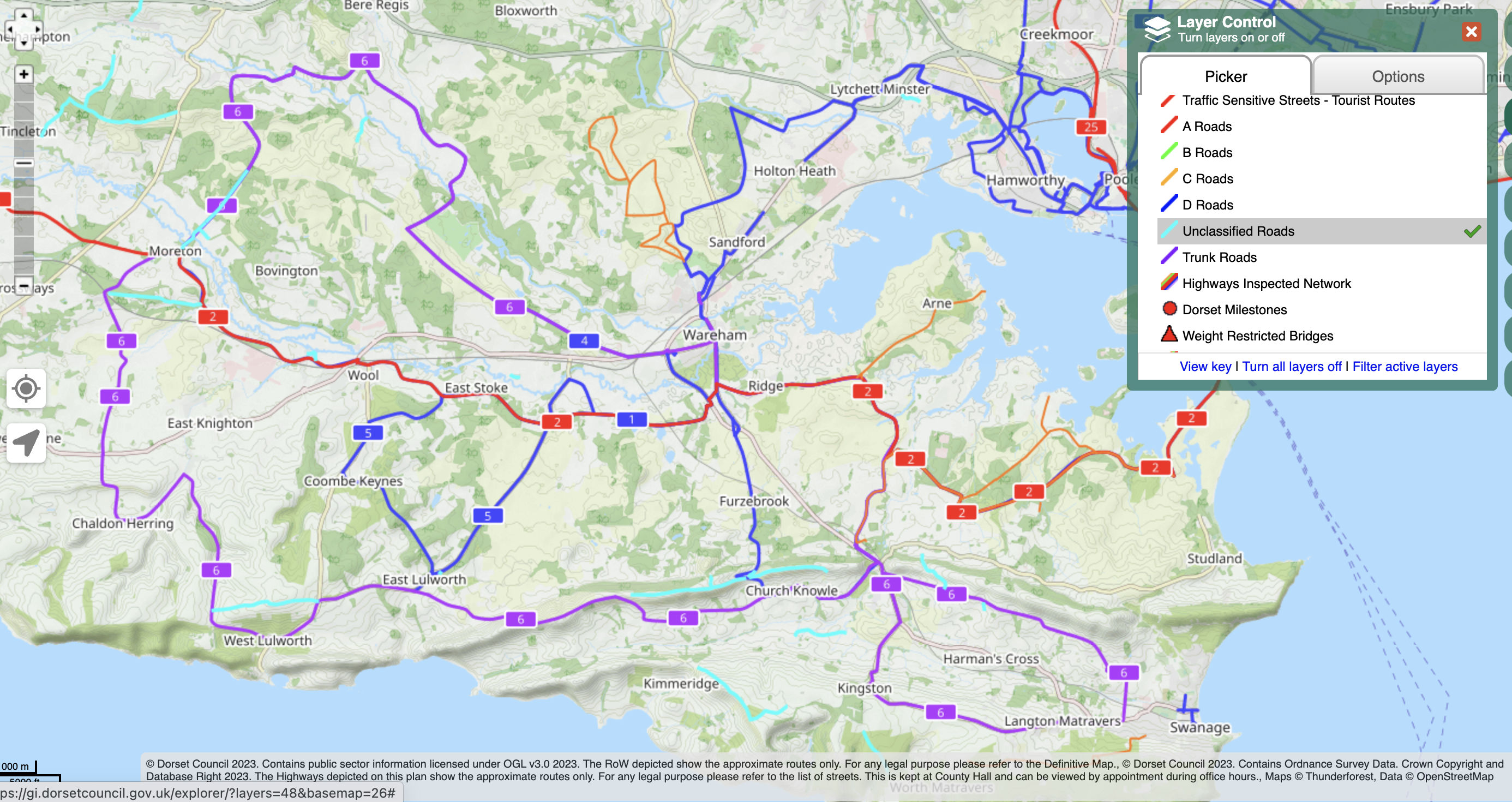
The comparative screenshot in the UK below looks a bit skimpy compared to the Gaia and OS versions above, but two zooms in shows a lot more track detail. I do like the ‘globe’ icon which toggles when online, most usefully satellite view as well as ‘OS Maps’ in the UK (not real OS maps, as above, who protect their copyright like the crown jewels), plus wind, rain and temperature (aka: ‘weather’).

DMD2 UK map. Not so legible

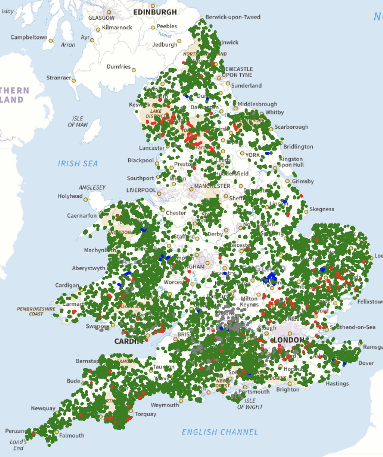
Even then, I find DMD2 look cluttered compared to the Gaia and in the UK would obviously use OS, Amazingly, there is no key or legend built into the app to work out what the multi-coloured tracks mean. Searching online gives this page, and a DMD Facebook user condensed it into the image below left.

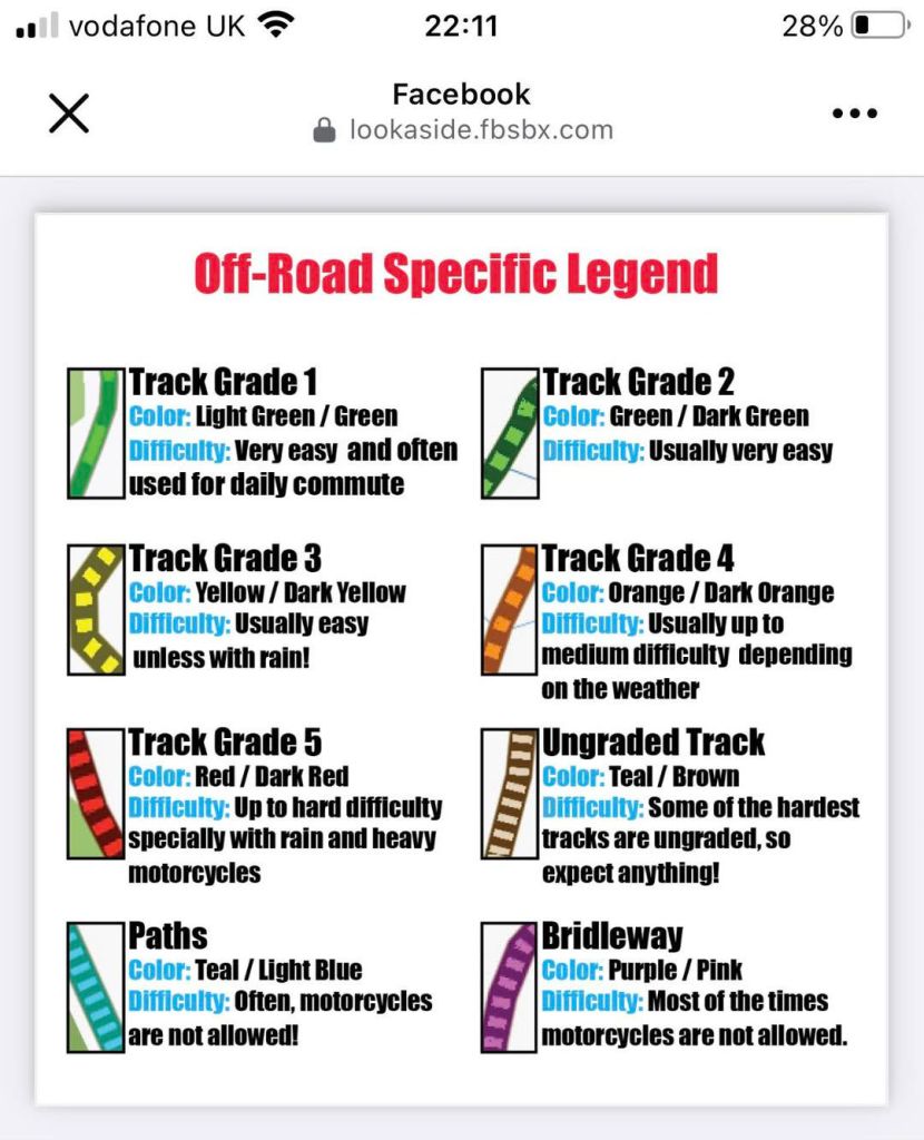
It seems difficulty – always subjective, weather and moto dependant – is prioritised over rights of way, but my UK DMD2 map certainly doesn’t relate to what I know locally. Green and blue are footpaths, purple is supposedly a bridleway, but rarely corresponds with OS data. Meanwhile, there are masses of brown tracks (as in southern Morocco). Of brown tracks DMD says: …it should be unpaved but no further information is present. Difficulty: Some of the hardest tracks are ungraded, so expect anything!‘ Afai can see, there’s no designation for a legal UK Green Lane/Byway. I know the few around and they’re all brown or don’t exist. So without a verified gpx to follow, DMD2 would be unusable for off roading on UK Byways, but in Morocco (for example) a brown track ought to be a real track. Just make sure it is connected to other roads or trails.

I’ll be trying to get to grips with DMD2 and Gaia on my tablet this winter, while having my long proven Montana loaded with a couple of good maps as back up.
More later.

300L: The Purbeck Trails

See also
Honda 300L main page
Dorset’s Great Western Trail

Isle of Purbeck according to Dorset CC’s Definitive Map. Free for all online, same as most county councils.
TRF GRM: 6000 miles of green roads

After my enjoyable runs along the TET’s Great West Trail in Dorset I cracked and joined the TRF to verify what else there might be in the area, particularly around the Isle of Purbeck. The TRF’s websites look smart, so does their quarterly Trail magazine now edited by Jon Bentham, formerly of Rust Sports, plus there’s a regular column by TRF ambassador, his excellency Austin Vince. They say membership has doubled in recent years to 8000 – now 8001. You wonder why; it’s not like trail biking in England and Wales has become popular all of a sudden, has it?
Of course what I’m really signing up for is not so much the Brotherhood of the Byway, but access to their Green Roads Map (above left), covering England and Wales. It’s similar to a local council’s Definitive Map (top of the page; explained previously) but maintained and updated by regional TRFers.

My Purbeck recce was largely inspired by finding a richly illustrated 1960s guidebook called Dorset, the Isle of Purbeck (above) by Rena Gardiner. One might call her artistic style expressionist (like Van Gogh), and in her prime she was a one-woman printing press and former Lambrettista. On my rides through Purbeck I’d pass many of the places she illustrated.

One thing with Purbeck as opposed to inland Dorset which the GWT traverses, is that it’s a lot more touristy. The road from Wareham via Corfe Castle to Swanage Bay is often clogged, probably like much coastal access in the West Country at this time of year. That means ramblers and dog walkers are afoot, not all of them conversant with the legal status of Byways, ORPAs, collectively: Unclassified Country Roads (UCR). It still felt unnerving setting off to trail ride in sleepy, bethatched Dorset as opposed to the peaty wastes of mid-Wales.

The rolling Purbeck hills below Kingston with Corfe castle straddling the gap.

After the hottest June since the Devonian Schism, followed by the wettest July since the Paleogene Upheaval, the Purbeck Hills were greener than a car-sick toddler. I left it a few days for the jet stream to shimmy off somewhere else, but it’s now August and upcountry campervanners are parading around with their dogs. So I decided to recce some bits by stealth on the MTB. It was a good idea.

Grange Arch – said to be the inspiration of Ian Fleming;s ‘arch villains’.

Right on the eastern edge of the Lulworth Firing Range army land, Ridgeway Hill leads east from Grange Hill viewpoint to Corfe Castle (left). At a deliriously long 4.4km it’s probably a county record. After a shirt while it passes the 18th-century folly of Grange Arch (above), looking down on Creech Grange, as drawn by Rena G, below.

The name is Purbeck, James Purbeck.’ Nope, doesn’t work.

Creech Grange was once the family seat of the Bond family who still own a lot of land on Purbeck, and after whom Ian Fleming named his famous agent, 007. Before attending the towel-flicking precincts of Eton, fledgling Fleming endured the character-forming torments of a Purbeck boarding school.

But what the TRF’s GRM or the Dorset DM don’t tell you is that the first 1.75km of this UCR, from the viewpoint past the Arch to a gate, is closed to motors from March till October. (I sent this info in to GRM updates but as before, no response.) But with the clear suggestion of (albeit seasonal) vehicle access, these two signs (left) were the only incontrovertible admissions that rideable Purbeck Trails even exist.

From the 500′ ridge there are great views south to the Jurassic Sea and north to Poole Harbour. At a gate an all-year UCR branch comes up from Stonehill Down to the north (above). It joins the Ridgeway and continues east (below) to cross a road snaking over a dip. Nice, wide open, hill top trail riding. Plenty of room for all.

Ridgeway hill east to Corfe. Let it roll.

At the road I chanced on the giant hillside lizard (left) that made the news the other day. Having pedalled the following section a few days earlier (shoo-ing away a herd of cows blocking the gate), I didn’t have the heart to re-ride it on the moto, as being close to Corfe’s congested campsites, it’s relatively busy with high summer ramblers. From the top the wide open trail looks down on Church Knowle (below) and the 700-year-old Barnstone Manor which, according to the DM, is Britain’s oldest inhabited house.

This UCR eventually drops off the spine of Knowle Hill and finds a back way into Corfe Castle, catching the castle ruins from a little seen aspect (left).
Built soon after 1066 and a strategic Royalists hold-out during the English Civil War, it was besieged and finally destroyed by Cromwell’s New Model Army in 1643.
From any angle the imposing castle towers over the Purbeck Stone clad village that takes its name, and in her book Rena G expended many pages on both (below). You wouldn’t know it but Purbeck has several still active quarries and many of England’s medieval cathedrals were clad in distinctive Swanage marble. Unusually, the roofs of Corfe’s houses use thick, Purbeck stone tiles.

Corfe in August is not a place to linger, unless you’ve no choice in a steaming traffic jam. On the far side of the gap which the castle once defended, the ridge rises again towards Swanage. Here Rollington Hill UCR switchbacks south over the ridge via a farm of that name.
I pull up at the turning where a sign (left) glared ‘No Access to Water Park, Turn Around’ along with a No Entry sign for good measure. I hesitate. I’m pretty sure it’s a public right of way and I’m not lost so I ride up the track towards the farm yard, any minute I’m expecting an ‘Oi!!, gerrof moi….’. With relief I reach the safely of a gate where the track rises up to a hilltop mast.

Coming down Rollington Hill with the castle in the background.

At another gate a grumpy looking rambler is tucking into her sarnies, blocking the way. I give her a cursory nod and use the walkers’ gate instead. Darlingly, this is a virgin trail I didn’t pre-ride on the MTB, but today am emboldened by a novel ruse: I’m dressed in my cheapo overalls which I like to think make me look like a farm worker looking for lost lambs, or a contractor for English Heritage seeking new Areas of Outstanding Natural Beauty. And it worked too. A few days later I was connecting another trail near Tolpuddle when I came across some young Hiluxers doing a suspension twisting turn in a bomb hole. Though they had just as much right to be here as me, they initially mistook me for some sort of warden.

Trail Warden coming through!

Some 1300 metres later I’m on the asphalt and riding back into Corfe. Southwest of here lies the hilltop village of Kingston with it’s old-looking 19th century church poking out of the trees, and the ivy-clad Scott Arms pub below. According to ancient genealogical conventions, if I whisper the secret family motto I’m entitled to a free pint and a quarryman’s pasty.

Kingston

Kingston was another popular subject for Rena Gardiner, particularly the ‘mini cathedral’ church in the New English Style, whatever that was. Inside there’s a superb array of stained glass from which it is fun to play Guess the Biblical Figures from their accoutrements. See how many you can guess.

Two UCRs span out near Kingston, but were it not for the GRM or DCC DM, you’d have no idea you could legally ride them. A footpath or bridleway sign might be the best you’ll see, which are clearly no invitation to motards. This patchy signage to discourage motos is to be expected. If you want to trail ride in the UK you need to ‘do your own research’ as Q-Anon-ers like to say. Fair enough – any journey or adventure needs planning.

South of Kingston an ORPA (UCR) turns off a valley running south to Chapmans Pool on the coast, and traverses some cow fields before dropping off the ridge along a gully which lead to what looked like an isolated farm on Google Earth.
On the way I passed an ambiguous sign (left) which I’ve now taken as code for a UCR. On the pushbike the gully gets a bit stony, so easier down than up on a gangly moto, but the ‘hillbilly farm with rabid dogs’ was just a harmless terrace of stone cottages before a road turned up to Renscombe Farm and Worth Matravers beyond.

I’ll come back on the 300L one time for that one. Another UCR runs west of Kingston to Smedmore Hill, navigating tall grass and deep ruts (above). It arrives at a gate near popular Swyre Hill walkers’ viewpoint, but a bench here overlooks Kimmeridge Bay and distant Portland Bill with views just as good (below). The GRM shows it as green (‘full access’) but following notes say the west end – a stony descent towards Kimmeridge village – is ‘non-vehicular’, so I guess it’s a legal dead end on a moto. On both the GRM and Dorset CC maps, the last kilometre of this UCR strays oddly across a cultivated field before rejoining the actual track close to the road. Could you push your bike down to the road to make the connection?

View from Smedmore Hill over Kimmeridge. But the moto trail ends here.

One UCR I definitely won’t bother riding on a Honda runs via East Orchard Farm just out of Corfe. Near the end of the road to Blashenwell a private sign advises ‘No Through Road’ (left). You can see curious holidaymakers straying out of Corfe and three-poing turning in Blashenwell farm yard, though technically there is a through road via East Orchard, it’s just a muddy UCR.
At a bend before Blashenwell, easy cow field tracks and gates lead to East Orchard Farm, but from here the UCR – signed as a footpath – becomes an overgrown, muddy stream bed, in places barely wide enough for an MTB. I get nettled and scratched and sodden. ‘Deep mud on some sections caused by agri-traffic…’ warns the GRM, but you wouldn’t even get a farmer’s quad in here. Only motos will make it worse. With the racket and spray a moto would make trying to push through the 500m to West Orchard Farm, honestly, it ain’t worth it, even if it’s allowed.

East Orchard? Leave it – it ain’t worth it!

My recce of the Trails of Purbeck is done: adding up to less than clicks (seasonal restrictions permitting) or nearly 6 miles off-asphalt over as many separate trails. It sounds pathetic but, like the GWT, on road or trail it sure gets you into some lovely countryside.

Just beyond the ‘Isle’s’ vague western perimetre near Lulworth Camp, another UCR called Daggers Hill Drove scoots up and over a hill in 2.4km. On top an army Landrover was watching, but you could drive this easy track in a Micra to avoid the traffic streaming out of nearby Lulworth Cove.
North of here, near the little-known Winfrith nuclear plant which they’ve been decommissioning for 20 years, is a 2km trail west to Redbridge. I took a chance down it coming back from the GWT a few weeks back, only to discover later it was a kosher UCR after all. I must be getting a good nose for Dorset UCRs! Reversing it today while dodging a few big puddles, I pass a fellow trail biker on a KLX250! Good on him, exercising his ancestral right to ride this route.

‘Public route’ on Moreton Drive – code for ‘road’

The day’s last trail was an intriguing 2.3 clicks straight through a forest north of Moreton village. Only, not for the first time I didn’t scrutinize the map forensically enough and clock the F-word buried deep in the detail. F for ‘ford’ that is – across the River Frome which delineates Purbeck’s northern boundary. I rolled up to a scene of kids splashing about while parents scrutinised their phones on deckchairs (below)
I observed the kids’ knees as closely as was appropriate, and in my head extrapolated probable leg length from teenage anatomy (based on current dietary trends) and decided not to risk it, even pushing. Deep fording can ruin engines and is something I save for absolute necessity. The other day our old Rover car died after bombing through a six-inch ford near the house. It dried off and restarted after 15 minutes, but now I crawl through at walking pace.
Had no one been around, at Moreton I might have hopped onto the footbridge which looked rideable on a small bike. I’ll test wade it one time. ‘Deep ford in winter’ warns the GRM. Deep enough in summer too.
Not to be thwarted, I scooted around a couple of miles to the northern end of the Moreton Drive – you could ride it on a RD350LC – and arrived at the ford from the other side. It didn’t look any shallower, so I turned round and headed home.

Riding back through Bovington Camp I clocked a Costa / Greggs combo – always good to know out here in the sticks.

I also passed the point where, in 1935, T E Lawrence (left) had his fatal crash on what was his seventh Brough Superior SS100 – the ‘Rolls Royce’ of motorcycles in the inter-war era. Lawrence just left the military a few months earlier and was heading back to his humble cottage up the road at Clouds Hill. You probably know the rest.

T E Lawrence’s grave in Moreton cemetery

At what appears to be a roadside tank training viewing area/car park, there’s a low-key memorial stone by a tree, plus a well-written info board about Lawrence (above right) which also addresses the enduring ‘Catchpole Conspiracy‘.
It turns out Lawrence is buried at the cemetery back in Moreton, and it’s said the neurosurgeon who attempted to treat his terrible head injuries went on to recommend the use of crash helmets for WW2 army despatch riders, and here we are today.

300L – Dorset’s Great Western Trail 2

CRF300L Index page
Dorset’s Great Western Trail 1

The other day’s inaugural run along the TET’s Great Western Trail in Dorset was unnervingly easy and enjoyable. I wasn’t wrong footed and barely put a foot wrong. Today’s westward continuation was going to be my difficult second album.
For more afteride bike impressions, see bottom of the page.

Rights of Way (skip if boring – E&OE)
The last time I looked into it, to establish the status of a right of way in England & Wales (Scotland is a write-off) you had to inspect a county council’s definitive or ‘master’ map (DM) held in its offices and viewable by appointment. This is why people ride wasteland, join clubs or go to Morocco. Now we have the internet county councils publish this map online for all to view anytime for free. Vehicle access wise, the map will identify the very few Byways (aka BOATs), as well as much more numerous Unclassified Country Roads, (UCRs) which I called ORPAs (‘other routes with public access‘, on OS maps). But according to this typical statement, the Dorset Definitive online map (example below) doesn’t have the legal status of the county’s official Definitive Map held in a glass vault in Dorchester Castle. So while you cannot fully rely on the online county master map, it ought to be more up to date than the latest OS edition and is free.
Perhaps the best online map for trail biking is produced and maintained by the Trail Riding Fellowship. It’s viewable at greenroadmap.org.uk where it says guests (non-TRF members) can register and view the map with limited features, but I couldn’t manage it. This is why we like the simplicity of UK TET with the GWT. One 3800-mile gpx download and you have enough to be getting on with.

Only one Byway in red, but quite a few ‘UCRs’ in light and dark blue, some of which join through.

These UCRs or ORPAs – shown on OS maps as small red spaced dots on 50k maps • • • • , or green on 25k • • • • – have been a bit of an eye opener to me just lately, still stuck as I am in the 1980s RUPP era, but ORPAs have been on OS maps since 1997 and RUPPs were downgraded or mass reclassified as Restricted Byways by 2006. All this has passed me by over the decades. Clearly I’ve spent too much time in the desert where, by and large, an RoW is determined by the terrain and you and your vehicle’s ability to navigate it.

UCRs might be sealed or just tracks, passable or otherwise, but providing they don’t dead end at some backwoods ‘dueling banjo’ meths compound (as I stumbled on the other day), you have the promise of a through route. So I can now verify that track I followed in mid-Wales the other week was a UCR and doesn’t even get any special annotation to the Powys Definitive online map. As DK and DW, a pair of intrepid travel bikers and TRF lifers clarified to me “In 99% of cases, you can legally ride a bike on a UCR“. When you view the Dorset GWT on an OS background, you can see it aligns with UCRs and the much less frequent Byways as well as regular metalled yellow ‘C’ roads.

The TET gets offensive
The forecast was a bit shaky; I’d probably get a hose-down at some stage but would dry off eventually, given global climate patterns. I was planning on reaching Lyme Regis, about the same distance as the other day, though something about today’s route looked more challenging and maybe more typical of the GWT.

Maiden Newton to Lyme – only 36 miles. No biggie then…
I set off along the same trail through Sares Wood to Tolpuddle to make sure I didn’t make it up.
That’s more like it! I feel at home now.
I get in a tangle around Dorchester and then miss the road to Maiden Newton; I find I often mess up the nav when I half know the way; a little knowledge is a dangerous thing, grasshopper. To make amends I consider this shortcut down a hillside to Maiden, but at a gate I re-scrutinise the Garmin’s OS map and it’s only a Bridleway, which I confirm later on the county DM. Can’t be going there.
Back on the GWT, I turn onto my first trail, sorry – unclassified road. I’ve made the Garmin’s GWT tracklog green to make it easier to see.
I can do this!
I think ‘Public Route’ may be a kind of ORPA. Back on the asphalt, my front tyre seems to be making a lot of noise. It was 19psi this morning, not a pressure I run. There’s a lot of debris down the middle of these hedgebound, single track lanes. Have I got a slow puncture on the presumably crappy OEM IRC tyre? (Yes). I’ll top up at the next servo.
Many roads lead to Hooke. I wonder if houses in Poorton are cheaper than Powerstock? Hooke in the Domesday Booke
Hooke’s dinky, red sandstone church of St Giles. ‘Only’ 600 years old.
Unsuitable you say? Hold my beer!
I still find it hard to believe I’m allowed to actually ride ‘footpaths’ like this. I am what I am and I’m one of the sheeple ;-)
I emerge by a field where hidden ruts alongside a 2000-volt electric fence help concentrate the mind.
First gate of the day – good for the abs.
Here comes that weather.
I pass through Beaminster town with half an eye out for an airline, before burrowing back into the undergrowth like a motorised hedgehog.
Never seen a BOAT sign before. Encouraging.
Oh dear, what’s up now?
I’m knocked back by a couple of limestone rock steps on a stoney slope. It would have needed quite a launch plus some artful finesse – not a combo me or the 300L share at this time, thanks for asking. Alone, a bad fall could end… badly. The TRF call this lane an ‘old favourite’. Not me.
I don’t even think about it and walk the bike up in 1st, but it gets jammed on the bigger step, then the chain comes off. A bigger tyre with less air might have clawed its way up. Never had a chain derail on a moto but at least it’s not broken nor has cracked the crankcase (had that on a KLX once – ruined engine). Luckily, this time I left home with tools. I drag it back down – this is where old-school tubular rear racks pay off. I prise out the very slack chain which easily rolls back onto the sprocket. Did the derailing stretch it so much? Along with my imminent flat tyre and the darkening skies, I’m a bit unnerved.
Nearby there’s evidence that fourbies struggle here too.
This lane – Meerhay or Mintern’s Hill (50.825716, -2.733489) throws me, but there’s no mention of it online. Even coming downhill I’d think twice, but it must be just me and my age.
Returning to Beaminster, a delivery driver stops and asks about getting through. He knows about the BOAT and meanwhile, points me to a car garage in town.
I pop in for a shot of air, just as the clouds unzip, let loose and shake off. Aired up to 30psi to get me home, I pretend to fiddle with the GPS until the downpour passes.
I’m aiming to rejoin the GWT as it heads down to Bridport. At a crossroads I stop and tighten the chain with my new Rally Raid tool. It took 2.5 full turns of the nut. WTF? It wasn’t hanging off after a wash and lube two days ago. Is the Regina suddenly shot at just 1500 miles on this 28-hp donkey? Very odd, but better to know now than on Jebel Saro.
Beferned phone box. A sign of the times.
Beferned 300L. Not more of the psychedelic type, I hope.
My mojo has rebounded so I continue west out of Bridport towards Lyme on the GWT. North of Symondsbury I come across a ‘closed road’ sign. Shame, it’s a nice track – Hell Lane in fact, as featured in ABR magazine a few years back.
It’s a ‘public route to a public path’ which must mean something legally.
Had I read the TRO more closely I’d have seen it expired last year. Specsavers, I know, but ditch the red sign already!
I try a way round to the north but I’m blundering around. This isn’t a moto RoW.
The chain thing and all the rest has worn me out so I scoot south to the seaside for a seafood snack by the seashore. Let’s try West Bay. I was hoping for calamari at a quaint 1770s cobbles and thatch Smugglers Inn – I get 1970s bucket & spade in batter with chips.
Little West Bay seems to be a bikers’ hang out.
Heck, they even have a Helmet City! The sweet smell of creaking leather…
Recognise that cliff?
Yep it’s ‘Broadchurch’. Remember all the hype over that show?
That night a nearby cliff slid down and made the news. That would have been a heck of a reverse tsunami.
A couple of weeks later, after a lot of rain, West Bay / ‘Broadchurch’ cliff, itself had a big rockfall.
Lyme in the far distance, one for next time.
I head home on backroads. It’s Chesil Beach! Never been there neither, here’s my chance.
Gravel; large amounts. ‘The origin of the beach is a matter for scientific speculation‘ says an info board.
Bit harsh.
Backroading homewards, near TE Lawrence’s grave, two roads diverged in a wood and I took the ORPA less traveled by. And that has made all the difference; I got home 4 minutes earlier. I’ve done 100 miles and I am now quite tired.

After thoughts on L
I’m getting a feel for the 300L off-road. No, really! The stock gearing feels spot on for this sort of riding; a full load might change that. But the fuelling is a bit on-offy in lower gears; good for engine breaking. I recall the WR250R (same hp) had the same issue and there were alternative, slow-action throttles or some such available. It’s an efi thing.
The stock tyres are good but I don’t think will prove very durable; iirc my CRF250L IRC rear didn’t even make 3000 miles in SW USA. As said, the Rally Raid suspension seems dialled in, or if not it won’t be hard to do so. I notice the throttle cables jam solid on full left lock as a result of the taller Renthals; to be expected for a stoop-free standing stance – without risers! Easy to fix or not that important. On the road it zips up to an indicated 60 – going faster needs a big yank on the handle; it’s a 286cc after all.
I do wonder about this 19er front business, but trying is knowing. In return for on-road stability I hope the steering won’t get too sluggish on the trails. I have a spare front hub which I was going to lace to an unbranded 19-er and flog, but I think now I’ll fit an SM Pro 21 MT (tubeless; and at £170, £50 cheaper than an Excel) instead. Then I’ll have a three-wheel full tubeless set up: 17 + 21/19. The 2.15 SM Pro MT is half an inch wider than the stock 1.60 x 21 which will mean a heavier, wider tyre that won’t help trail agility, but might aid faster, bend swinging stability and wear.

I’m still not fully satisfied with my seat bodge. It has a dip in the front so it’s either fully sat back (OK for high speed) or perched up front. This may be where they shaved it down to make it lower. It would be nice to have a fully flat seat to slide around on to spread the pain.
A mate sent me a pic of his normal L seat (left) and there is definitely more meat to it; he’s my weight and finds it fine. I could’ve got mine rebuilt locally in leopard skin metal flake, but decided to simply buy a new black OEM 2023 seat from Partzilla discounted to $105 (30% cheaper than a red 2021 seat). Add shipping and UK tax and that’ll be about £150. I ought to get most of that back for my low seat.

300L – Dorset’s Great Western Trail 1

CRF300L Index page
Dorset’s Great Western Trail 2

This summer I find myself relocated in the English countryside far from London and with a usable trail bike, not some fraken-mutt. ‘Dorset’s good for green lanes’ I was told, but it didn’t look like it on an OS map.
As it is, I gave up on English green laning long ago, convincing myself that, certainly the southeast of the country was too congested for trail bikers to mix with ramblers, Nimbies, Just Stop Trailbikers and all the rest. I know well it’s the same limited access story – worse, in fact – with river paddling in England. A ride around adjacent mid-Wales a couple of years ago didn’t raise my hopes much either: beautiful country but more gates than Terminal 5 on a bank holiday getaway.
But we can thank the Trans Europe Trail (TET) initiative, based on the successful BDR project across the fabulous western US – some of which I’ve ridden and which may have been inspired by the legendary TAT. Supported by Adventure Spec among others, knowledgeable local volunteers across Europe have threaded together a network of TET routes which you might struggle to unravel yourself using maps. It’s all laid out on a plate and once figured out, TET releases 1000 of miles of trail biking adventures in the form on a free .gpx tracklog to stick in your digital navigation device. See the TET link above. Users send in updates and you can view this post as one. In a way it’s a bit my like route finding guidebooks. There’s also a Dorset TRF behind a private FB page (not all regional TRF groups are like this). I was happy to send a donation to TET.

A mile of track here and there seems insubstantial, but thread them all together and you’re in business, and the road sections give you a chance to recover. And compared to up north, ancient Dorset dodged the last Ice Cap and is thick with prehistoric trails most of which became today’s footpath, lanes, green or otherwise. It means there are enough footpaths and bridleways to share. I also suspect inland Dorset is helpfully overshadowed by its spectacular Jurassic Coast. Add no conurbations away from Poole/Bournemouth, no National Trails, outstanding medieval cathedrals, or even motorways. Things might be different in Devon and Cornwall.
Of course most of England won’t be like North Africa or SW USA where dirt trails can fill a day, but it’s the best we have and gets you out exploring your nearby countryside on your bike.

GWT southern arm

The Great Western Trail is one of two named TET UK sub-routes – an 800-mile loop reaching down from Wiltshire to Land’s End and back. It’s pitched at more agile trail bikes, not giant Advs.
It has a southern arm of about 60 miles from Poole to west Dorset. Being close to it, I set off from Wareham one afternoon on the 300L to see what I might find. I fully expected to encounter frequent or locked gates, road closures (TROs) and maybe even hostile natives unschooled in the legal status of green lanes. I could not have been more wrong.

First, I needed to fill up. The true (verified) mpg was actually 31kpl or only 88mpg. It’s not looking good for a true 100mpg
I’m trying pricier E5 this time. Some say it’s better all round, including mpg.
But 99 octane? I never knew there was such a thing away from a drag strip. No wonder the planet’s on fire.
A fellow L-head told me there’s a setting on the dash to show volume consumed since last fill; a more useful way of gauging range once you’ve verified your capacity (13.8 litres or on my Acerbis). Actually my bike seems only to display gallons, maybe because it’s set to miles, but my volume is 3 Imp gallons.

Is the bike running smoother and pulling better on E5, or do I just think it is?
Still, it’s nice to be bimbling along deserted backroads and heading into the unknown.
North of Bovingdon the tracklog flicks left up a wooded track.
It feels deeply transgressive to be riding here, and in sleepy Dorset too, not the North York Moors. Can it really be a right of way?
Looking later at a 50K OS map, red dots indicate ‘other routes with public access‘, or ORPA as I will now call them (below), along with the better known BOATs and RUPPs. Never knew that one, but I wouldn’t be surprised if like some of the latter, an OPRA does not necessarily indicate a vehicular rights of way. On the day, how can you tell? You have to hope the TET Linesmen did their homework and the status is unchanged.

A very pleasant 4km trail through the woods leads to the famous village of Tolpuddle.
Home of the Tolpuddle Martyrs, hard-up farm workers who, following a pay cut in 1834, formed a legal workers’ union but got trapped and 7 years transportation for ‘swearing a secret oath’. Again, you’d expect a story like this up north, not in quaint Dorset.
The TET takes a bridge over the A35 and winds its way along farm tracks.
Surely any minute now I’m going to get harangued by some angry bloke in a tractor?
My first gate. Here we go, I thought…
But what can be better than a lonesome track winding its way down a grassy valley, like a scene from the Hobbit.
Down the bottom some blokes reposing by a pond gave me a chummy wave. Later on, some dog walkers did the same. Where are the brandished fists? Have I unknowingly brushed against a psychedelic fern and slipped into a parallel universe?
The post office in Milborne St Andrew after a shave and a short back and sides.
Internet fact: Dorset has more thatched roofs than any other British county, with nearly 10% or around 4 per square mile.
I knew it was out here somewhere. This week there’s been much chatter about the Portland barge. The bloke at the MoT place was not impressed. Portland is to Dorset as Barrow in Furness and Windscale are to the Lake District.
I toodle along deserted country lanes which, but for their asphalt coatings, would all be BOATS, etc.
A semi overgrown shortcut. On an OS map this is marked as a yellow road.
It leads down to Piddletrenthide. All this Piddle and Puddle is Olde Saxon for ‘stream’ or ‘wetland’.
Piddletrenthide high street after I digitally tidy away unsightly cables.
Immaculate, postcard pretty villages like this are two-a-penny in west Dorset.
Interestingly, there is a misleading T-junction sign at the top of this road, but it leads to an unsealed BOAT on the TET which I suppose would flumox a campervan.
I pass through Cerne Abbas, home of the famous Giant.
You’d hope this is a pre-Christian representation or someone is going to be saying a lot of Hail Marys.
It was actually carved in the Saxon era.
A stony trail leads from Up Cerne up Seldon Hill. Along with ruts hidden in long grass, about as technical as it got. Hereabouts the trail peaks at 260m (850 feet) and joins the main GWT loop to Lands End.
I decided to wear my Moto 3 for the first time since my AT debacle, but next time I’ll wear the HJC so I look less Darth. This goodwill can’t last, can it? Obviously there is much to be said for bimbling along and silencers the size of locomotive pistons, but being alone in mid-week must aid tolerance too.
We walked this way one very hot day a few weeks ago. Also very enjoyable.
The rolling hills of west Dorset. It’s great to be out but don’t show this picture to Theresa May.
The L occluded by thistles and grasses. The bike is of course effortless to manage but around here I check the tyres which seem a bit hard. In fact they’re at a lowly 25/20; maybe I’m under-eating. The Rally Raid suspension is barely taxed. I do wonder how the bike will ride such trails with the fat 19er front I have in the pipeline. Nothing I’ll ride today couldn’t have been managed on an AT, GS, T7 or a Chinese 125 scooter, come to that.
My second and last gate of the day which has been a big surprise – or is it just mid-Wales that is gate crazed? Last year on the Glyndwrs Way I counted 70 gates in 15 miles walking. A sheep thing perhaps.
Wessex in mid-summer – not a gigafactory for miles (off to the left in Somerset, actually).
Unusually overgrown. I’m getting splattered with exploding seeds.
I reach a ruin and realise I’ve followed a footpath by mistake. The red tracklog line on my Montana is extremely thin and hard to see. I fiddle with the settings but can only change the colour to green. Later I find my answer:
Who may have lived here and where did they go? Why did they leave the place in such a mess?
Road signs from a Famous Five era. Many of Enid Blyton’s FF adventures were based on Dorset where she vacationed annually for decades.

Crossing the infant Frome near Cattistock and which meets the tide from Poole harbour at Wareham quay (below).

Wraxall Lane – another ORPA. It gets a little muddy; the CRF tiptoes through.

I pop out of the thatch and meadow wonderland at Maiden Newton on the A356 north of Dorchester and where this ornate ancient church catches my eye. It’s now nearly 6pm; 2.5 hours to cover 40 easy, fun miles. I’m hungry so it’s either buy something or ride home. I head back 25 miles. From Maiden it looks like the same distance along the GWT to Lyme Regis on the Devon border. I can’t wait to tick that one off and maybe inch my way west with what remains of the summer.
Who knew in 2023 I’d rediscover trail riding in England after 40 odd years! Sure no track is more than 2 miles to the next road, but old tracks are thick as ascents down here, and it’s not really about what’s under your wheels, it’s where they lead you. And as we know it’s the ‘Blue Highways‘ and dirt roads where adventures and discoveries are easiest to find. More to come.

Dorset’s Great Western Trail 2

CRF300L: Midsummer ride: saddle, screen & mpg

Project 300L Index Page

You probably know that feeling at the end of a long day’s ride in the UK. You’re tired and butt-sore but the bike is warmed right through and after hours in the saddle you’re in the zone and fully at one with the machine, darting through roundabouts with a flick of the hips and tuned in to the hazards around you.

I left Dorset for the 130-mile ride to the ABR bike show armed for discomfort and a low average speed. The two-lane A350 covers half the ride and there was less than ten miles of dual carriageway on the whole run. Instead it was old-time motoring with frequent roundabouts, occasional traffic lights and small town bypasses, plus the odd individual who thought it best to keep under 40 just in case. Fine by me on a slow bike. With the 300L’s limited ability for decisive overtakes, I sat back and watched the mid-summer verdure inch by and the mpg creep up to over 100.

In just a few years the ABR Festival has deservedly become a hugely popular event. And as a regular speaker there, it’s also one of the best organised of its kind with loads of things to actually do and a switched on admin crew inviting some serious people, not the usual Adv-UK suspects like me.

Nearly four hours later I rolled into Ragley Hall much less crippled than I thought I’d be considering my diverse musculoskeletal ailments – aka: getting old. These were the benefits of an enforced slow place. Narrow saddled ‘two fifty’ trail bikes are notoriously uncomfortable over long distances but my one-hour presentation and subsequent chatting proved much more draining, not being used to that either.
I spent the night in a garden in nearby Upton and next day headed off towards mid-Wales to rediscover some of the backroads I’d walked and cycled on the Glyndwr’s Way last summer. At some point I’d need to head back for another ABR talk at 4pm. After yesterday’s ~200 miles, this time the thinned-down seat soon gave rise to that familiar discomfort, a feeling as old as all my biking years. But also one that’s fixable.

Lovely mid-Wales

Rhayader – Wales’ trail-biking Mecca, such as it is – proved to be that turn-around point, but rolling through the town, no cafe jumped out at me invitingly. So I followed a single track road out towards Abbeycwmhir on the GW and where a back way wound its way on to Llanbadarn Fynydd (GW) which I knew had a cafe.
Walled in by lush summer hedgerows, a narrow country lane turned to gravel which led into a forest. Is this a rideable trail I wondered? Why no prohibition signs or locked gates?

My Garmin is loaded with OS mapping which showed this was not* a green lane (‘BOAT’, etc). But it led less than two miles to Bwlch y Sarnau on the Glyn’ Way, a deserted hamlet at over 1000 feet whose name evoked pre-Christian Wales and where there was a self-service ‘porch cafe’. It also saved a long diversion, so unexpectedly I found myself outlaw off-roading in mid-Wales. How thrilling! There were a few MTB tyre imprints in the earth but nothing from a moto. Doing this is bad form and not something I’d knowingly do again, but in just a few minutes I reached Bwlch via a couple of gates. There was no one around, same as last year walking and pushbiking in this area.
* Turns out it was a green lane after all – a UCR or ORPA. Explained here.

Let’s off road!

At Bwlch cafe I chatted with some bikepackers having a brew during a three-day tour. This is such a great region for that as I found last year. But for legit trail biking, a quick glance at the OS map on my Garmin didn’t reveal many permitted green lanes much longer than what I’d just illegally ridden, In search of uninterrupted off-road adventures, that’s why I went to the Sahara in the first place way back in 1982.

Byways around Rhayader but read this first. Then again, there is always the Welsh section of the TET which will probably be quiet backroads with occasional off-asphalt excursions and doubtless a very nice ride across rural Wales.

By the time I’d selfied myself and finished my cuppa, the Garmin’s ETA back to the ABR show was cutting it a bit fine. Sod the mpg – I’d have to crack on!

Mamils & Saddle Sores
In getting lowered, my seat has lost some padding, and the slippery Cool Cover saw me slide forward on a downslope; a common annoyance with some bike saddles.
As a back up I’d packed my padded lycra cycling shorts which they say can improve moto saddle comfort, but first I pulled out one of two slabs of 20mm rubber foam (neoprene) last used on my Himalayan, and sat on it for the two-hour ride back to Ragley Hall. The anterior agony slowly subsided but the bare rubber was too grippy so I slid around inside my loose trousers which wasn’t so comfy either. Plus I couldn’t up stand to aire mon derriere as the pad would’ve blown away.

I rolled up to the Bridgestone tent with 10 minutes to spare and did my chat with Simon & Lisa (left), but apart from the fact that it was another lovely mid-summer’s evening, I wasn’t looking forward to the four-hour ride back home. So I decided to do something about it and set about shoving the foam pad underneath the Cool Cover. If it worked well I’d trim it all properly later.
It made me wonder do you want a grippy seat surface or not? I do notice grippy seat covers for trail bikes on ebay. It must be related to riding – active off-roading or low-energy road touring plus what you’re wearing too; how close a fit and the fabric’s own grippiness. With my baggy cotton cargo pants, the Cool Cover is slippery which can cause friction, but sat directly on the neoprene pad back from Wales, the grip was massive and I slide around inside my trousers which was as bad. I do seem to recall leather trousers which I wore for years helped prolong comfort, whether down to good grip on seat vinyl or the close fit.
Heading home with the neoprene underneath the Cover, the saddle was levelled off and I slid about less on deceleration. It was all round a big improved on the sore morning’s ride and a few days after I got home I trimmed the two pieces of foam to fit the 300L’s seat, glued them together and fitted them under the Cool Cover. The seat is now about 35″ (890mm), 14mm more than before (half being the airy Cool Cover mesh) but a whole lot more comfortable. See more bottom of the page.

Other comfort matters
Leaving Morocco in March, I retired my old X-Lite X551 after ten years. The vent never worked well (wrong angles for upright trail bikes), the sun-visor lever fell off years ago and after multiple removal and washing, the lining was coming adrift.
But I’m a longtime big fan of this type of lid so got myself an HJC i30 for about £110. Grey comes shiney not matt as implied online but so far so good. It fits snugly with quick-clip chinstrap, the sun visor lever is much easier to operate and the top air vent is more effective. It remains to be seen how long the lining fittings will last after regular washing. But the HJC not quiet or, to be precise, I’m a bit too tall for the 300L’s unadjustable screen and the buffeting makes a racket, even with earplugs. Crouching down puts me out of the turbulence but is unsustainable.

Back home I remembered I bought myself an MRA XCreen adjustable draught deflector (left) for the Him but ended up not needing it.
I dug it out, made sense of the instructions and decided to clamp it to the screen with a view to drilling and bolting it on if it proved effective or necessary (you get both options in the mounting kit). Articulated arms on adjustable splines lock it in position so you can set the optimal angle at a standstill. It looks like it ought to work funneling air up and over my head and looks better than the simple spoiler Touratech still sell and which I tried on my XT660Z 15 years ago. You can view my meticulously annoted Mileage Diaries here.

Other than that the ride back with just a refuel break was great. The pad under the Cool Cover soothed the posterior on what ended up being 500 miles of two-lane blacktop over two days. On a bigger bike I don’t think I’d have been that much quicker on these types of roads without lots of speeding and other risks.
I never rode my 300L stock but the Rally Raid suspension definitely keeps the bike in shape darting around roundabouts. I got in about 9pm, visor and screen thick with bug splatter but still with energy to pre-wash the bike with Muck-Off and lube the chain while it was warm. It all bodes well for the long ride to Morocco later in the year.

True mpg
The 300L has one of those handy average fuel consumption displays and my ride up to ABR saw it settle at 102mpg as I rode through the gate. Pretty good but this is an estimate. For the true mpg I evaluated the bike’s odometer error off the GPS over 200 miles. Result: the bike indicated 205.6 miles over a GPS recorded distance of 200 miles. Not bad but 2.5% over.

Somewhere on the ride up I topped up with 11.8 litres over a corrected (true) 221 miles. That’s 355km which divided by 11.8 = 30.1 kpl or only 85.5mpg (see table on the left) – over 15% out. On the bright side the two litres left in the 13.8-L Acerbis tank meant another potential 60km which gives a possible range of well over 400km. That will do nicely, whatever the mpg is. It sure is great not having to think about fuel twice a day.
The next fill up on the way home included the rushed ride back from Wales with the display now indicating ’91mpg’. I put in 11 litres over a true 217 miles, which is 350km. That was 31.8kpl or 90mpg. A lot more accurate and oddly, a big improvement on the slow ride up, despite the faster pace. I suppose a full tank’s worth at steady pace may have helped, or could the bike’s computer be ‘learning’, as I’ve read they can do? We shall see but I am still hoping to get a true 100mpg one day.

Update:
I set off to the Isle of Wight a few days later with the seat padded to full length and the MRA fitted. I soon noticed I was not dropping my helmet visor as soon as possible. With a guesstimated angle set at my eye level the MRA was working just right, shoving the windrush over my head, not into my face. Now all I heard was muted tyre and engine noise instead of wind and a steady 60 was much more tolerable.

Join not good

But fix one thing and another flaw becomes more apparent. My glued up join between the two bits of old neoprene was noticeable. Can’t be having that. I have time so may as well spend it trying to get it right.
I replaced it with a single piece of 20mm neoprene: a 250mm x 500 slab was 20 quid. Note, even with a sharp knife or scalpel it’s hard to get a smooth cut. Scissors are better, but anyway the grubby edges are hidden under the Cool Cover.