See also
Honda 300L main page
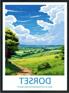
Dorset’s Great Western Trail
After my enjoyable runs along the TET’s Great West Trail in Dorset I cracked and joined the TRF to verify what else there might be in the area, particularly around the Isle of Purbeck. The TRF’s websites look smart, so does their quarterly Trail magazine now edited by Jon Bentham, formerly of Rust Sports, plus there’s a regular column by TRF ambassador, his excellency Austin Vince. They say membership has doubled in recent years to 8000 – now 8001. You wonder why; it’s not like trail biking in England and Wales has become popular all of a sudden, has it?
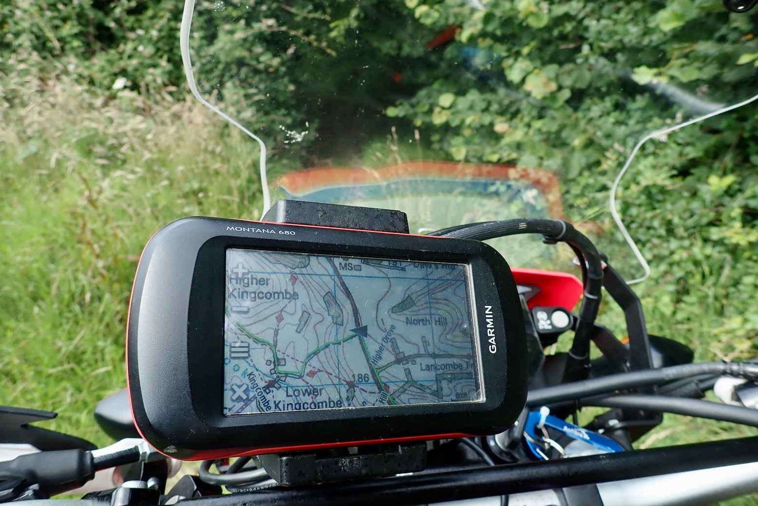
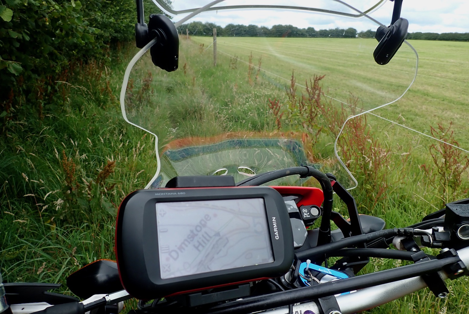
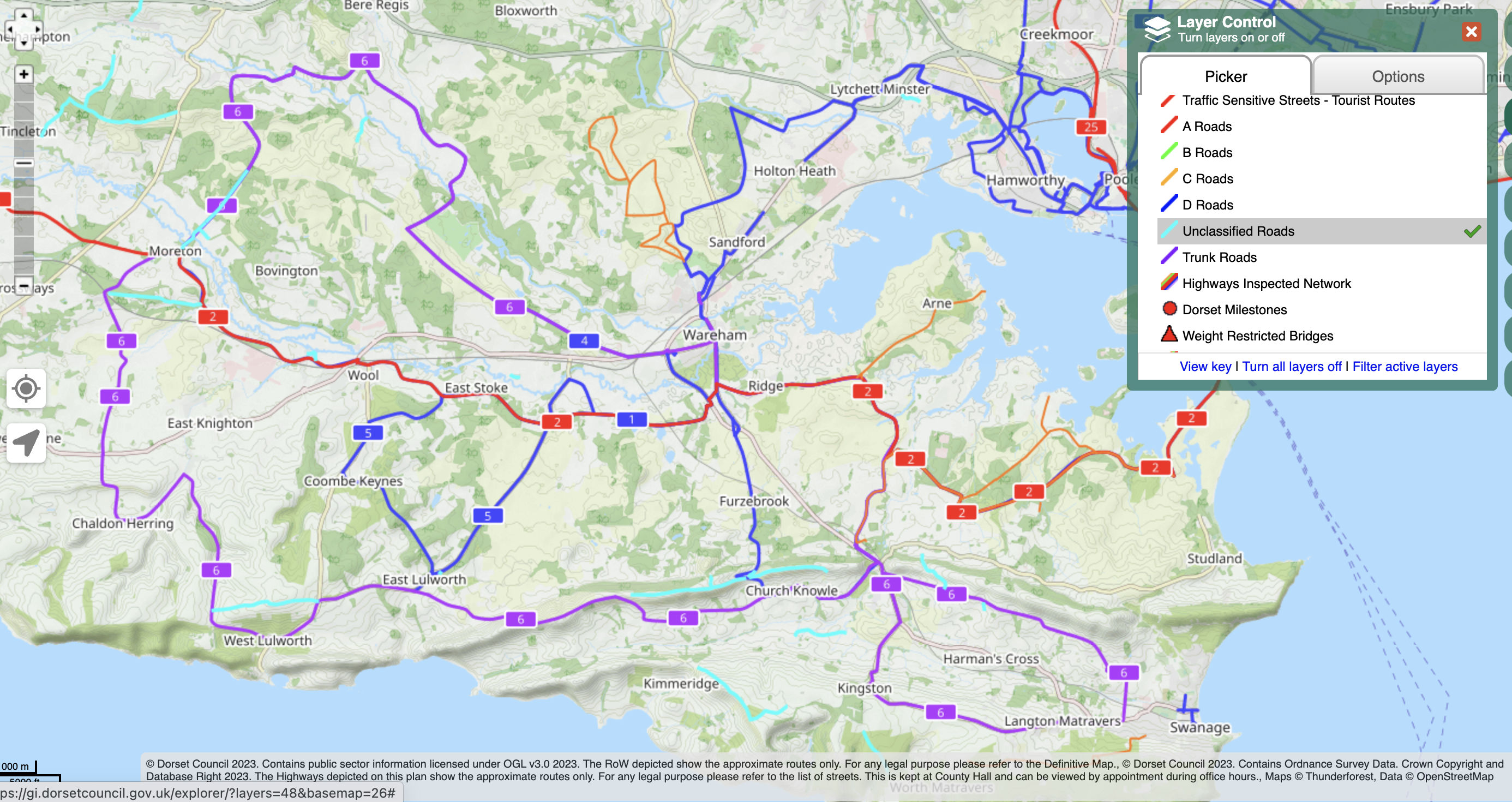
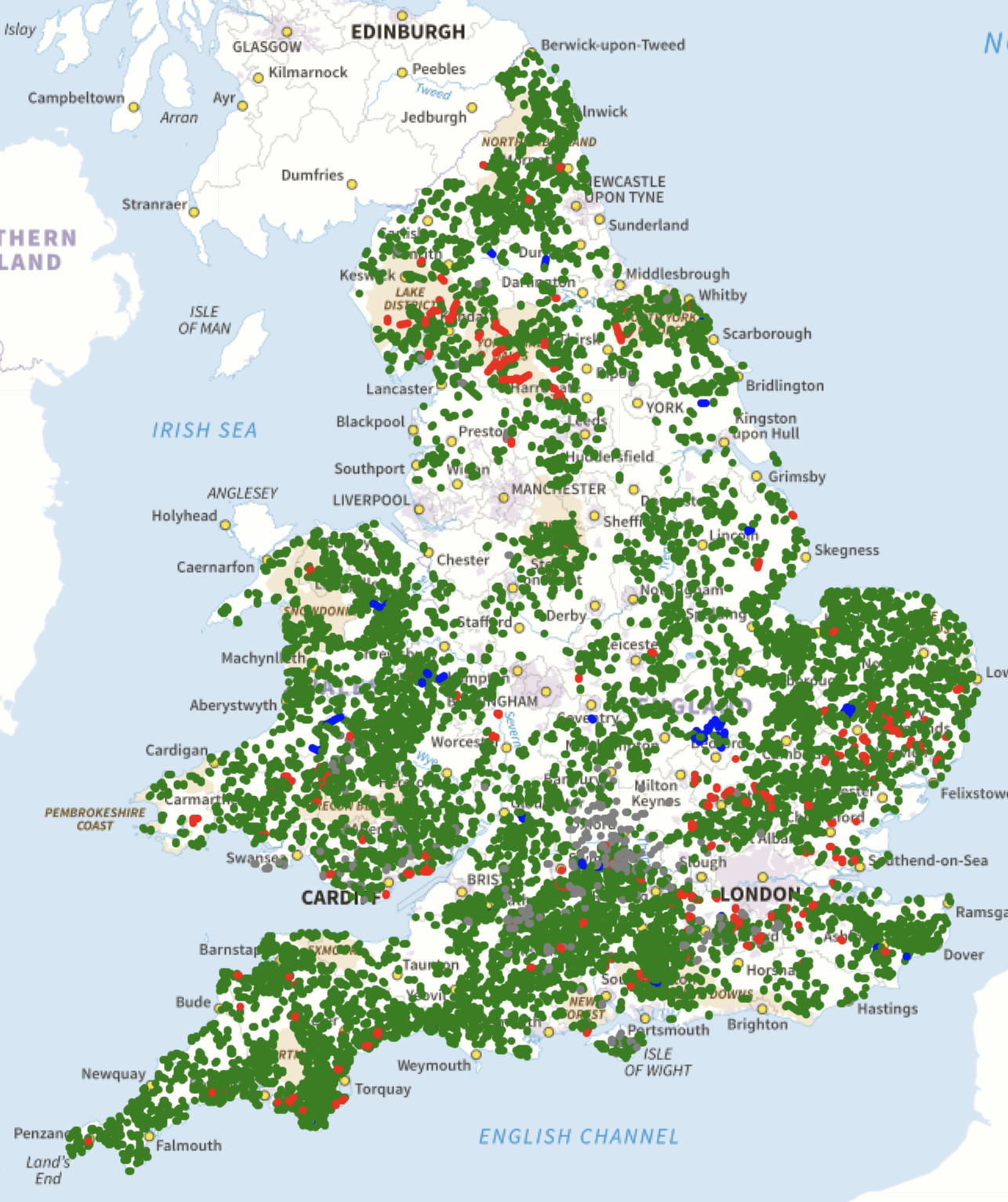
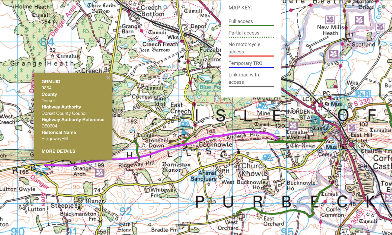
Of course what I’m really signing up for is not so much the Brotherhood of the Byway, but access to their Green Roads Map (above left), covering England and Wales. It’s similar to a local council’s Definitive Map (top of the page; explained previously) but maintained and updated by regional TRFers.


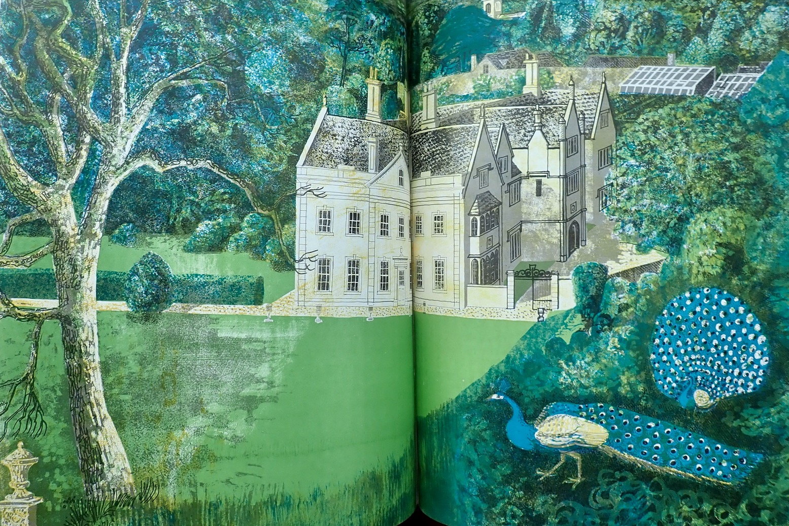
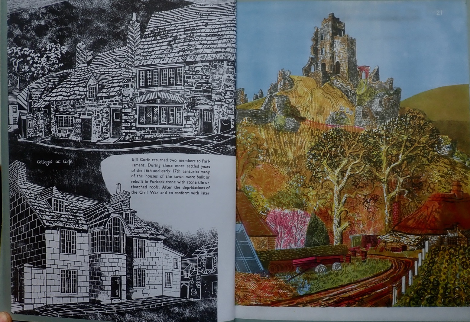
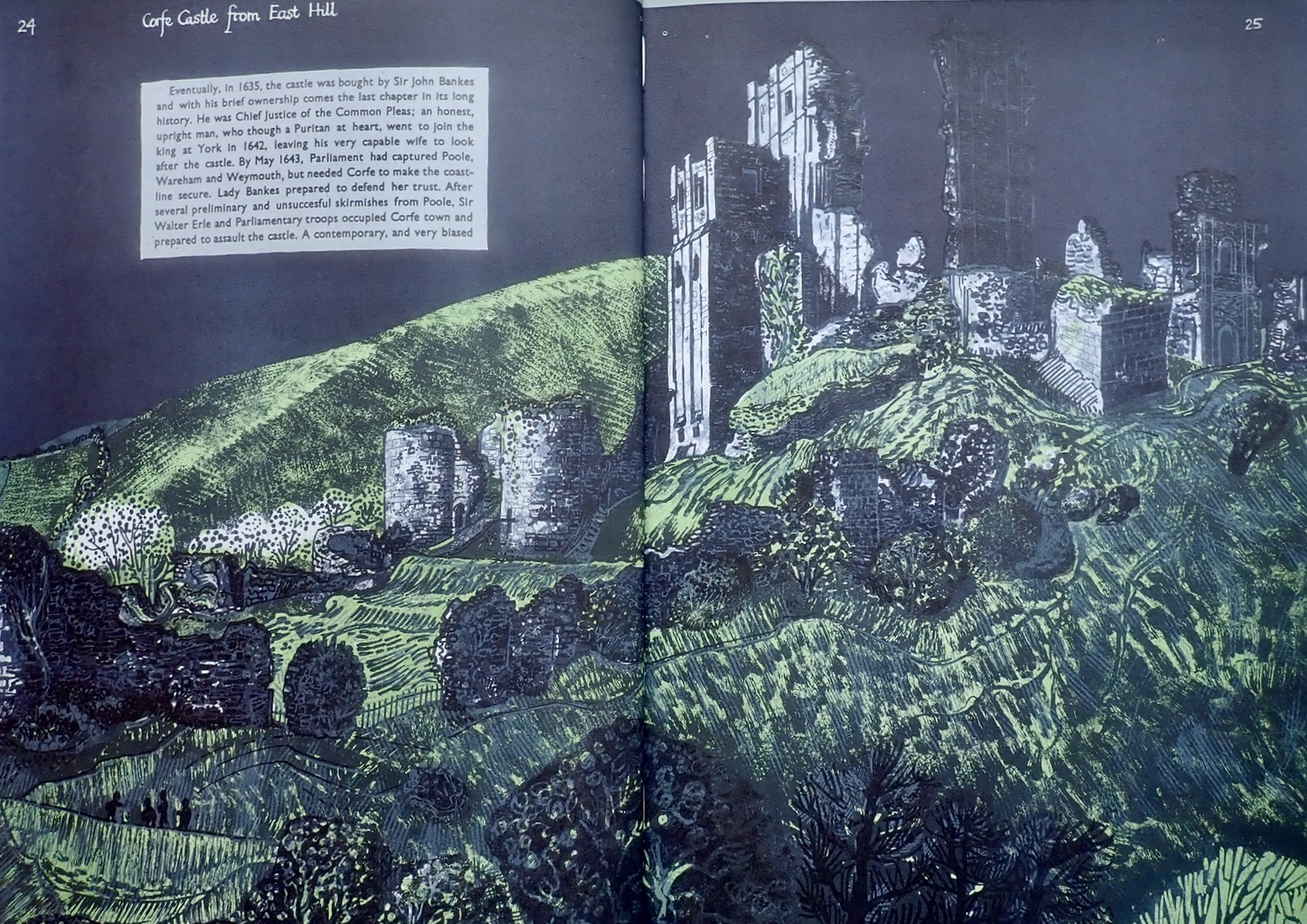
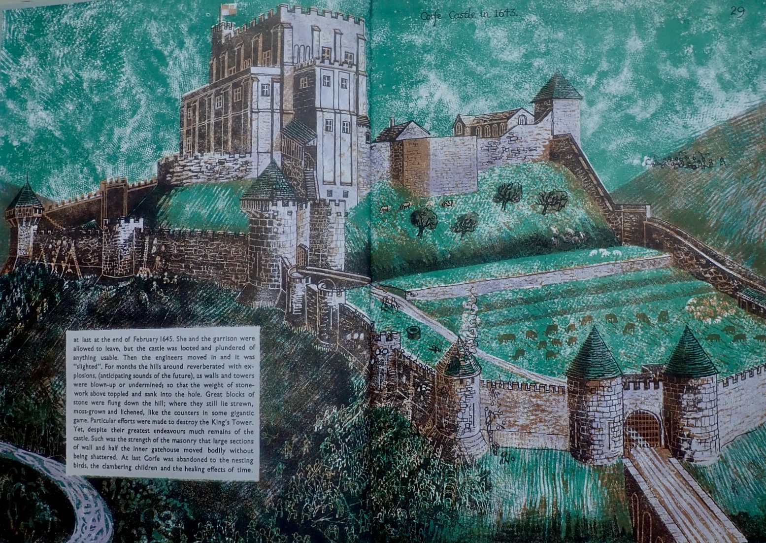
My Purbeck recce was largely inspired by finding a richly illustrated 1960s guidebook called Dorset, the Isle of Purbeck (above) by Rena Gardiner. One might call her artistic style expressionist (like Van Gogh), and in her prime she was a one-woman printing press and former Lambrettista. On my rides through Purbeck I’d pass many of the places she illustrated.

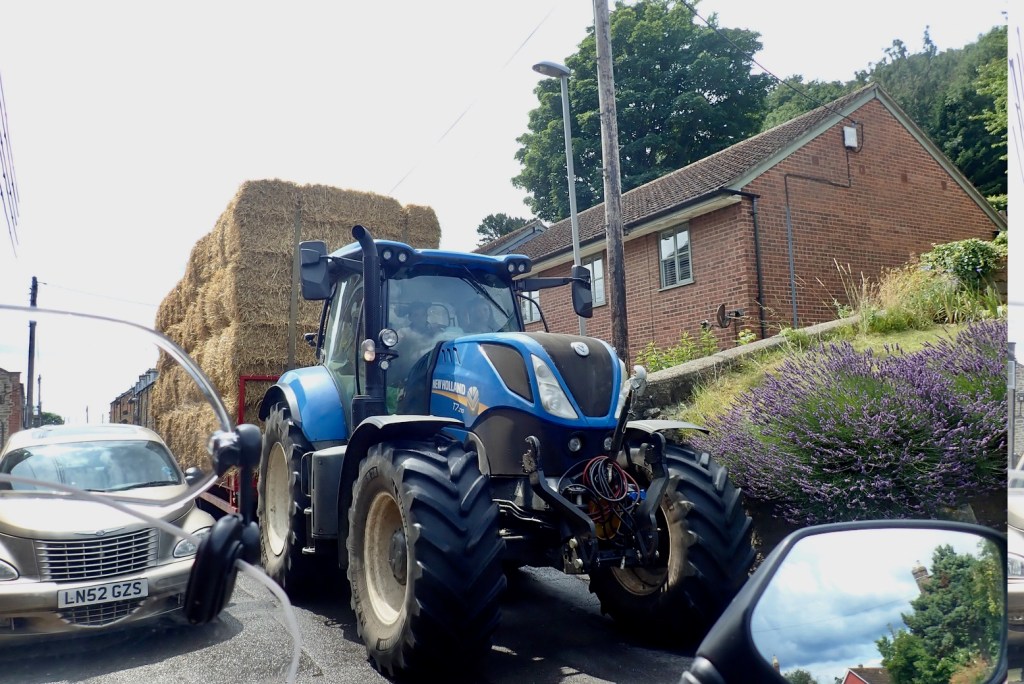
One thing with Purbeck as opposed to inland Dorset which the GWT traverses, is that it’s a lot more touristy. The road from Wareham via Corfe Castle to Swanage Bay is often clogged, probably like much coastal access in the West Country at this time of year. That means ramblers and dog walkers are afoot, not all of them conversant with the legal status of Byways, ORPAs, collectively: Unclassified Country Roads (UCR). It still felt unnerving setting off to trail ride in sleepy, bethatched Dorset as opposed to the peaty wastes of mid-Wales.
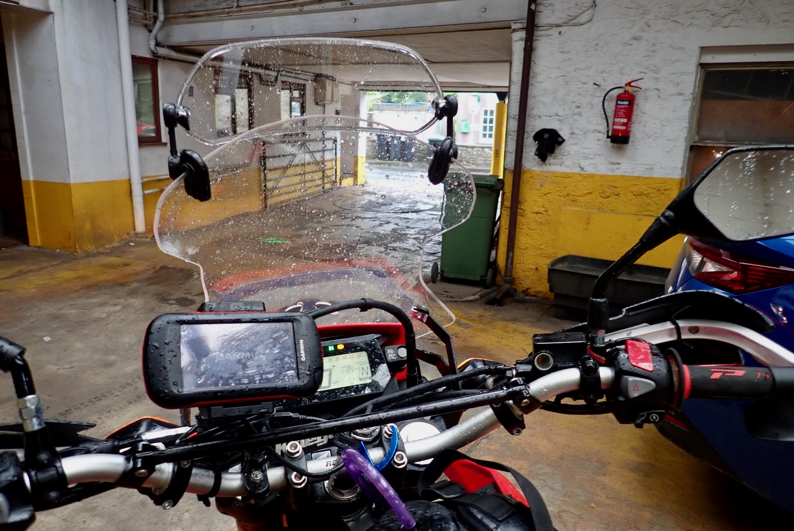
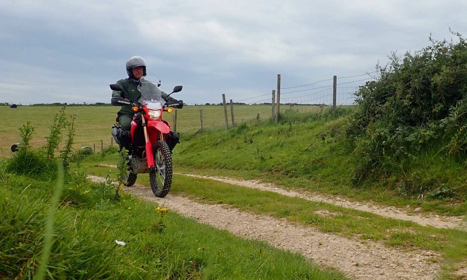
After the hottest June since the Devonian Schism, followed by the wettest July since the Paleogene Upheaval, the Purbeck Hills were greener than a car-sick toddler. I left it a few days for the jet stream to shimmy off somewhere else, but it’s now August and upcountry campervanners are parading around with their dogs. So I decided to recce some bits by stealth on the MTB. It was a good idea.
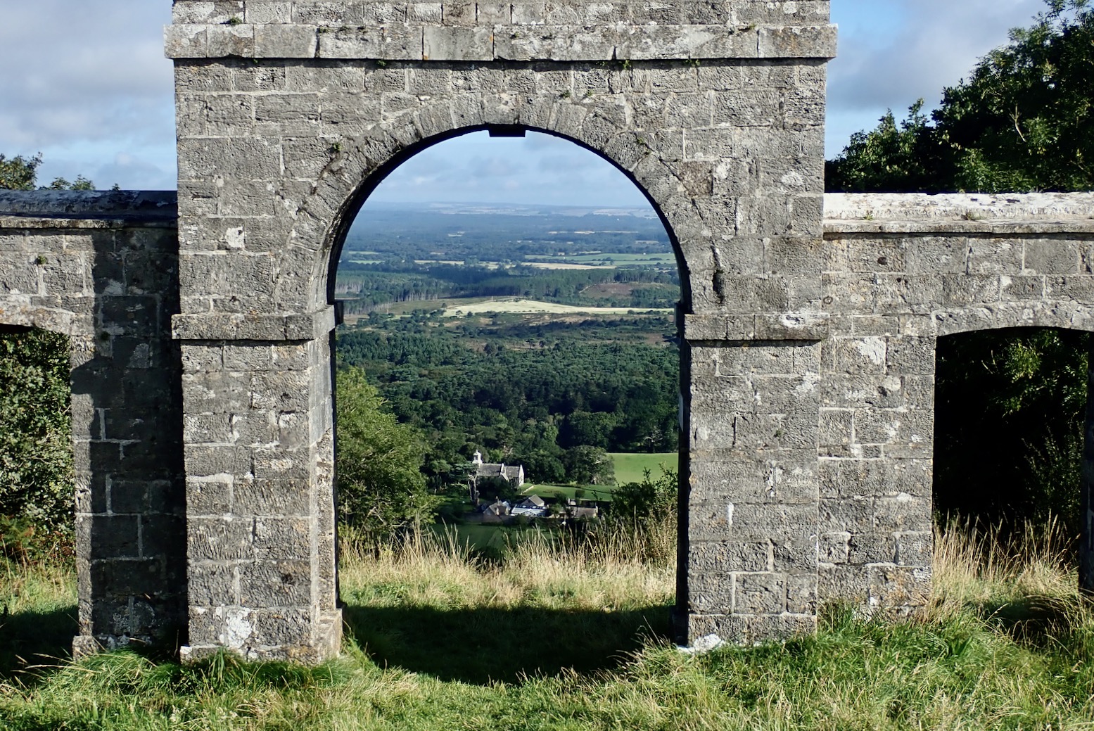
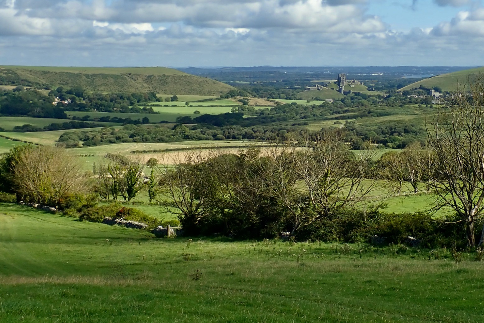
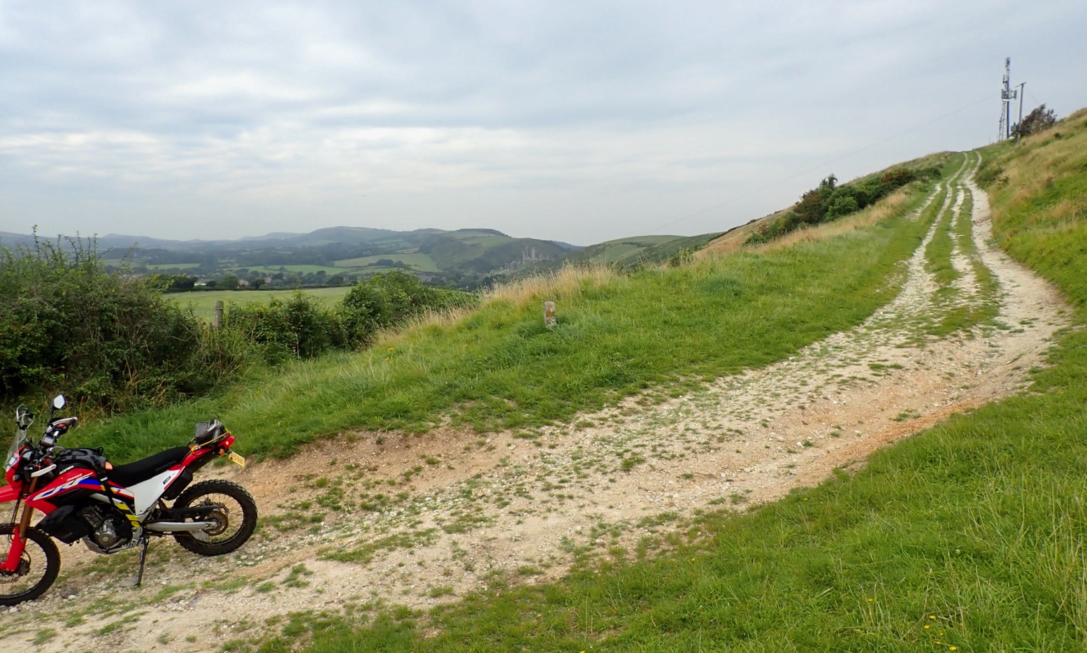
Right on the eastern edge of the Lulworth Firing Range army land, Ridgeway Hill leads east from Grange Hill viewpoint to Corfe Castle (left). At a deliriously long 4.4km it’s probably a county record. After a shirt while it passes the 18th-century folly of Grange Arch (above), looking down on Creech Grange, as drawn by Rena G, below.


Creech Grange was once the family seat of the Bond family who still own a lot of land on Purbeck, and after whom Ian Fleming named his famous agent, 007. Before attending the towel-flicking precincts of Eton, fledgling Fleming endured the character-forming torments of a Purbeck boarding school.
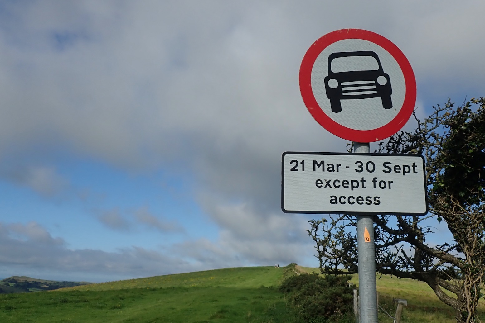
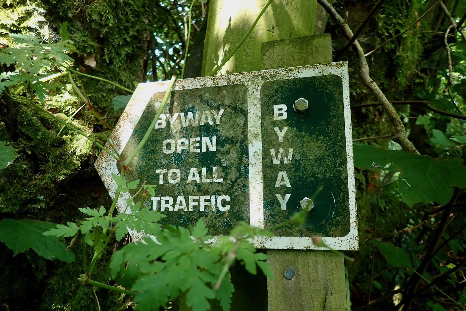
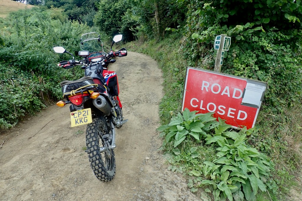
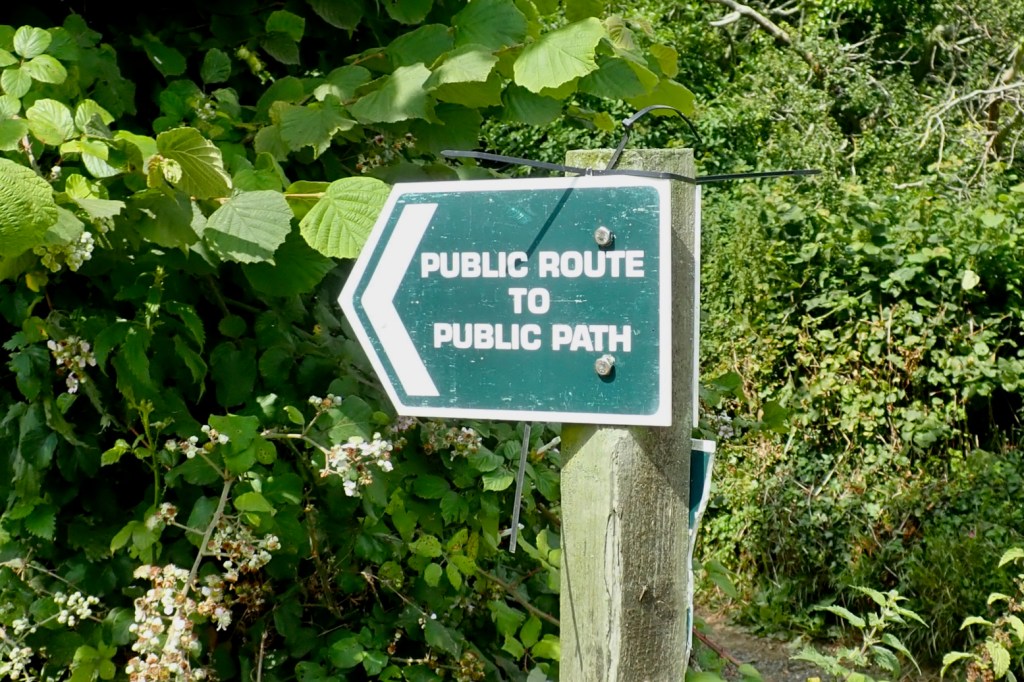
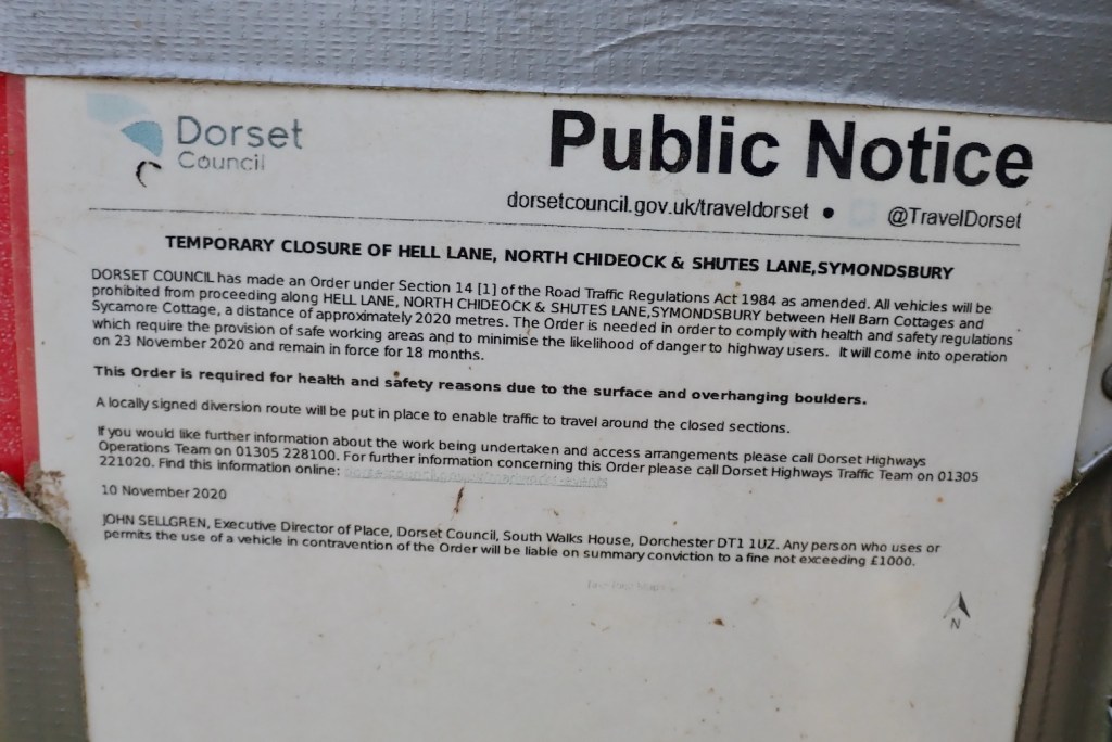
But what the TRF’s GRM or the Dorset DM don’t tell you is that the first 1.75km of this UCR, from the viewpoint past the Arch to a gate, is closed to motors from March till October. (I sent this info in to GRM updates but as before, no response.) But with the clear suggestion of (albeit seasonal) vehicle access, these two signs (left) were the only incontrovertible admissions that rideable Purbeck Trails even exist.
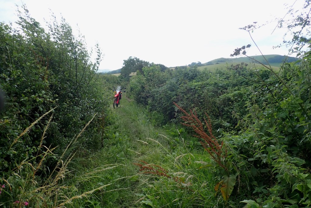
From the 500′ ridge there are great views south to the Jurassic Sea and north to Poole Harbour. At a gate an all-year UCR branch comes up from Stonehill Down to the north (above). It joins the Ridgeway and continues east (below) to cross a road snaking over a dip. Nice, wide open, hill top trail riding. Plenty of room for all.

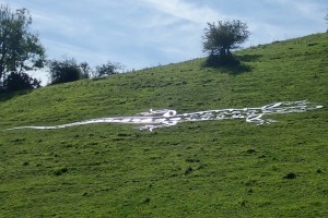
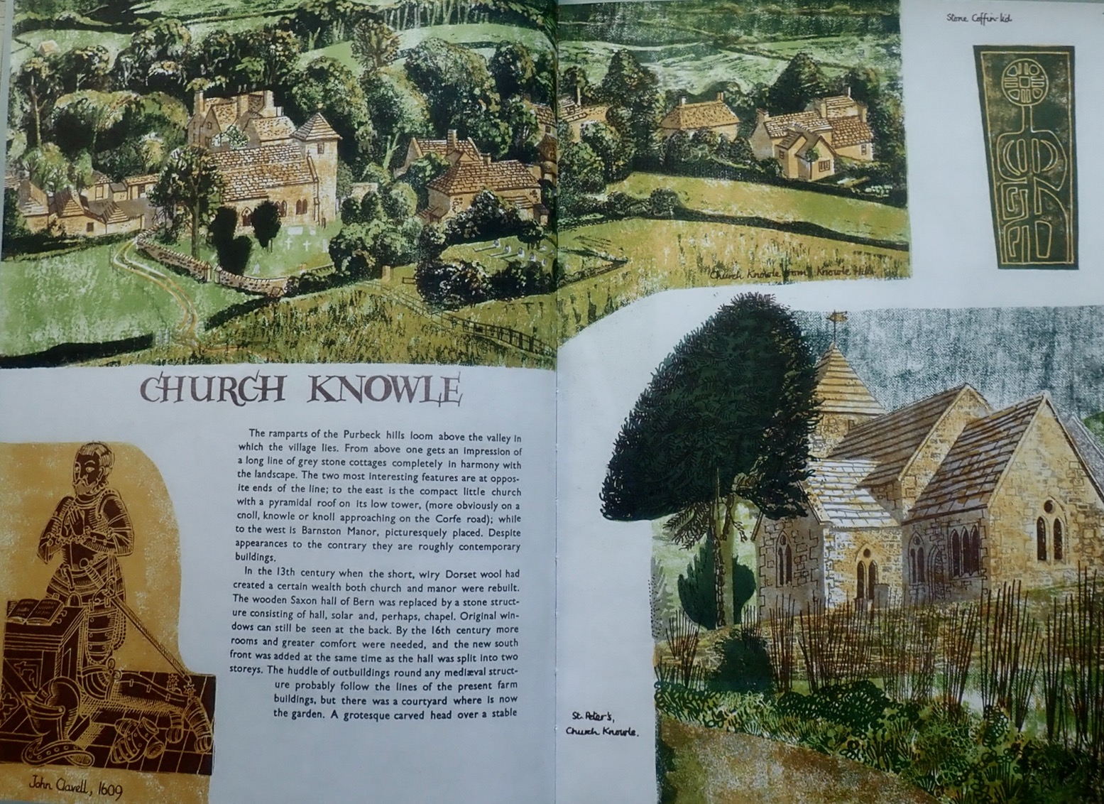
At the road I chanced on the giant hillside lizard (left) that made the news the other day. Having pedalled the following section a few days earlier (shoo-ing away a herd of cows blocking the gate), I didn’t have the heart to re-ride it on the moto, as being close to Corfe’s congested campsites, it’s relatively busy with high summer ramblers. From the top the wide open trail looks down on Church Knowle (below) and the 700-year-old Barnstone Manor which, according to the DM, is Britain’s oldest inhabited house.
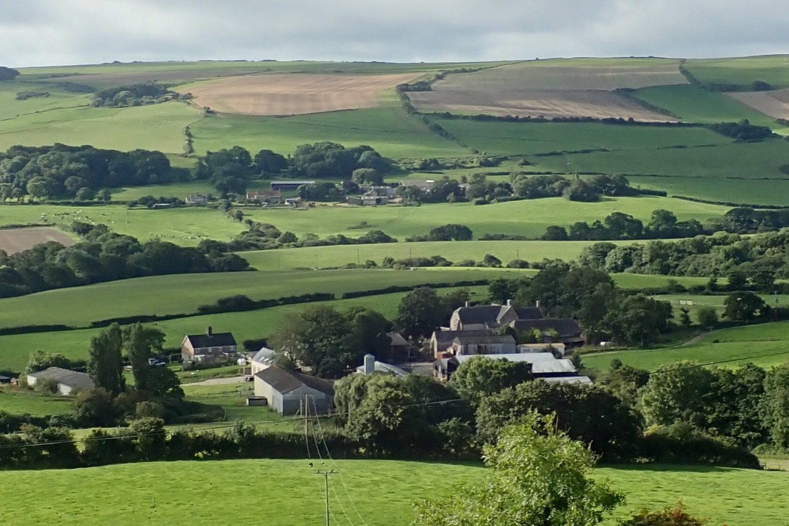

This UCR eventually drops off the spine of Knowle Hill and finds a back way into Corfe Castle, catching the castle ruins from a little seen aspect (left).
Built soon after 1066 and a strategic Royalists hold-out during the English Civil War, it was besieged and finally destroyed by Cromwell’s New Model Army in 1643.
From any angle the imposing castle towers over the Purbeck Stone clad village that takes its name, and in her book Rena G expended many pages on both (below). You wouldn’t know it but Purbeck has several still active quarries and many of England’s medieval cathedrals were clad in distinctive Swanage marble. Unusually, the roofs of Corfe’s houses use thick, Purbeck stone tiles.

Corfe in August is not a place to linger, unless you’ve no choice in a steaming traffic jam. On the far side of the gap which the castle once defended, the ridge rises again towards Swanage. Here Rollington Hill UCR switchbacks south over the ridge via a farm of that name.
I pull up at the turning where a sign (left) glared ‘No Access to Water Park, Turn Around’ along with a No Entry sign for good measure. I hesitate. I’m pretty sure it’s a public right of way and I’m not lost so I ride up the track towards the farm yard, any minute I’m expecting an ‘Oi!!, gerrof moi….’. With relief I reach the safely of a gate where the track rises up to a hilltop mast.
At another gate a grumpy looking rambler is tucking into her sarnies, blocking the way. I give her a cursory nod and use the walkers’ gate instead. Darlingly, this is a virgin trail I didn’t pre-ride on the MTB, but today am emboldened by a novel ruse: I’m dressed in my cheapo overalls which I like to think make me look like a farm worker looking for lost lambs, or a contractor for English Heritage seeking new Areas of Outstanding Natural Beauty. And it worked too. A few days later I was connecting another trail near Tolpuddle when I came across some young Hiluxers doing a suspension twisting turn in a bomb hole. Though they had just as much right to be here as me, they initially mistook me for some sort of warden.

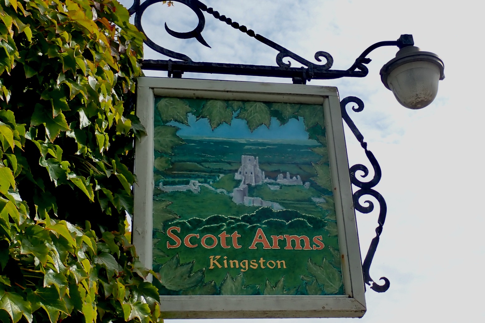
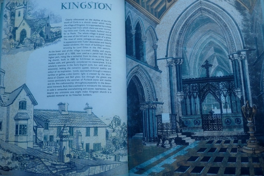
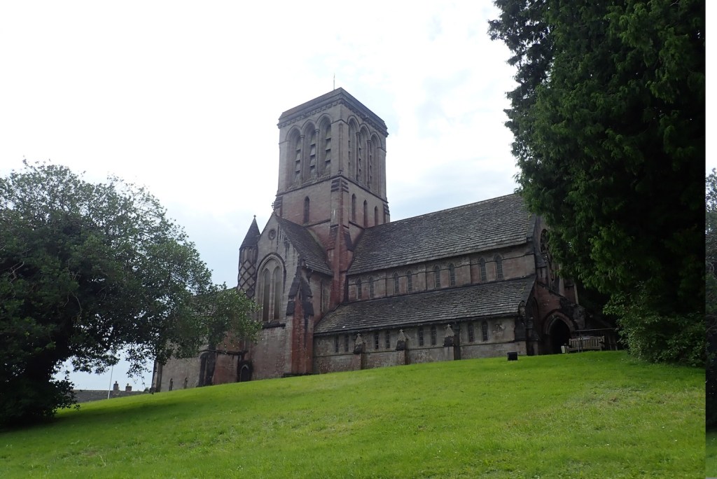
Some 1300 metres later I’m on the asphalt and riding back into Corfe. Southwest of here lies the hilltop village of Kingston with it’s old-looking 19th century church poking out of the trees, and the ivy-clad Scott Arms pub below. According to ancient genealogical conventions, if I whisper the secret family motto I’m entitled to a free pint and a quarryman’s pasty.
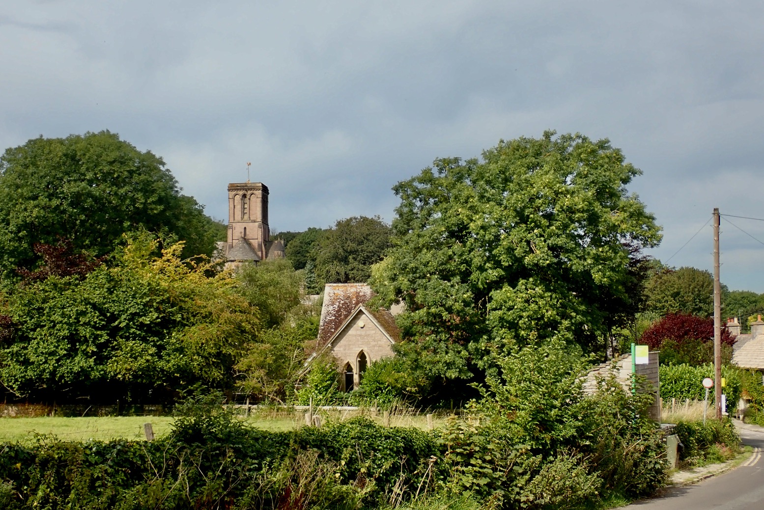
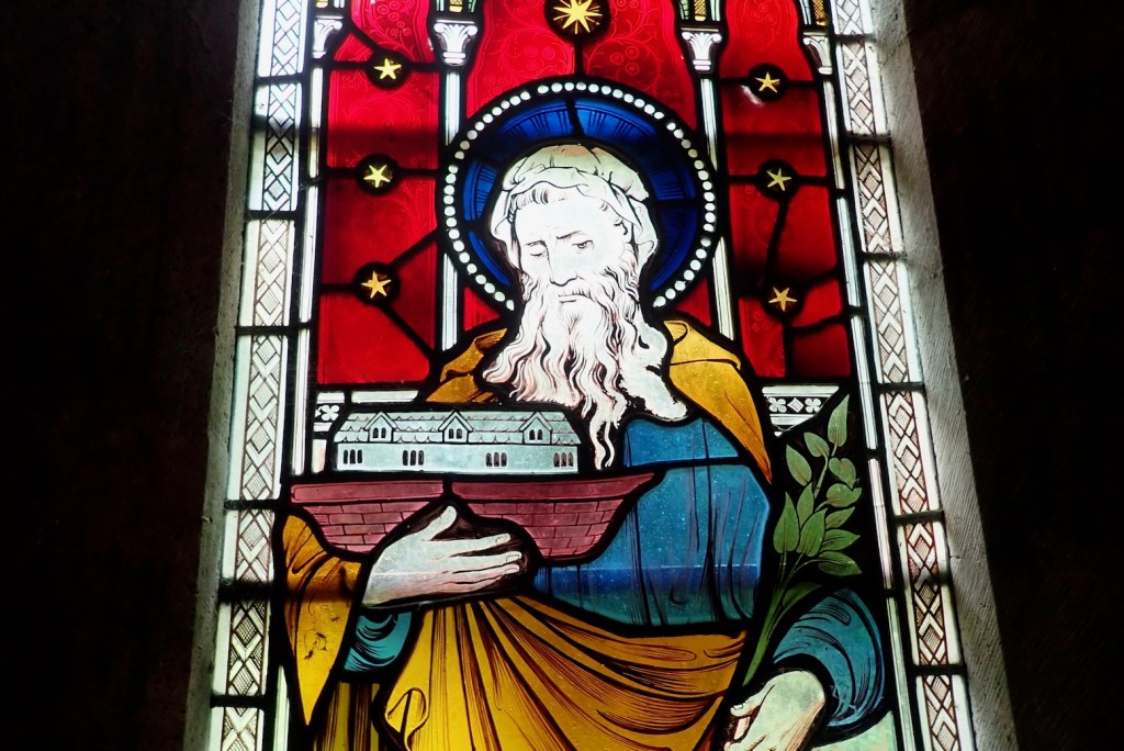
Kingston was another popular subject for Rena Gardiner, particularly the ‘mini cathedral’ church in the New English Style, whatever that was. Inside there’s a superb array of stained glass from which it is fun to play Guess the Biblical Figures from their accoutrements. See how many you can guess.


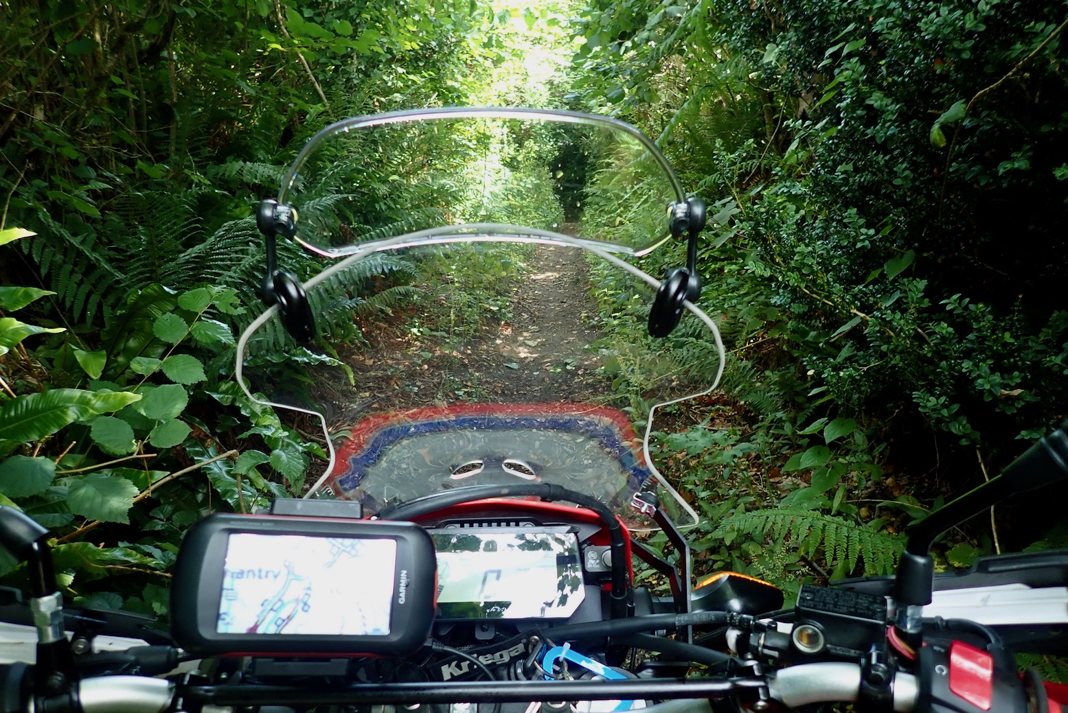
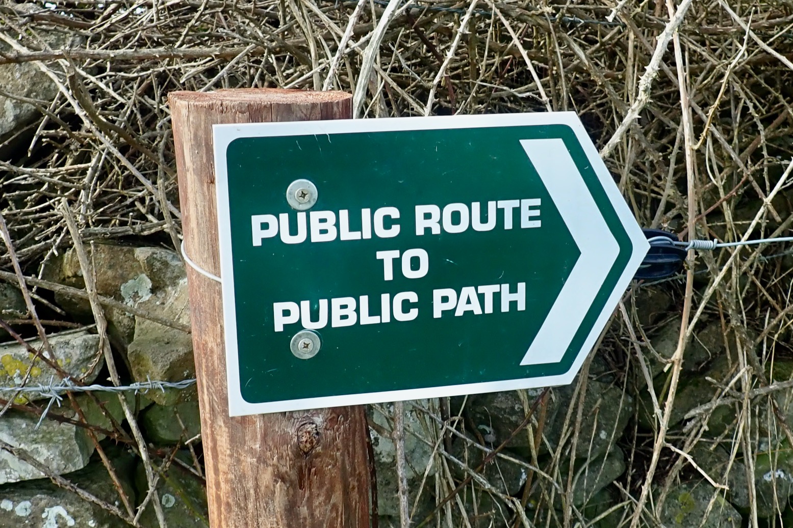
Two UCRs span out near Kingston, but were it not for the GRM or DCC DM, you’d have no idea you could legally ride them. A footpath or bridleway sign might be the best you’ll see, which are clearly no invitation to motards. This patchy signage to discourage motos is to be expected. If you want to trail ride in the UK you need to ‘do your own research’ as Q-Anon-ers like to say. Fair enough – any journey or adventure needs planning.
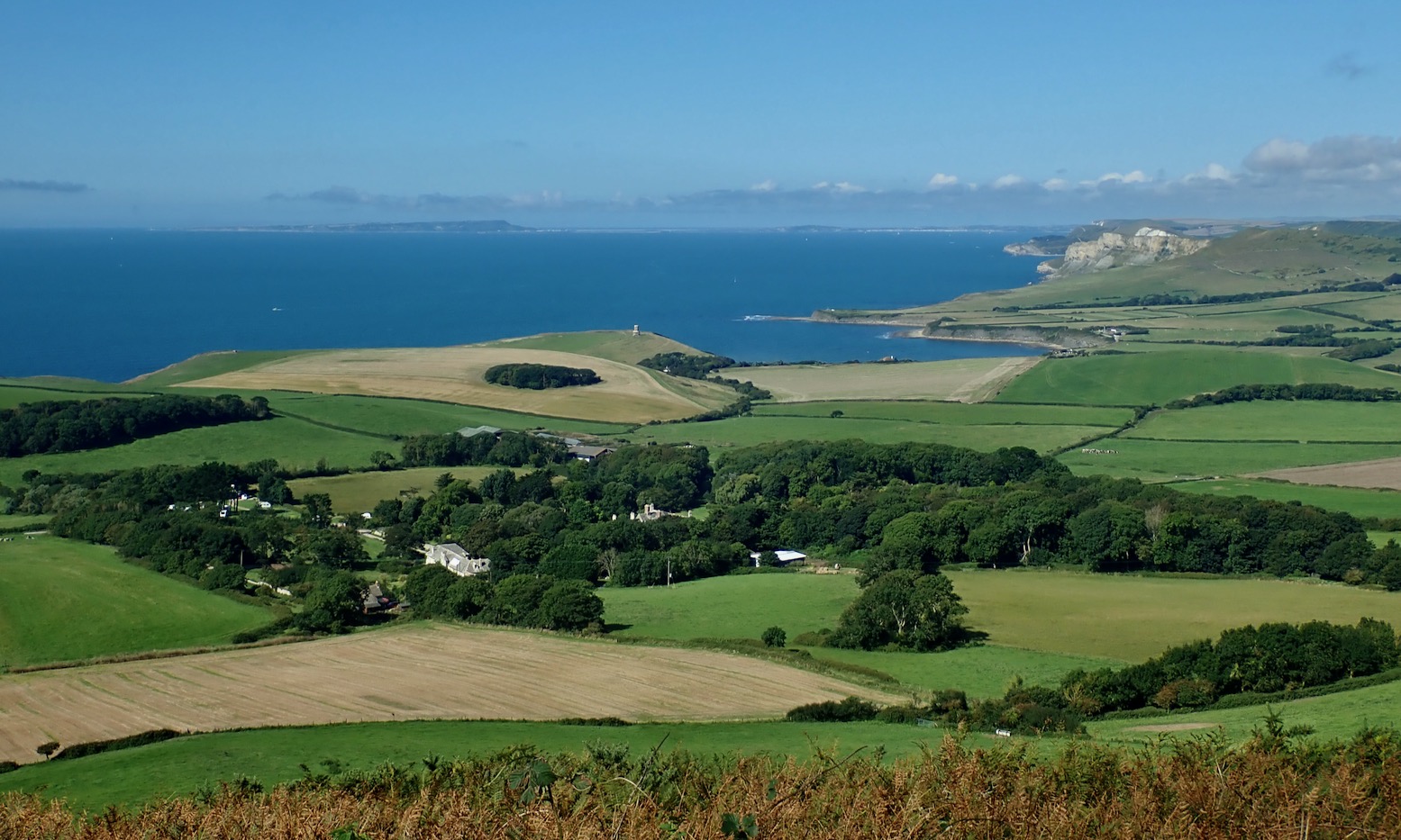
South of Kingston an ORPA (UCR) turns off a valley running south to Chapmans Pool on the coast, and traverses some cow fields before dropping off the ridge along a gully which lead to what looked like an isolated farm on Google Earth.
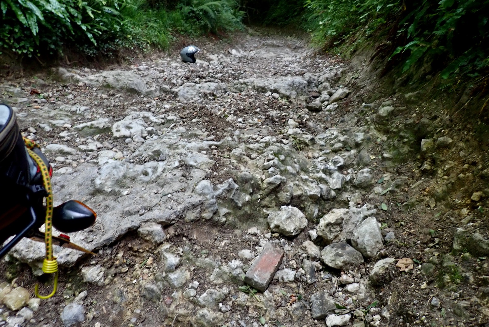
On the way I passed an ambiguous sign (left) which I’ve now taken as code for a UCR. On the pushbike the gully gets a bit stony, so easier down than up on a gangly moto, but the ‘hillbilly farm with rabid dogs’ was just a harmless terrace of stone cottages before a road turned up to Renscombe Farm and Worth Matravers beyond.

I’ll come back on the 300L one time for that one. Another UCR runs west of Kingston to Smedmore Hill, navigating tall grass and deep ruts (above). It arrives at a gate near popular Swyre Hill walkers’ viewpoint, but a bench here overlooks Kimmeridge Bay and distant Portland Bill with views just as good (below). The GRM shows it as green (‘full access’) but following notes say the west end – a stony descent towards Kimmeridge village – is ‘non-vehicular’, so I guess it’s a legal dead end on a moto. On both the GRM and Dorset CC maps, the last kilometre of this UCR strays oddly across a cultivated field before rejoining the actual track close to the road. Could you push your bike down to the road to make the connection?
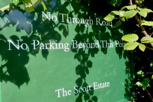
One UCR I definitely won’t bother riding on a Honda runs via East Orchard Farm just out of Corfe. Near the end of the road to Blashenwell a private sign advises ‘No Through Road’ (left). You can see curious holidaymakers straying out of Corfe and three-poing turning in Blashenwell farm yard, though technically there is a through road via East Orchard, it’s just a muddy UCR.
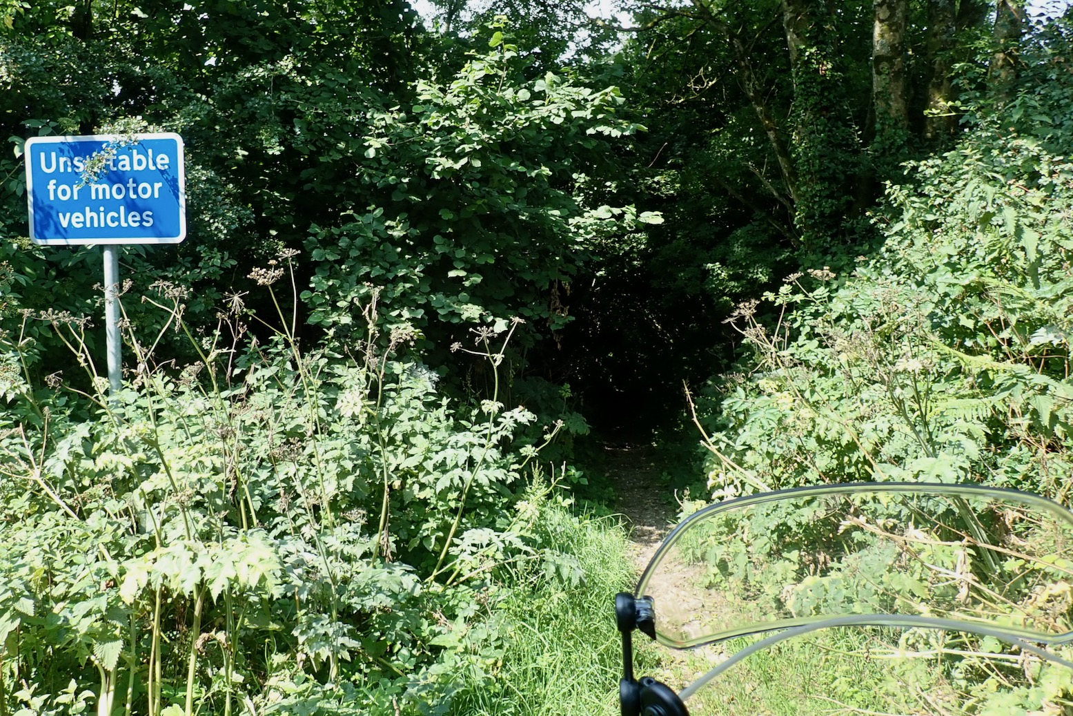
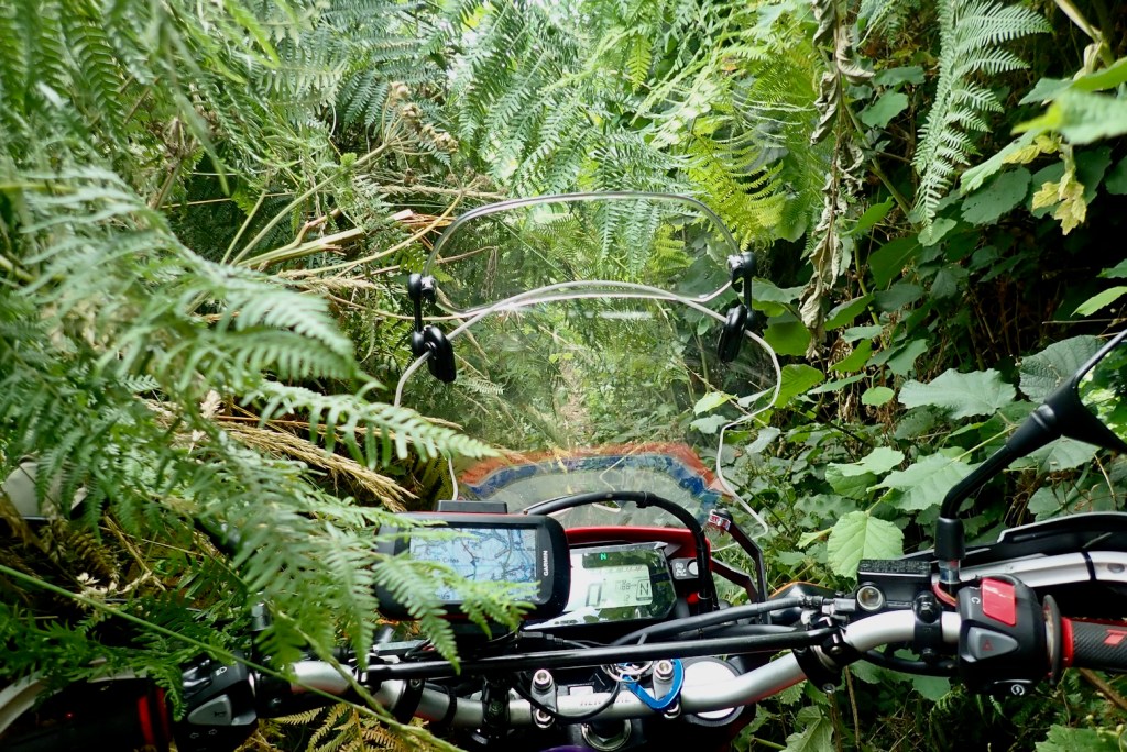
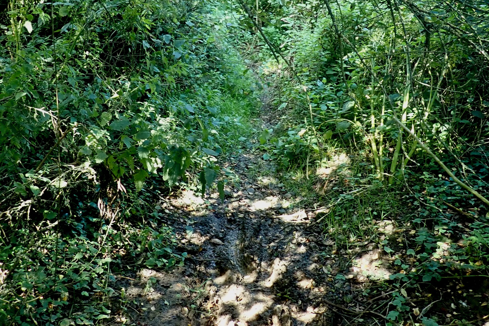
At a bend before Blashenwell, easy cow field tracks and gates lead to East Orchard Farm, but from here the UCR – signed as a footpath – becomes an overgrown, muddy stream bed, in places barely wide enough for an MTB. I get nettled and scratched and sodden. ‘Deep mud on some sections caused by agri-traffic…’ warns the GRM, but you wouldn’t even get a farmer’s quad in here. Only motos will make it worse. With the racket and spray a moto would make trying to push through the 500m to West Orchard Farm, honestly, it ain’t worth it, even if it’s allowed.
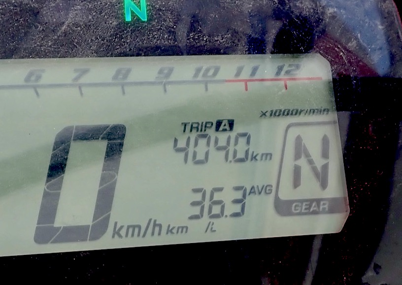
My recce of the Trails of Purbeck is done: adding up to less than clicks (seasonal restrictions permitting) or nearly 6 miles off-asphalt over as many separate trails. It sounds pathetic but, like the GWT, on road or trail it sure gets you into some lovely countryside.

Just beyond the ‘Isle’s’ vague western perimetre near Lulworth Camp, another UCR called Daggers Hill Drove scoots up and over a hill in 2.4km. On top an army Landrover was watching, but you could drive this easy track in a Micra to avoid the traffic streaming out of nearby Lulworth Cove.
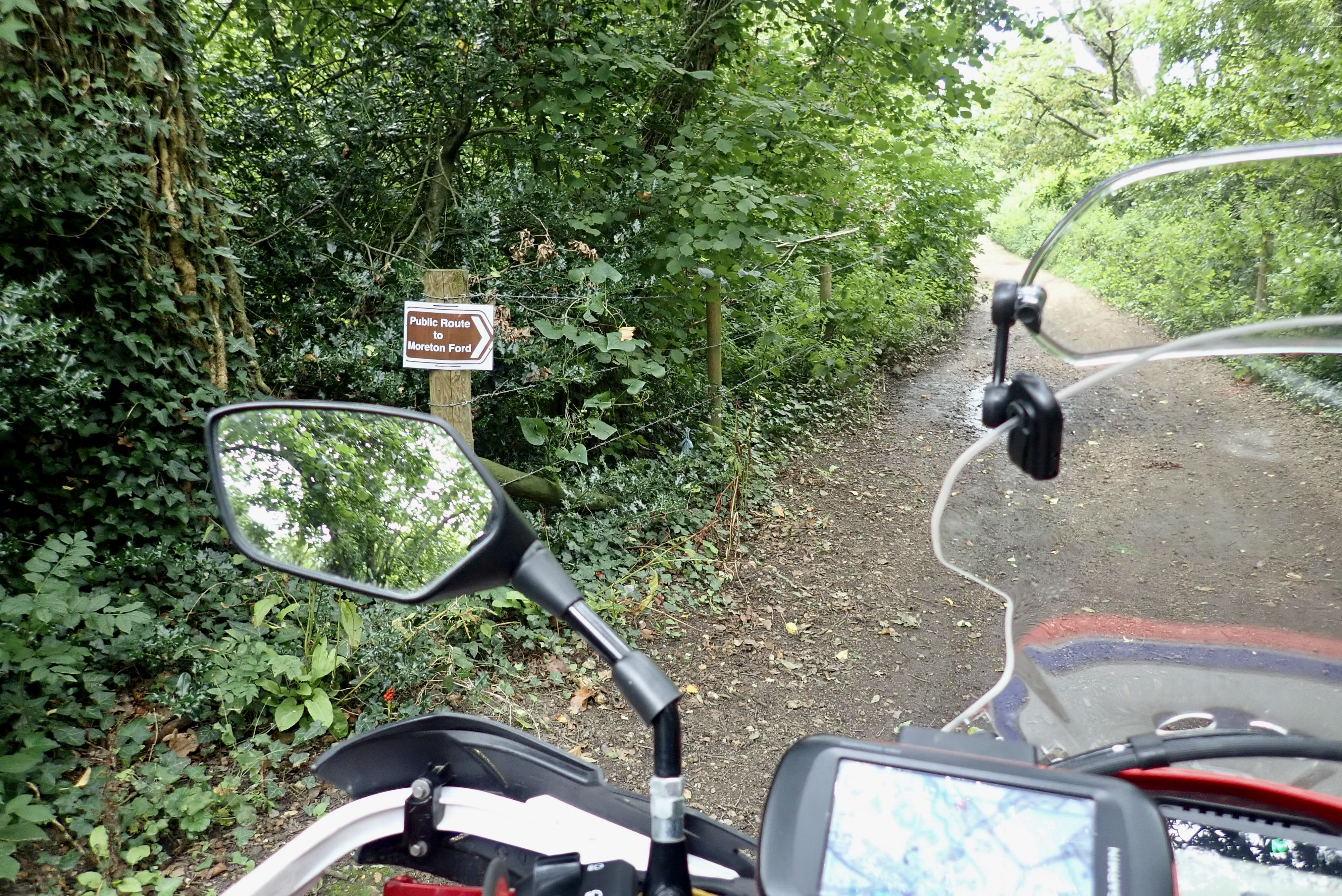
North of here, near the little-known Winfrith nuclear plant which they’ve been decommissioning for 20 years, is a 2km trail west to Redbridge. I took a chance down it coming back from the GWT a few weeks back, only to discover later it was a kosher UCR after all. I must be getting a good nose for Dorset UCRs! Reversing it today while dodging a few big puddles, I pass a fellow trail biker on a KLX250! Good on him, exercising his ancestral right to ride this route.
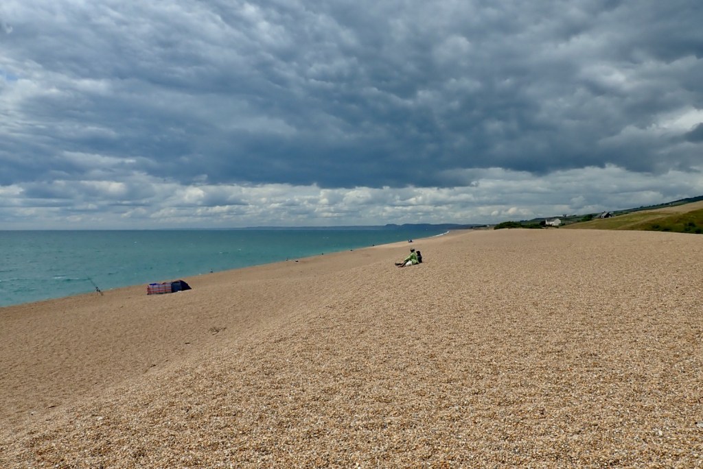
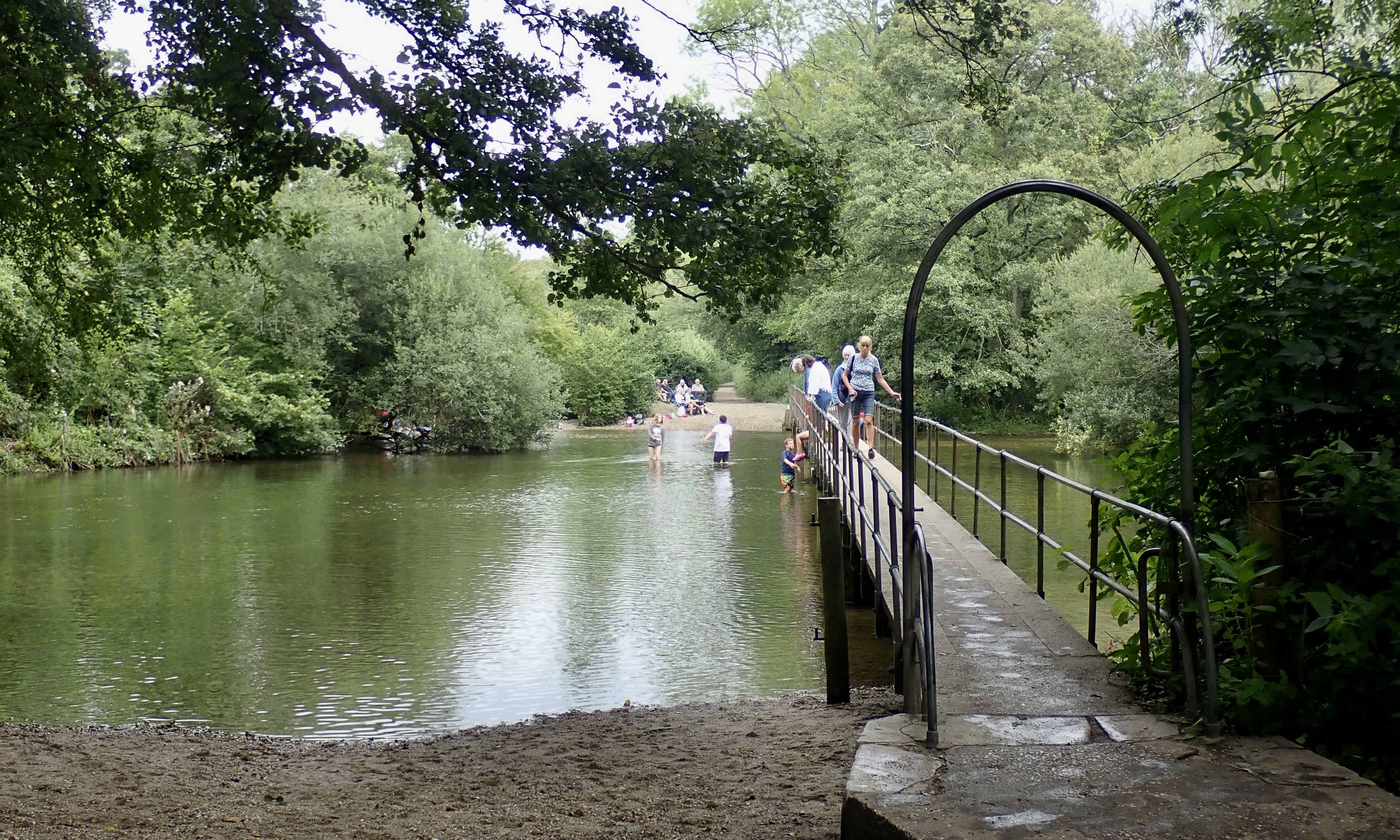
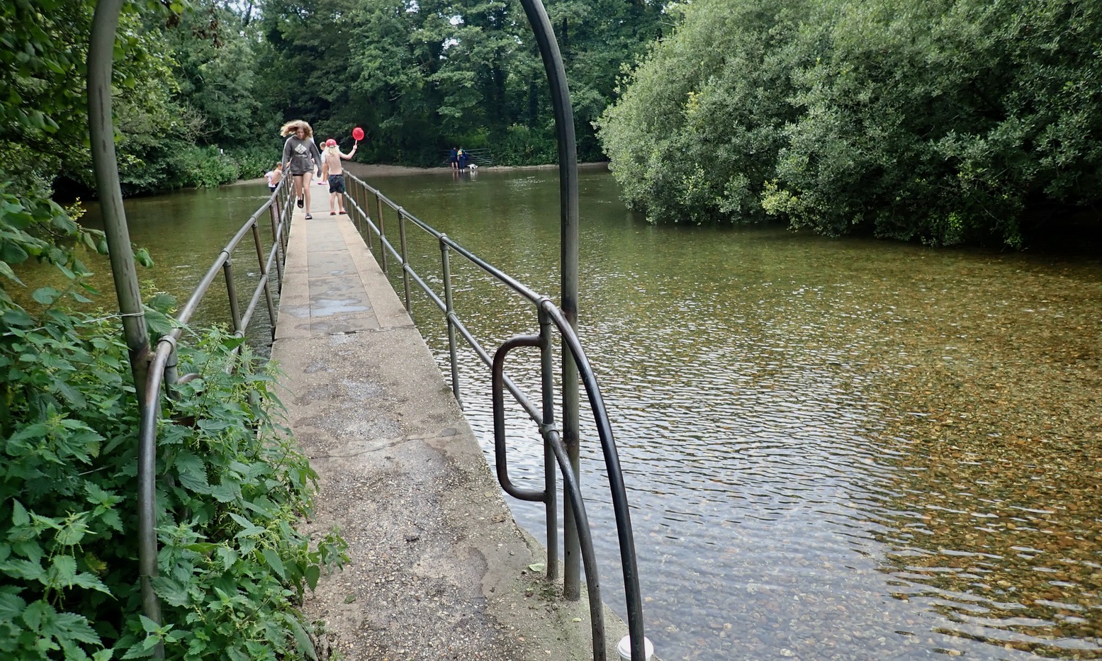
The day’s last trail was an intriguing 2.3 clicks straight through a forest north of Moreton village. Only, not for the first time I didn’t scrutinize the map forensically enough and clock the F-word buried deep in the detail. F for ‘ford’ that is – across the River Frome which delineates Purbeck’s northern boundary. I rolled up to a scene of kids splashing about while parents scrutinised their phones on deckchairs (below)
I observed the kids’ knees as closely as was appropriate, and in my head extrapolated probable leg length from teenage anatomy (based on current dietary trends) and decided not to risk it, even pushing. Deep fording can ruin engines and is something I save for absolute necessity. The other day our old Rover car died after bombing through a six-inch ford near the house. It dried off and restarted after 15 minutes, but now I crawl through at walking pace.
Had no one been around, at Moreton I might have hopped onto the footbridge which looked rideable on a small bike. I’ll test wade it one time. ‘Deep ford in winter’ warns the GRM. Deep enough in summer too.
Not to be thwarted, I scooted around a couple of miles to the northern end of the Moreton Drive – you could ride it on a RD350LC – and arrived at the ford from the other side. It didn’t look any shallower, so I turned round and headed home.

Riding back through Bovington Camp I clocked a Costa / Greggs combo – always good to know out here in the sticks.
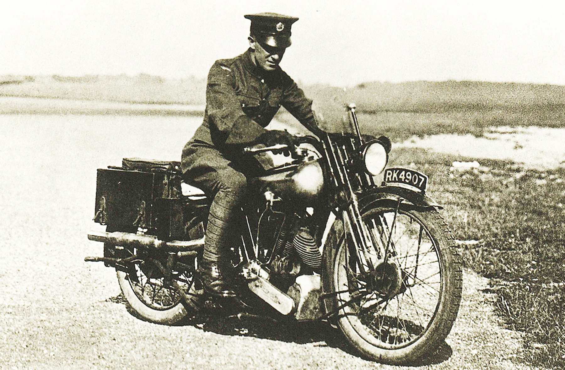
I also passed the point where, in 1935, T E Lawrence (left) had his fatal crash on what was his seventh Brough Superior SS100 – the ‘Rolls Royce’ of motorcycles in the inter-war era. Lawrence just left the military a few months earlier and was heading back to his humble cottage up the road at Clouds Hill. You probably know the rest.
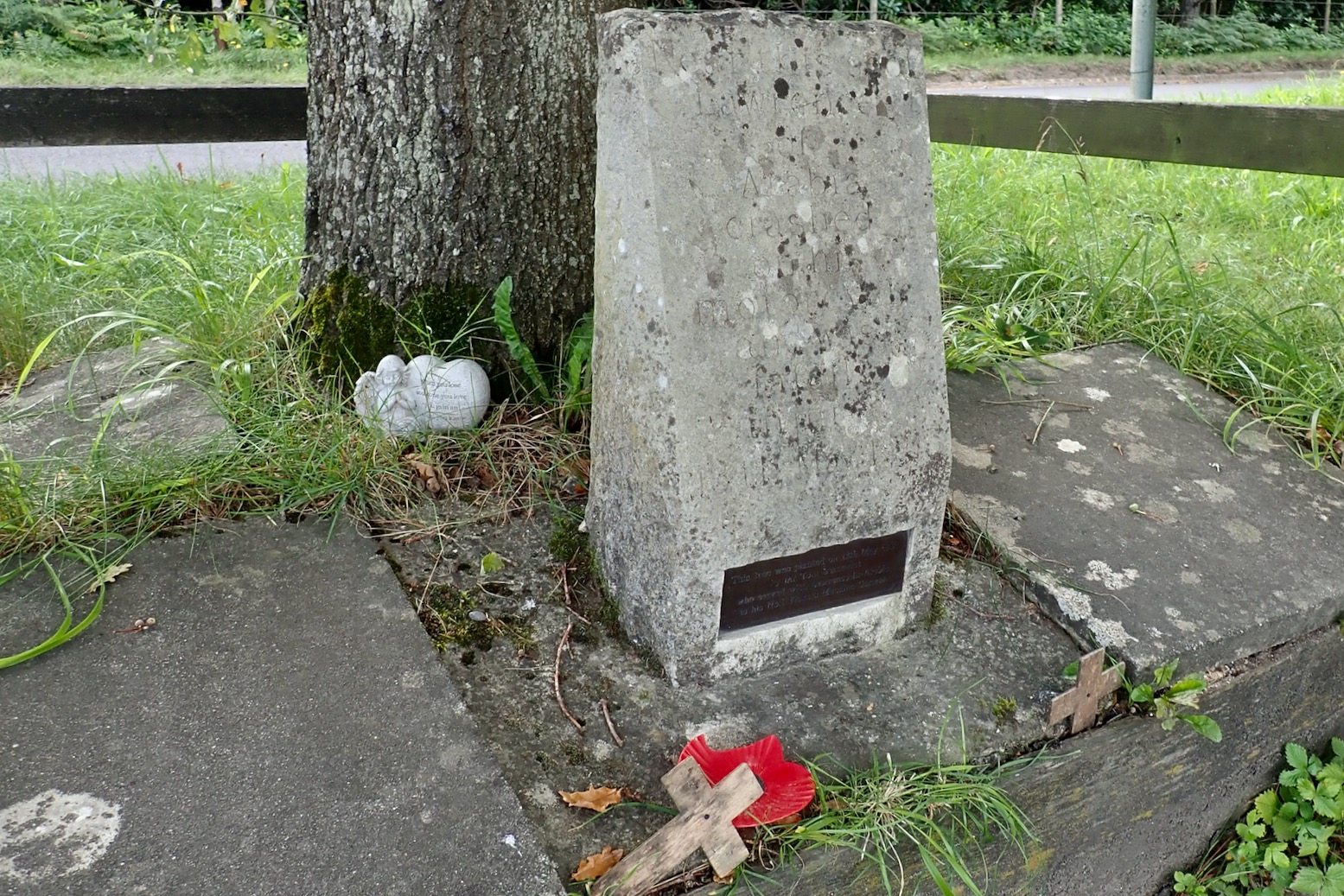
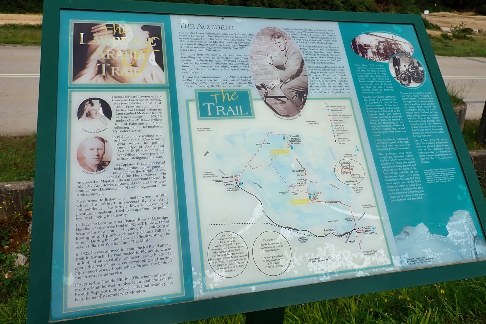
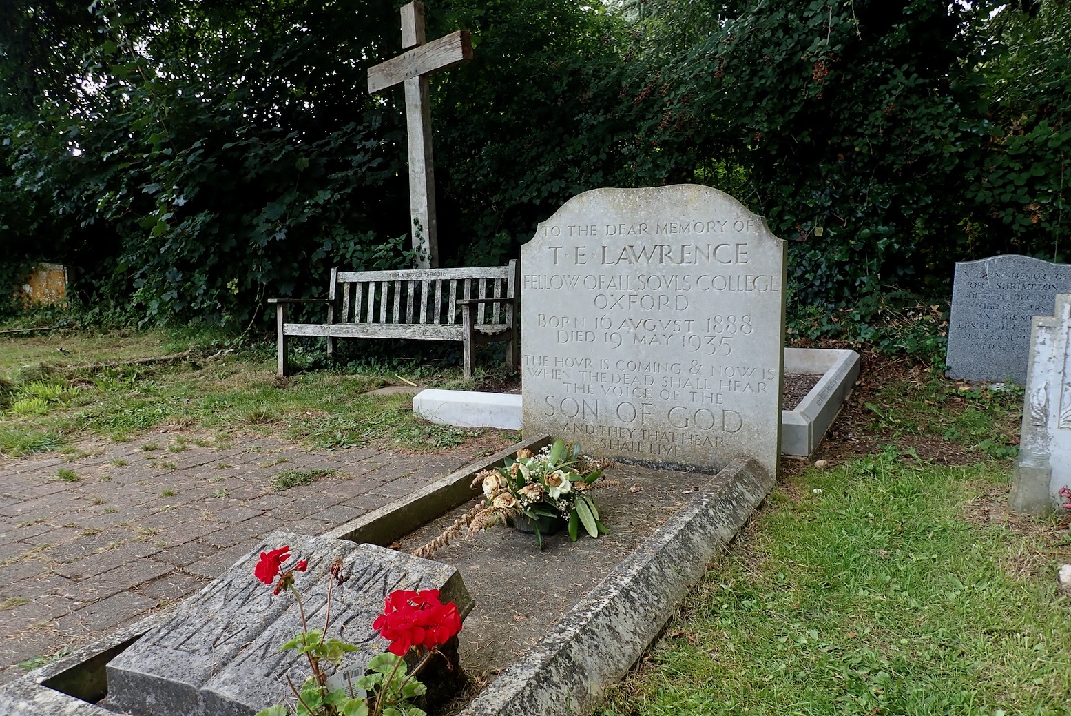
At what appears to be a roadside tank training viewing area/car park, there’s a low-key memorial stone by a tree, plus a well-written info board about Lawrence (above right) which also addresses the enduring ‘Catchpole Conspiracy‘.
It turns out Lawrence is buried at the cemetery back in Moreton, and it’s said the neurosurgeon who attempted to treat his terrible head injuries went on to recommend the use of crash helmets for WW2 army despatch riders, and here we are today.